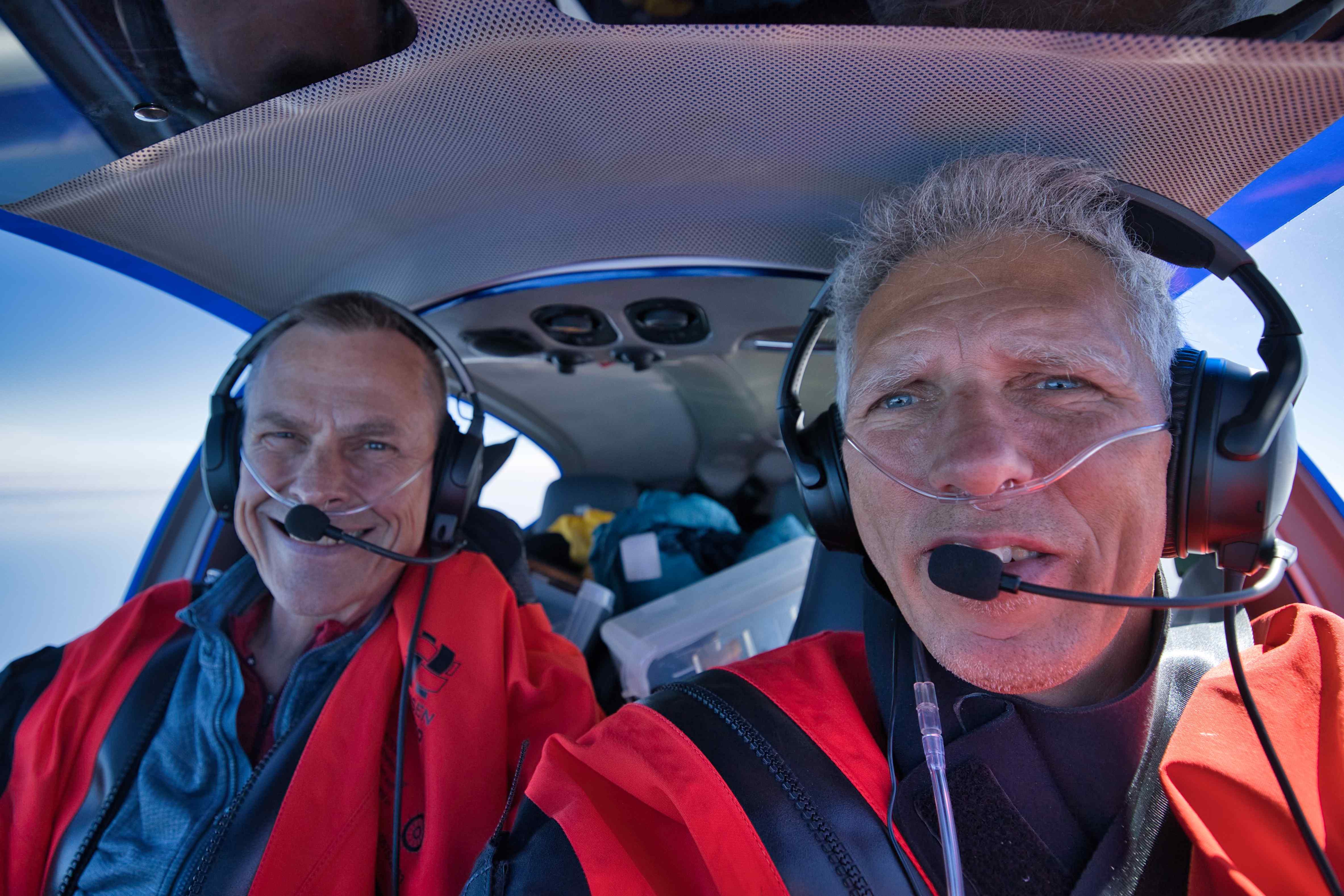
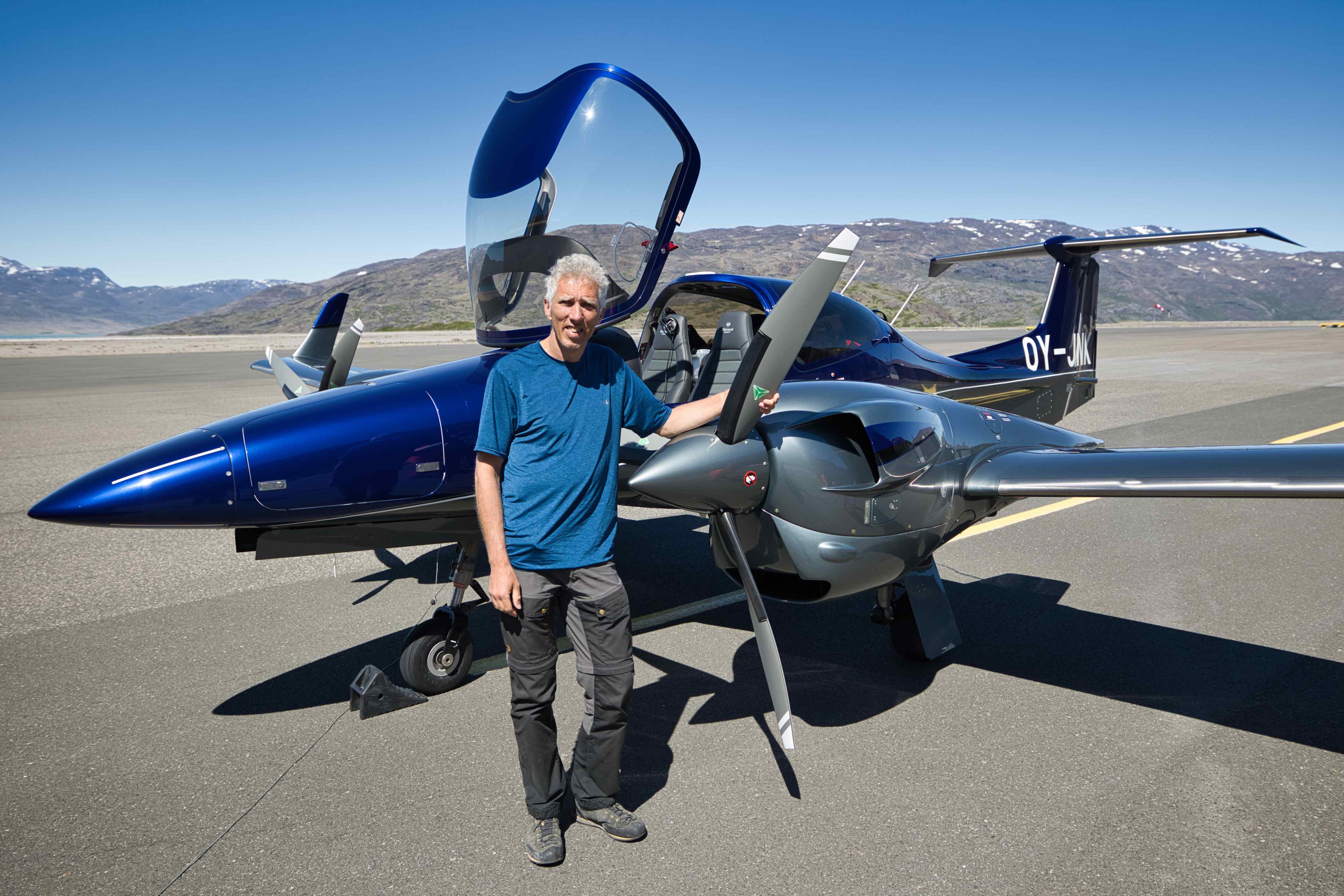
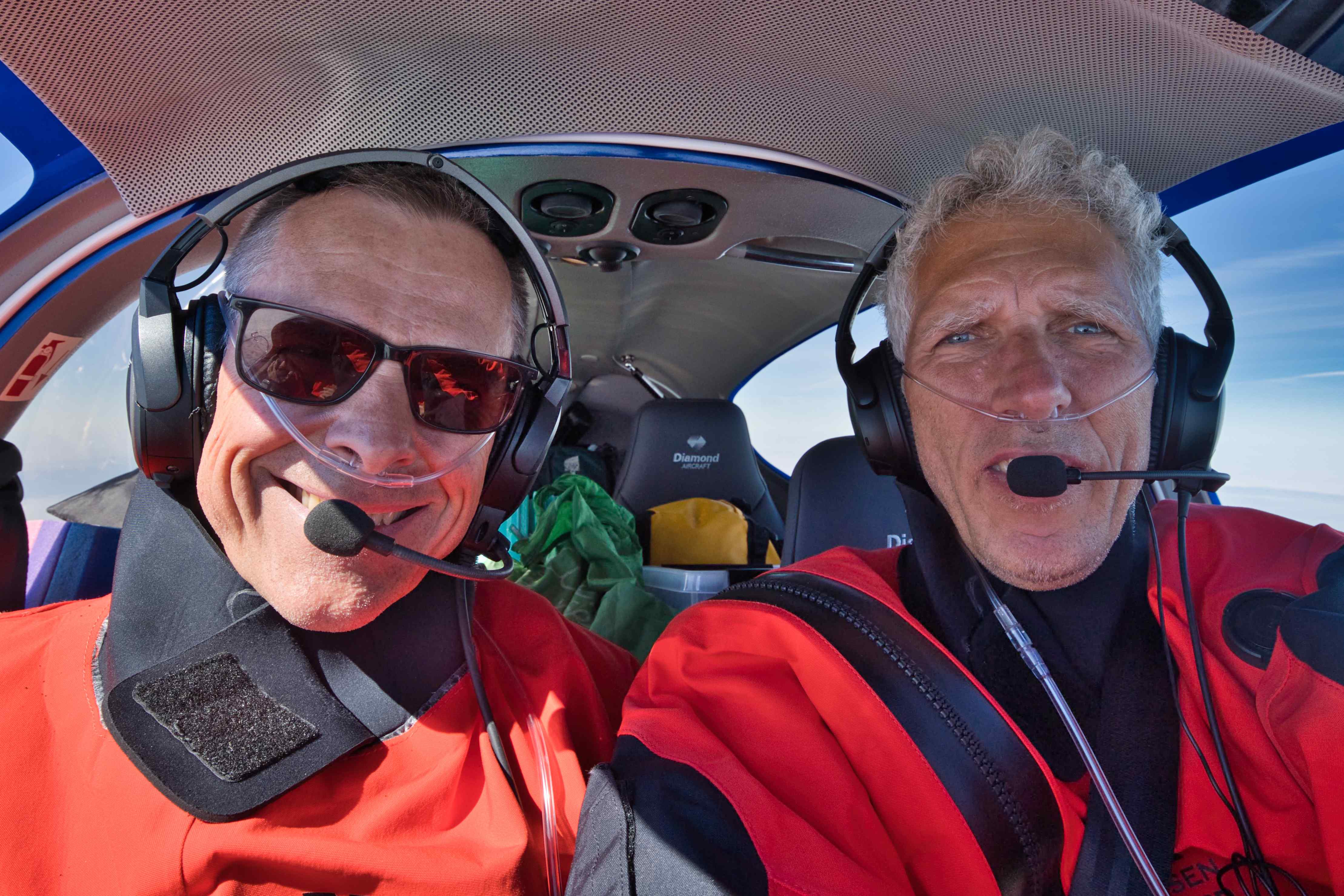
June 2024 – On the 3rd of June, 2024, together with my very good friend Frode, I departed from Roskilde Airport in OY-JNK, my one year old Diamond 42. Our goal was to reach and fly around in Greenland before returning to Roskilde two to three weeks later. We reached Greenland on day two after one night in Reykjavik. And we ended up visiting Kulusuk, Ilulisat, Sisimiut, Nuuk and Narsarsuaq with two to three days at each place.
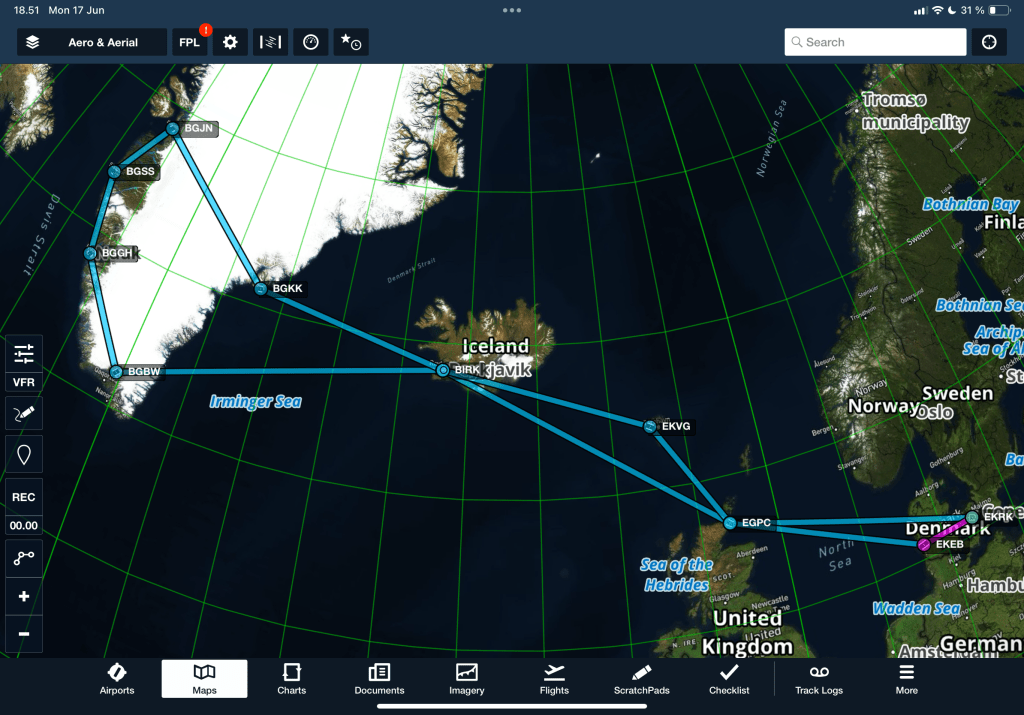
We ended up flying 13 legs with a total flight time of 36 hours and 10 minutes. Total route distance was 4,410 nautical miles or 8,167 kilometres. Including local flight in Kulusuk and all the other detours on the other flights, total distance flown ended up being 5,525 nautical miles or 10,232 kilometres. This gives an average ground speed of 153 knots or 283 kilometres pr. hour.
All flying between Denmark and Greenland and back was IFR (instrument flying) and almost all flying within Greenland (except the approach into Nuuk) was VFR (visual flying).
Our tour day-by-day
| Date | Itinerary |
|---|---|
| Monday June 3rd | We took off from Roskilde (EKRK) 7:00 am in the morning and landed in Reykjavik (BIRK) 6:45 pm after stops in Esbjerg (EKEB), Wick (EGPC) and Vagar (EKVG). We stopped in Esbjerg to pick up rented survival suits. Es stopped in Wick for fuel and to pick up rented survival raft. We stopped in Vagar just because. |
| Tuesday June 4th | Flew from Reykjavik (BIRK) to Kulusuk (BGKK). |
| Wednesday June 5th | Flightseeing from Kulusuk in the nearby stunning mountains. |
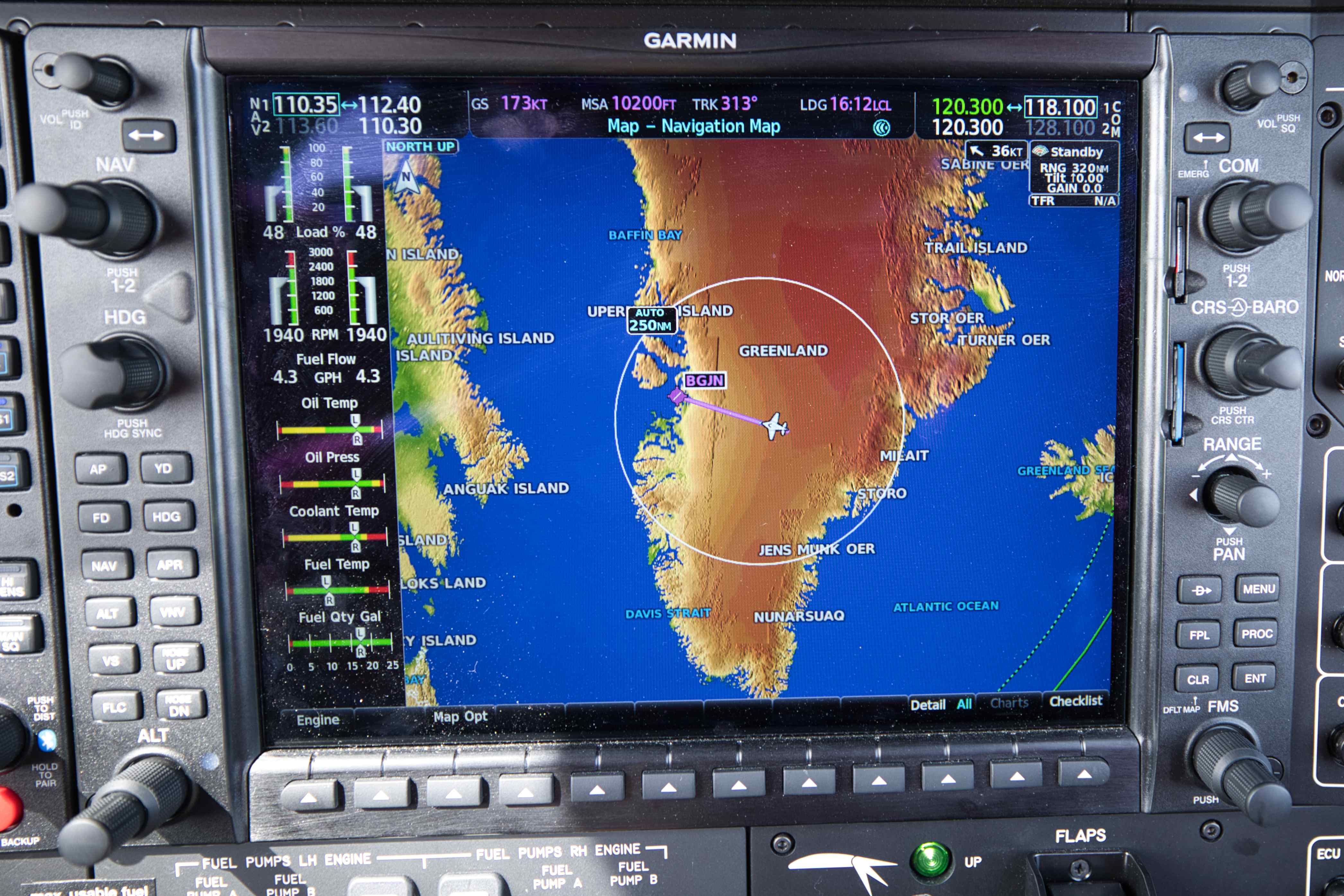
| Thursday June 6th | Flew over the icecap from Kulusuk (BGKK) to Ilulisat (BGJN). Midnight boat trip among icebergs outside Ilulisat. |
| Friday June 7th | Ilulisat sightseeing and kayak tour. |
| Saturday June 8th | Flew from Ilulisat (BGJN) to Sisimiut (BGSS). |
| Sunday June 9th | Went fishing and had the freshest Fish & Chips for dinner. |
| Monday June 10th | Flew from Sisimiut (BGSS) to Nuuk (BGGH). |
| Tuesday June 11th | Local sightseeing in Nuuk. |
| Wednesday June 12th | Local sightseeing in Nuuk. |
| Thursday June 13th | Flew from Nuuk (BGGH) to Narsarsuaq (BGBW). |
| Friday June 14th | Hiked 25 km. roundtrip to local glacier. |
| Saturday June 15th | Flew from Narsarsuaq (BGBW) to Reykjavik (BIRK). |
| Sunday June 16th | Doing almost nothing in Reykjavik. |
| Monday June 17th | Another day doing almost nothing in Reykjavik. |
| Tuesday June 18th | Flew from Reykjavik (BIRK) to Roskilde (EKRK) with stop in Wick (EGPC). |
Preparations
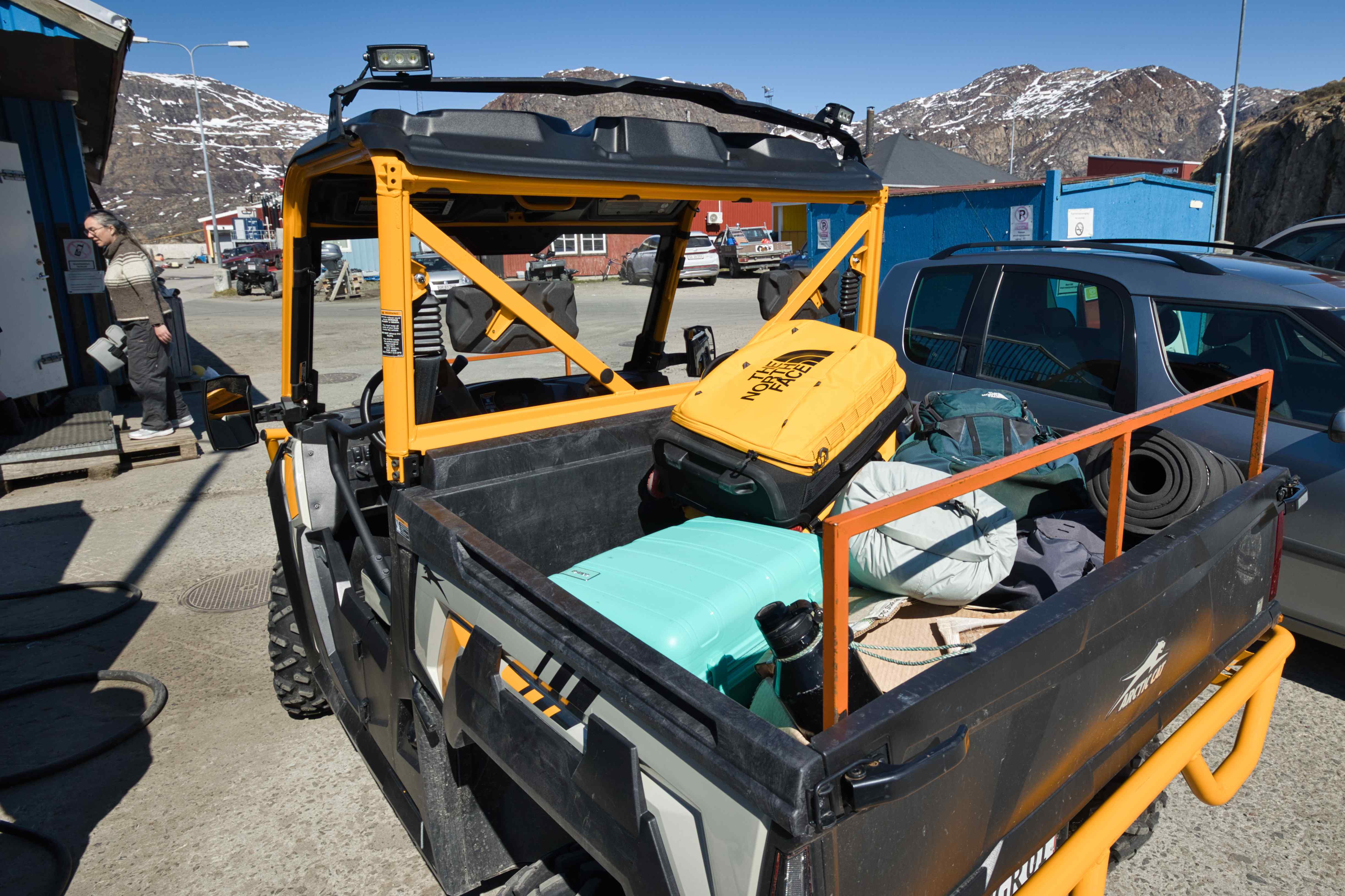
Ready for departure, the plane was packed to maximum take-off weight. How do I know? Everything was weighed to a precision of 10 grams!
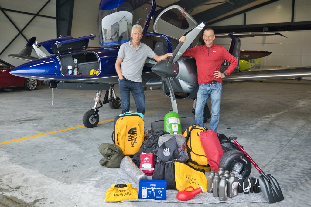
Preparation for the trip was not difficult, but being far away from my home airport for two weeks, and in this case in oceanic and arctic conditions where temperatures are low and airports are far between meant that we had to bring many items I normally wouldn’t bring. I also weighed everything as it was soon obvious that weight would be an issue, even with only two persons on board.
Items we brought along included:
- Survival Raft. We rented a 9.5 kg survival raft from Far North Aviation in Wick (EGPC). Far North Aviation is a small business mainly supporting pilots flying small airplanes across the pond. They rent out rafts, waterproof suits and sell fuel.
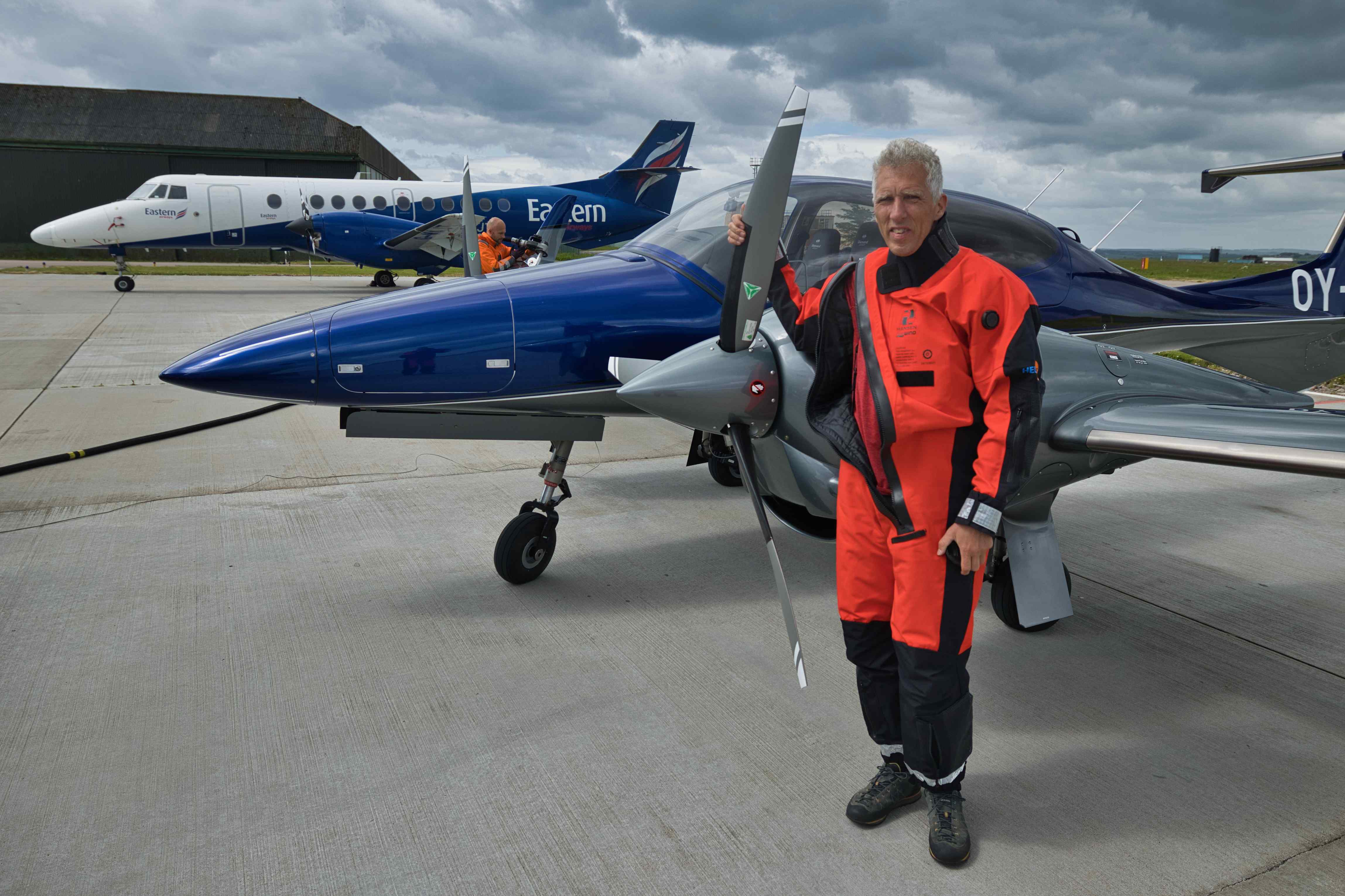
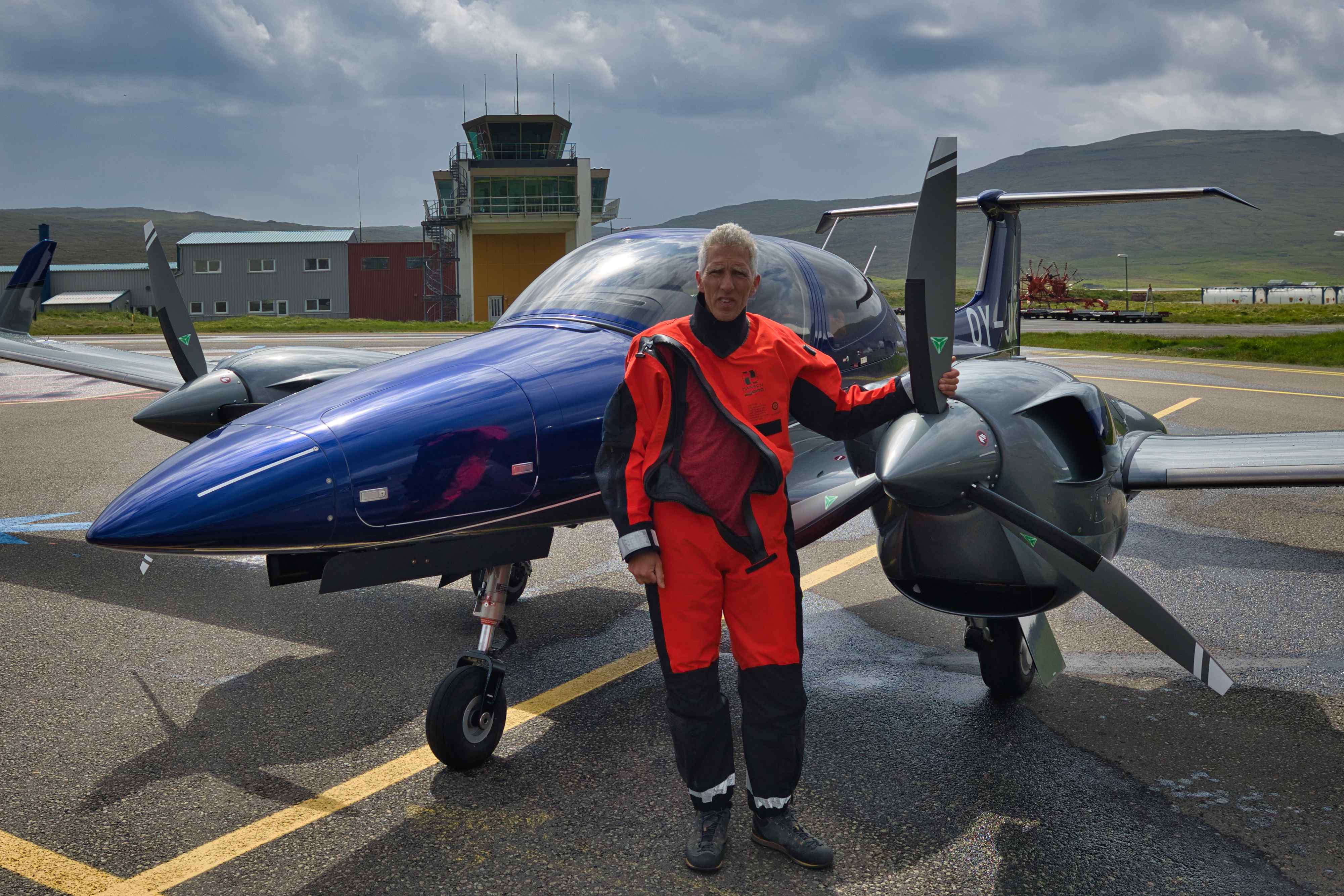
- Survival Suits. I have never flown with these suits before, but we would have long distances over cold water, and even with two engines wearing these suits seemed to be the right thing to do. We rented the suits from HeliPPE Aps in Esbjerg, Denmark, as they seemed to have the best gear and offers on rentals.
- Personal Locator Beacon (PLB). My airplane has its own Emergency Locator Beacon (ELT), but having a backup in a pocket in your survival suit can change everything in an emergency situation (if you have to leave the airplane or the airplane sinks).
- Iridium Satellite Phone. This one is obvious, phone coverage doesn’t exist anywhere outside the few and far between towns.
- Garmin InReach GPS tracker. This tiny device makes it super easy for everybody back home to follow us in real time. My tracker was set up to log our position every two minutes. All my tracks can be seen here.
- Dry food, dry fruits, chocolate and water. The requirements are 2,000 kcal pr. person pr. day, we brought way more.
- Stove to boil water for food and coffee. We brought a MSR WhisperLite Universal Stove which easily runs on jet fuel.
- Flares and emergency rockets to attract attention in case of emergency.
- Lightweight Ice Shovel.
- Tent, mats and sleeping bags for arctic temperatures.
- Two iPads with ForeFlight. ForeFlight was used for all flight planning, for most weather briefings, for fuel planning and for filing flight plans. During flights ForeFlight was used as navigation backup.
- Water tight grab Bag with essential stuff in case of an emergency. We had PLB, flares, water and satellite phone in the grab bag.
For the airplane we brought the following items:
- Spare tire and tube.
- Extra oil for the engines.
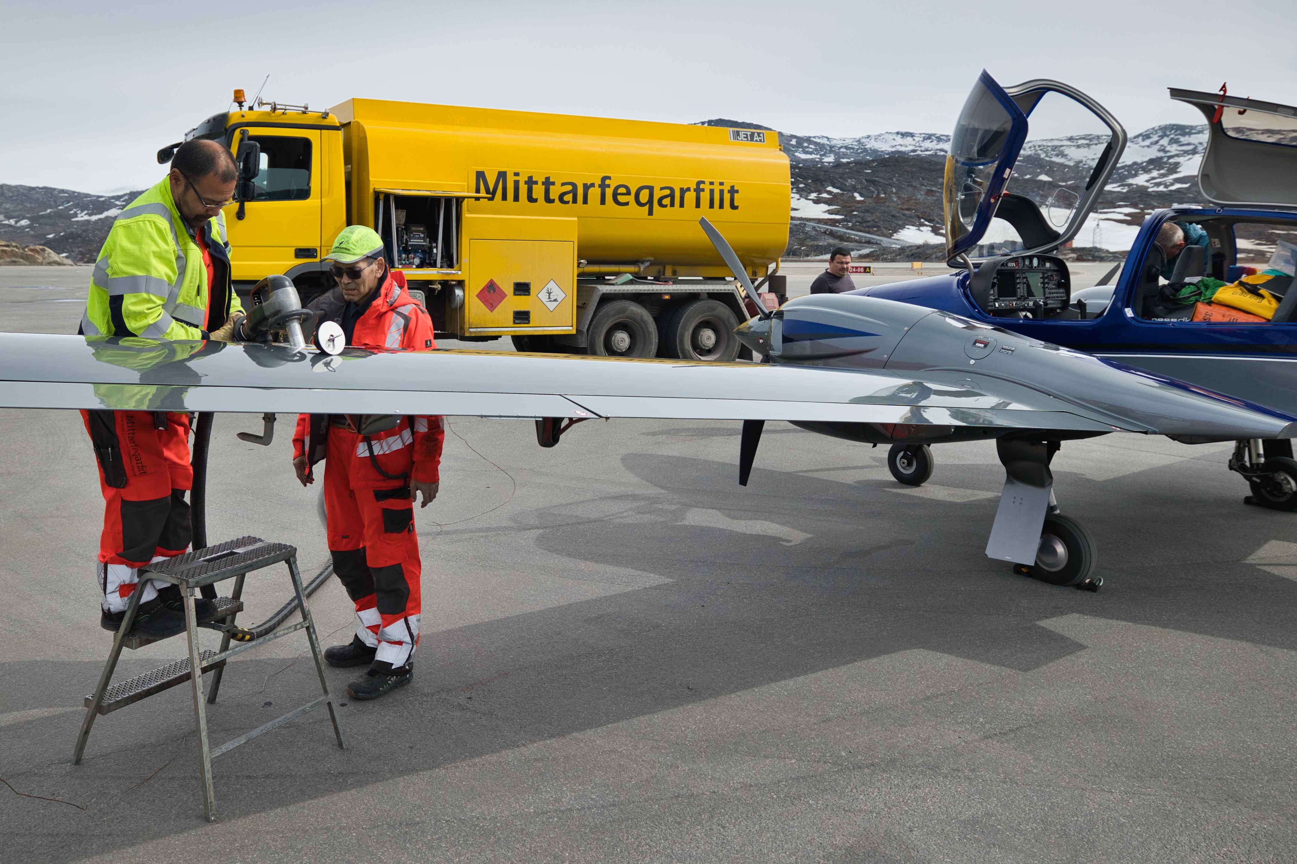
- Colourful markings for the wings. It is a requirement for flying in Greenland that the airplane is easy to spot in the arctic environment. I bought 5 circular orange stickers for the wings, each with a diameter of 60 cm. I didn’t put them on because I was sure my current blue and grey colouring scheme of my airplane would fulfil the requirement. But in case we would meet some authorities who wouldn’t accept our colouring scheme, I would had them ready.
- Oxygen for the entire trip. Most of the trips was done below FL100 (10,000 feet), but for the long flights over water I flew at up to FL180 (18,000 feet) depending on the wind. My oxygen bottle is a large, but lightweight 48 cb. ft. carbon fibre bottle. And my oxygen system is a Portable Pulse Demand System for two people from MH Oxygen. This oxygen system can last for up to 15 hours for two persons flying at FL180 (18,000 feet).
- Extra headset and extra batteries for headsets.
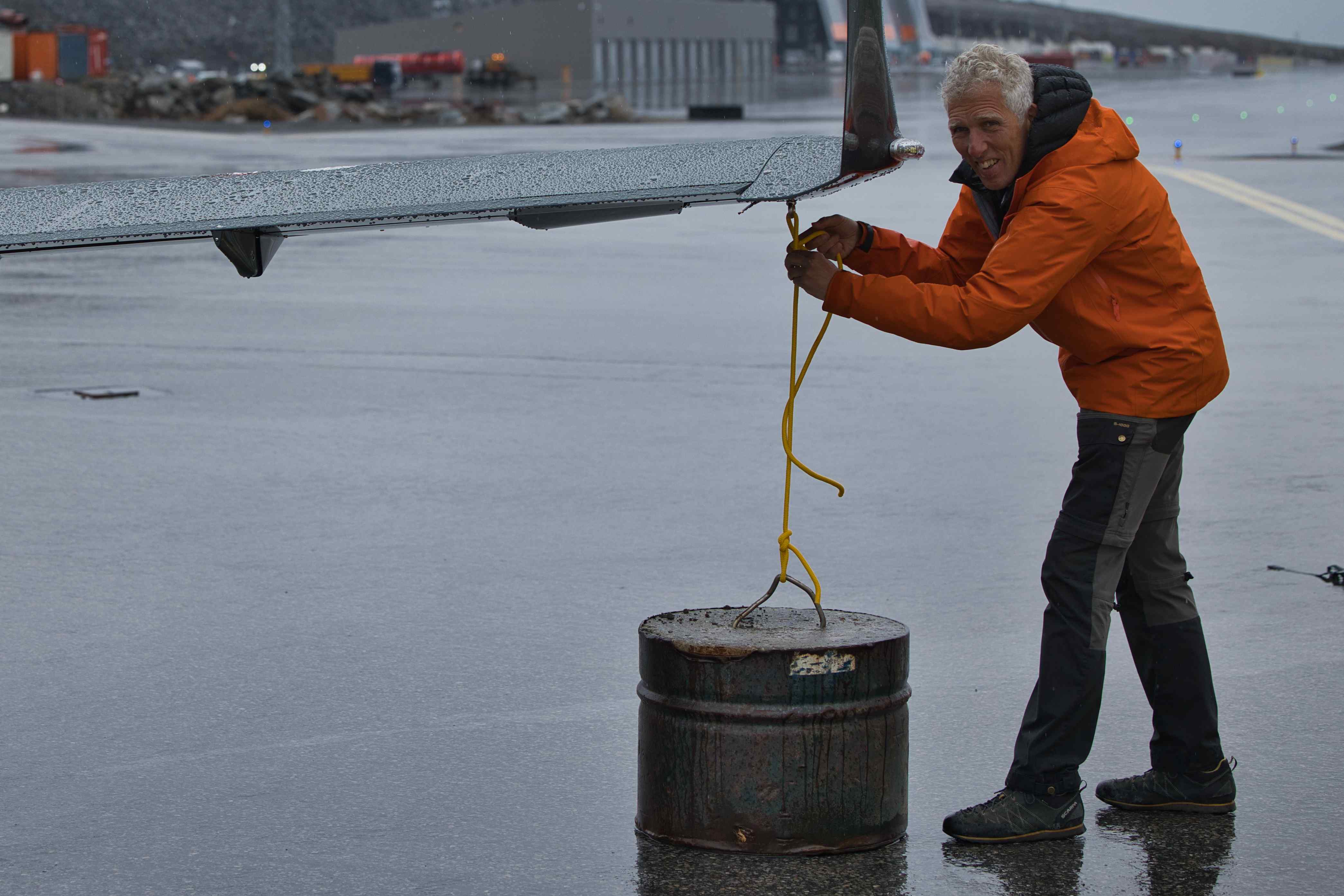
- Chocks, tie down clamps and ropes for parking. We always used the chocks as few were available in Greenland. And having our own ropes were handy at most places.
We also brought along a lot of photography equipment of cause:
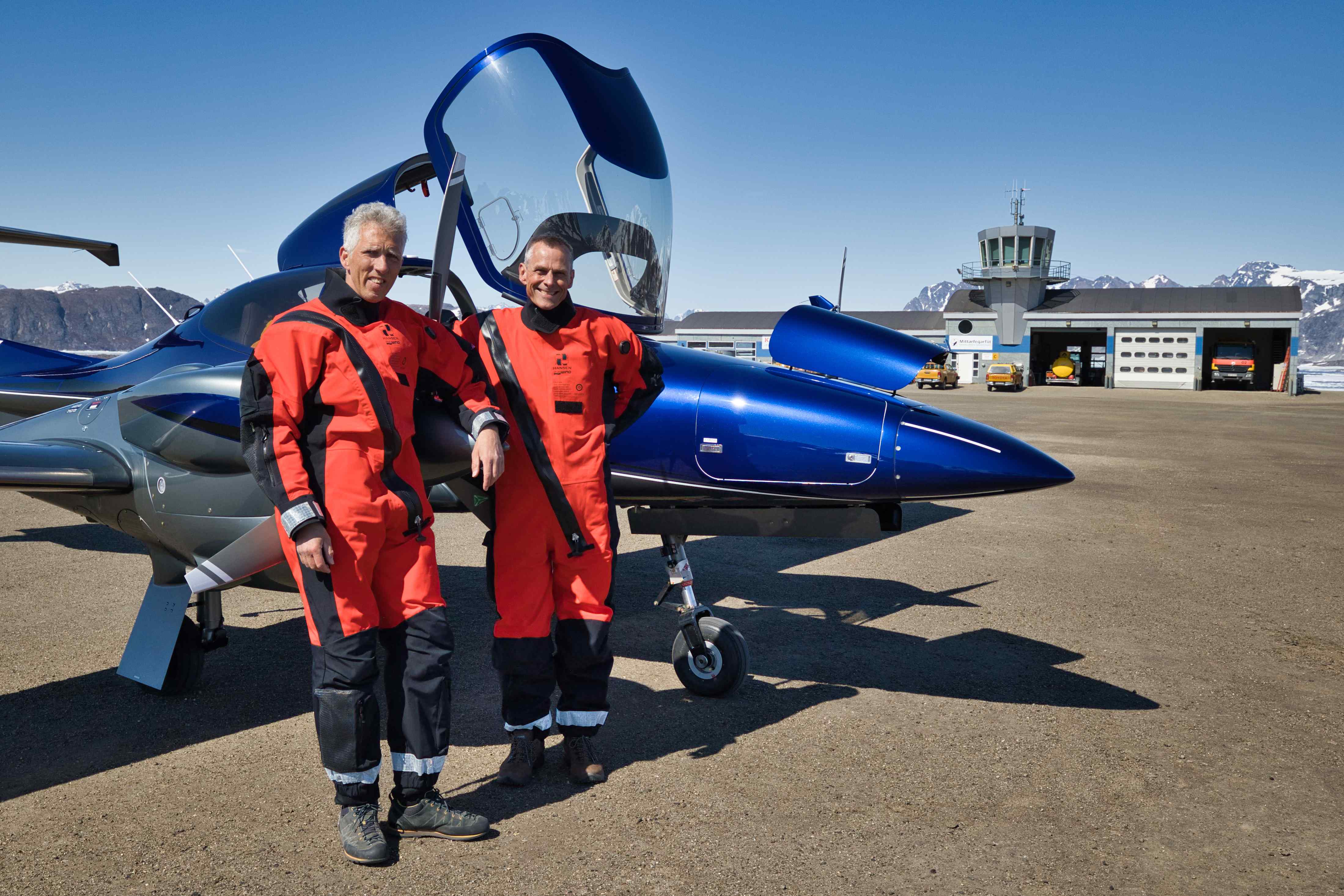
- Two full frame mirrorless cameras. I brought my Canon R6 and Frode brought his Nikon Z8.
- Three GoPro cameras. One of them were always mounted uppermost in the canopy facing forward.
- External microphone for GoPro which can be put between left side of my headset and my ear. This way we could record our own speaking as well as communication with controllers and towers.
From Roskilde to Esbjerg
1st flight, EKRK to EKEB, flight time 55 minutes, 122 nautical miles or 226 kilometres
Domestic flight in Denmark, from Roskilde to Esbjerg. In Esbjerg we only stopped for an hour to pick up survival suits and check out of Schengen because our next leg would take us to Scotland. In Denmark, once you file a flight plan for a destination outside Schengen, the Police will come to the airport to check your passports.
From Esbjerg to Wick
2nd flight, EKEB to EPGC, flight time 3 hours and 5 minutes, 420 nautical miles or 778 kilometres
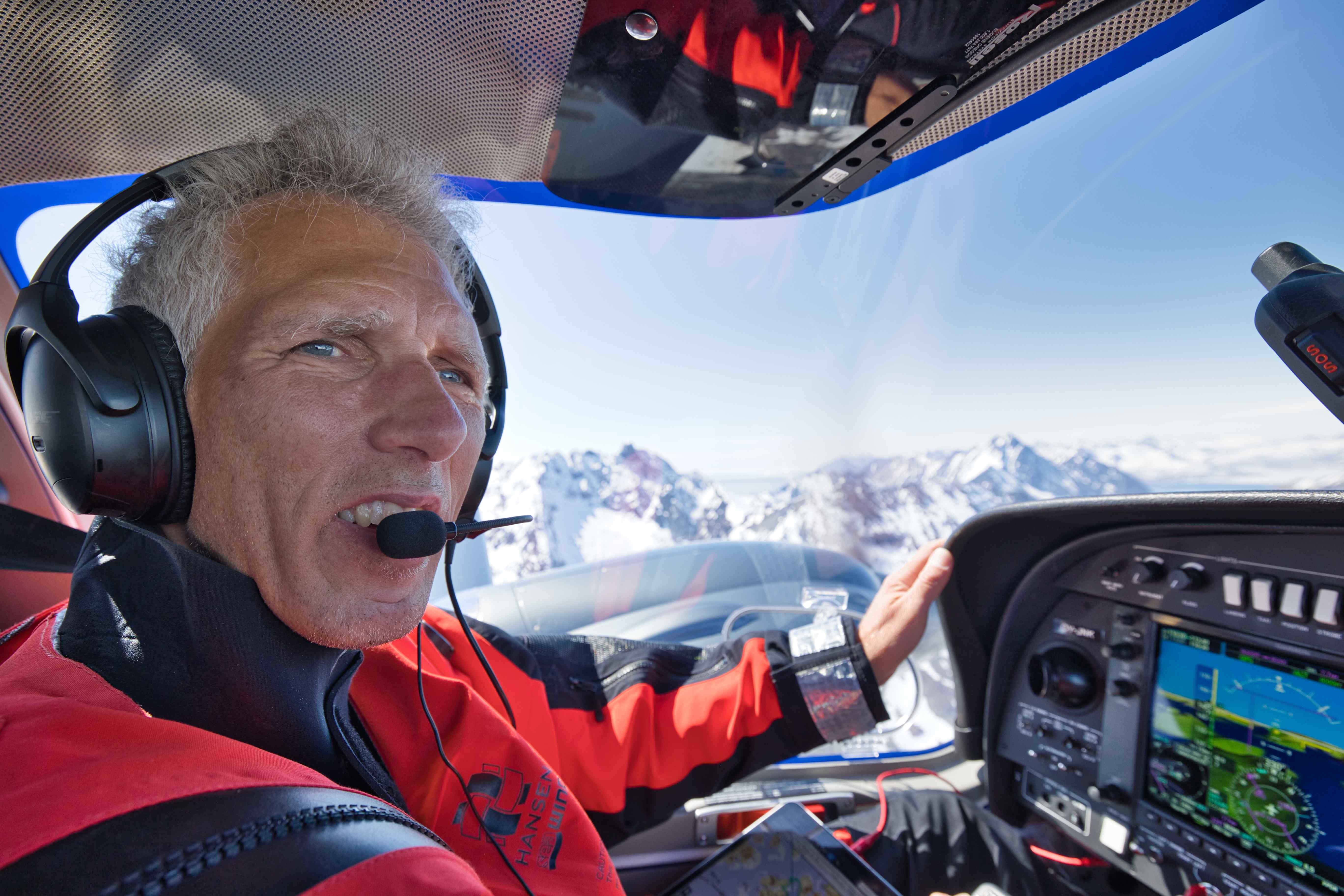
This was our first leg over water. This was also my first time flying in a survival suit. Flight planning was super easy, we flew IFR with plenty of fuel and plenty of alternatives. As we were flying into UK we also had to file a GAR, which is also super easy (start here).

Wick is a rather small airport and Far North Aviation is just a few steps away from the apron where a marshaller guided us to parking. A fuel truck came out to us right after landing because I had already told Far North Aviation that I would need fuel. We went up to their office and got our Survival Raft and coffee. Billing for rental, fuel, landing and take-off was all gathered on the same invoice and payment by Far North Aviation, super easy.
From Wick to Vagar
3rd flight, EGPC to EKVG, flight time 1 hour and 55 minutes, 250 nautical miles or 463 kilometres
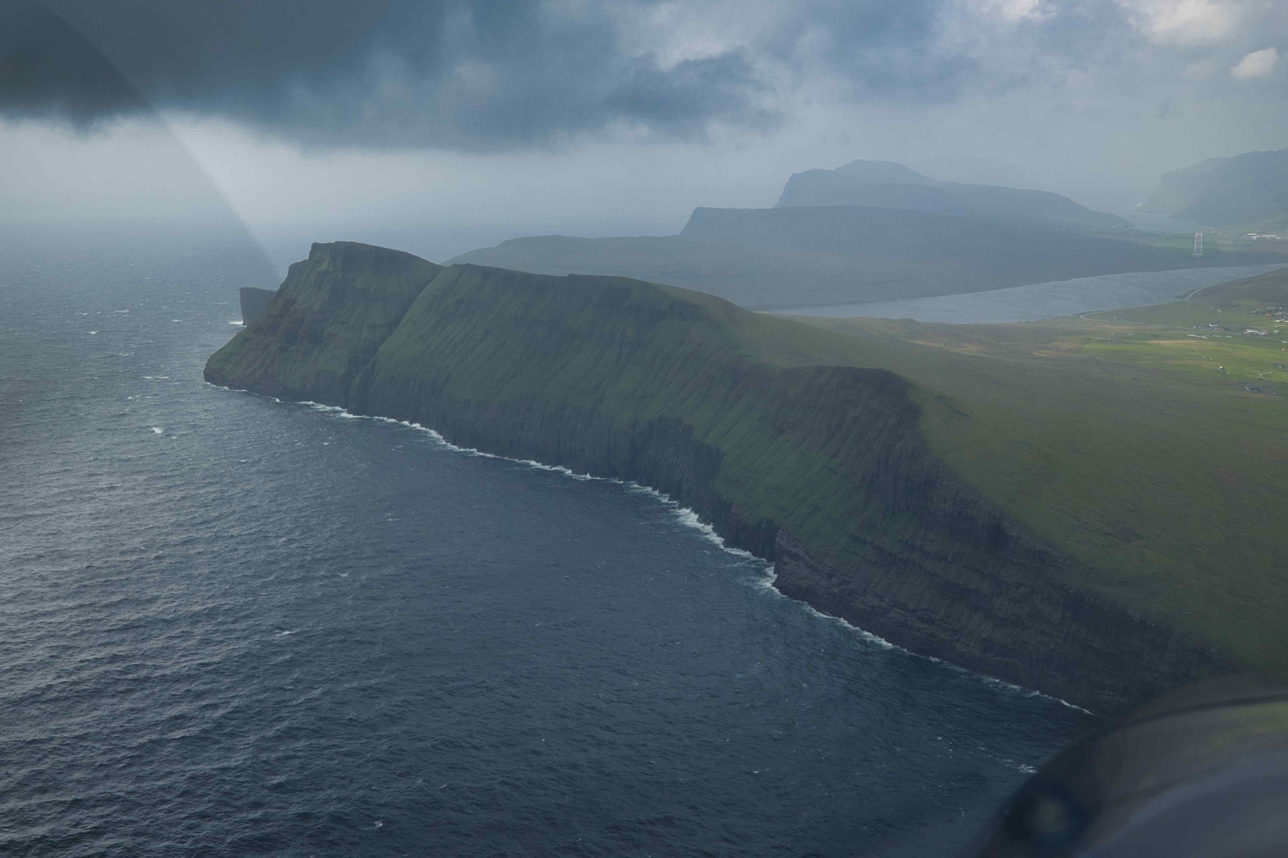
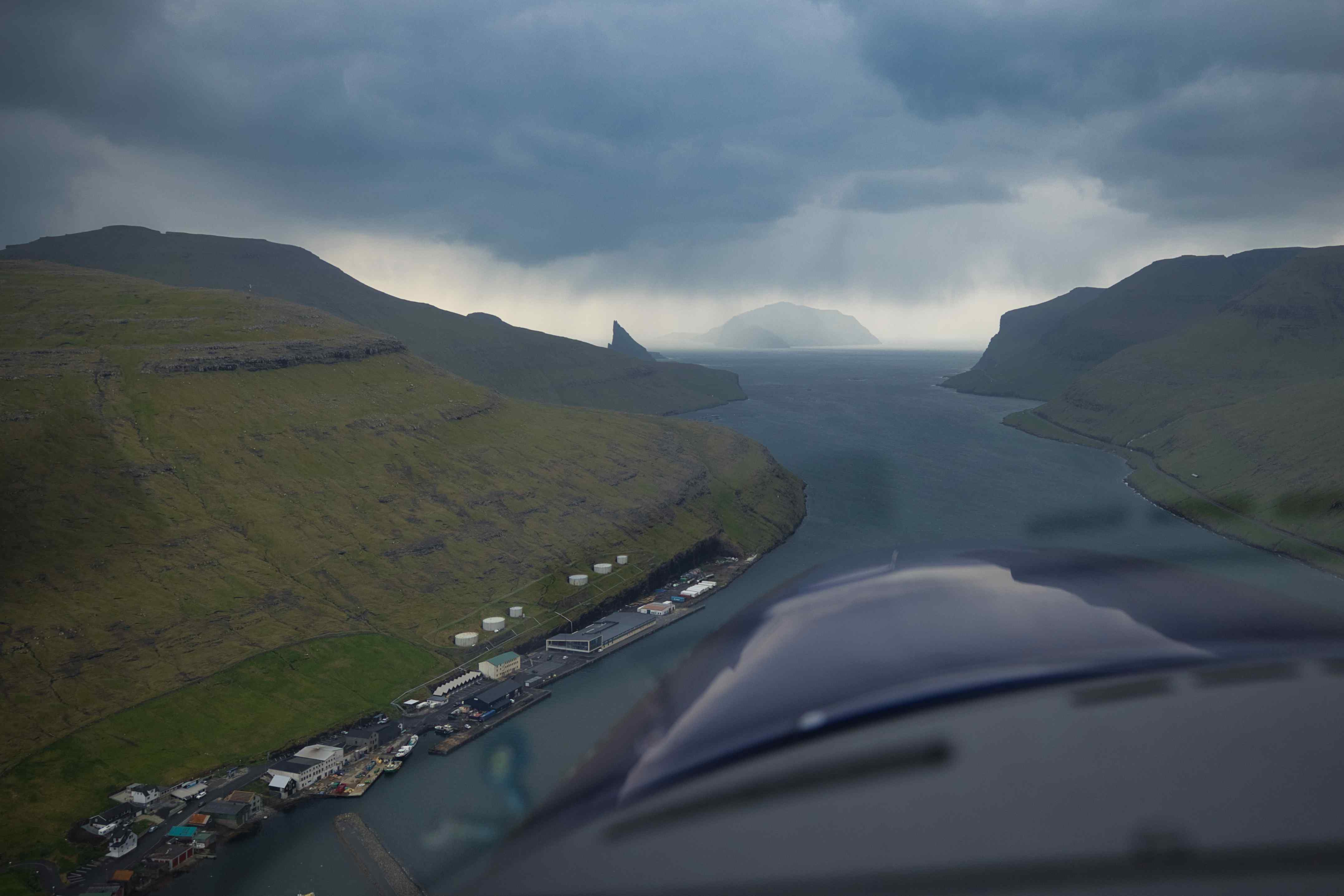
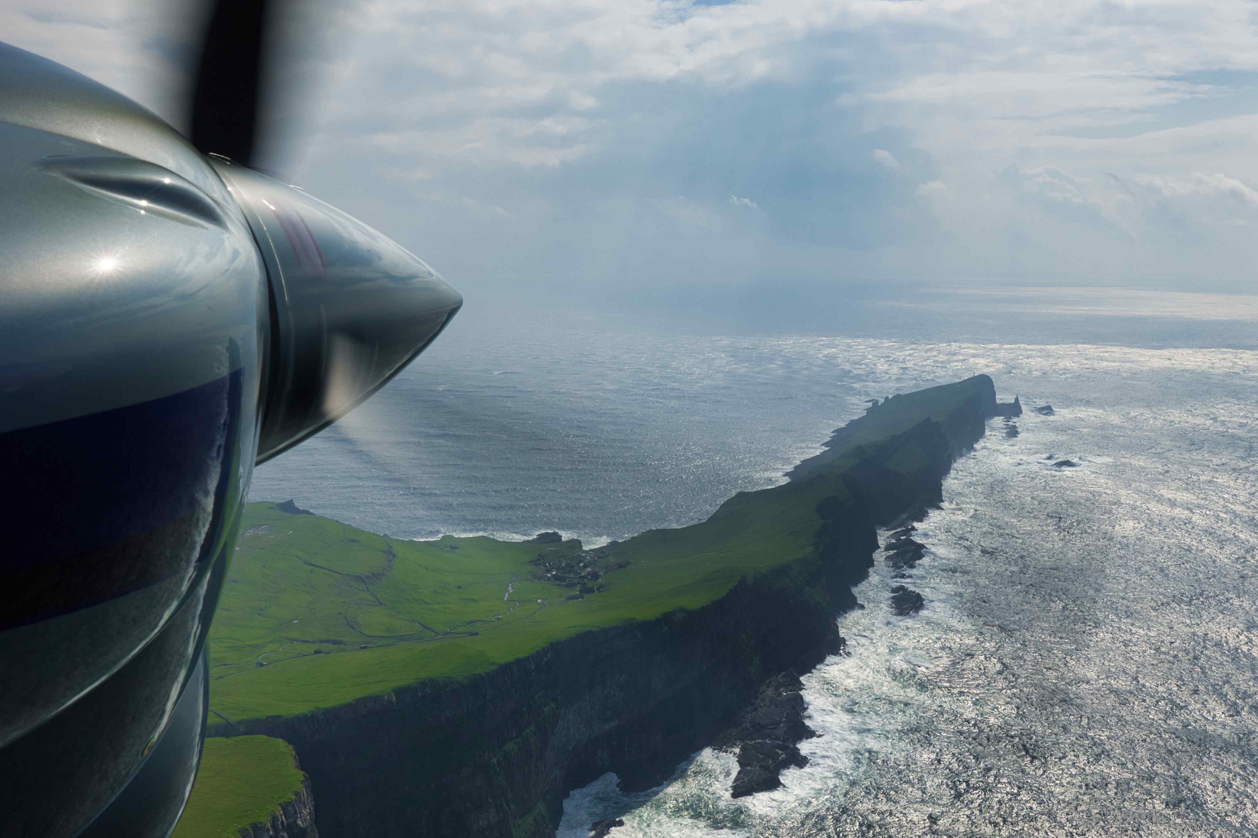
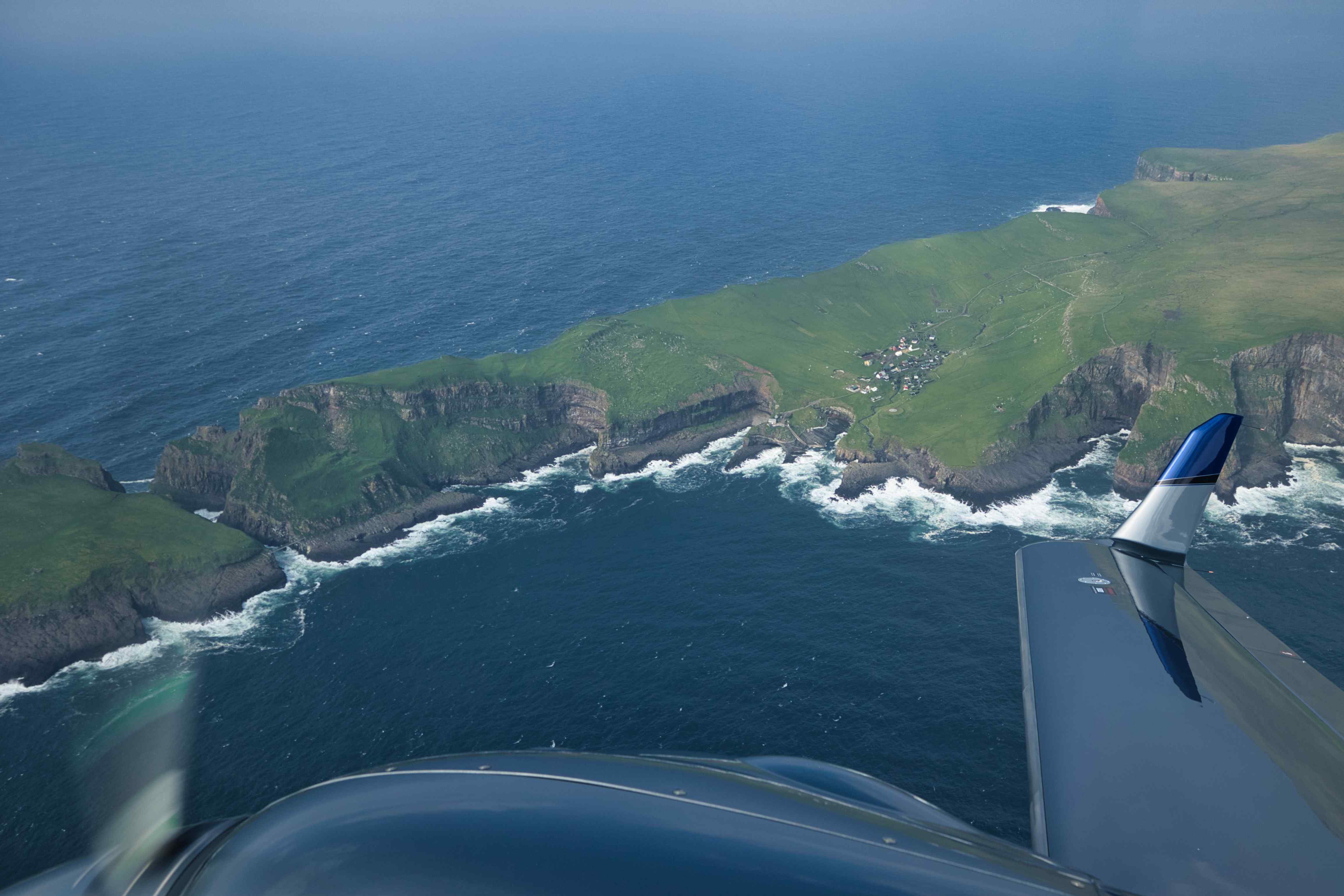
We didn’t have to land at Vagar in the Faeroe Islands, but landing there was definitely on my bucket list. And the weather forecast was acceptable, cloudy with strong wind directly down the runway.
Landing at Vagar requires familiarization with typical weather patterns around the Islands, basically one has to request, read, understand and acknowledge by email that all this has been done by the pilot prior to landing.
Flying from Wick to the Faeroe Islands means flying into Reykjavik FIR. Until early 2024 this required an oceanic clearance, but not anymore. So the entire flight was executed like any other IFR flight. Flying out of UK and back into Schengen also meant that another GAR had to be filed, still super easy.
We had enough fuel to continue to Reykjavik, but as always we topped up anyway, it is always nice to have plenty of fuel. On departure we got a clearance to do some sightseeing around Mykines before continuing according to our IFR flight plan.
All the following pictures are from around the Faeroe Islands, the first two are from the approach, the third one is from the airport and the remaining pictures from the departure.


From Vagar to Reykjavik
4th flight, EKVG to BIRK, flight time 2 hours and 20 minutes, 418 nautical miles or 774 kilometres
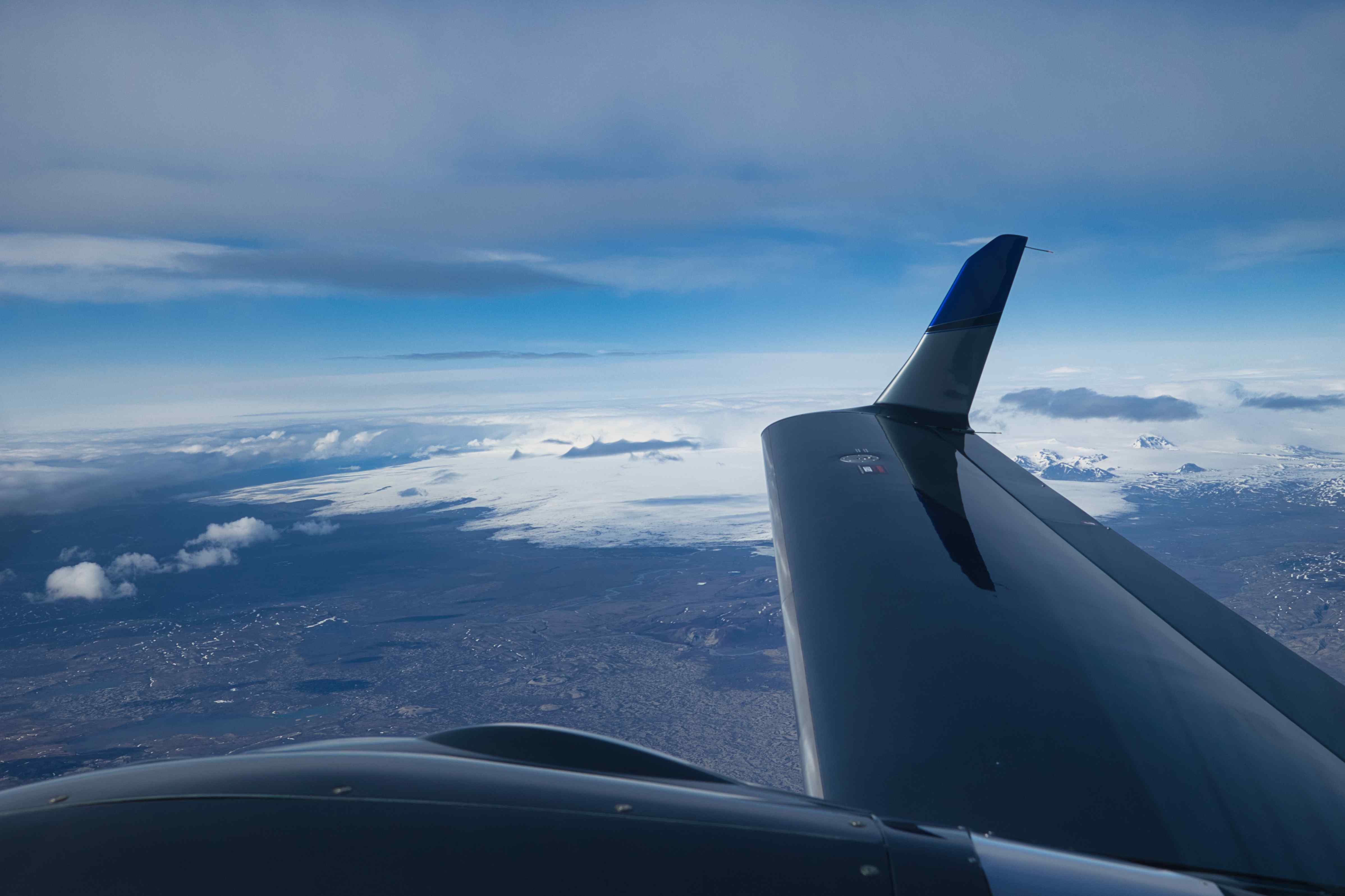
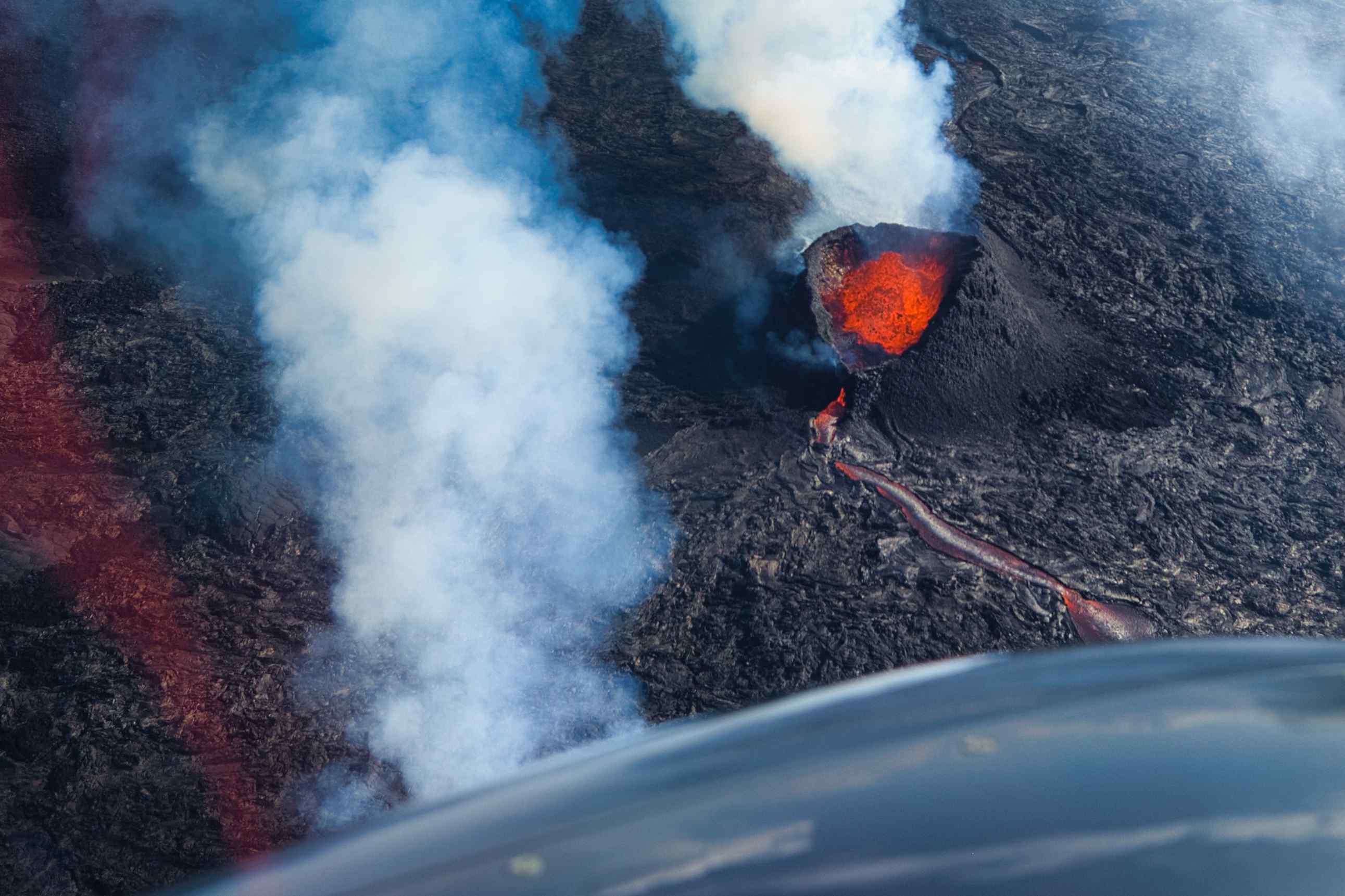
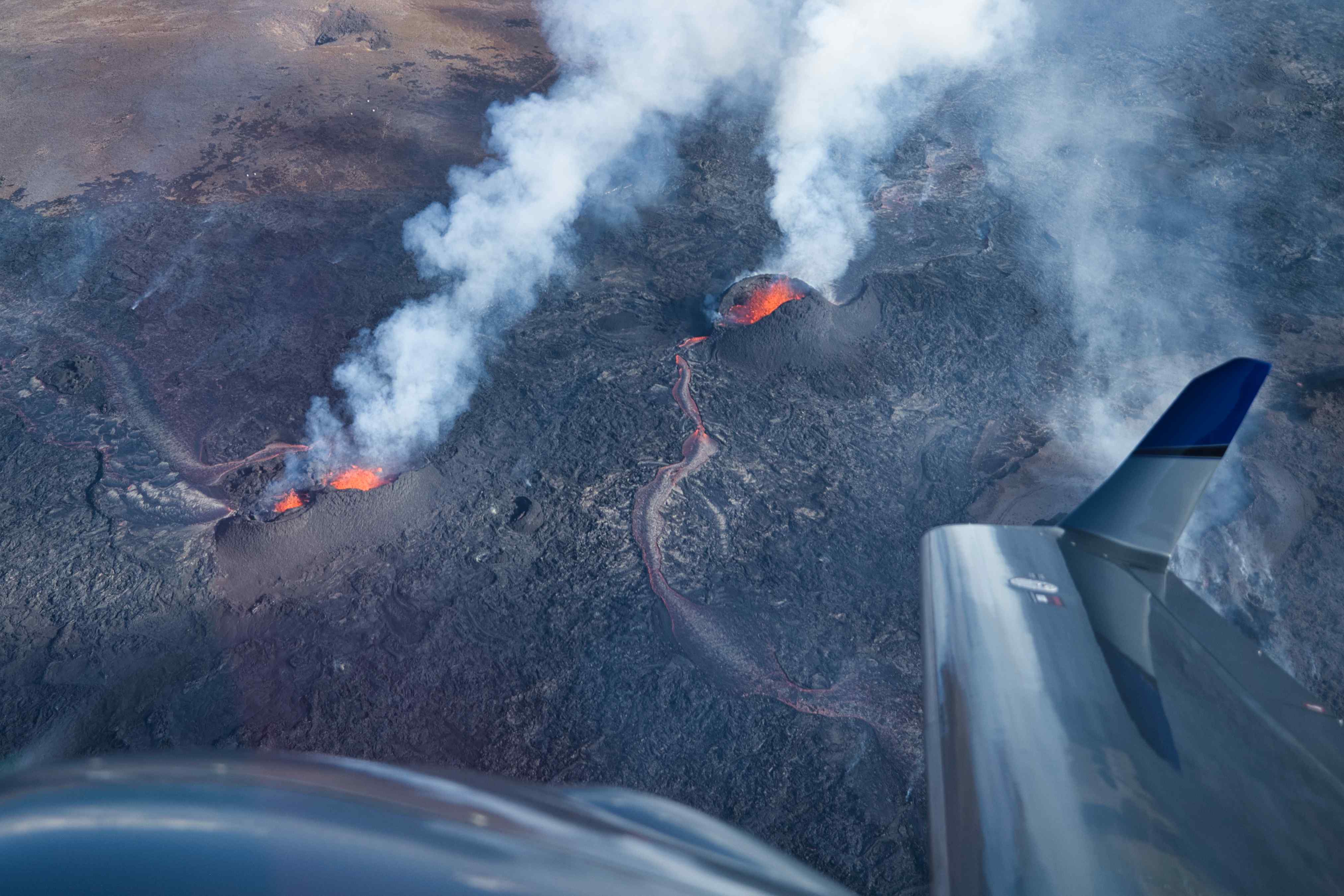
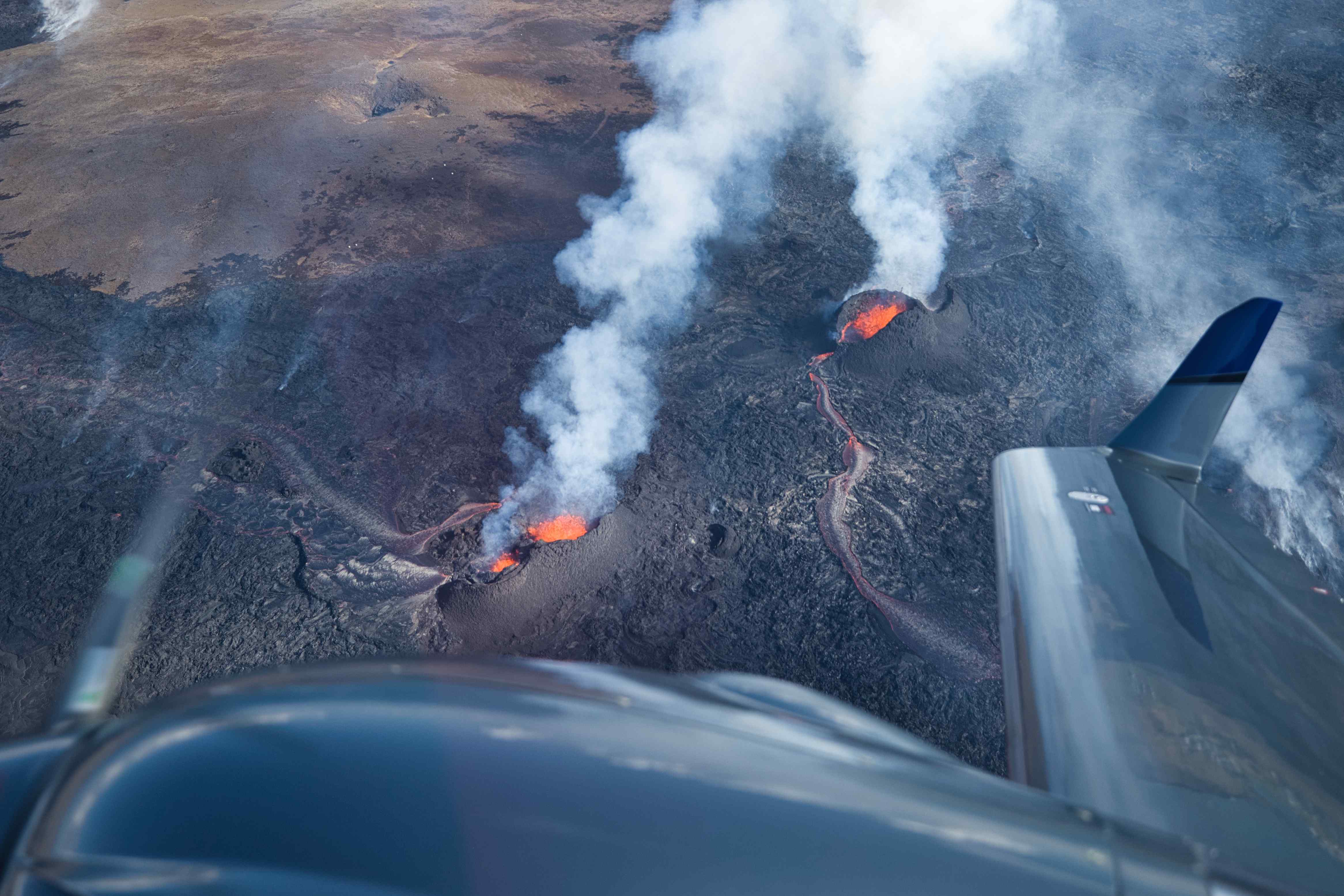
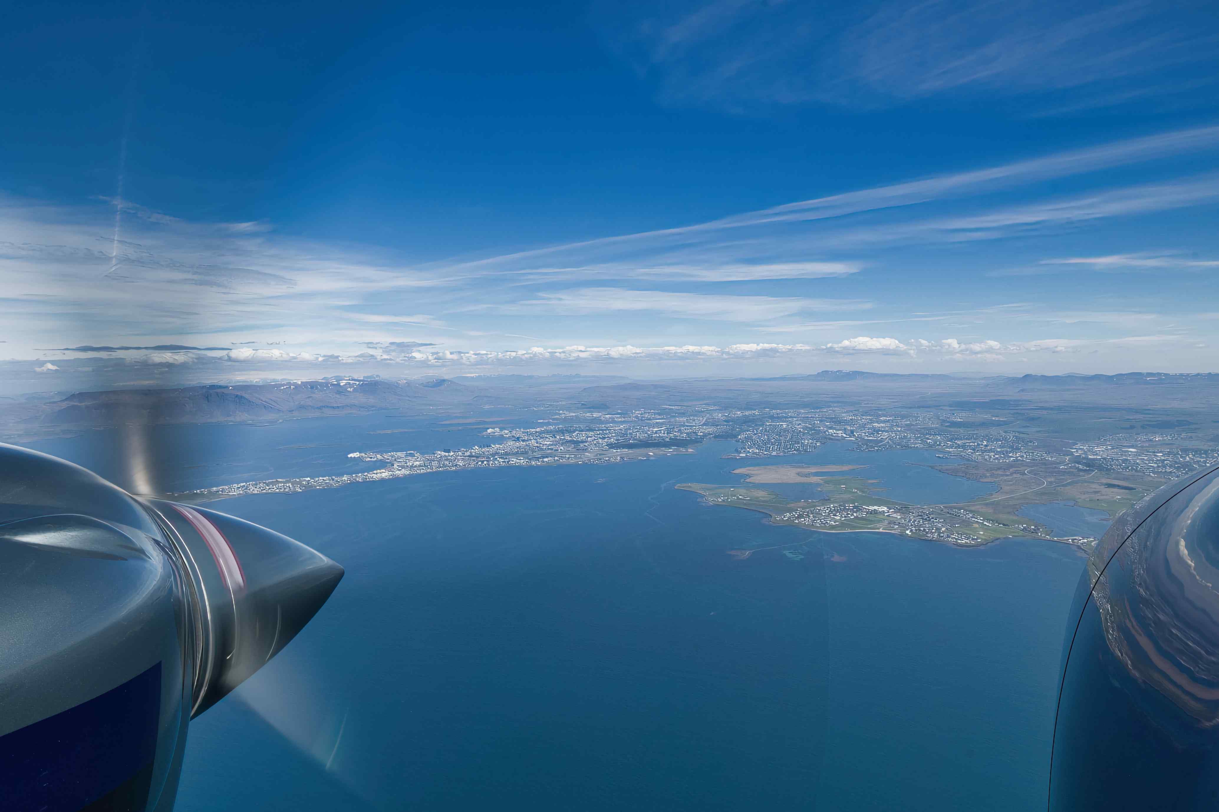
This turned out to be our last flight on day one. We didn’t see a lot of Iceland before reaching close to Reykjavik due to clouds. But when starting the approach into Reykjavik city airport the active volcano further to the west near Keflavik was really visible with a huge cloud coming up from the eruption site. We therefore cancelled our IFR and got a clearance to visually circumnavigate the eruption site before heading for Reykjavik for landing. What a sight, three craters were erupting with visible lava fountains and rivers of lava.


From Reykjavik to Kulusuk
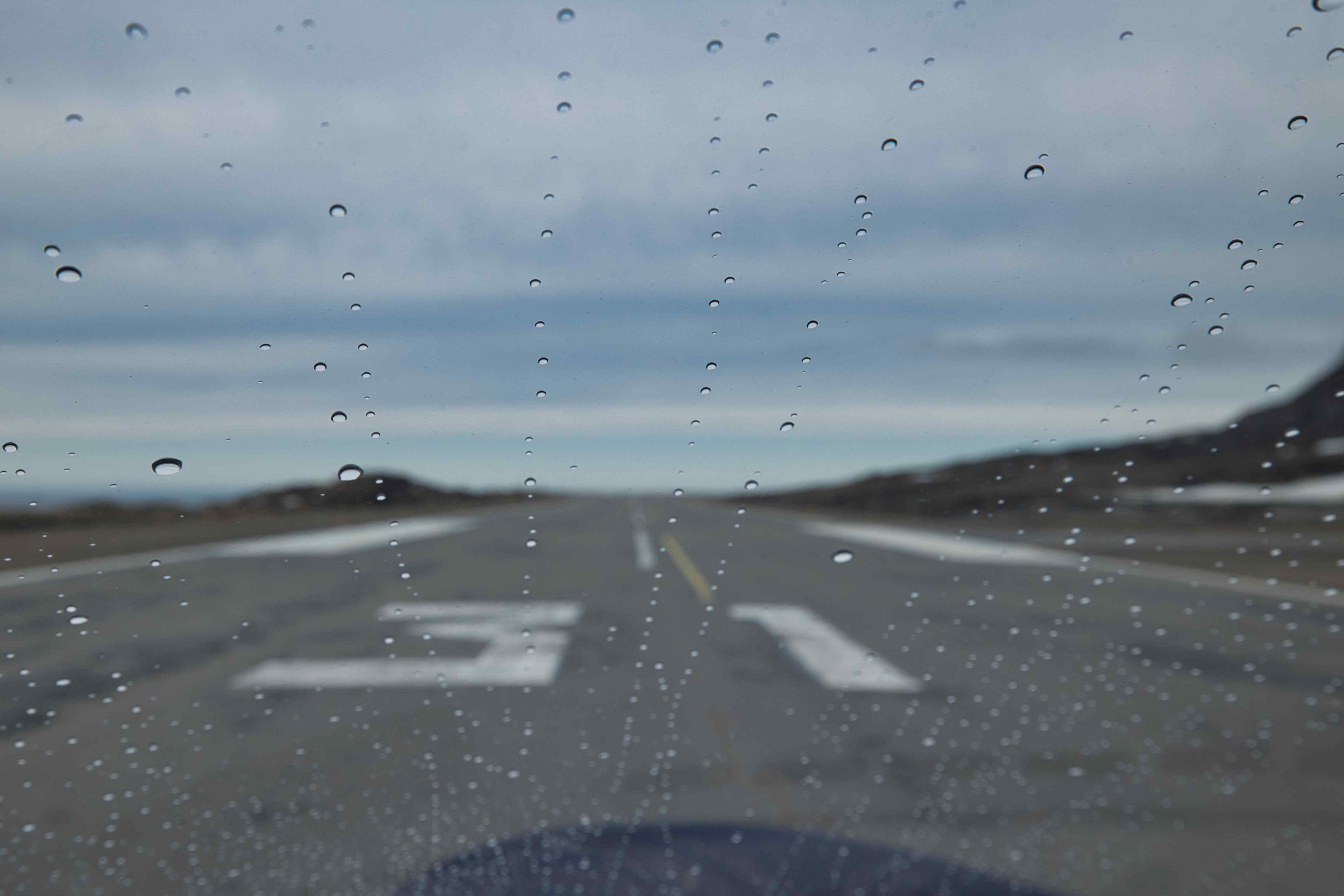
5th flight, BIRK to BGKK, flight time 2 hour and 55 minutes, 397 nautical miles or 735 kilometres
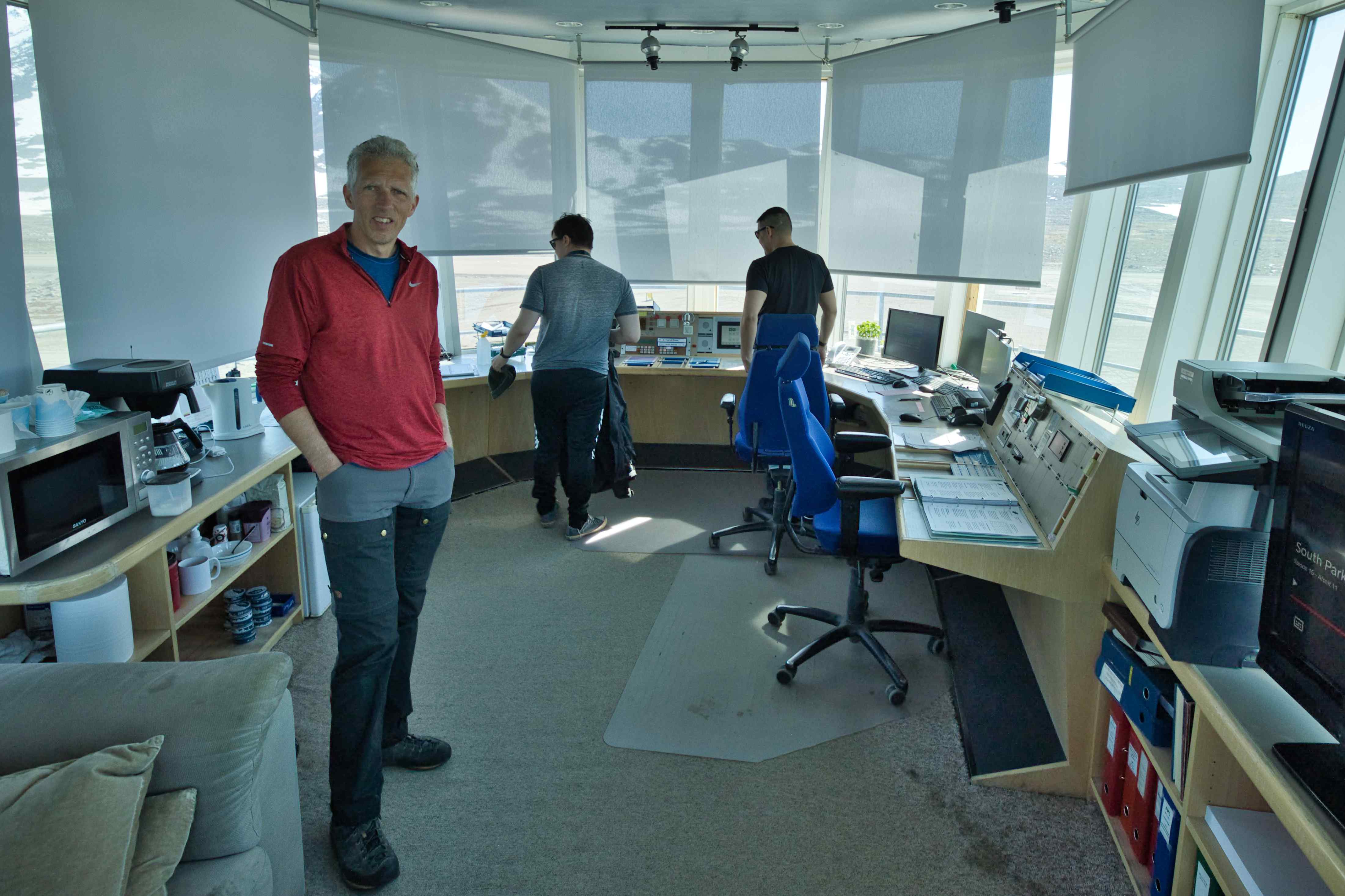
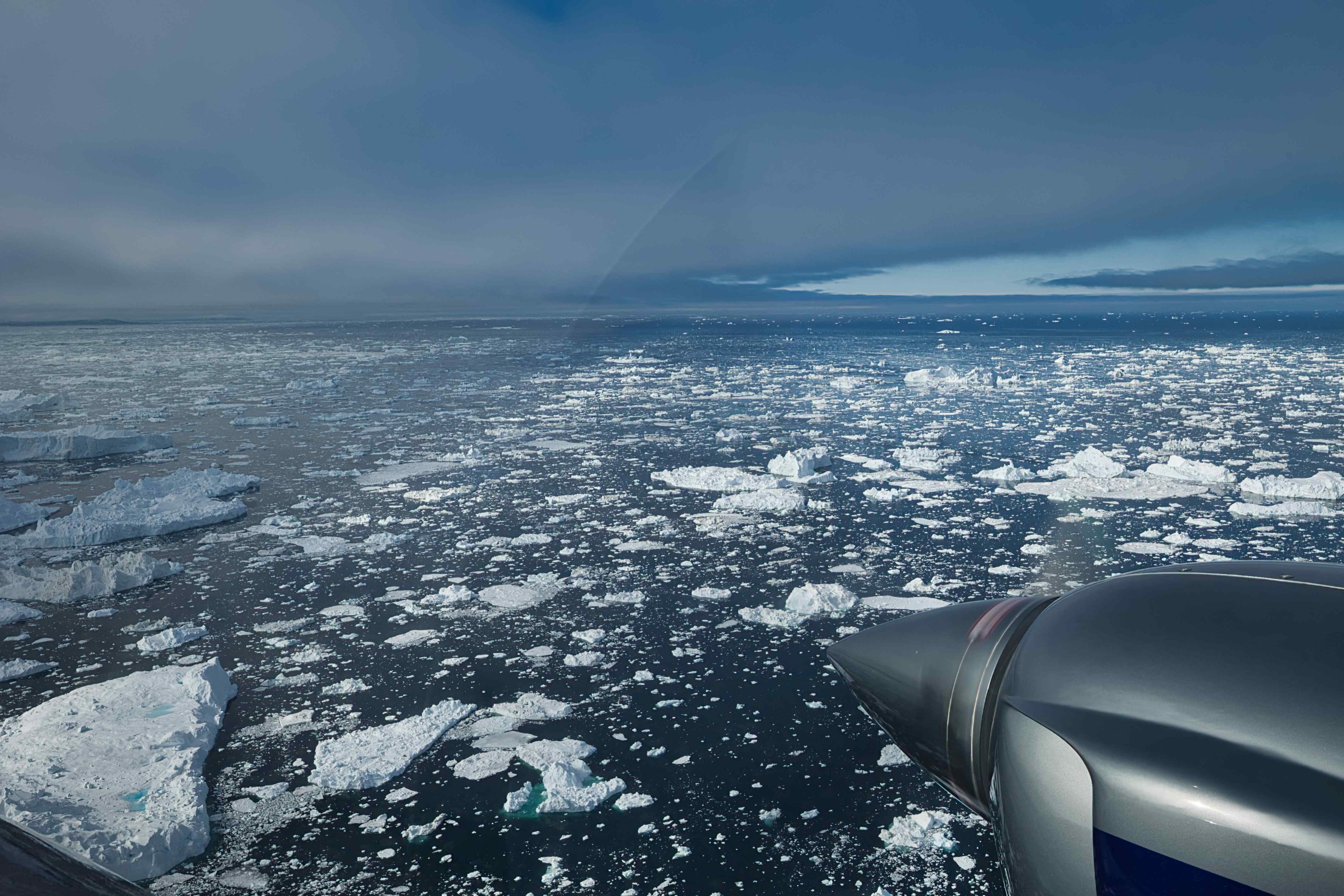
Finally, our flying would take us to Greenland. And what a flight, Greenland greeted us with the most stunning weather. And way more sea ice than usual. Also after landing we were greeted by really friendly people on the apron and in the tower. We ended up chatting with the AFIS people in the small tower for more than an hour. Among a lot of other things they told us that two polar bears had been spotted on the runway just two weeks before our arrival!

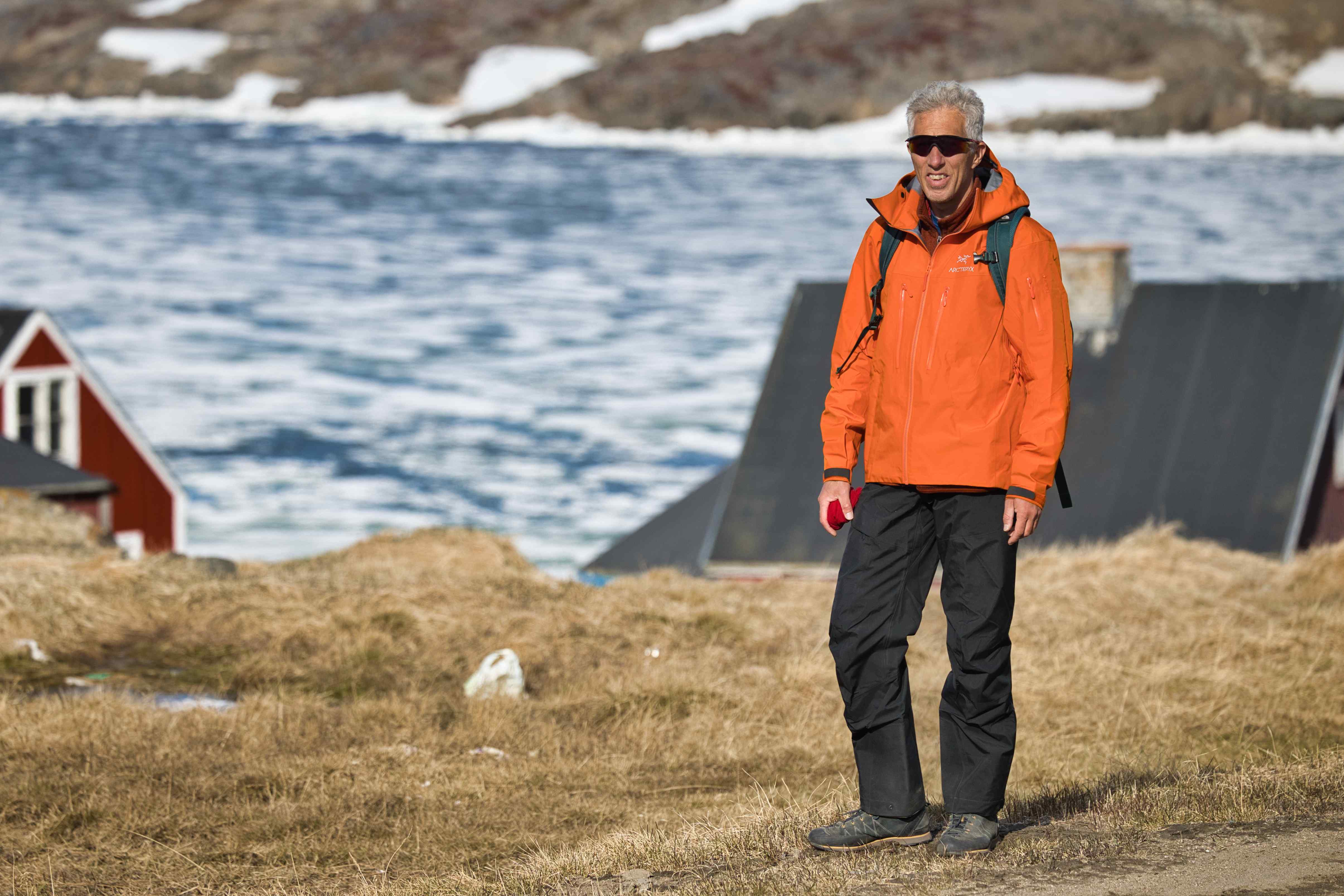
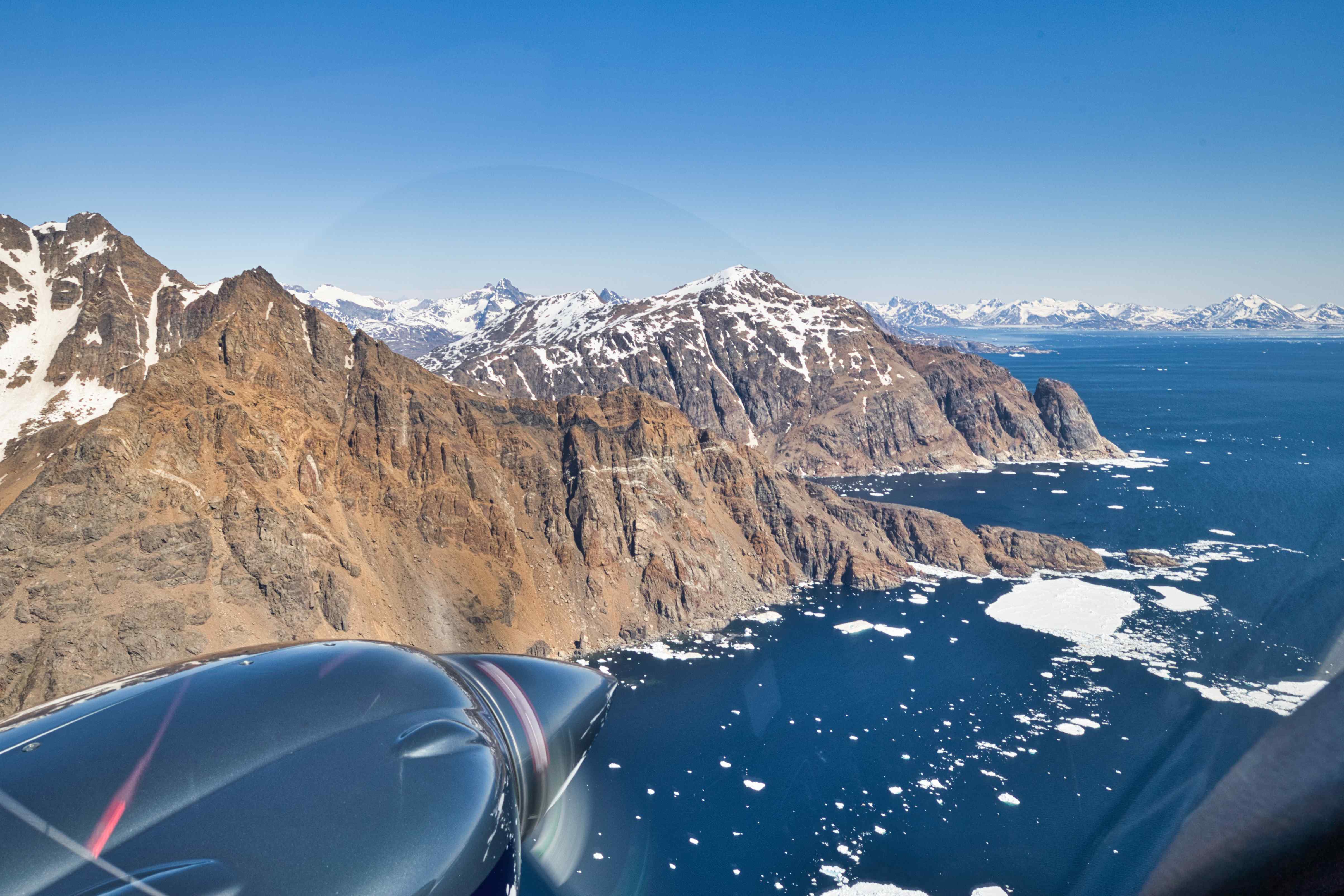
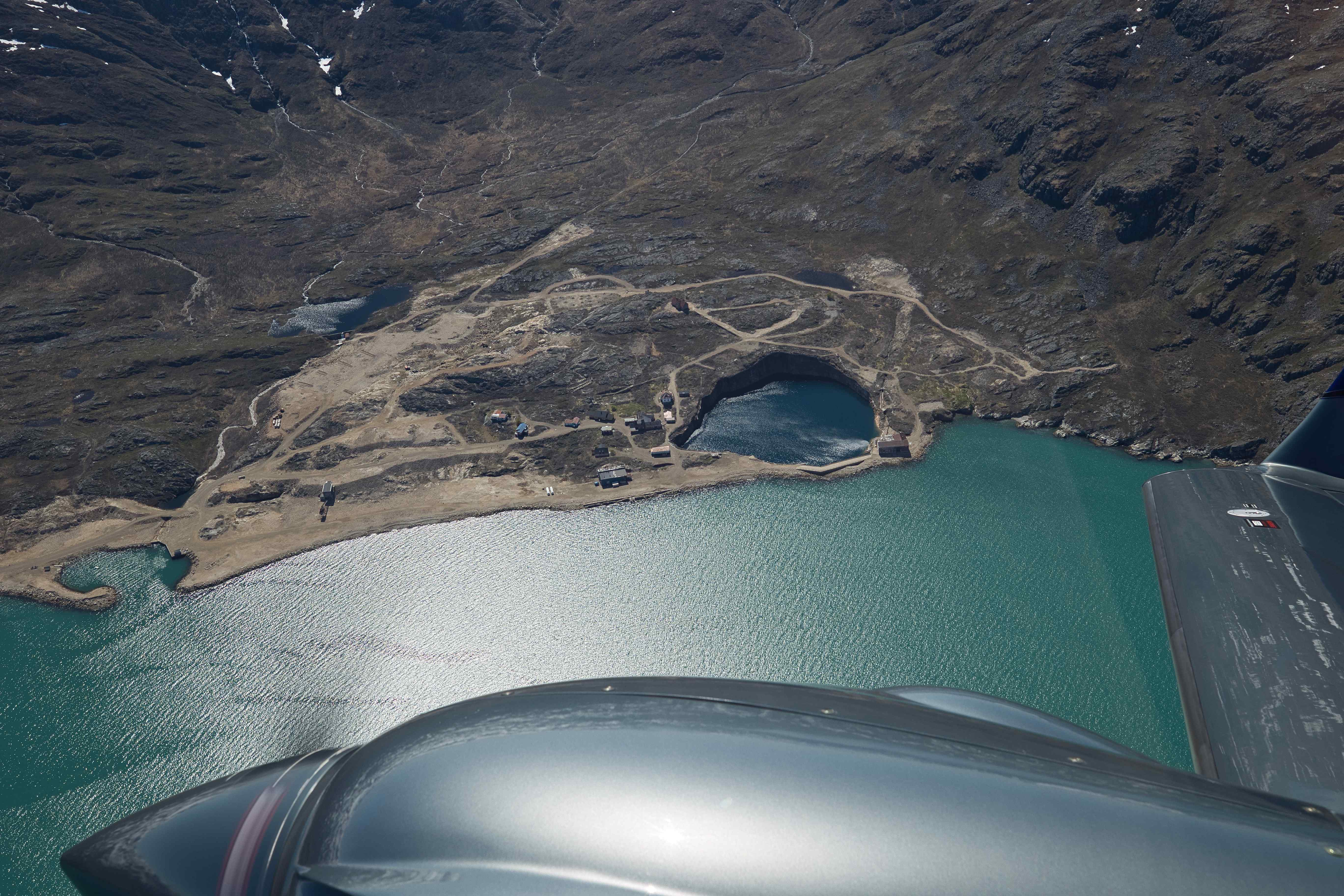
Kulusuk
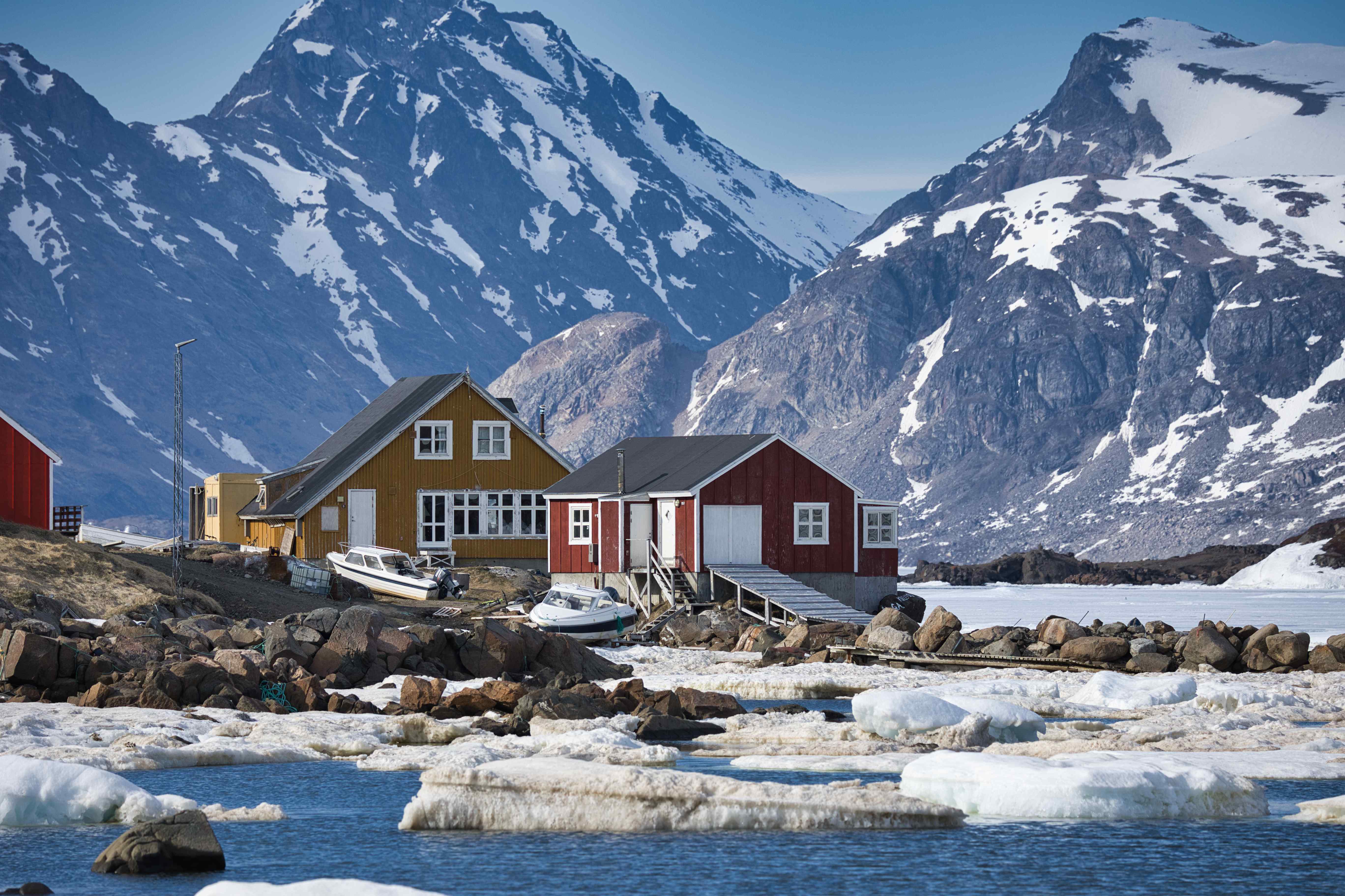
In Kulusuk we stayed two nights at Hotel Kulusuk, basically the only option in town and only 750 meters from the airport. We were about to walk the short distance when the operator in the tower came out and told us that he had already called for a car to pick us up. So a few minutes later we was sitting in an old van on what was more or less the only road around Kulusuk.
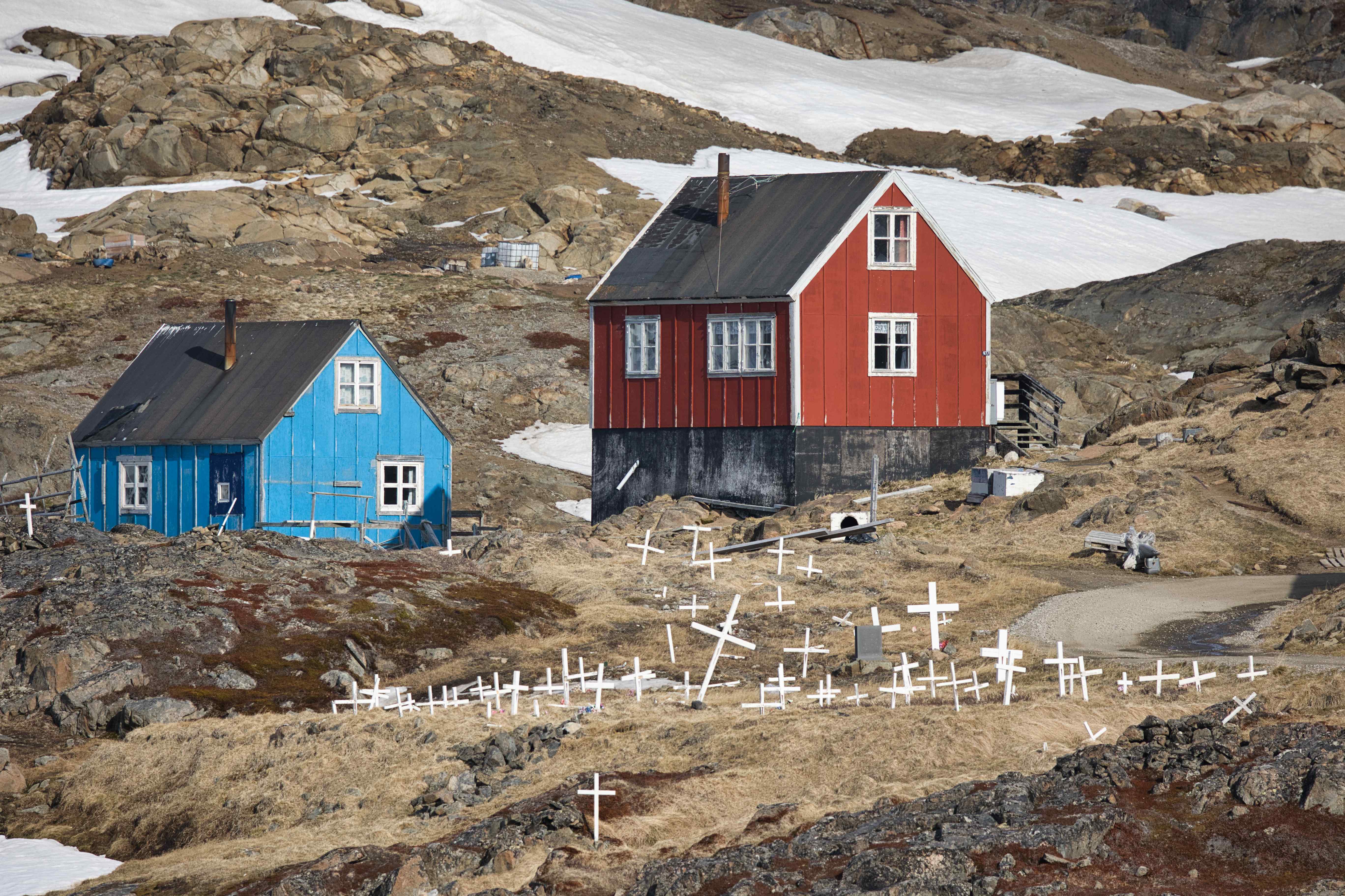
In the afternoon we walked around in Kulusuk, a tiny town with colourful houses.

The view from our hotel room was also magnificent. The entire night actually, it didn’t get dark al all!
Sightseeing flight around Kulusuk

6th flight, BGKK to BGKK, flight time 3 hours
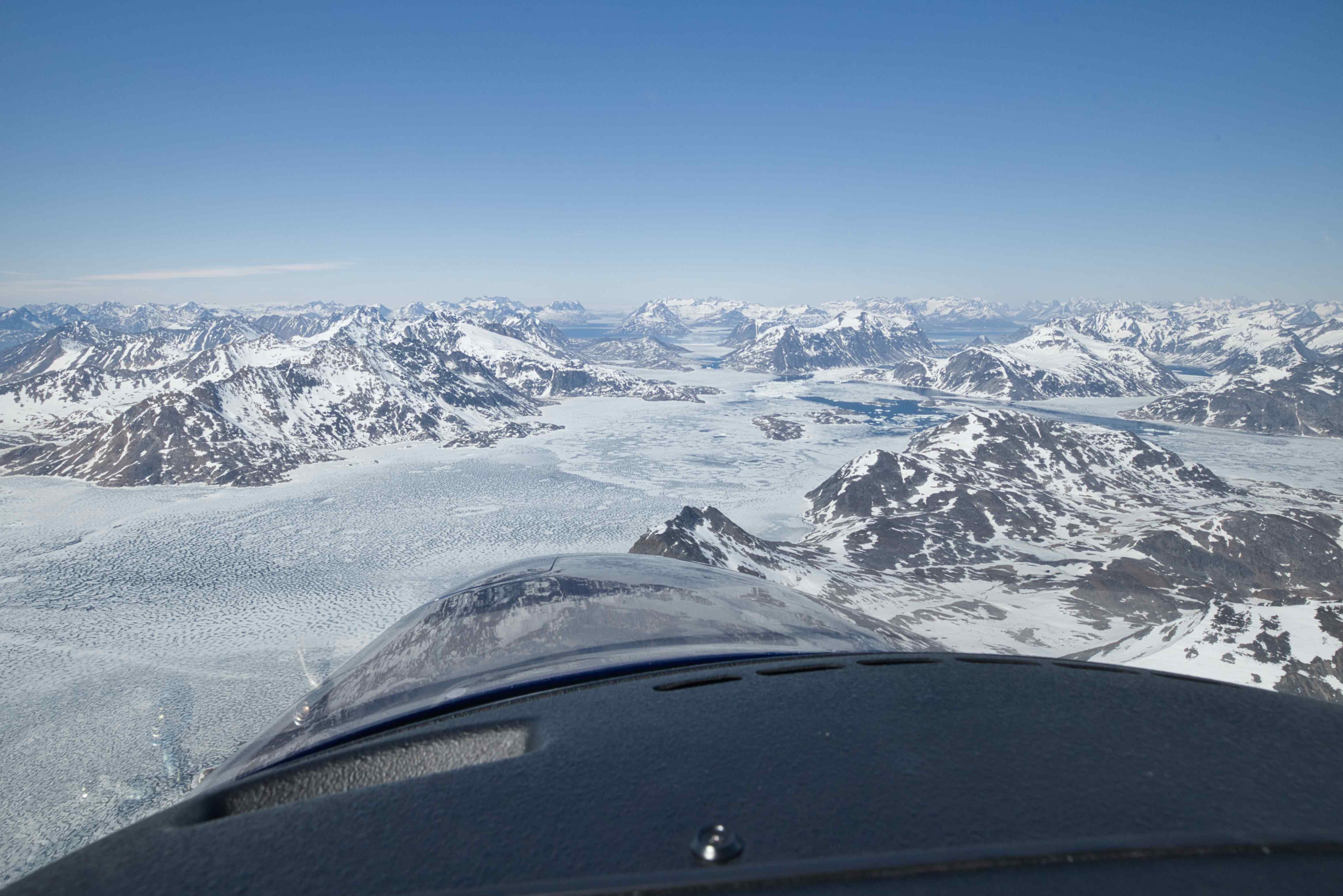
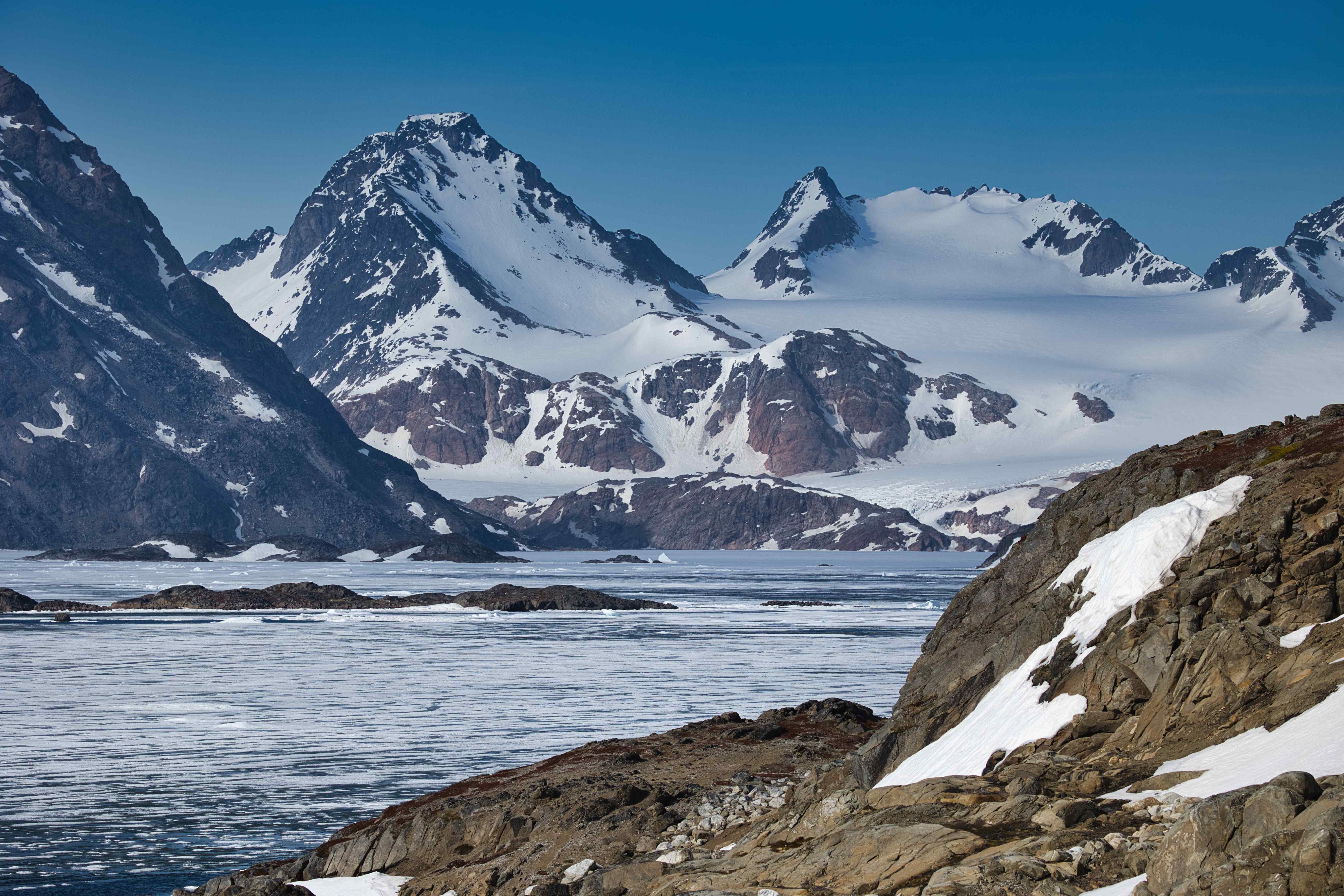
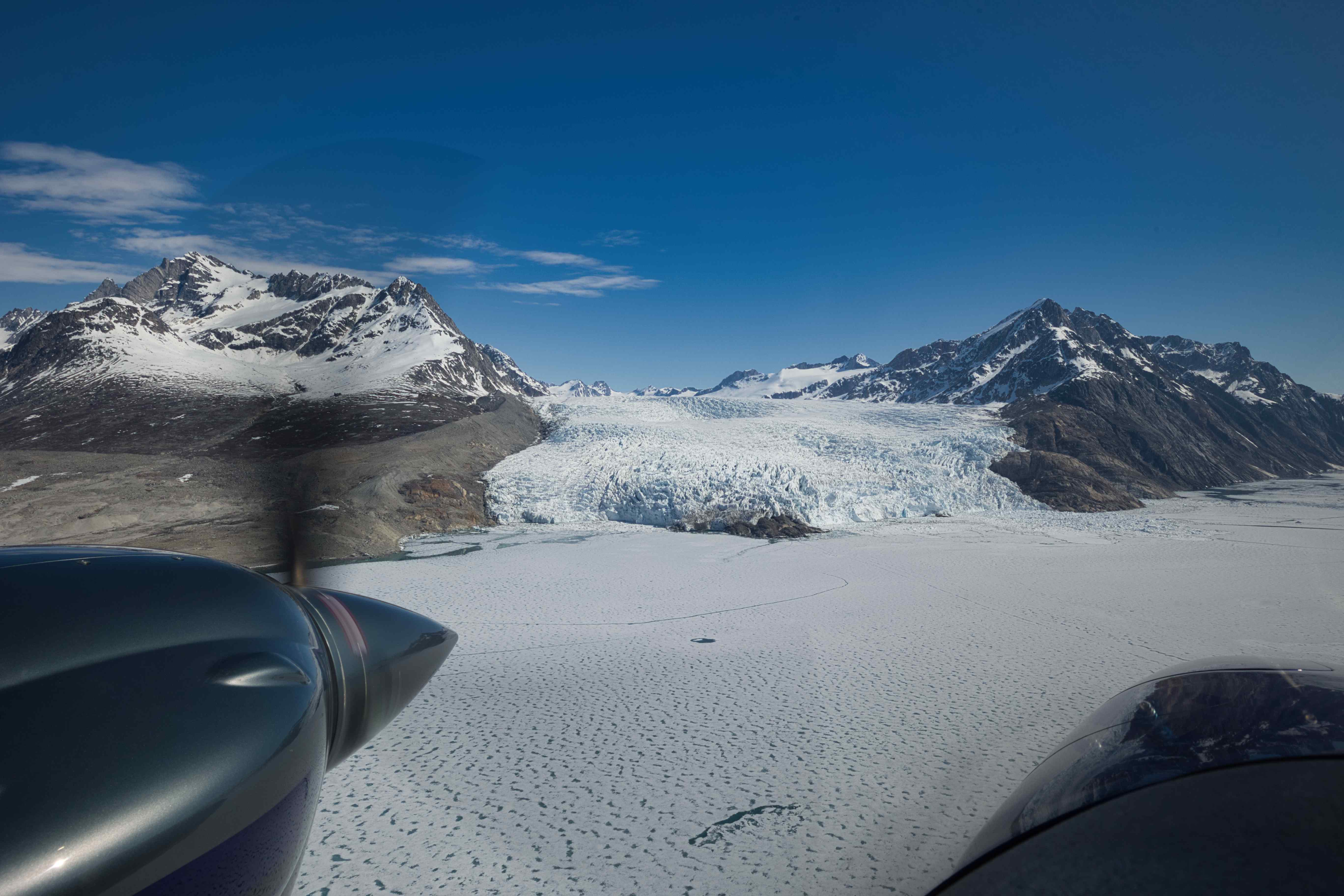
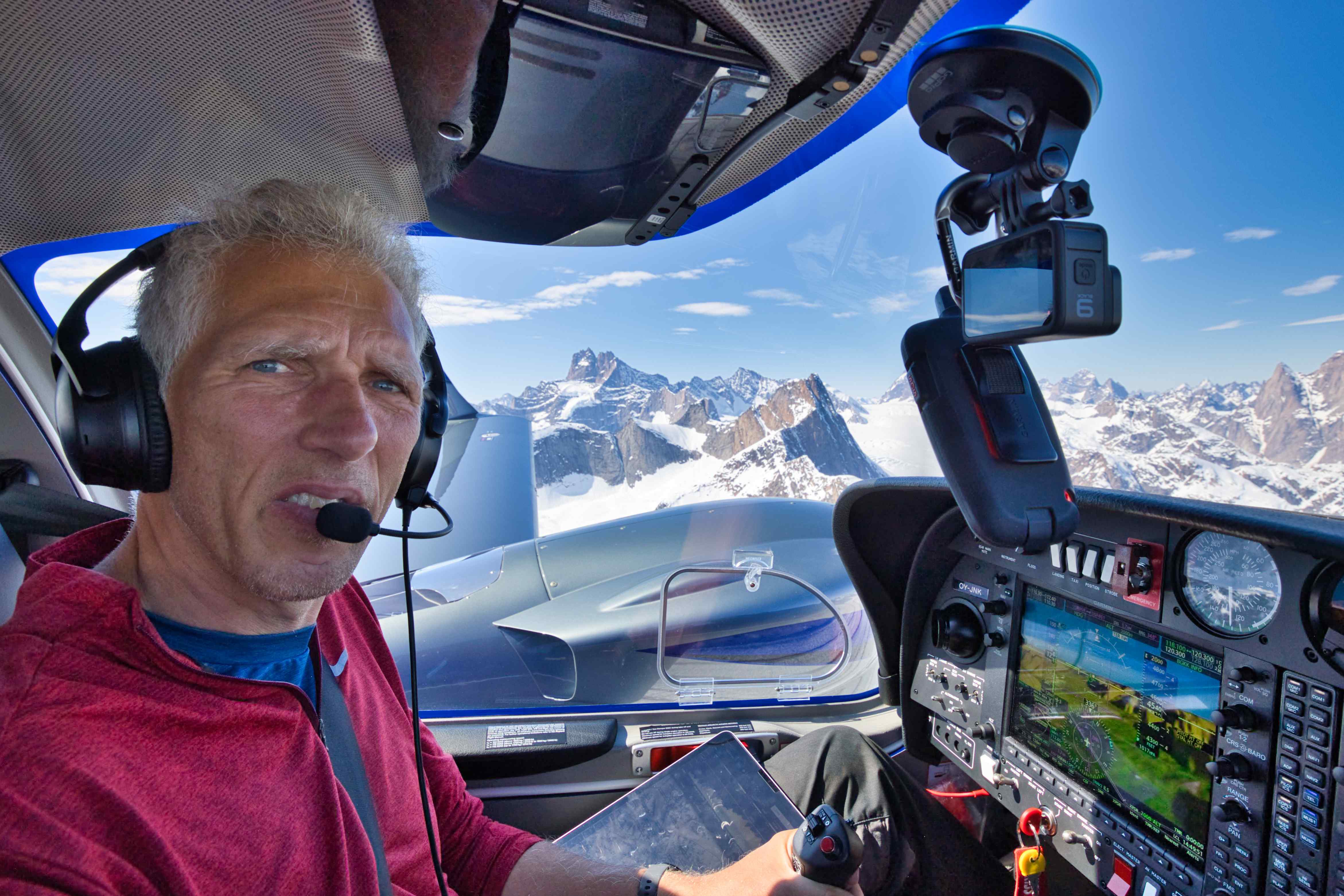
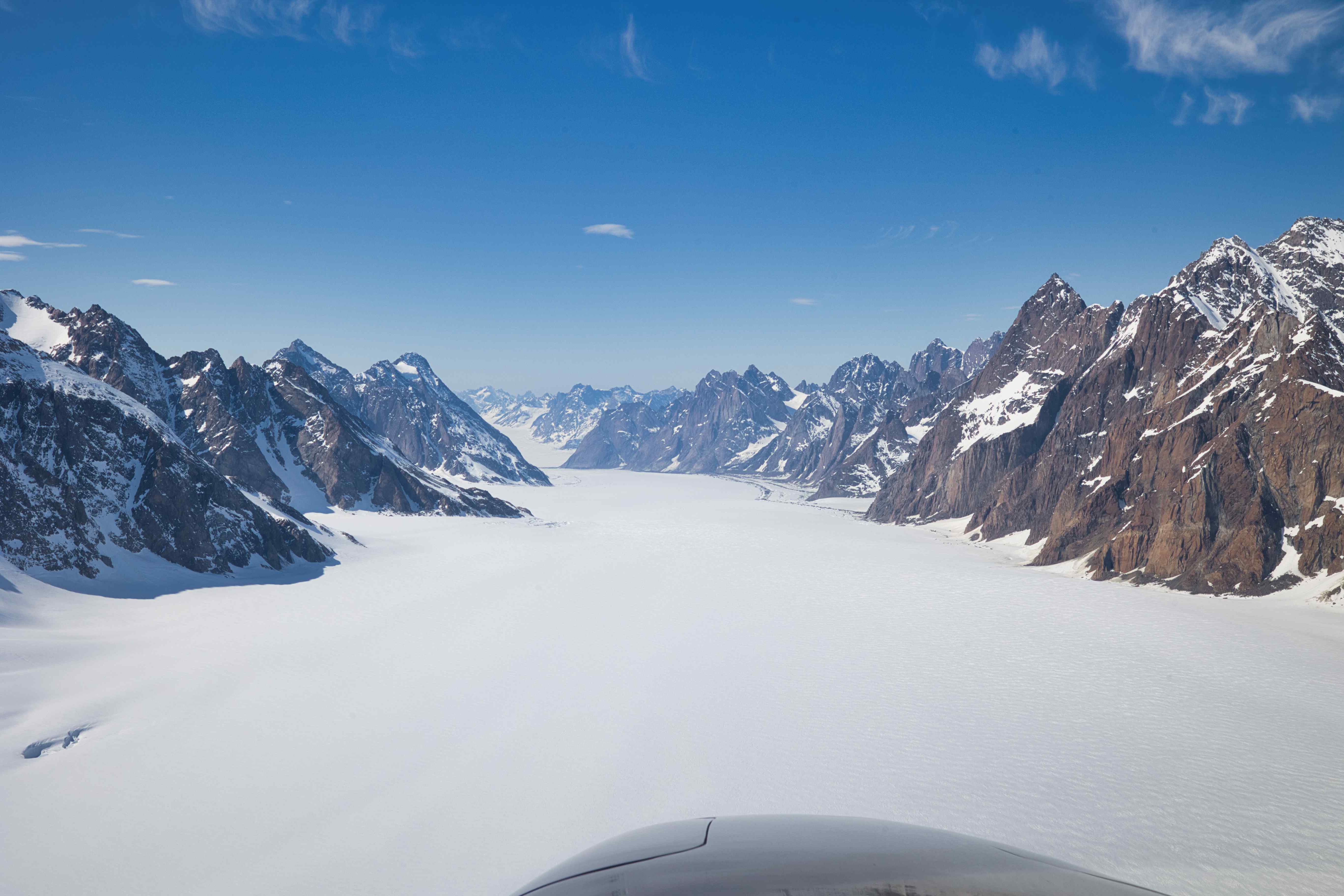
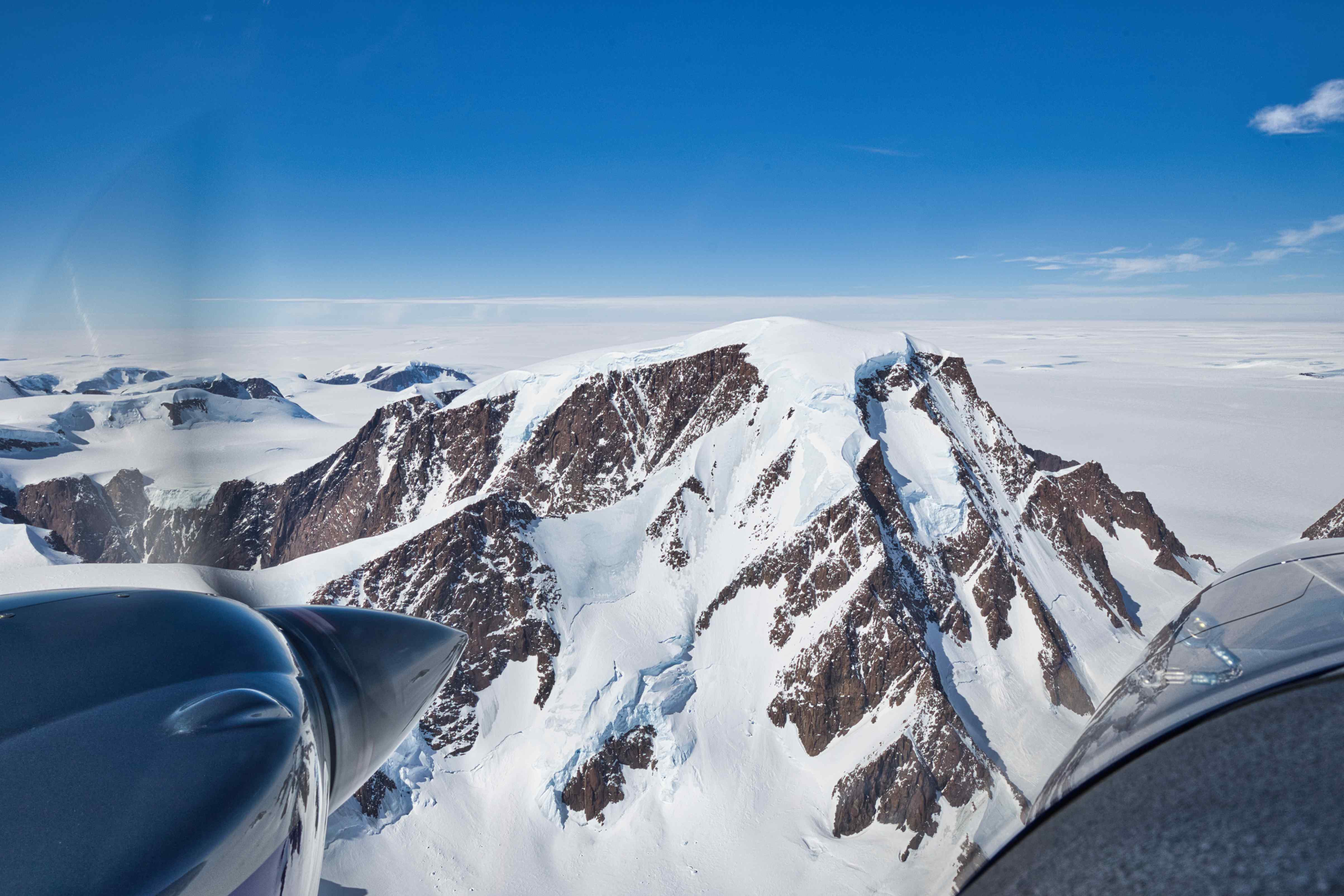
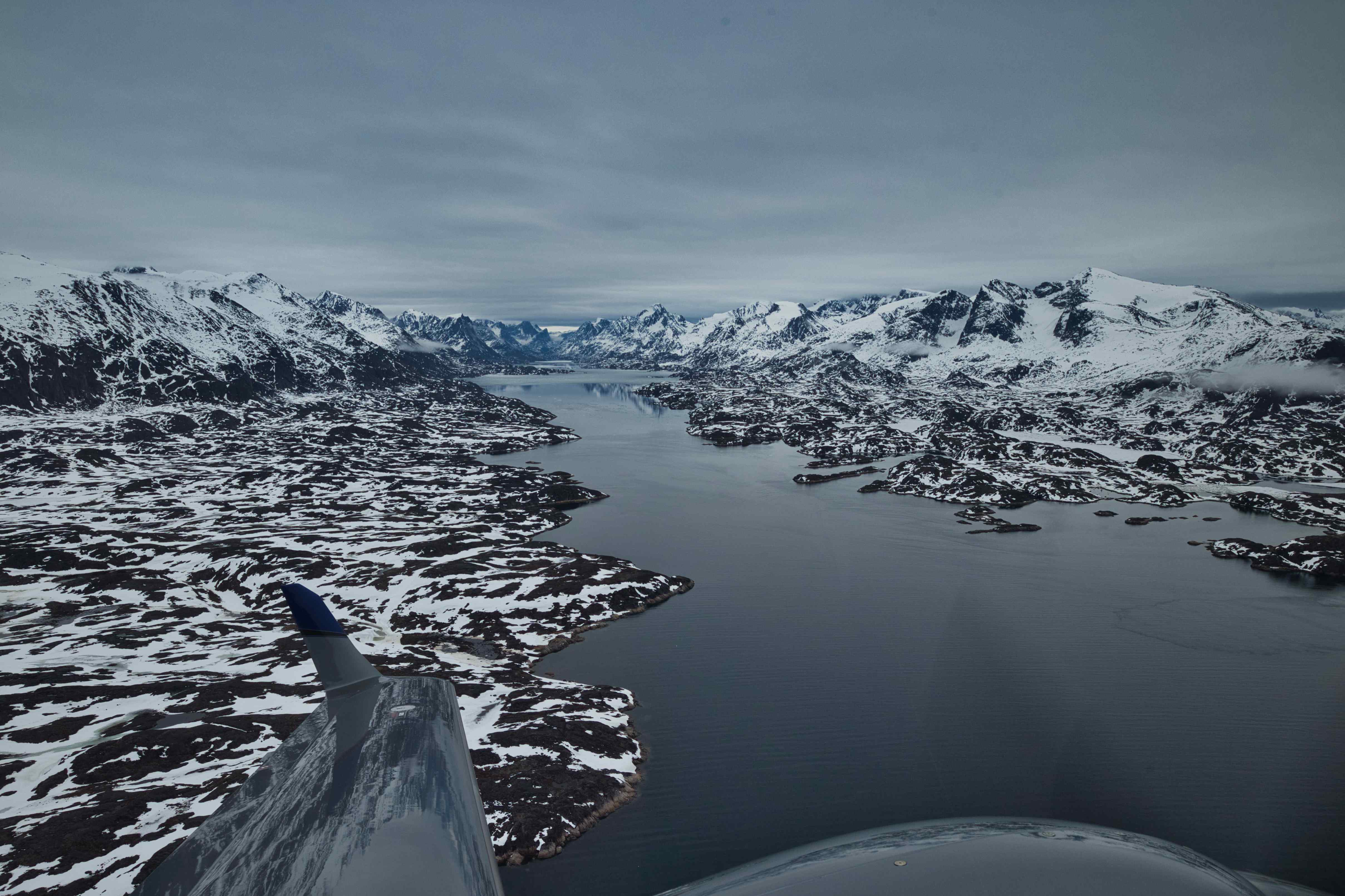
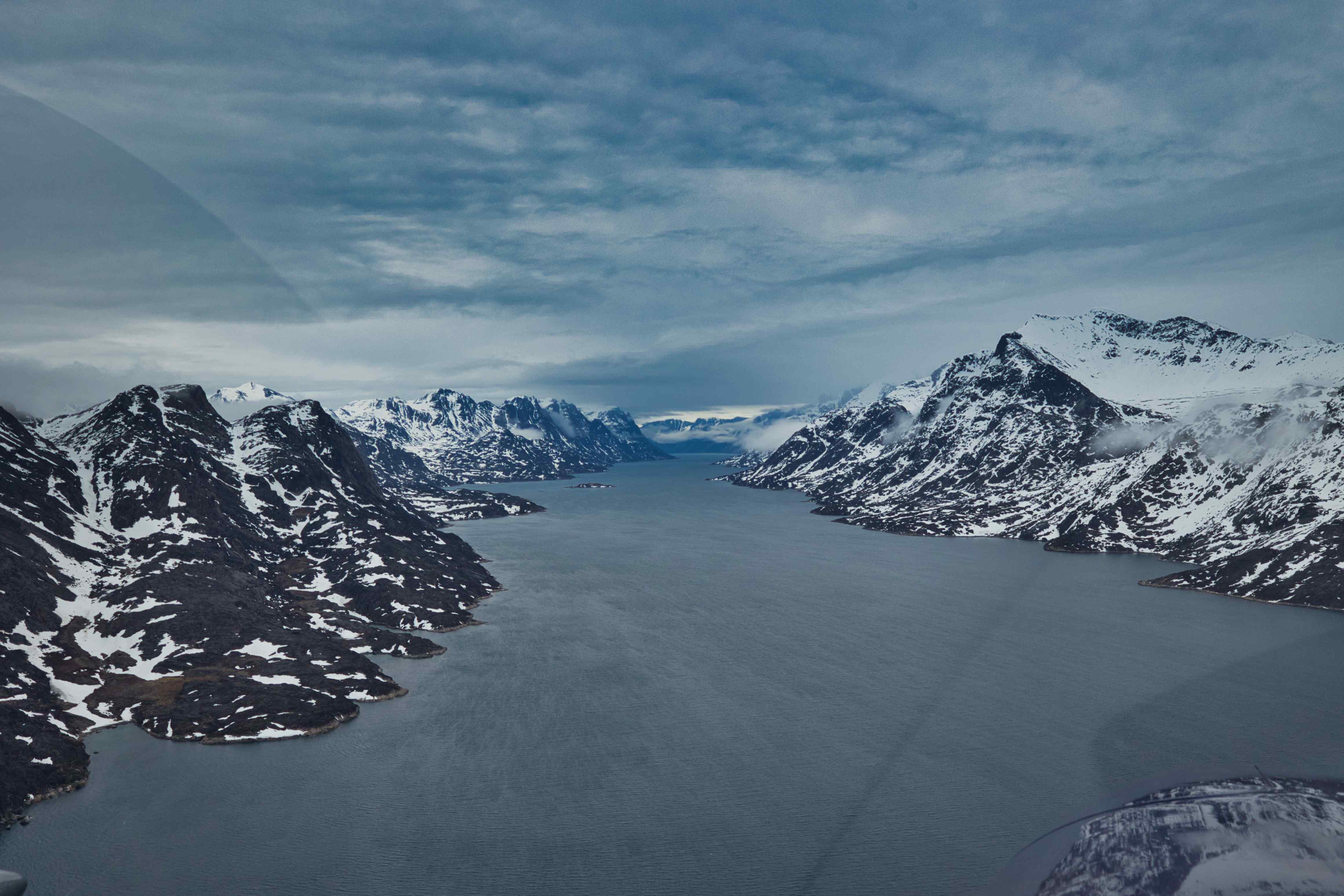
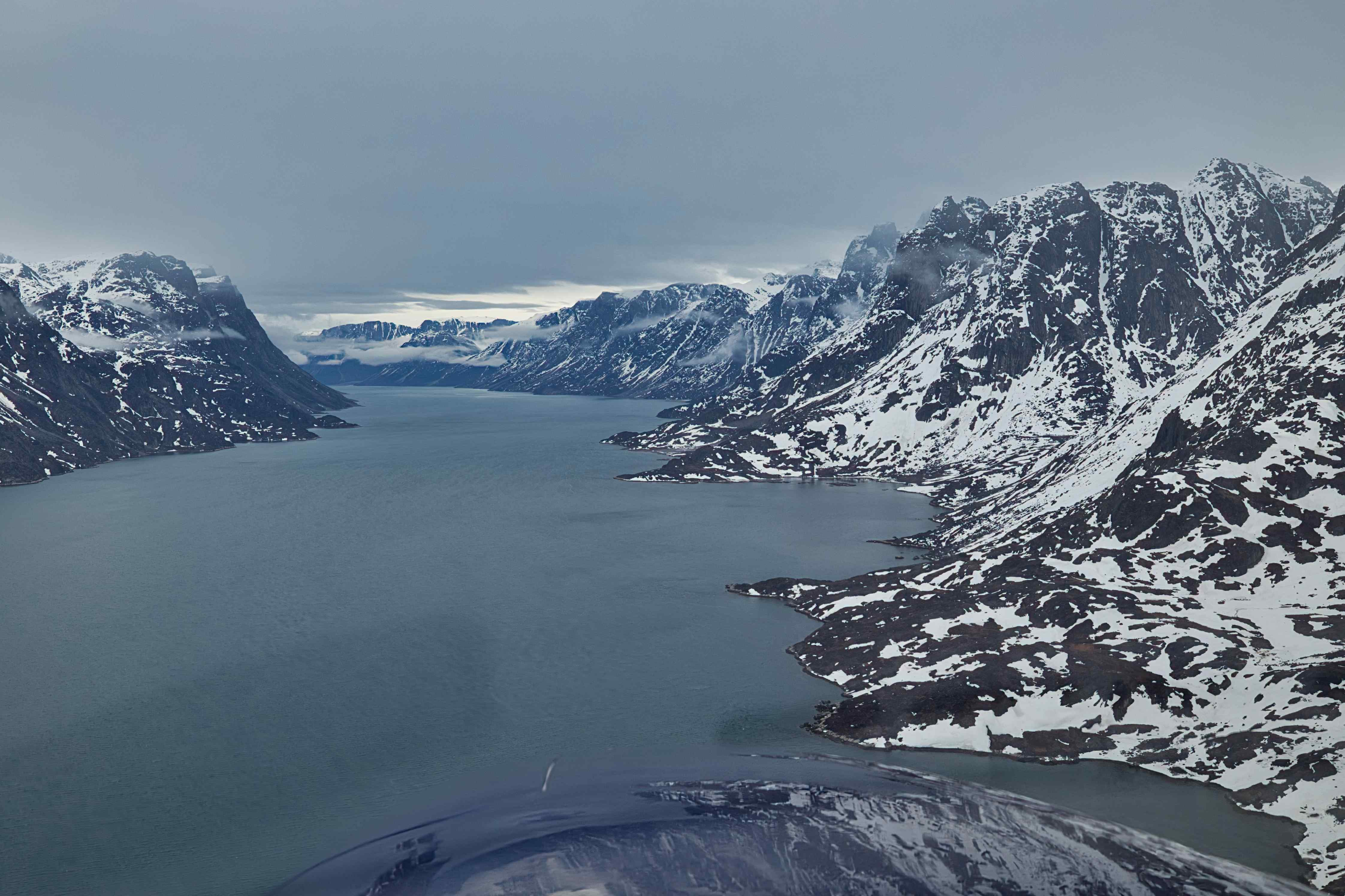
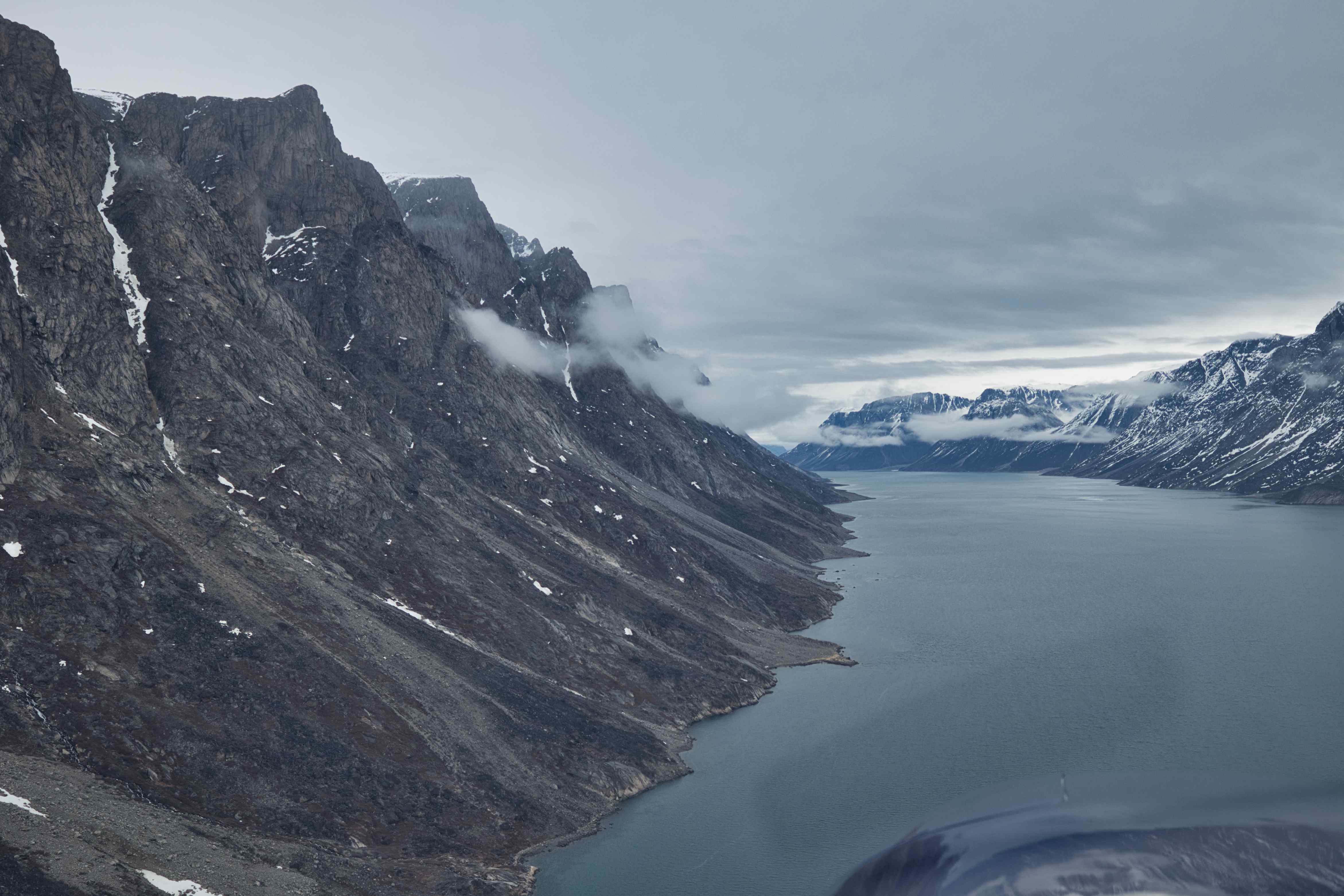
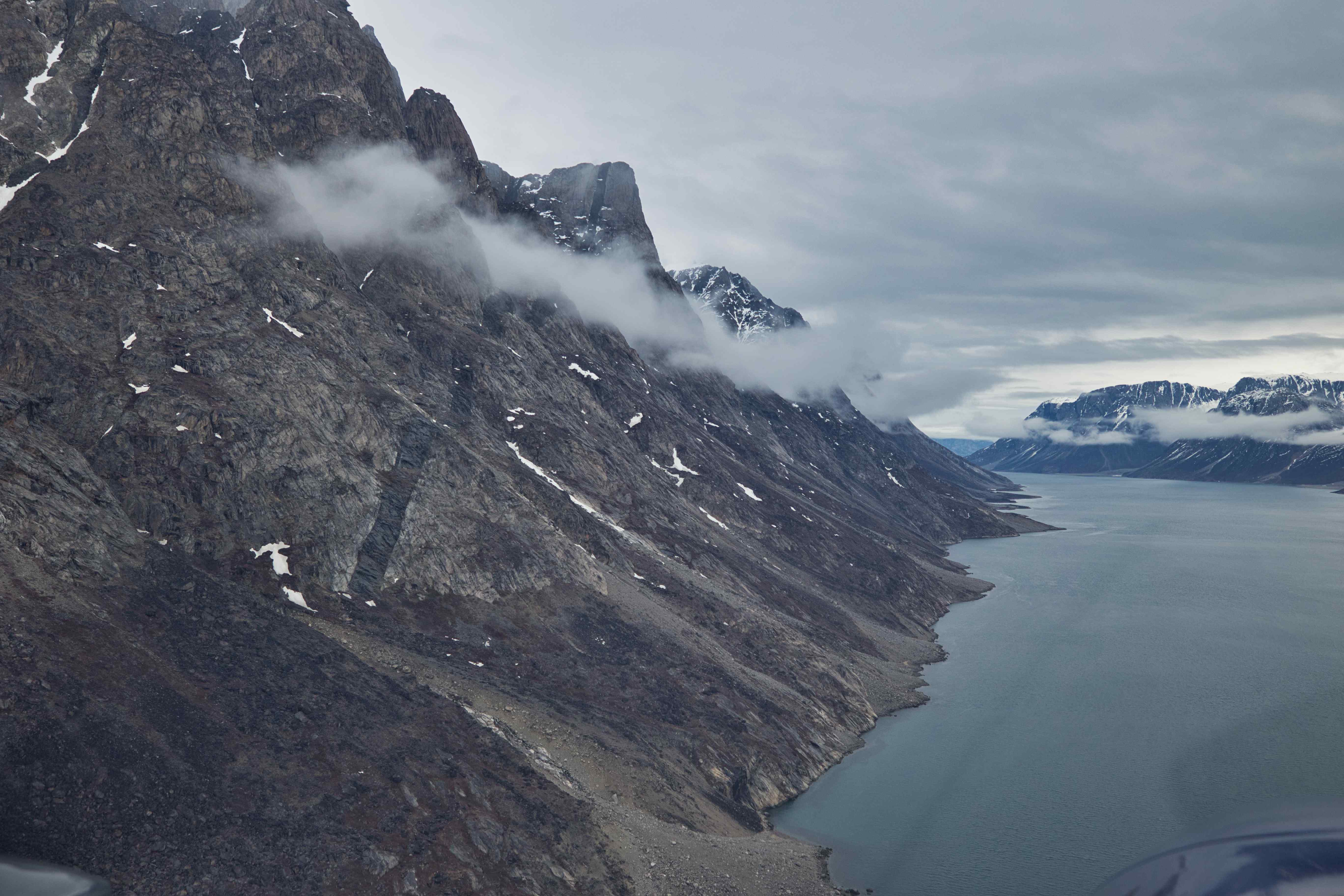
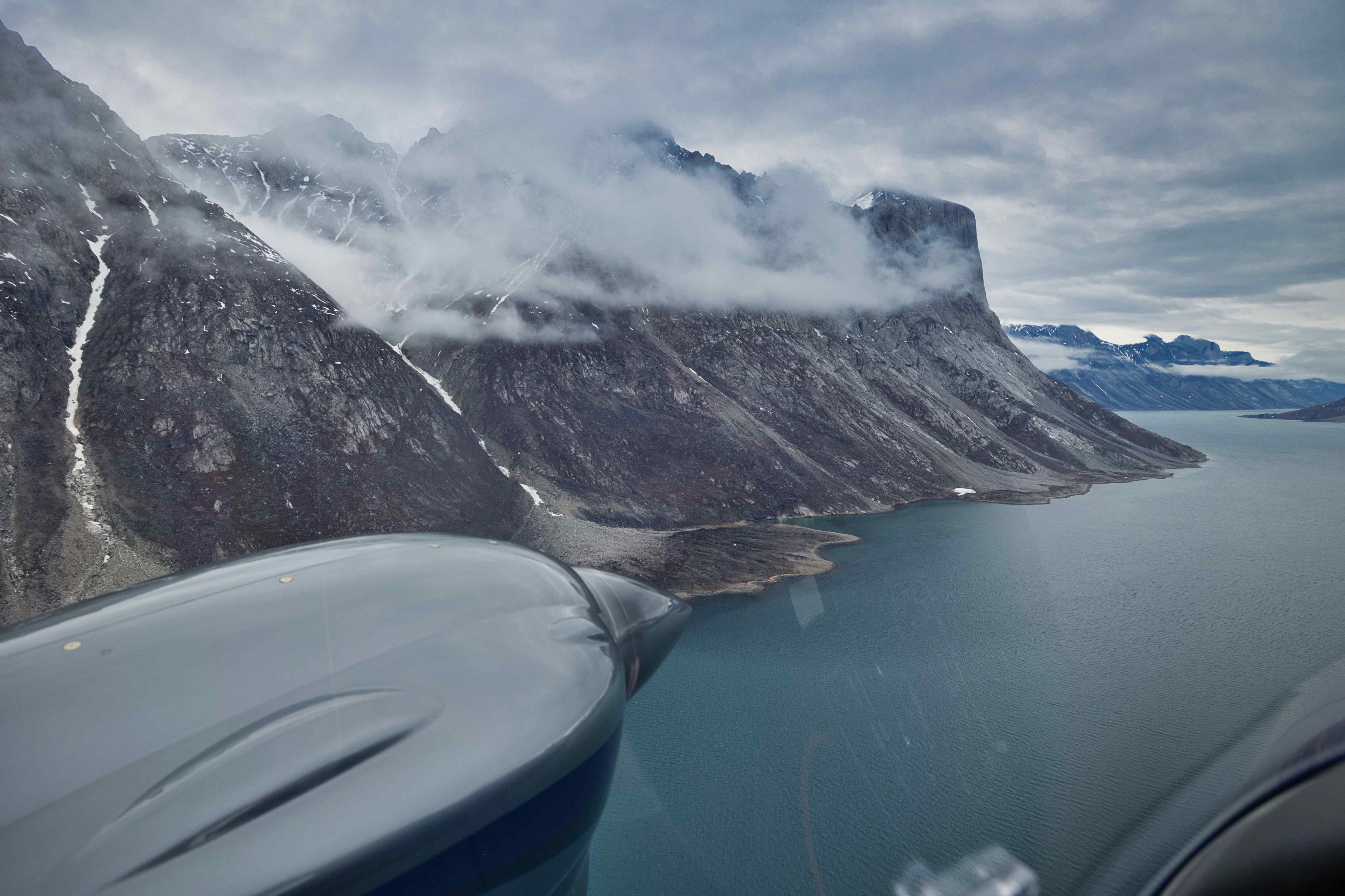
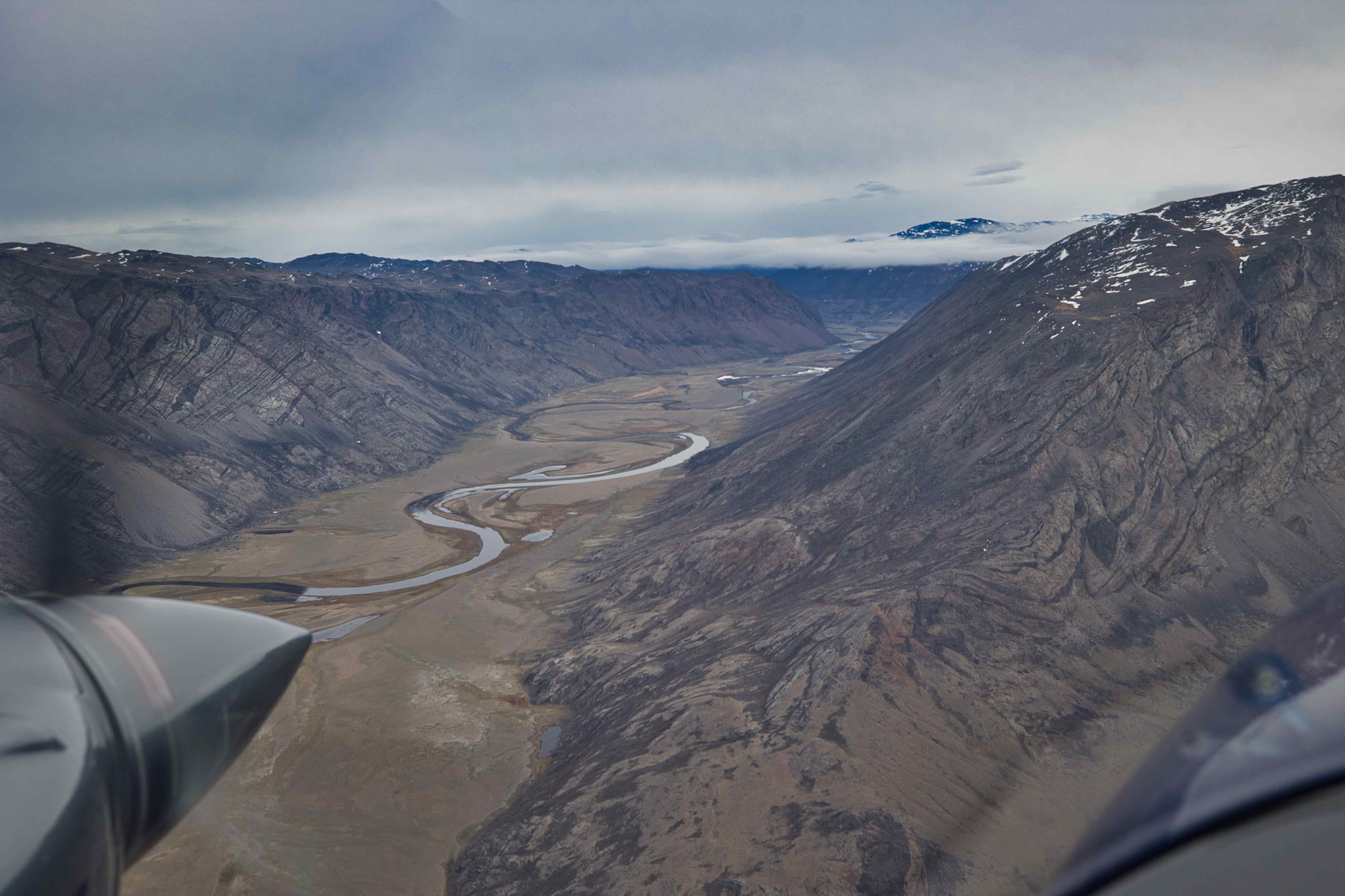
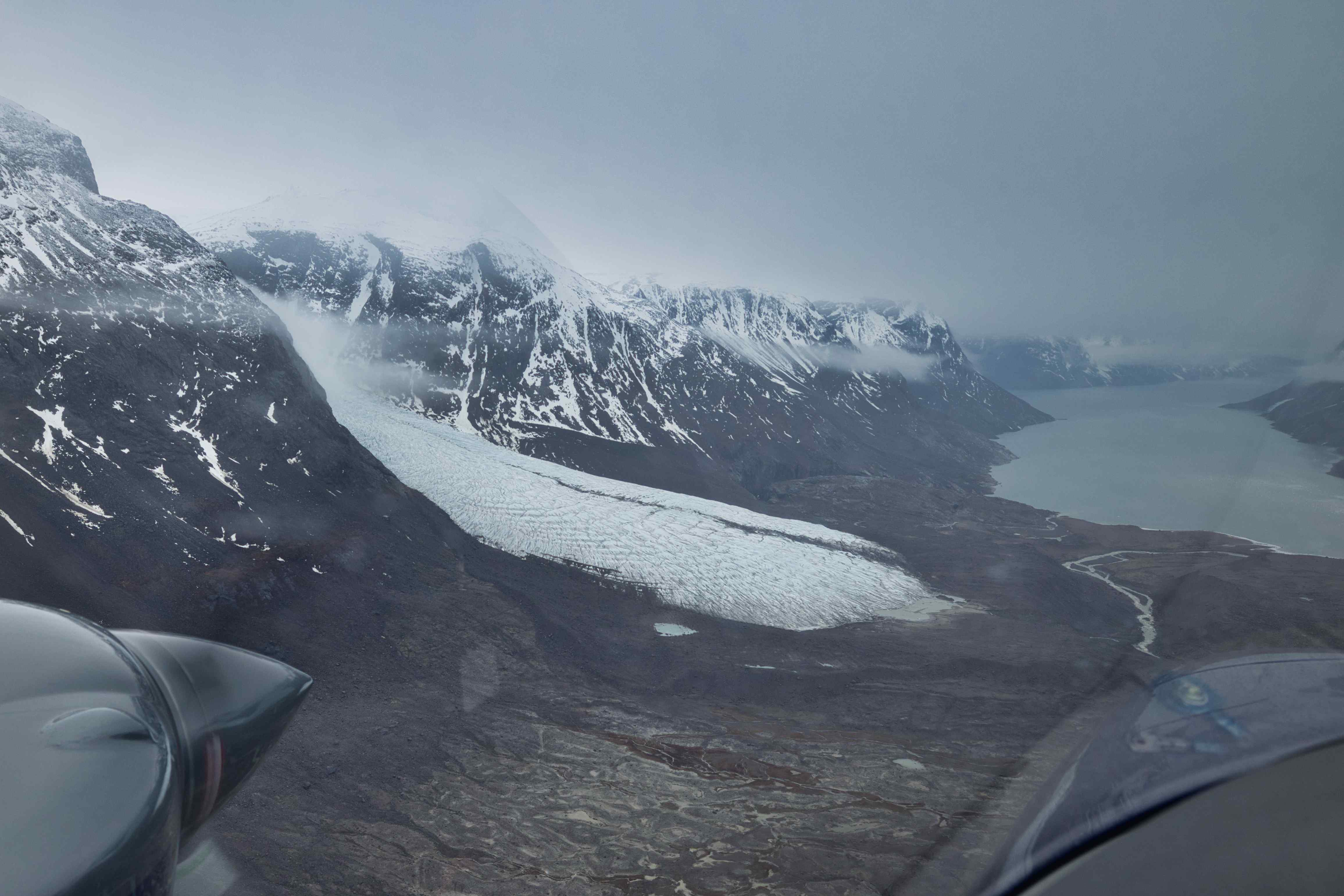
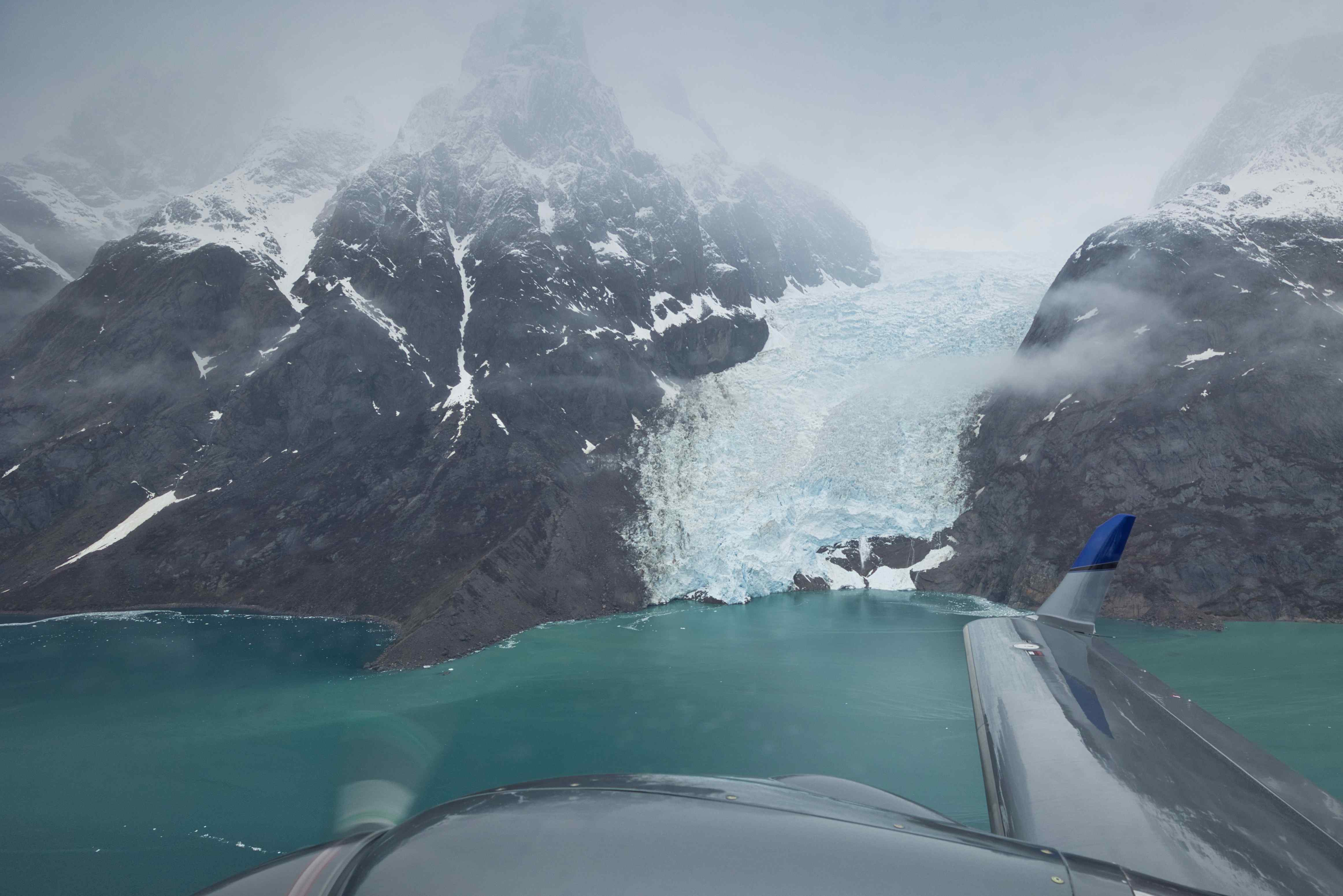
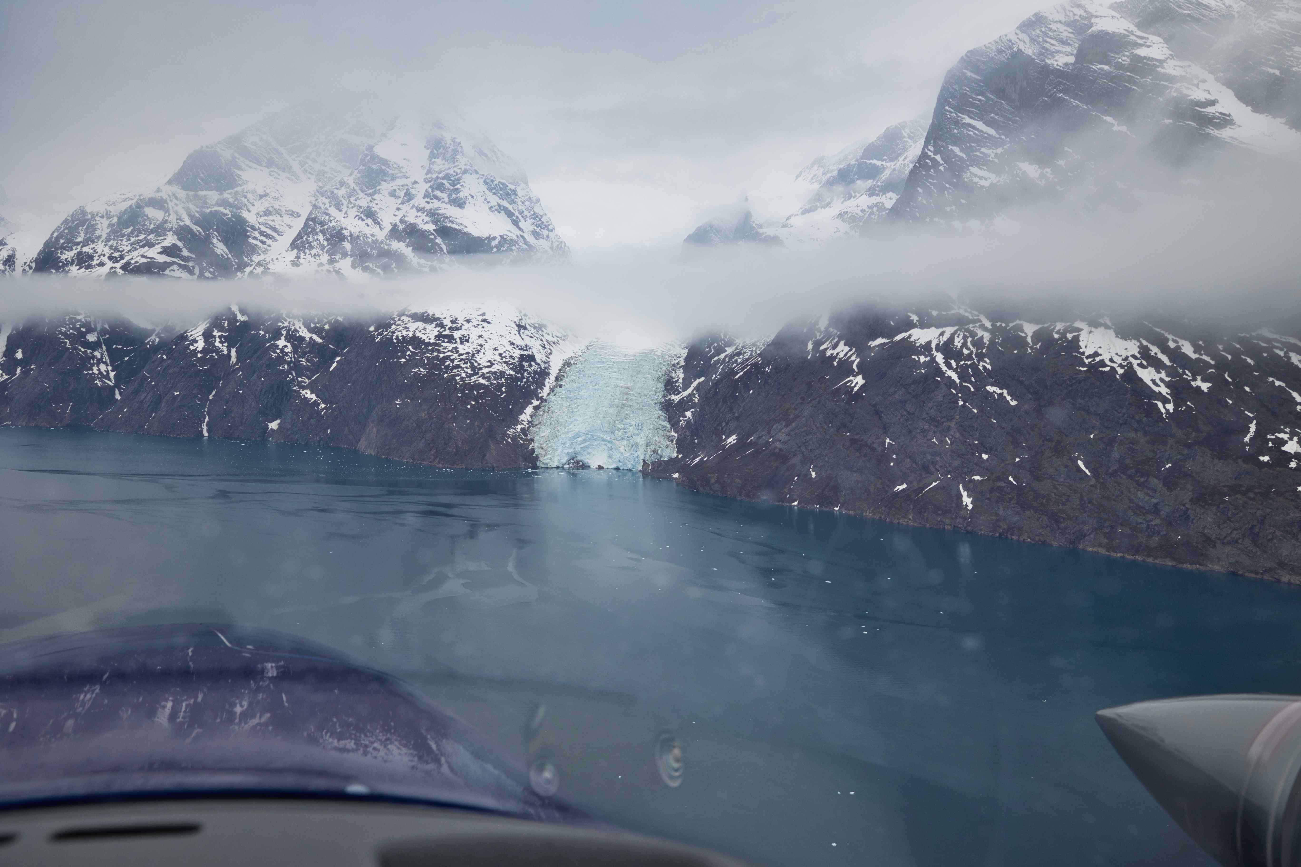
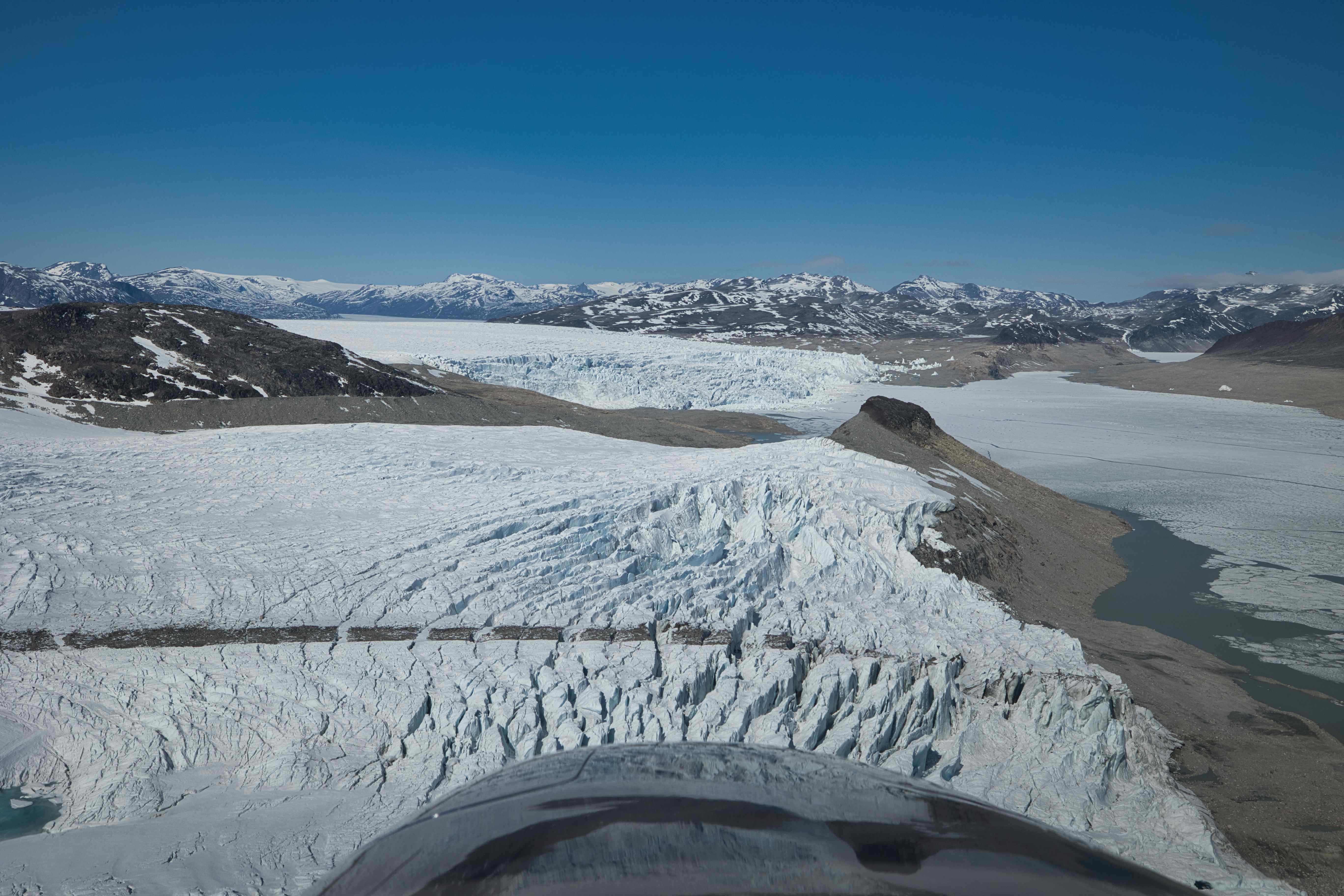
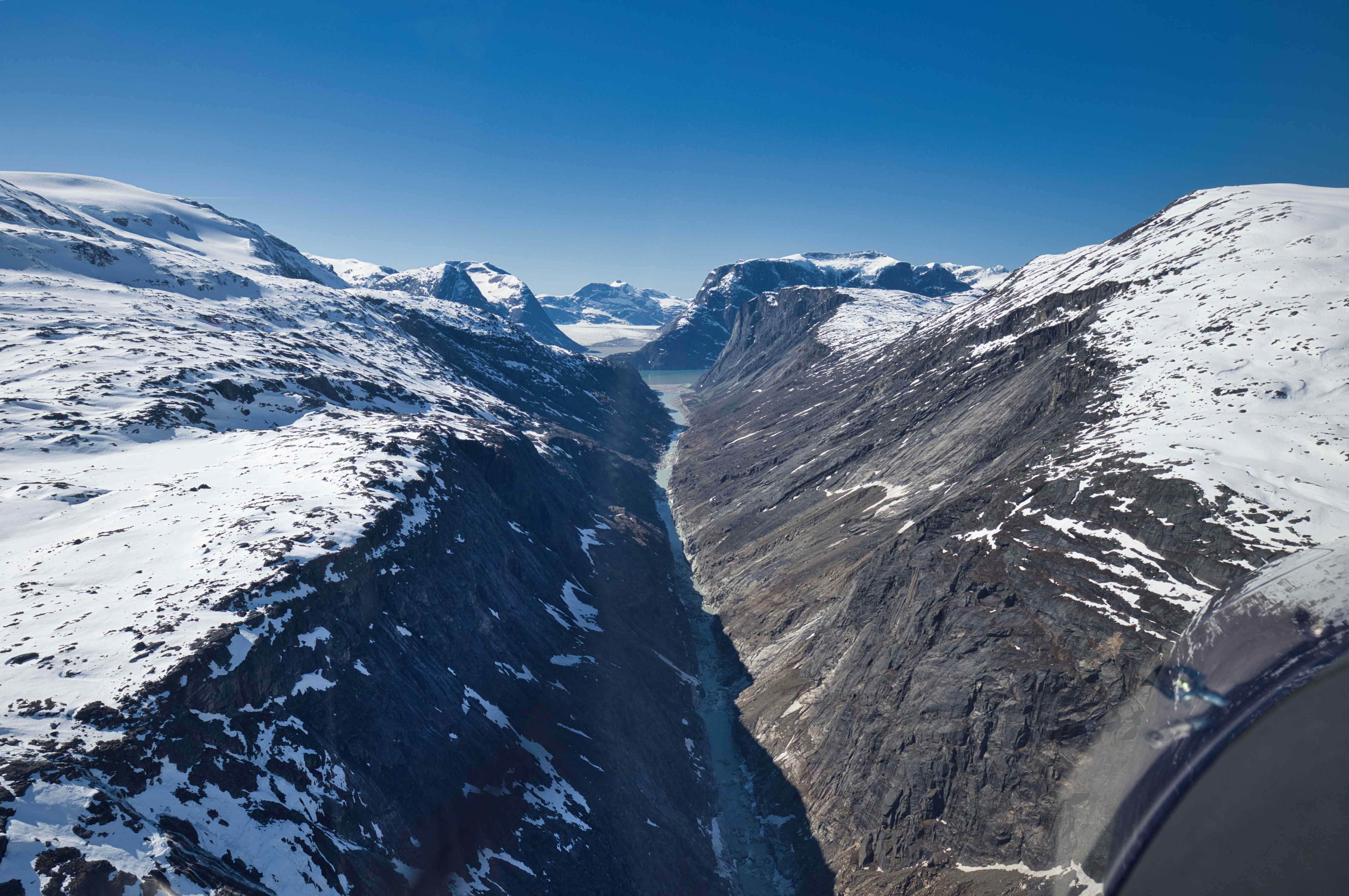
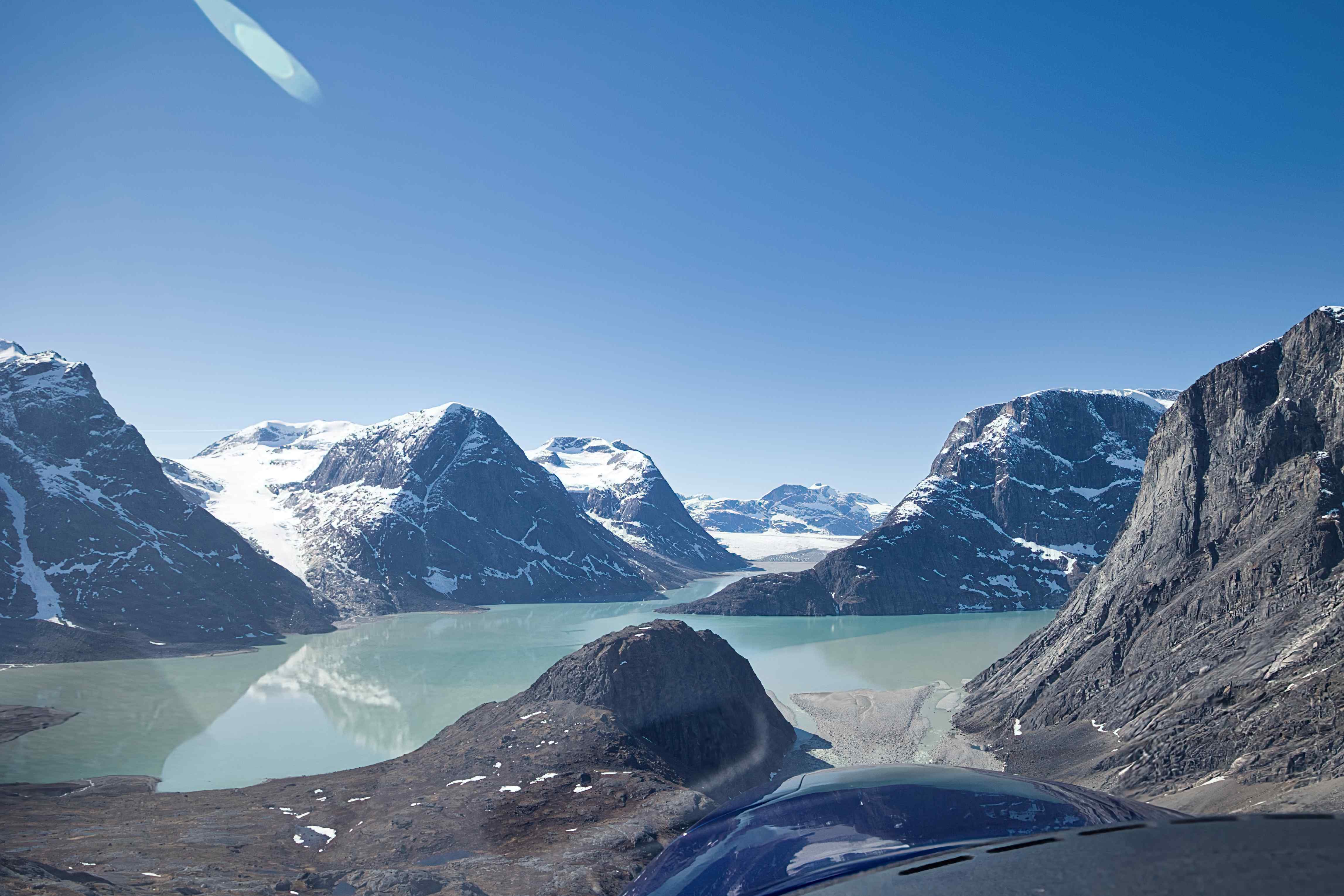
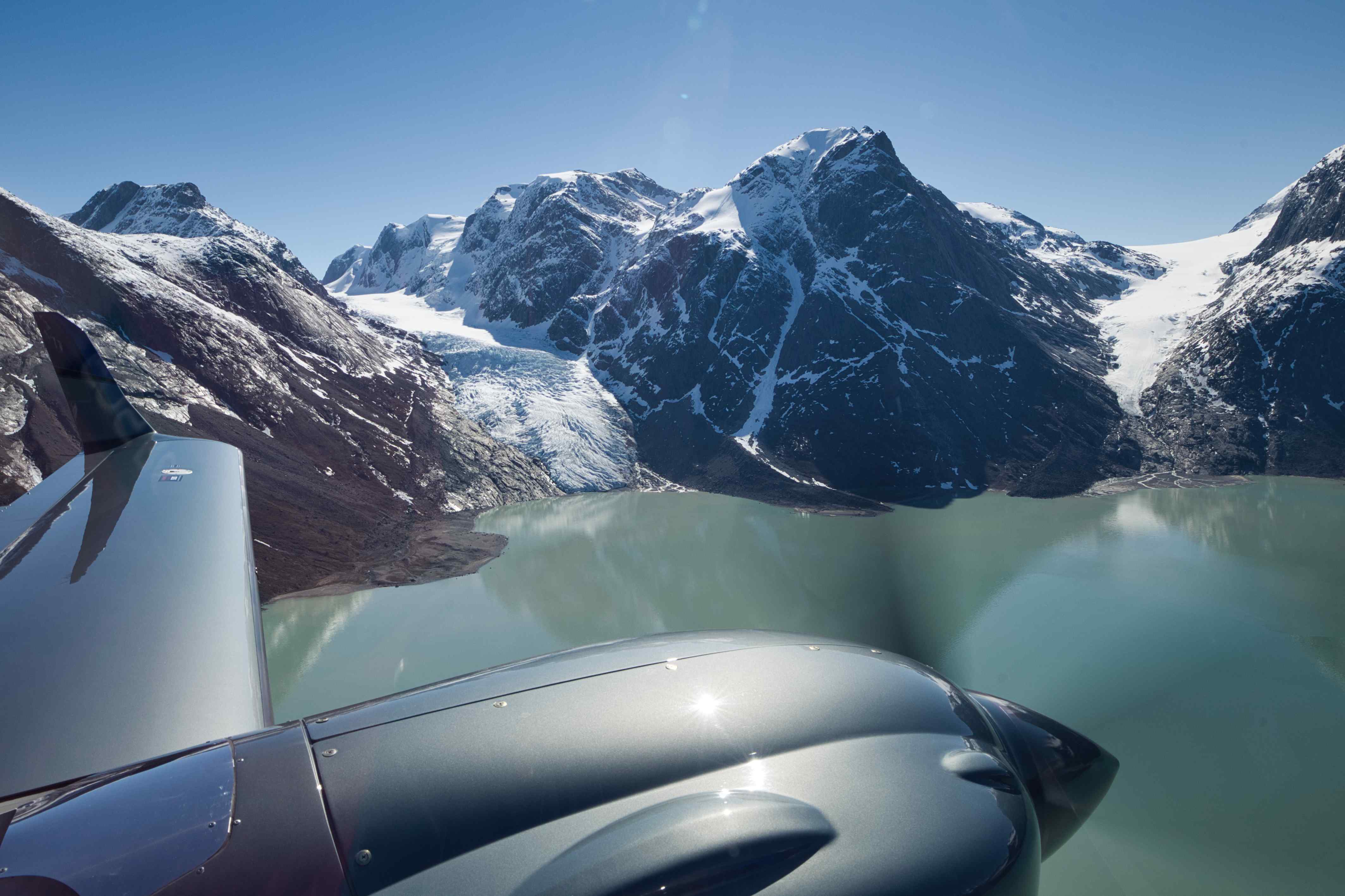
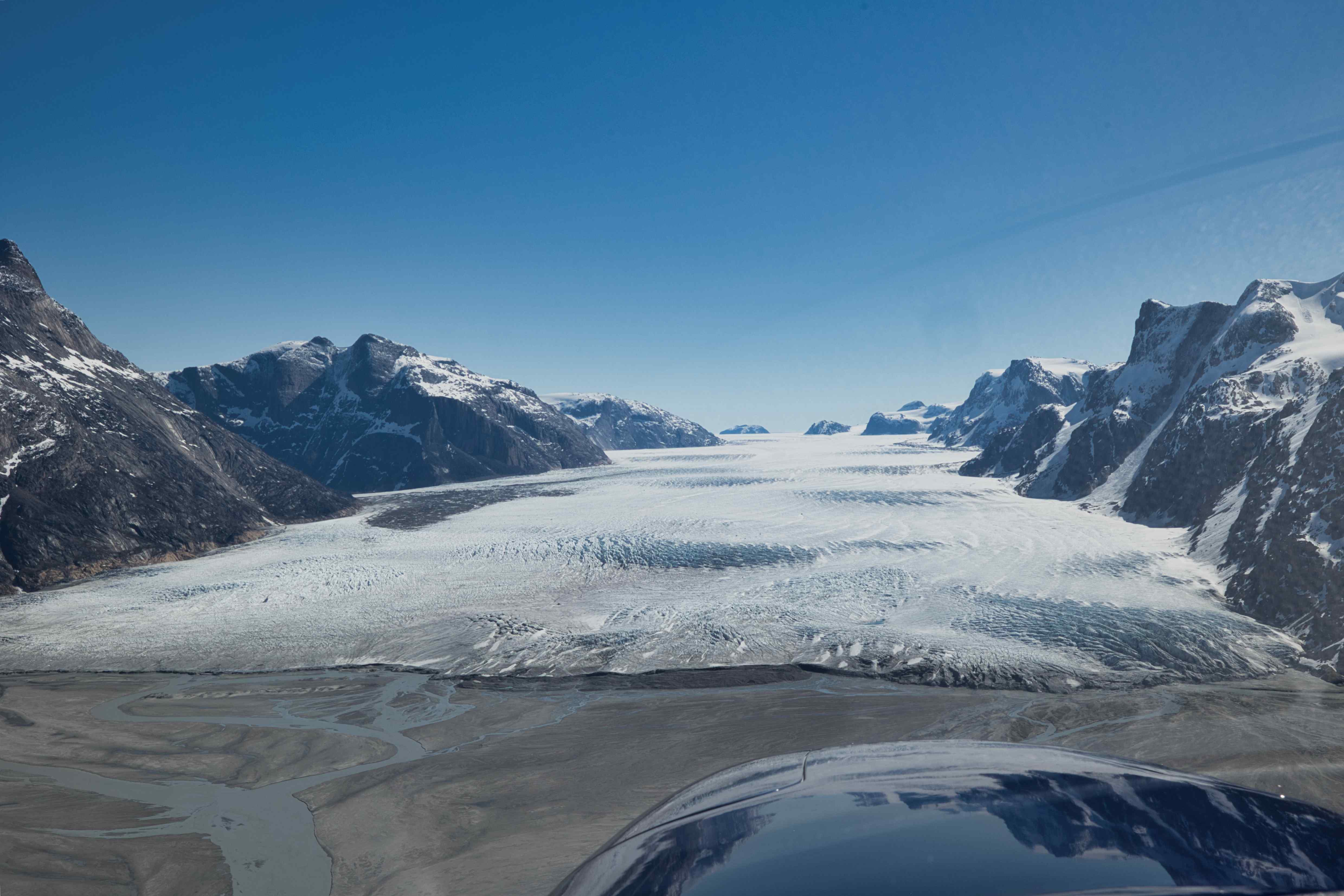
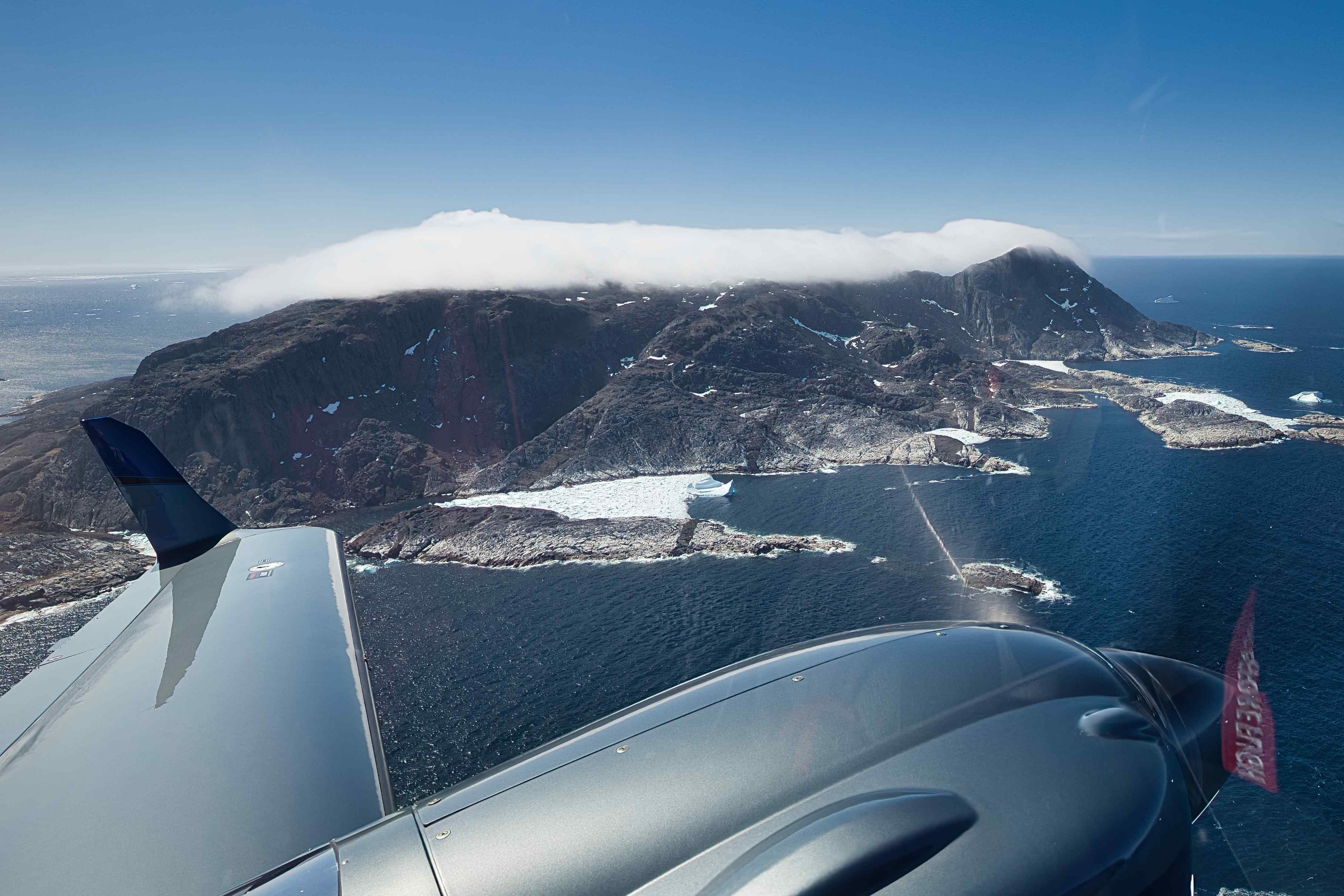
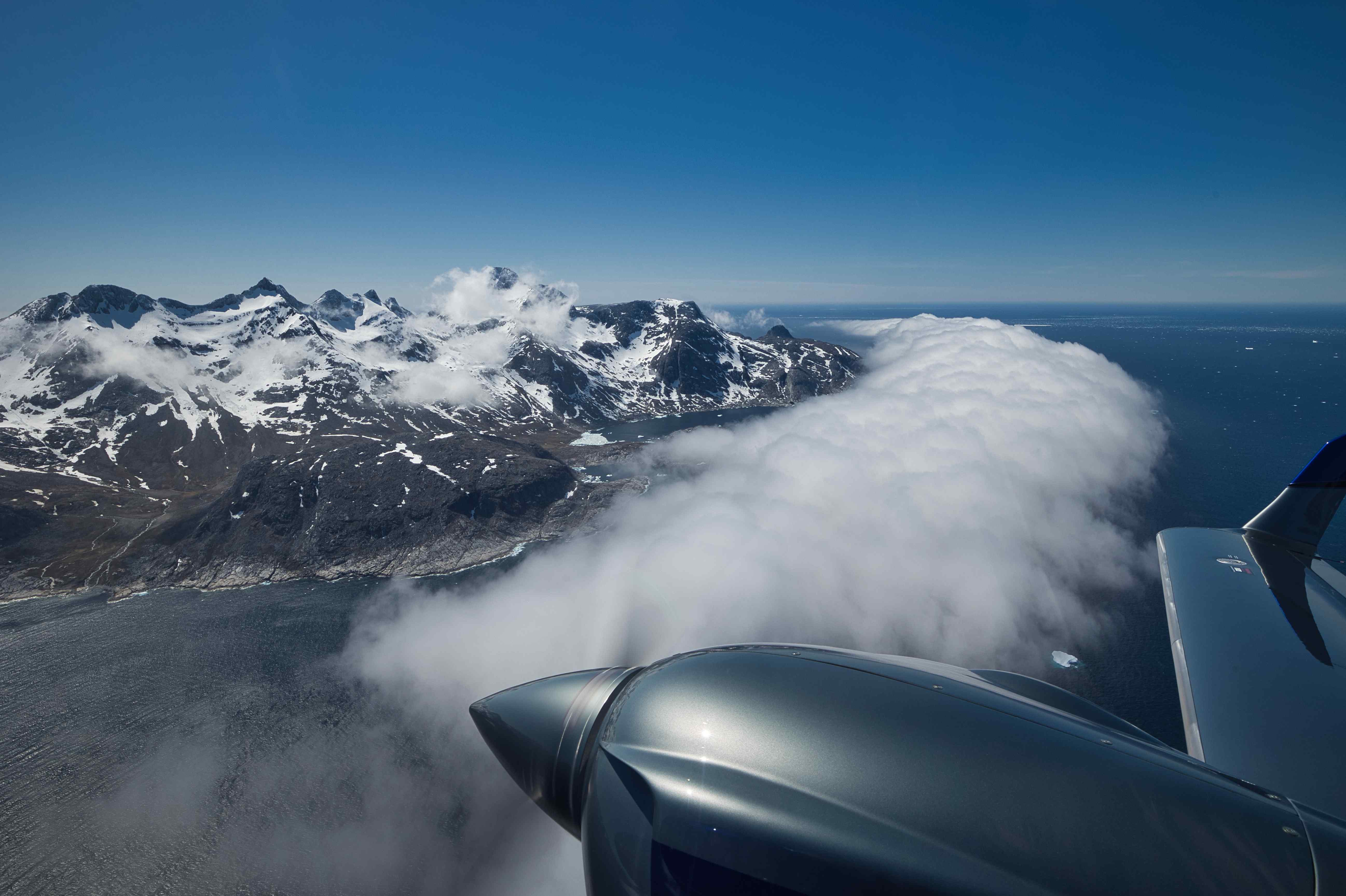
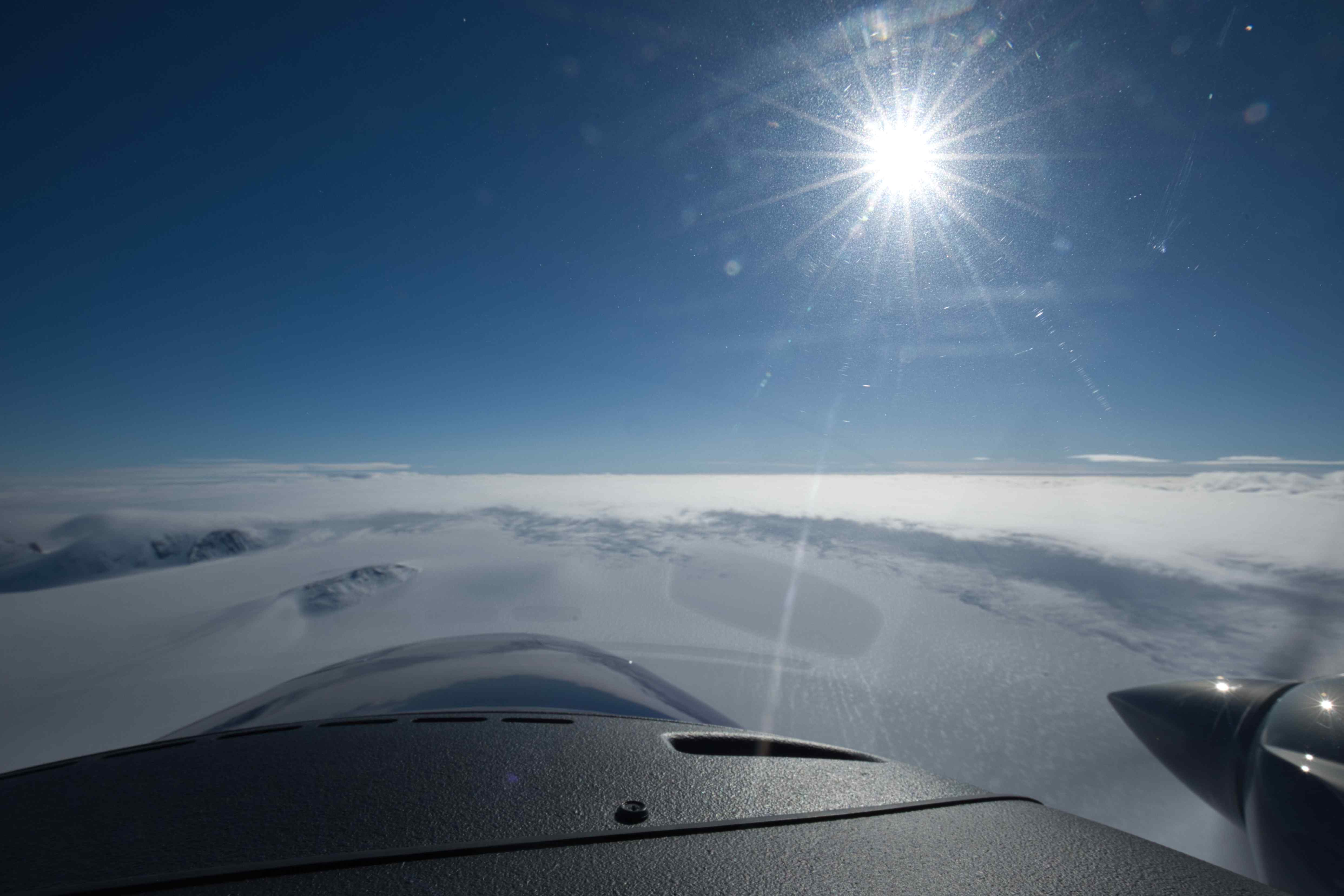
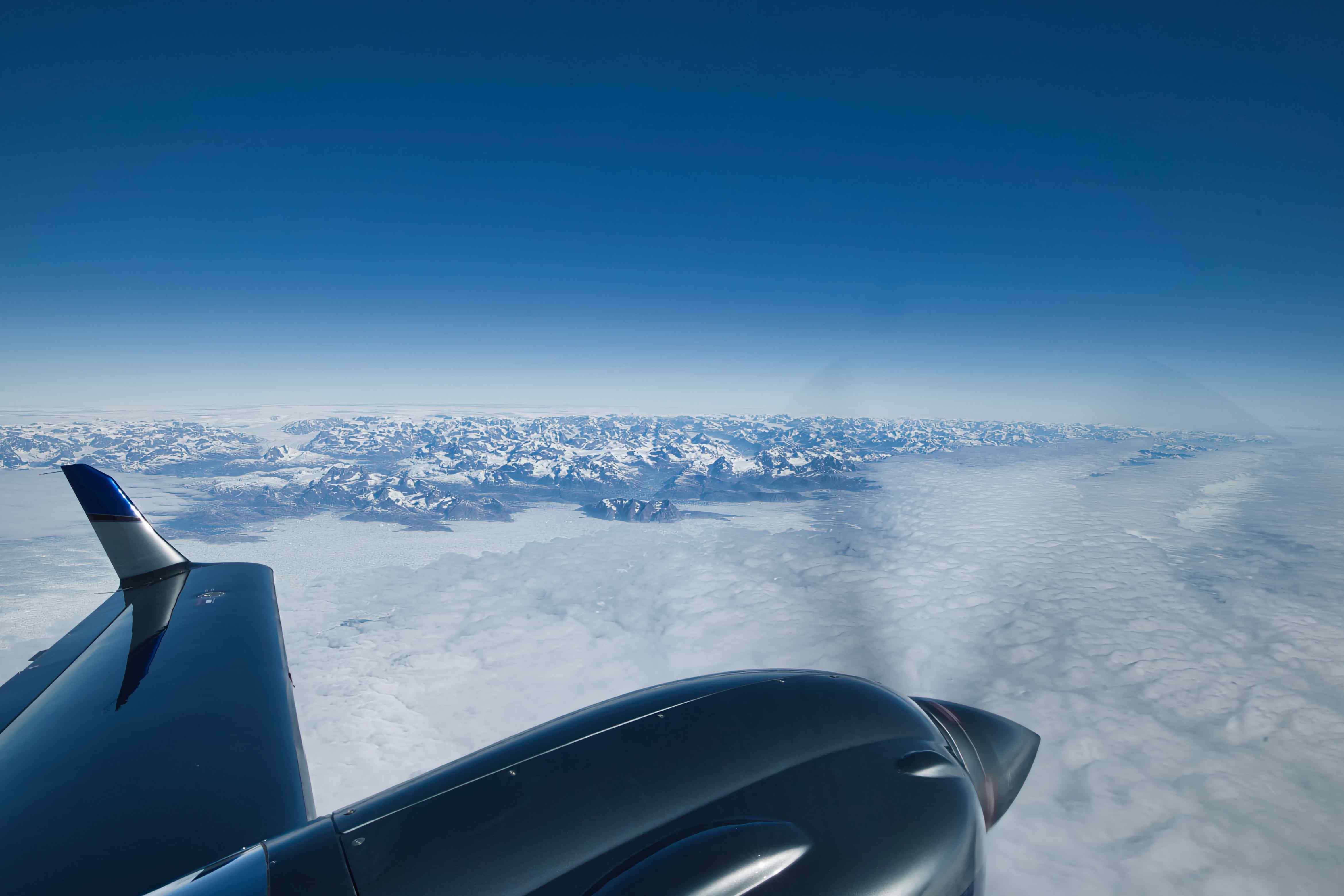
The mountains around Kulusuk is said to be some of the most beautiful ones in Greenland. And some of the highest ones too, the second highest peak (Mont Forel) is close by. We therefore spent our first full day in Greenland on a three hour sightseeing flight in and out of the fjords, up and down the glaciers, from the sea up to the icecap and back.

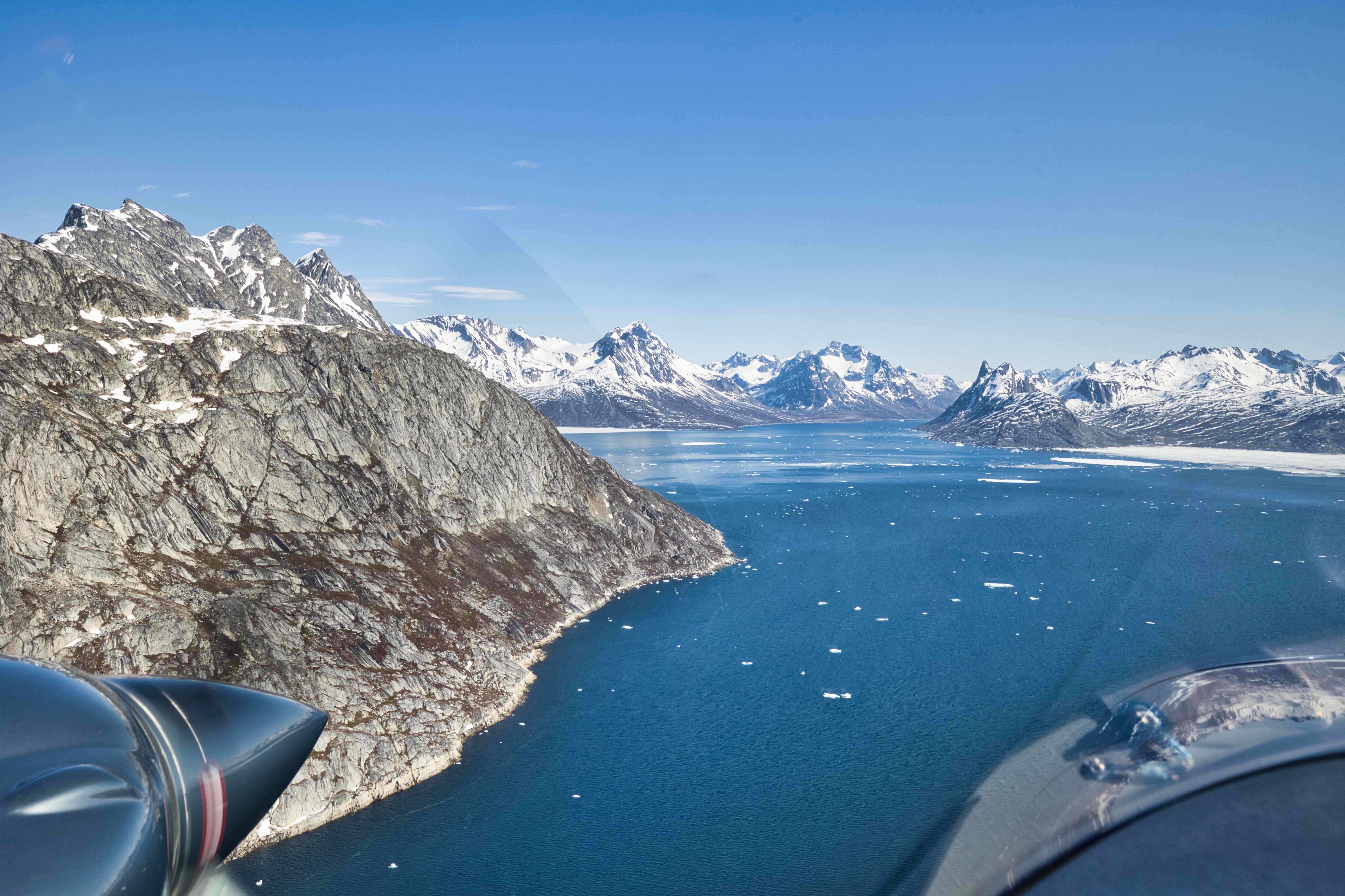


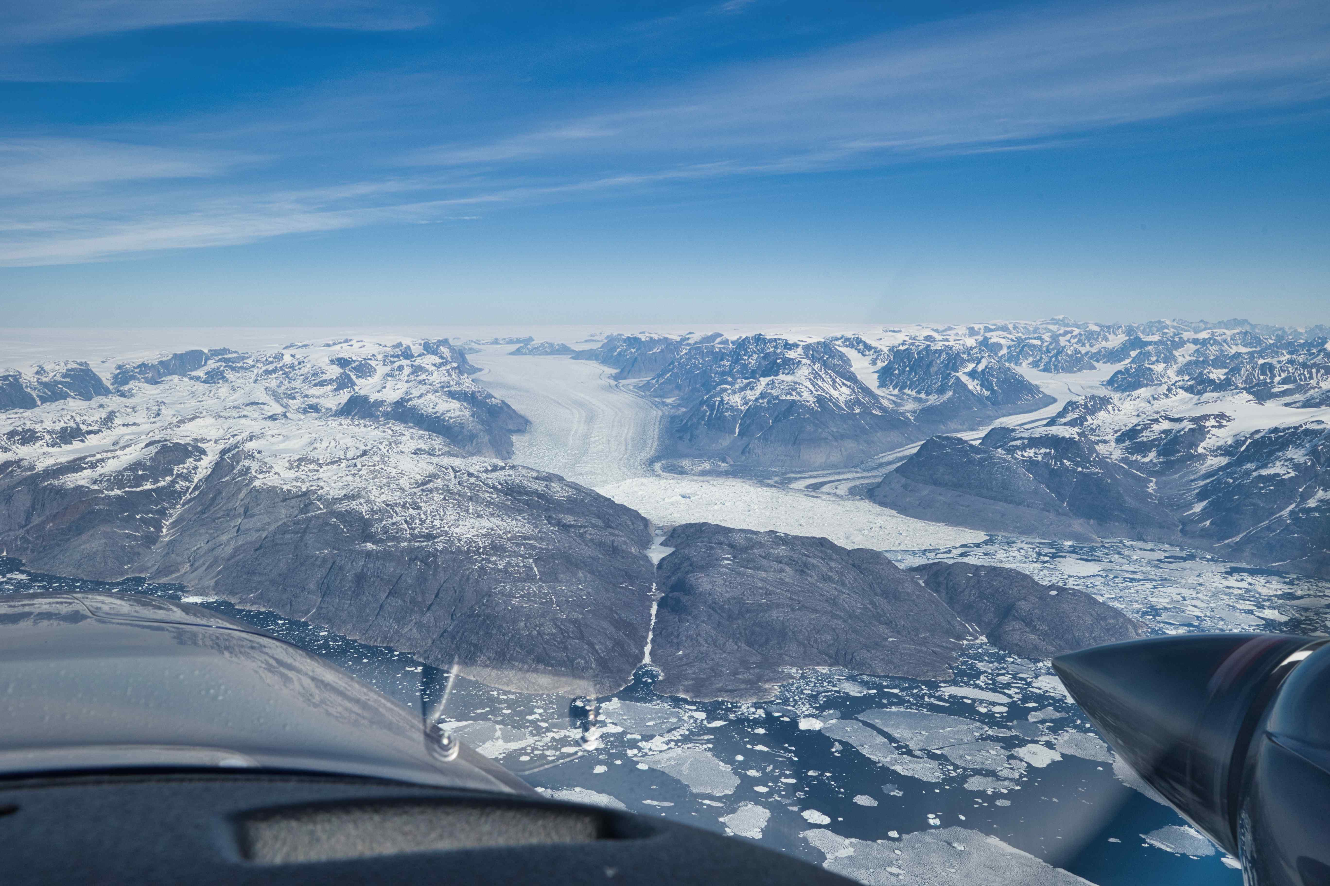
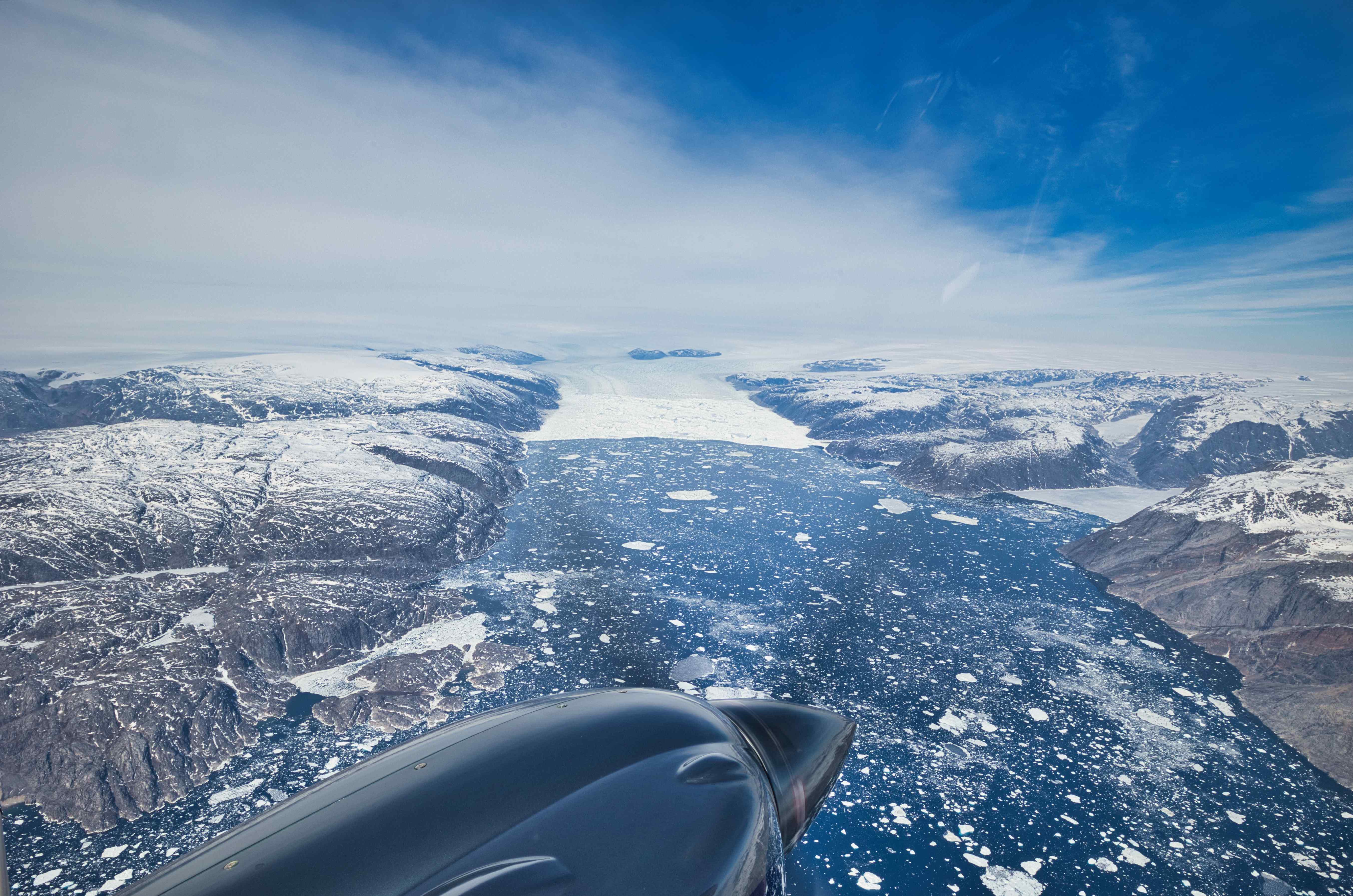
From Kulusuk to Ilulisat
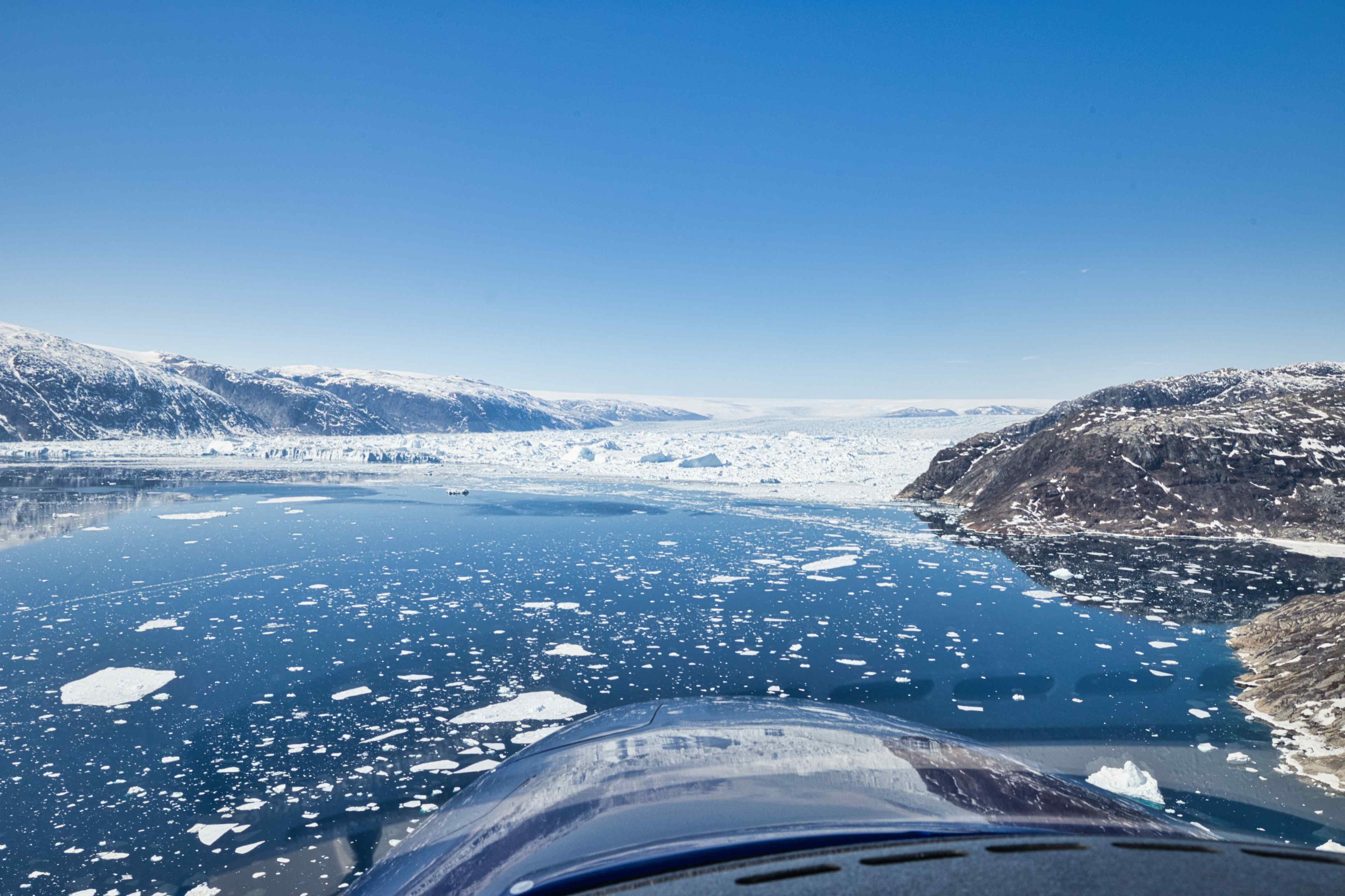
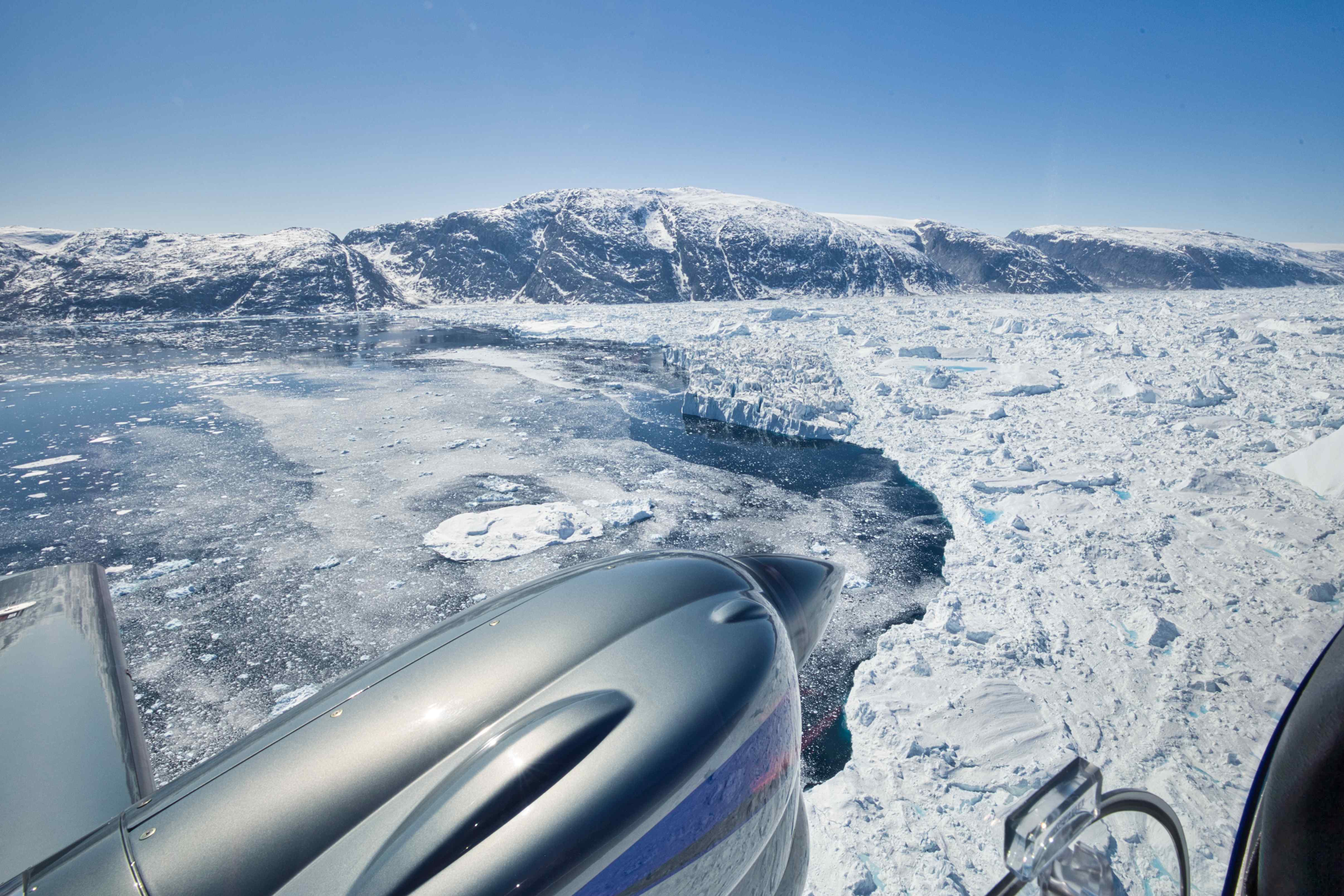
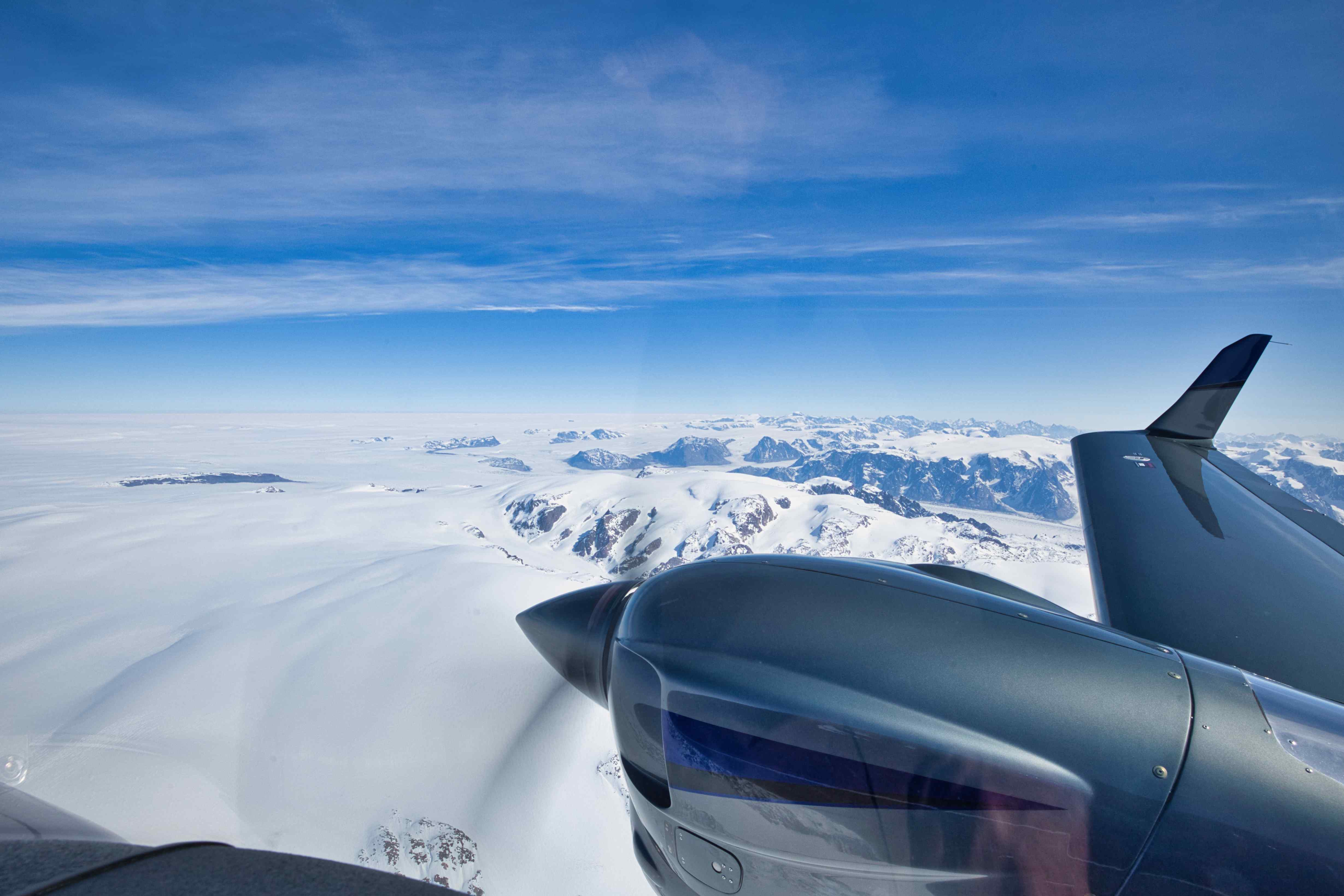
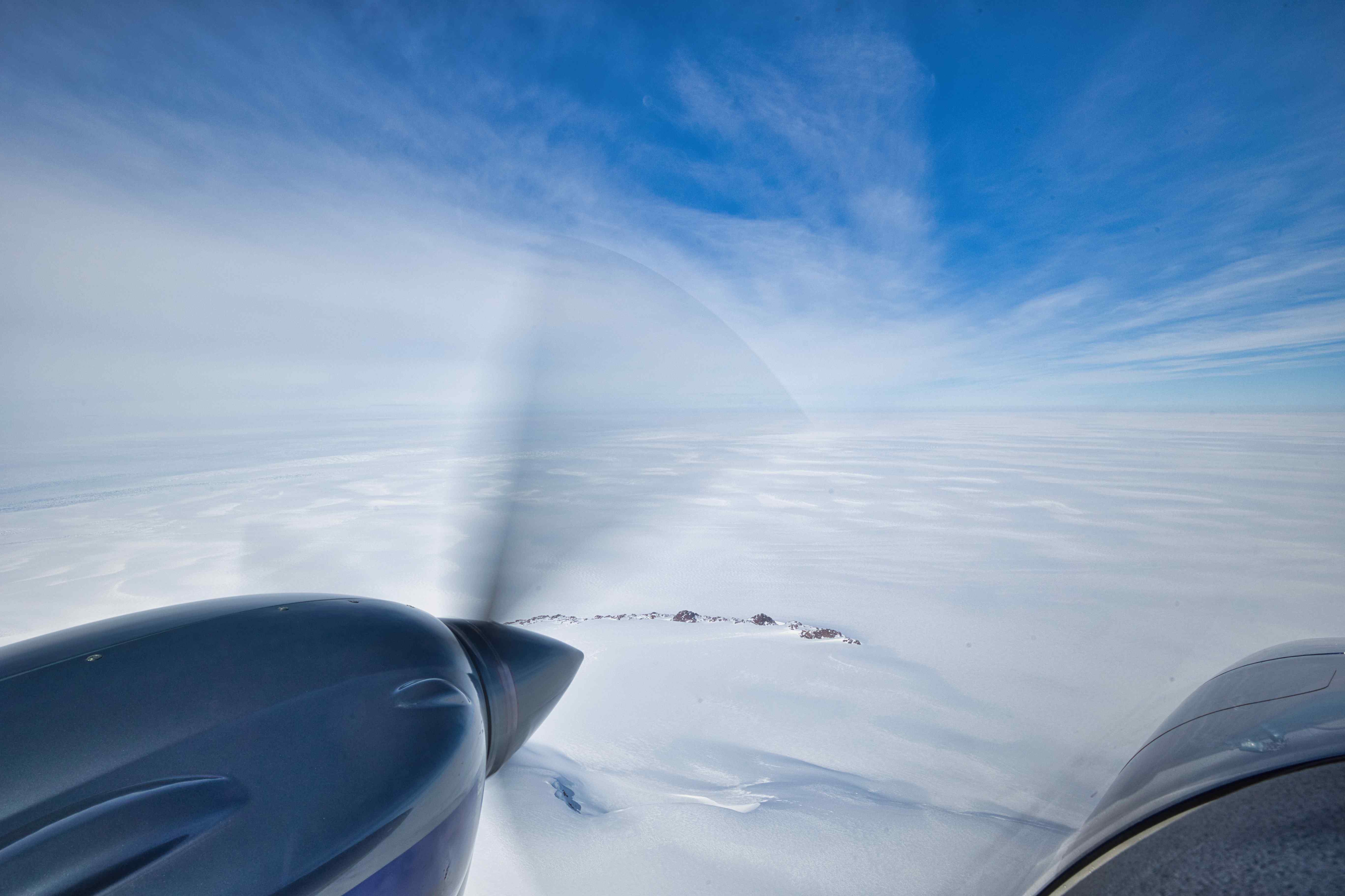
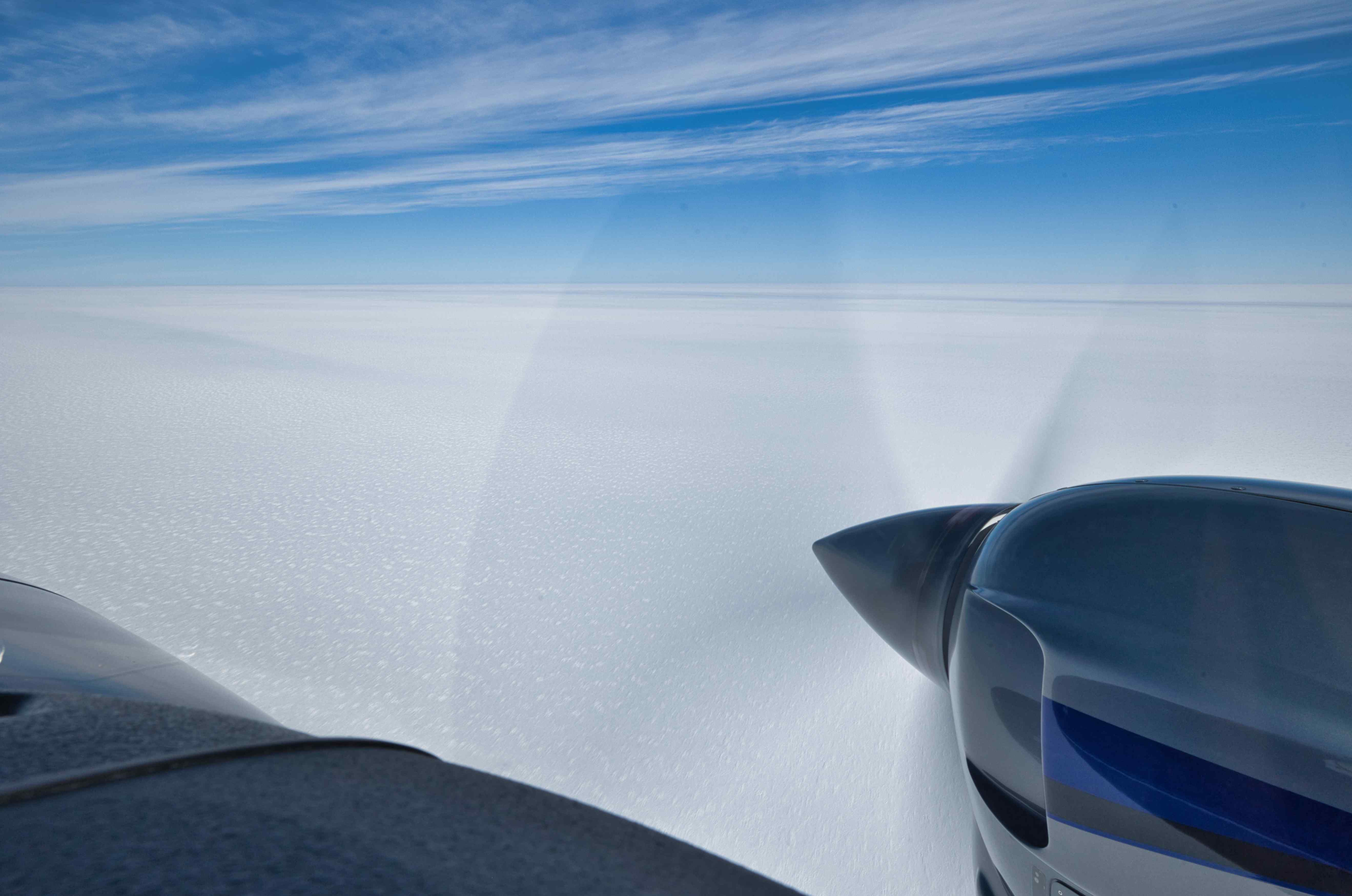
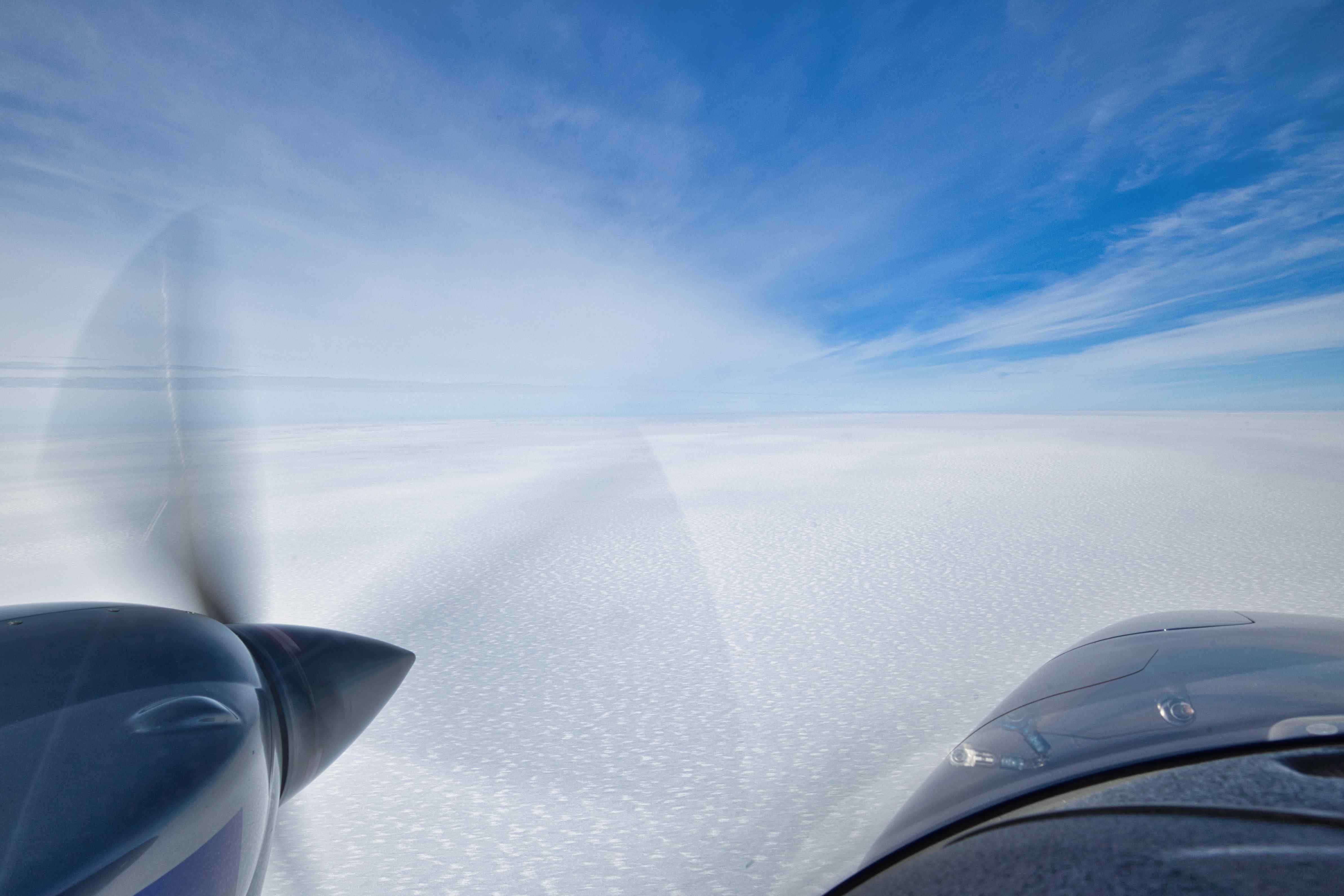
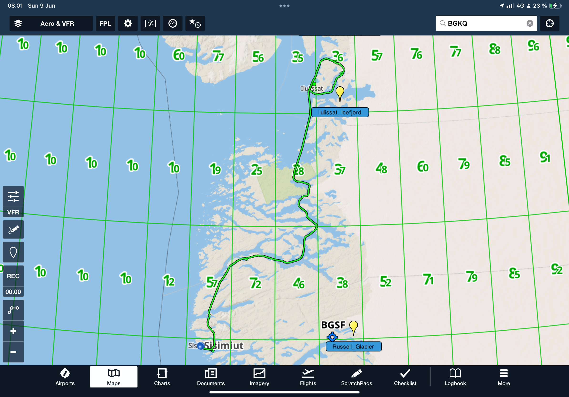
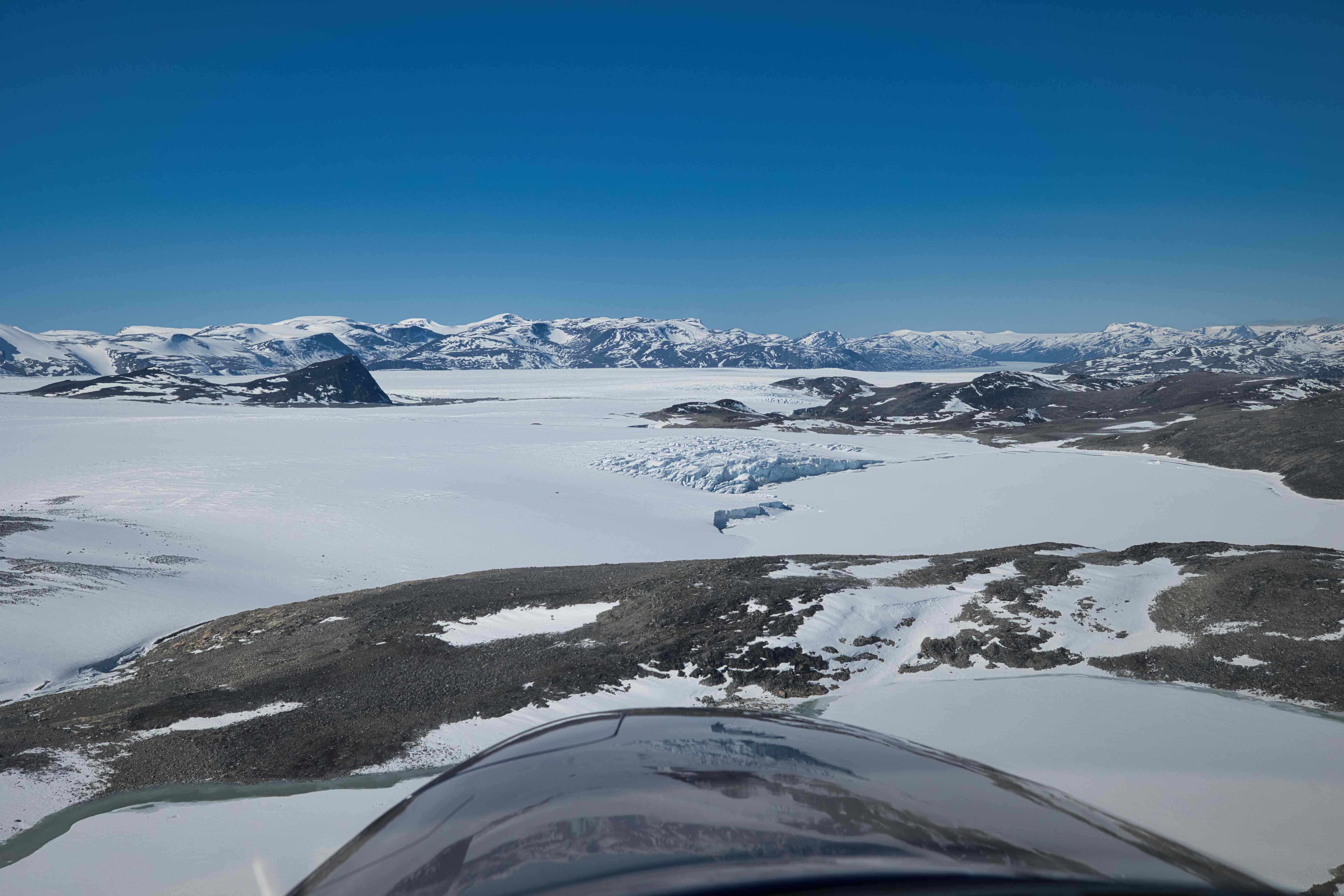
7th flight, BGKK to BGJN, flight time 2 hours and 50 minutes, 390 nautical miles or 722 kilometres
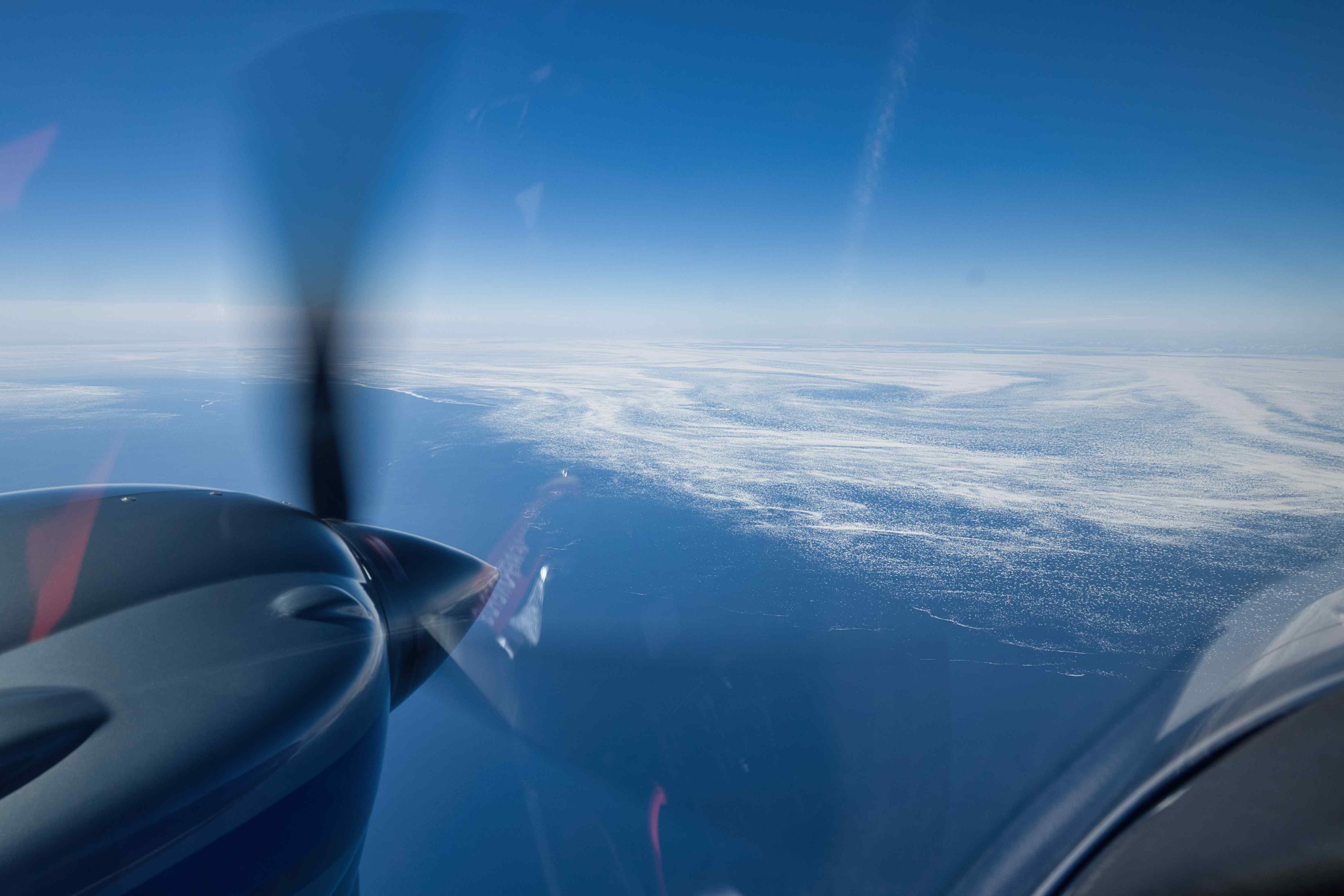
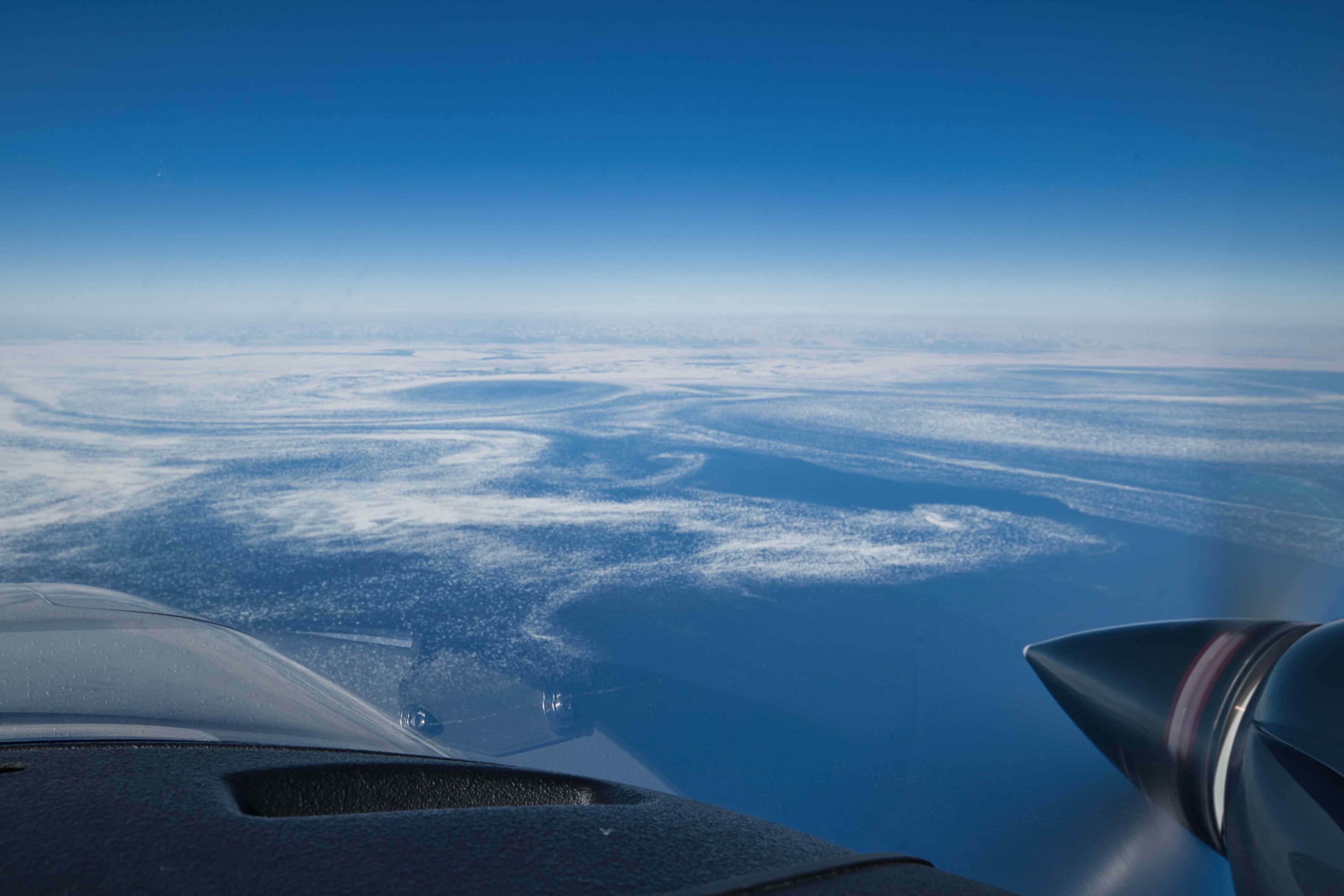
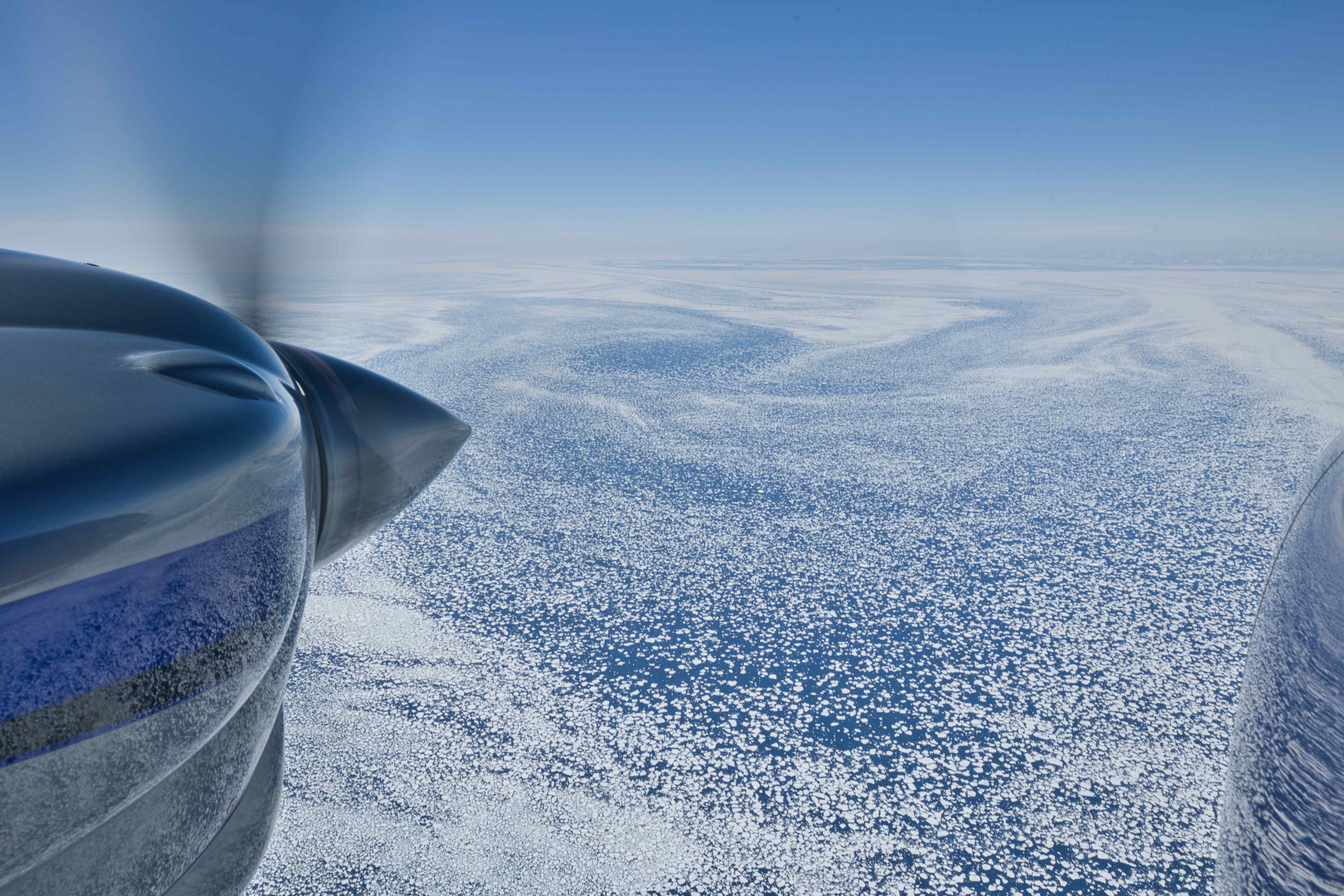
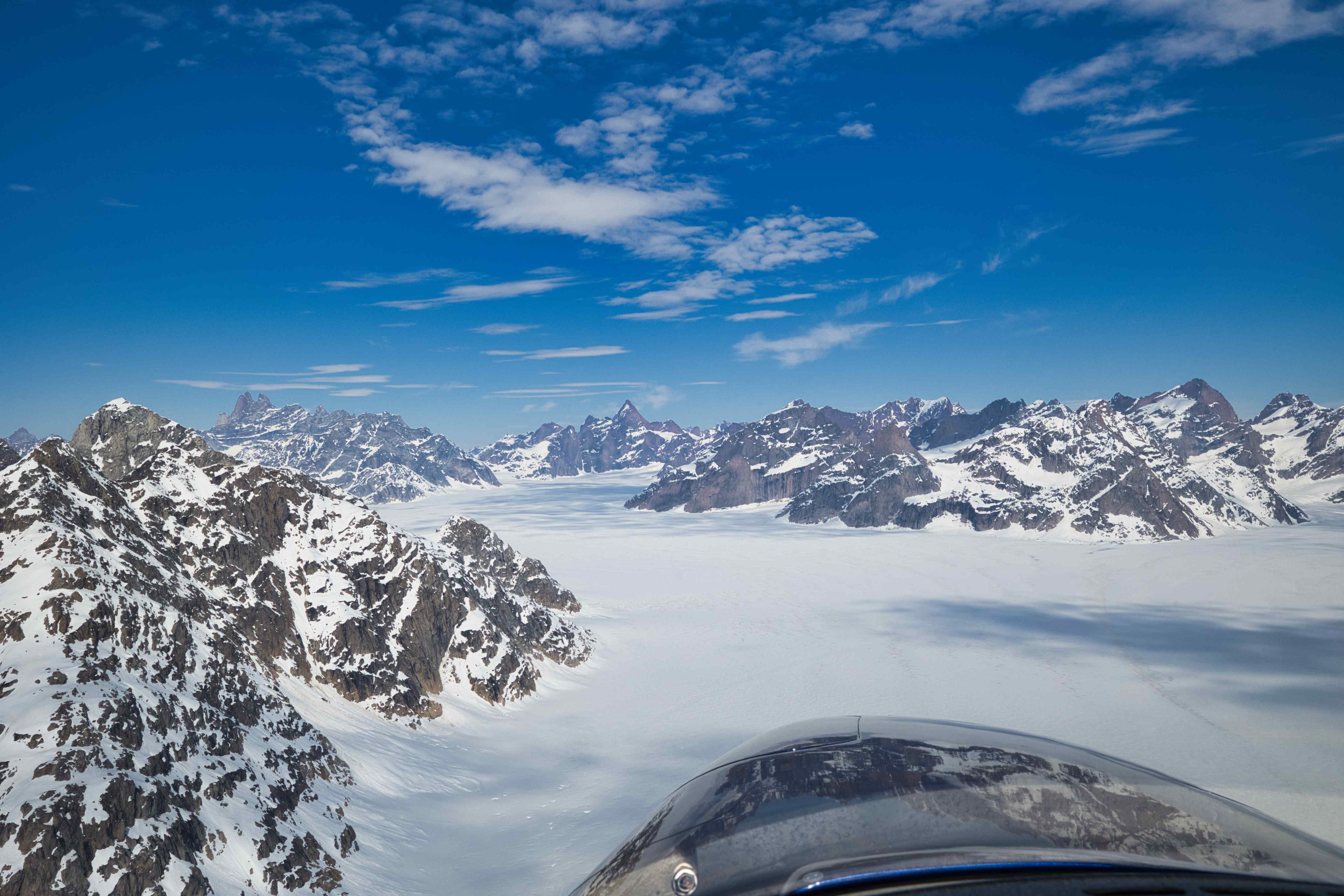
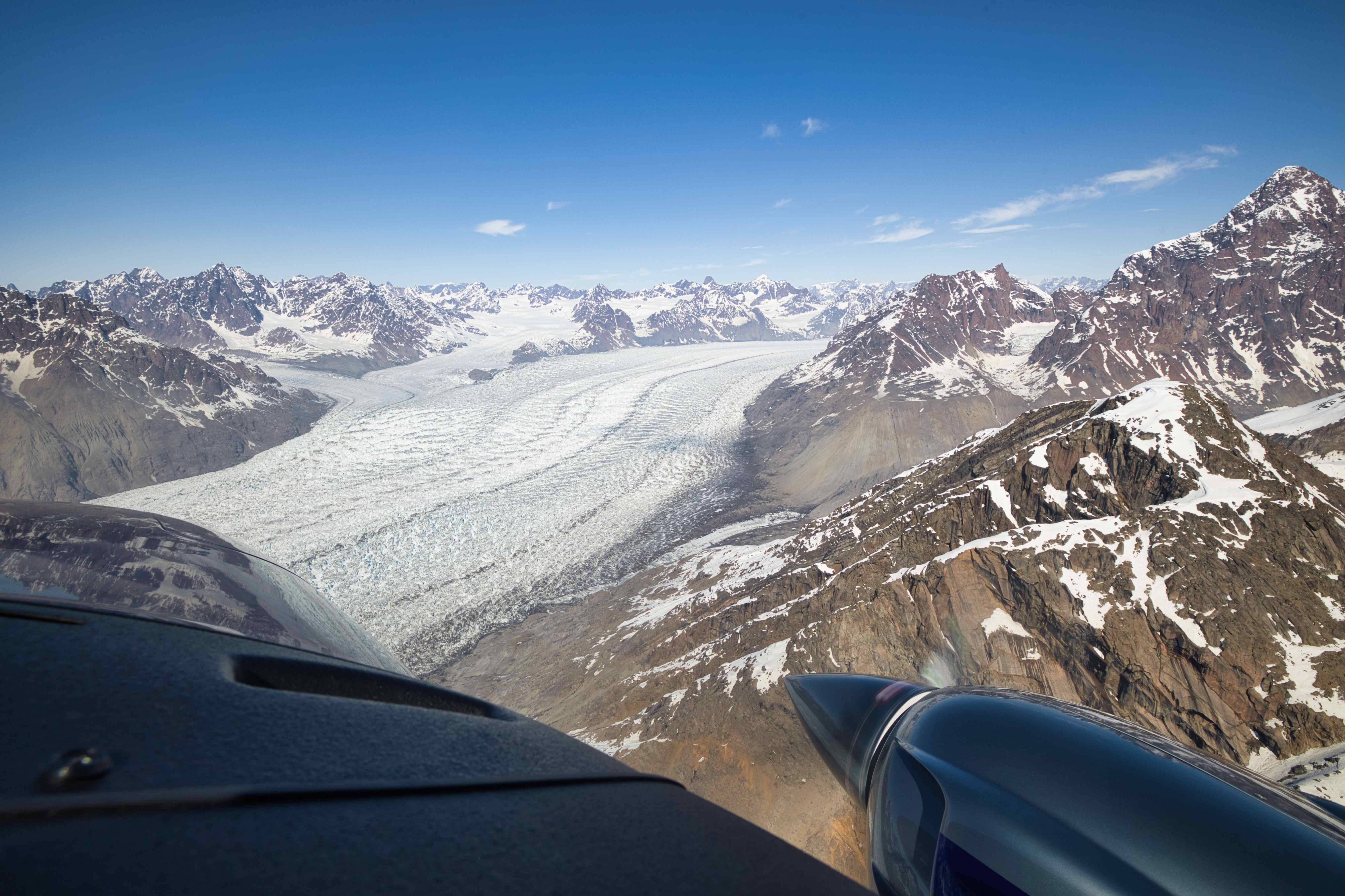
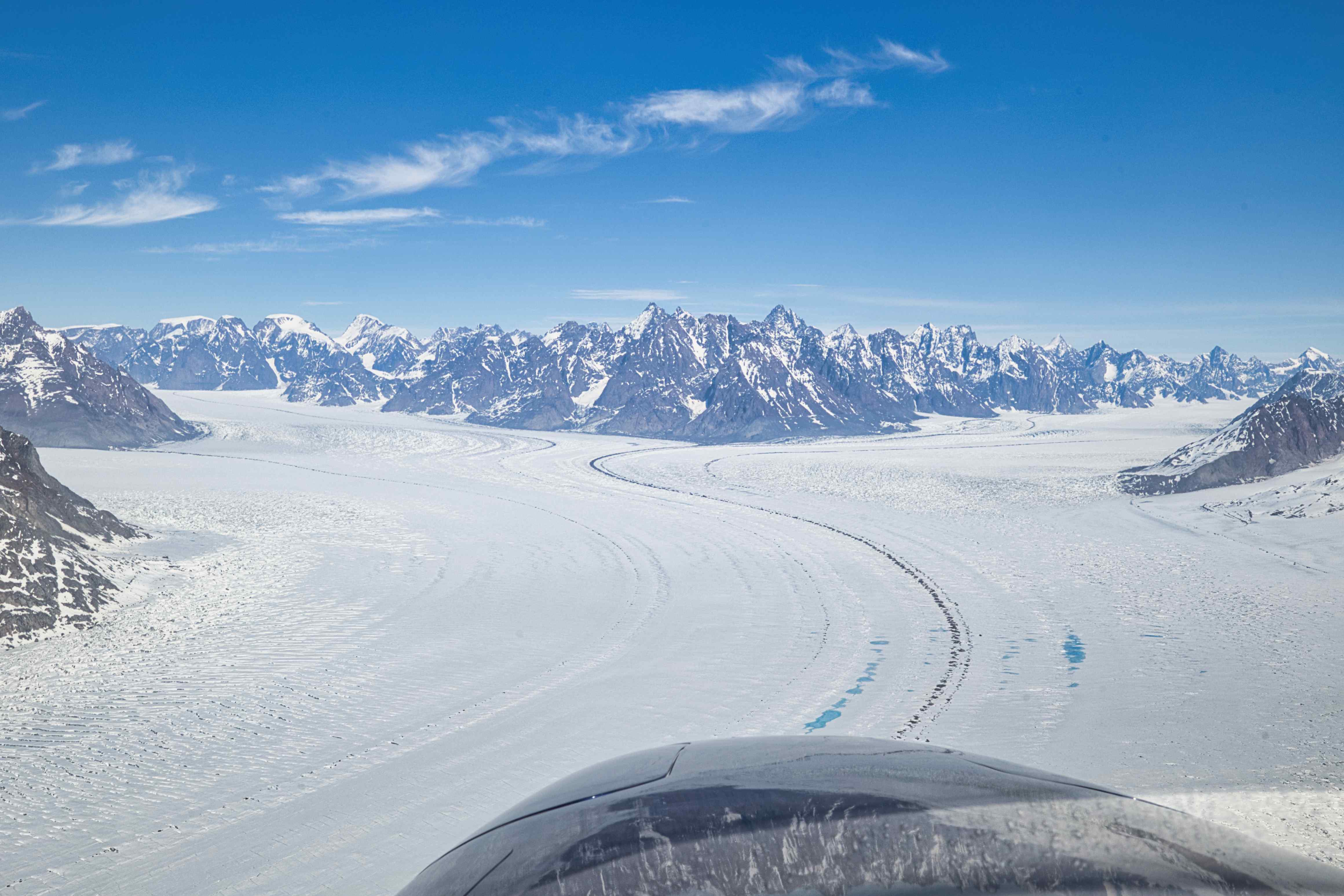
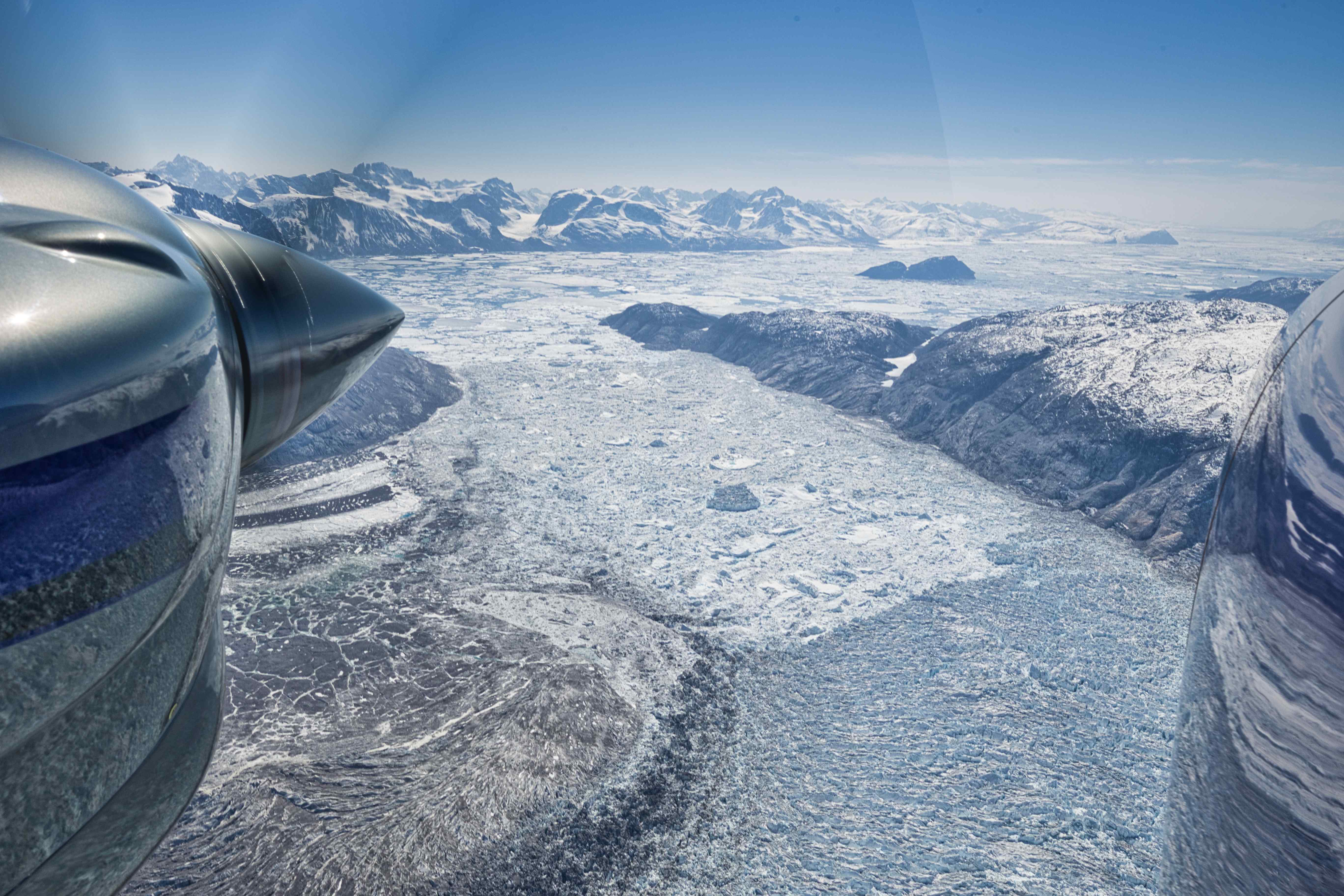
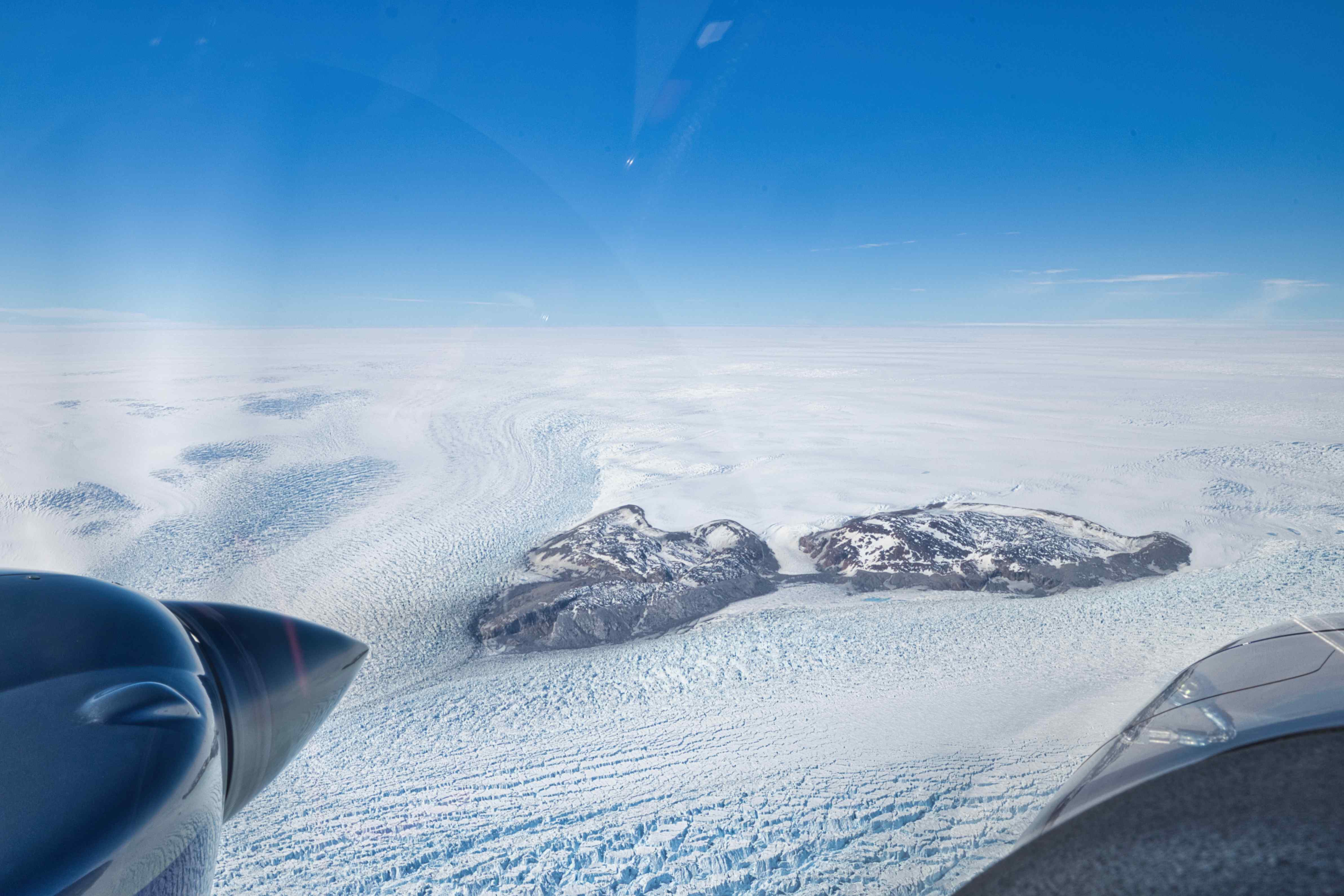
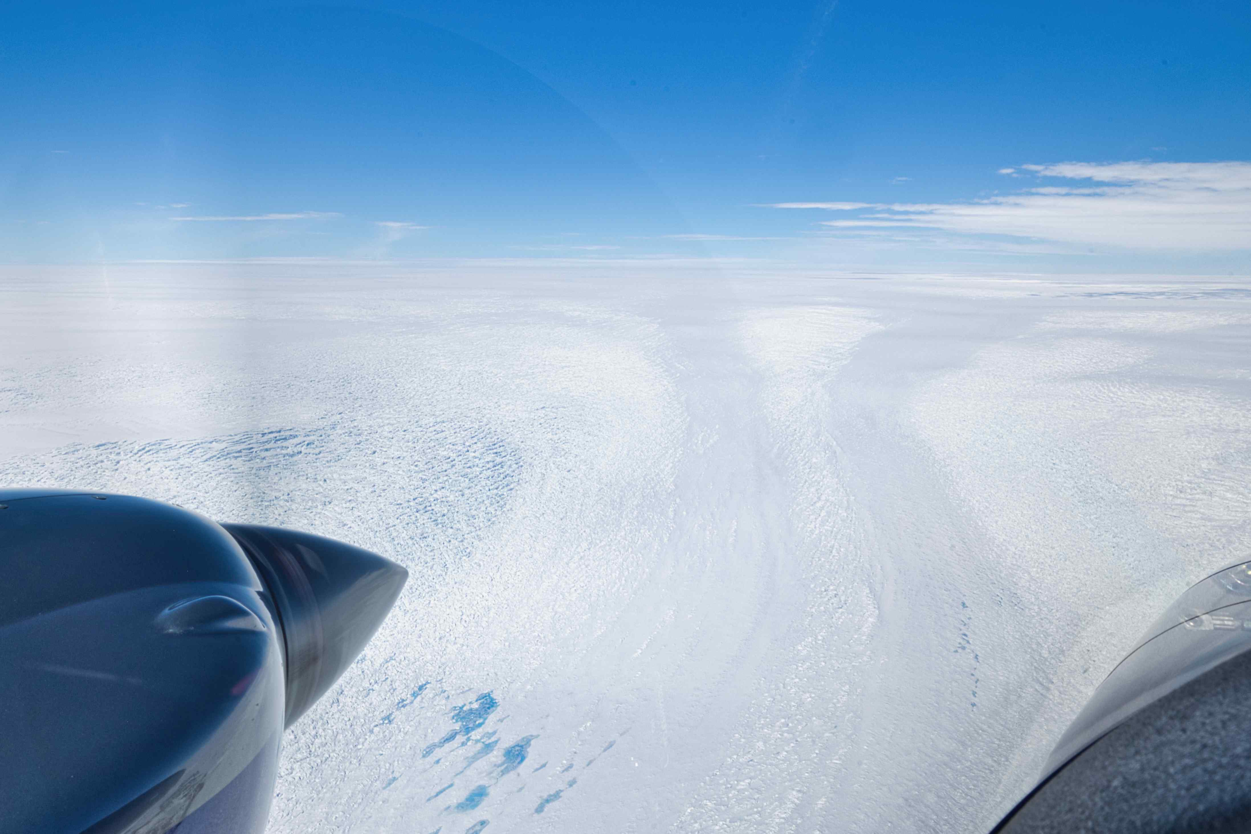
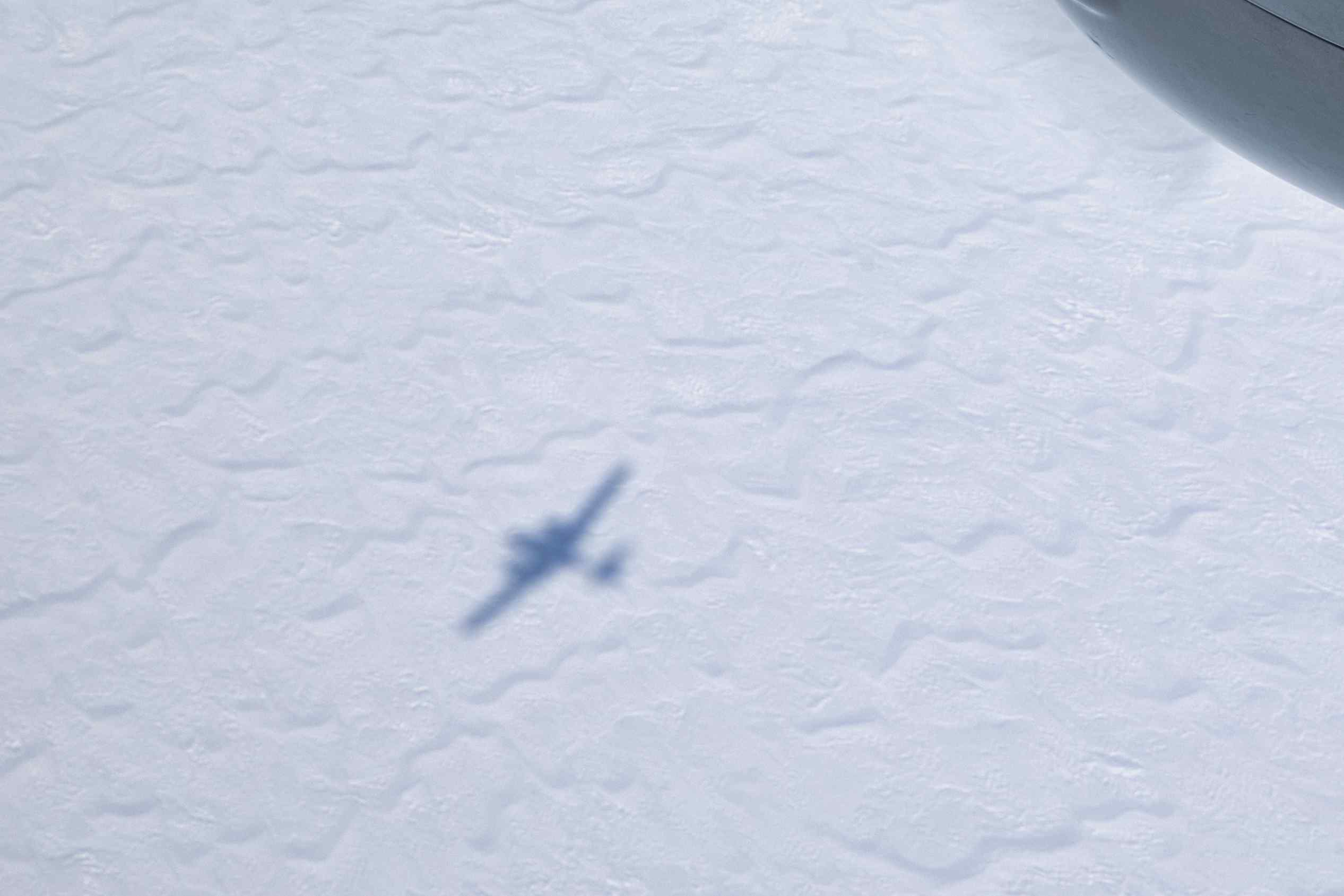
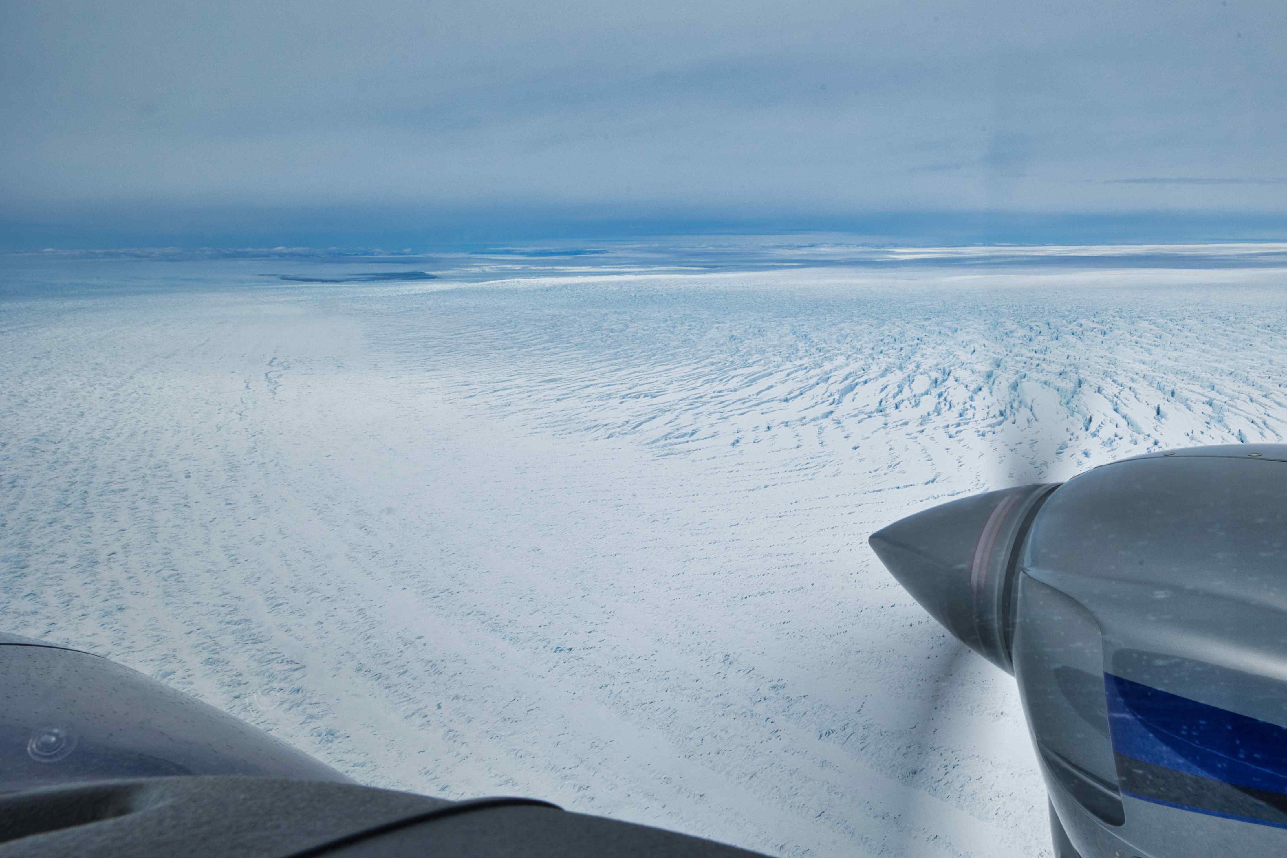
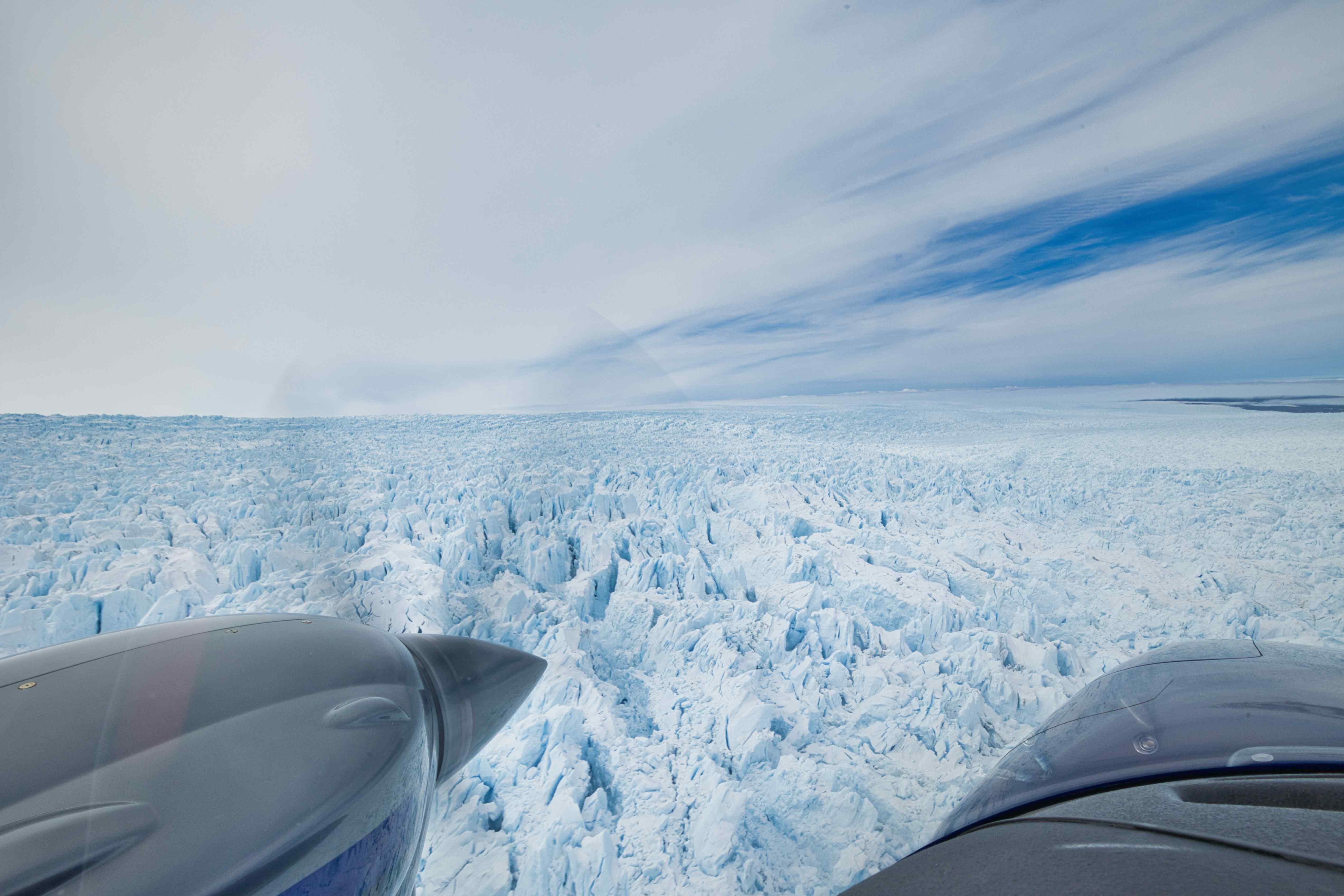
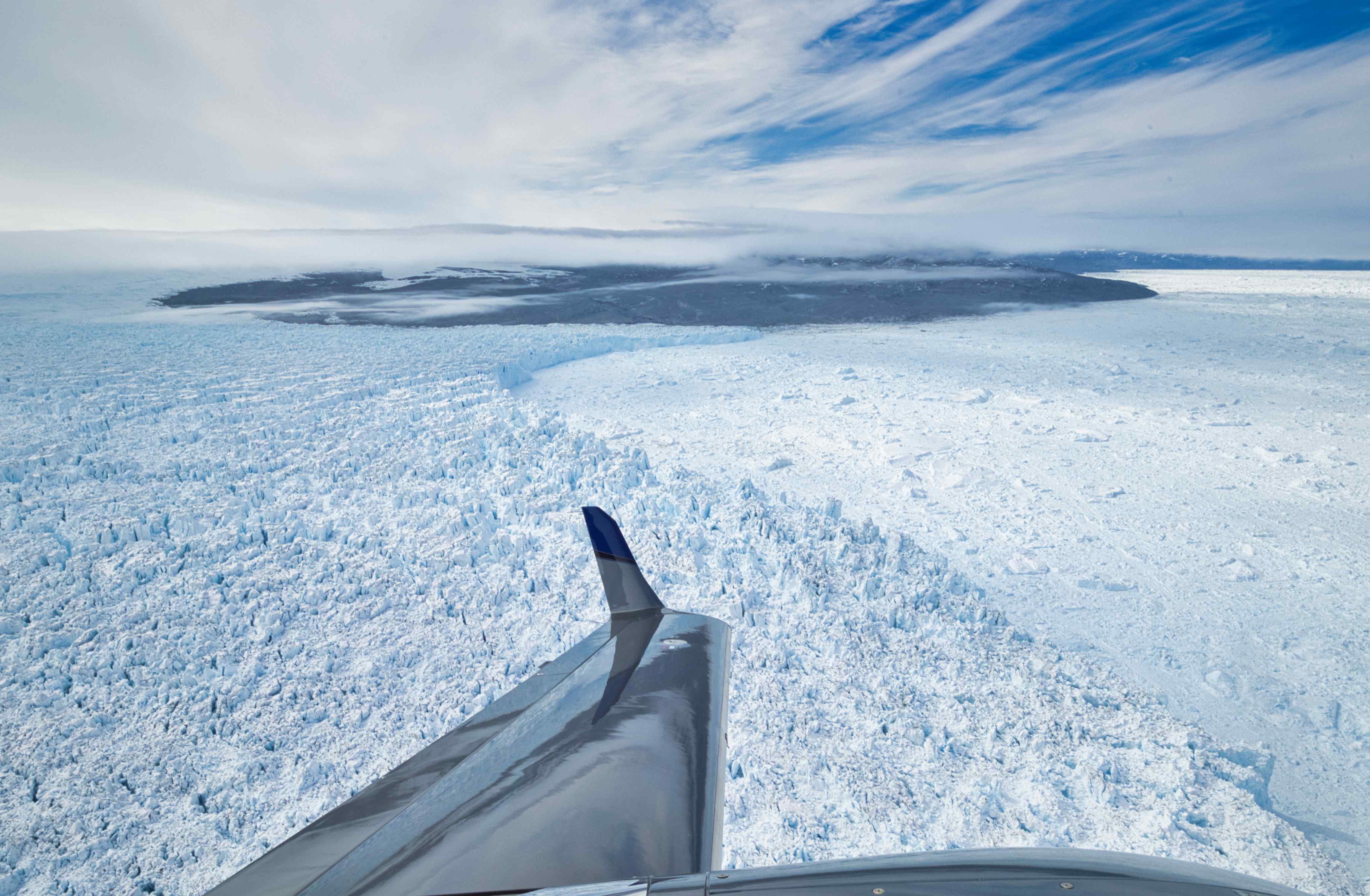
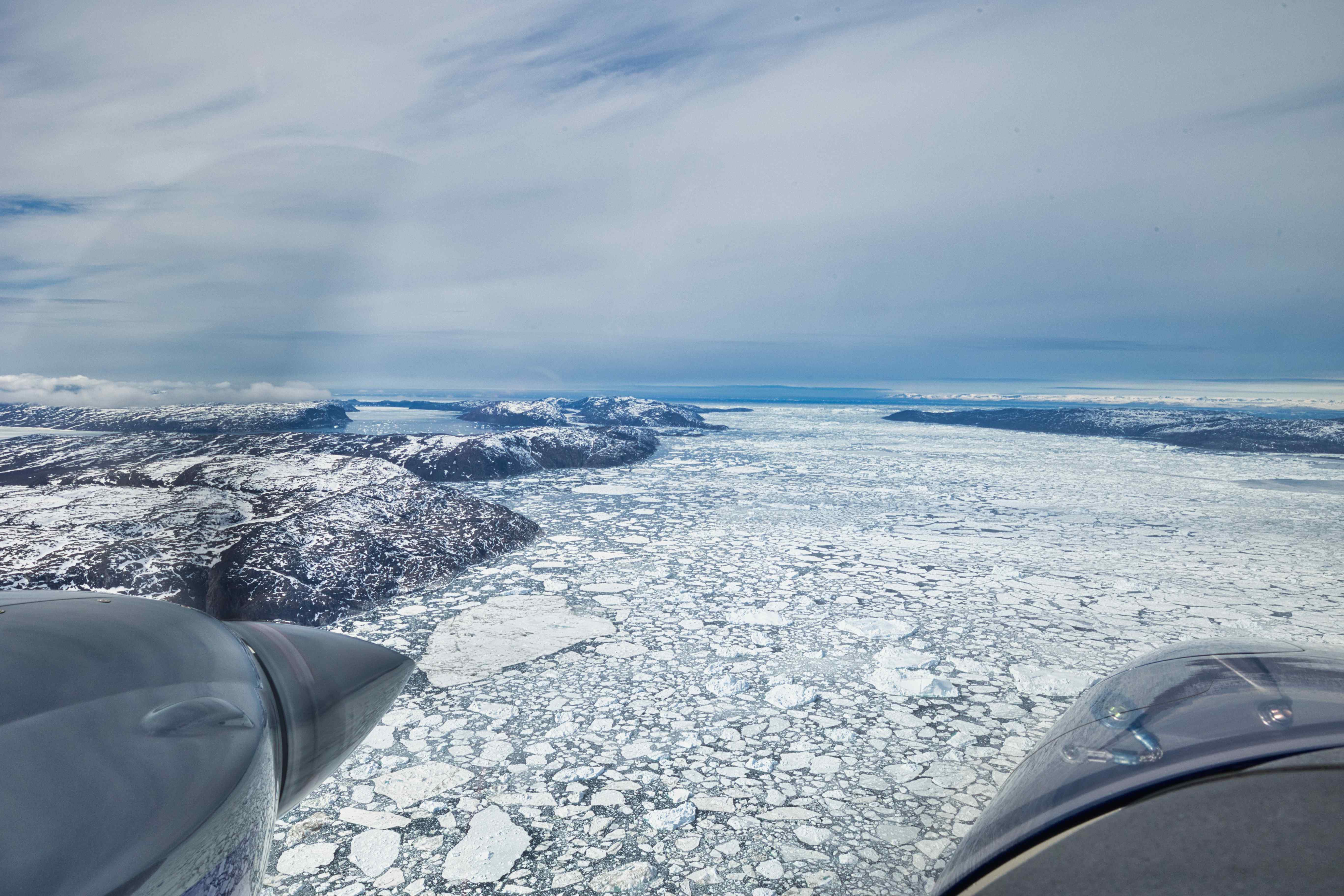
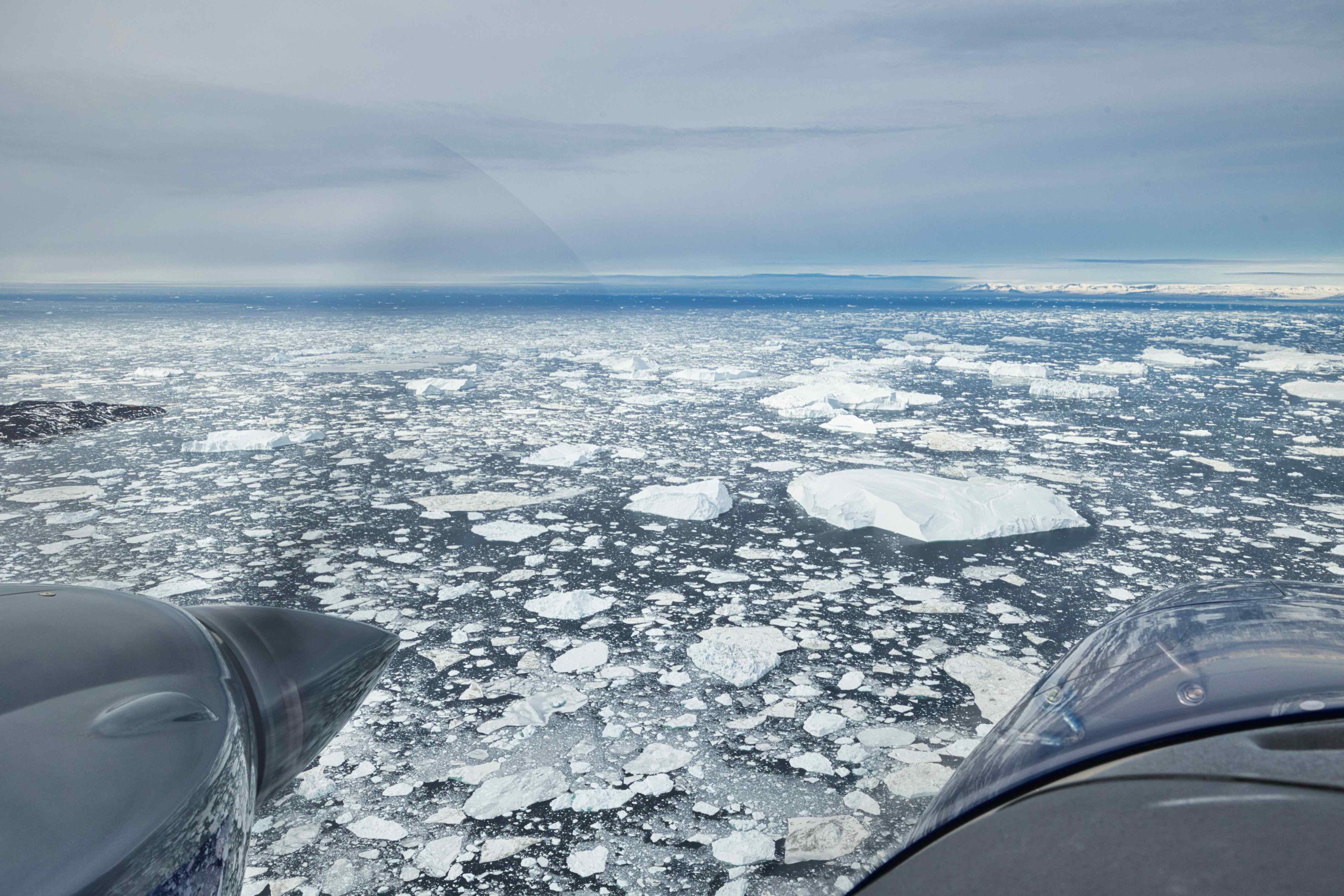
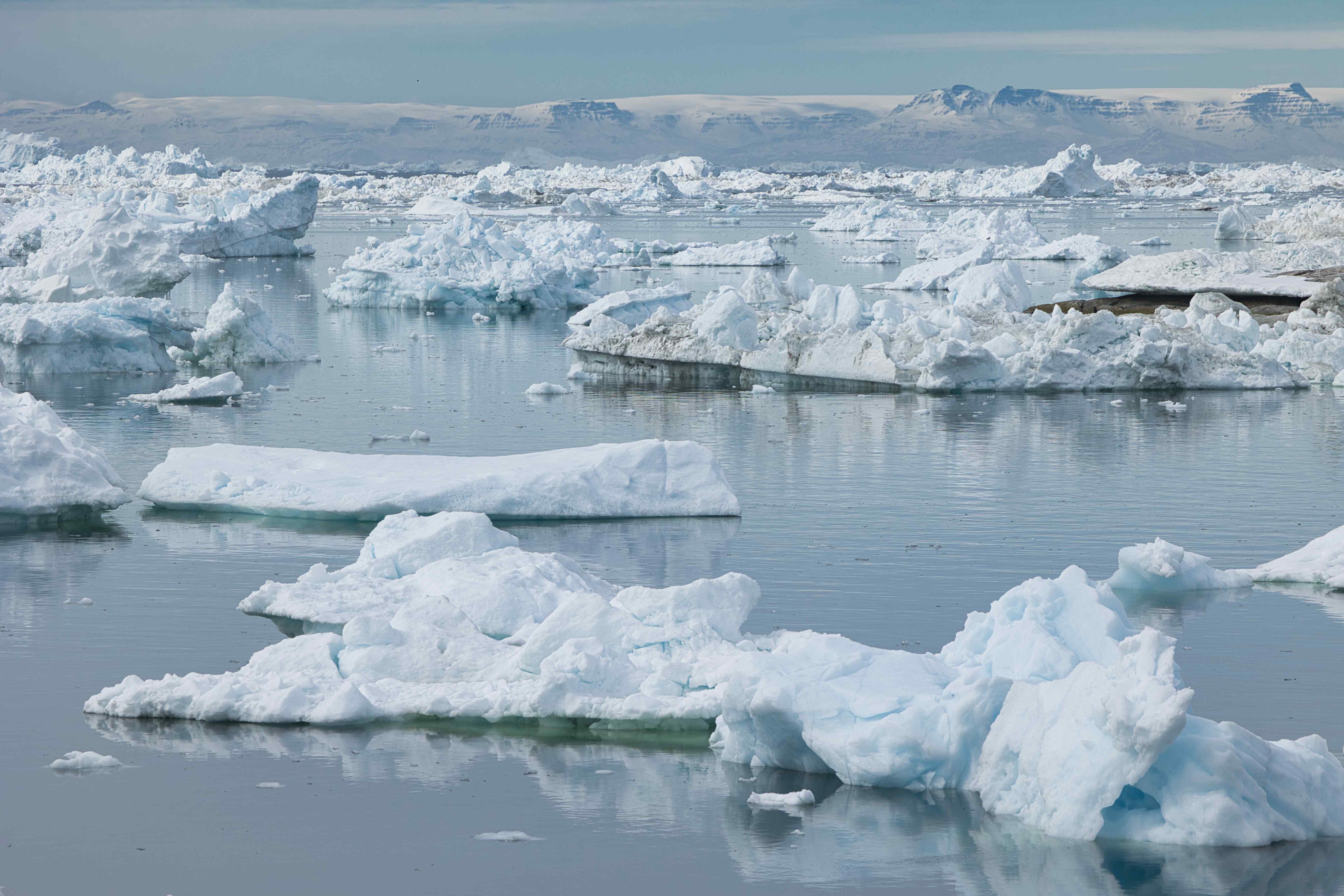
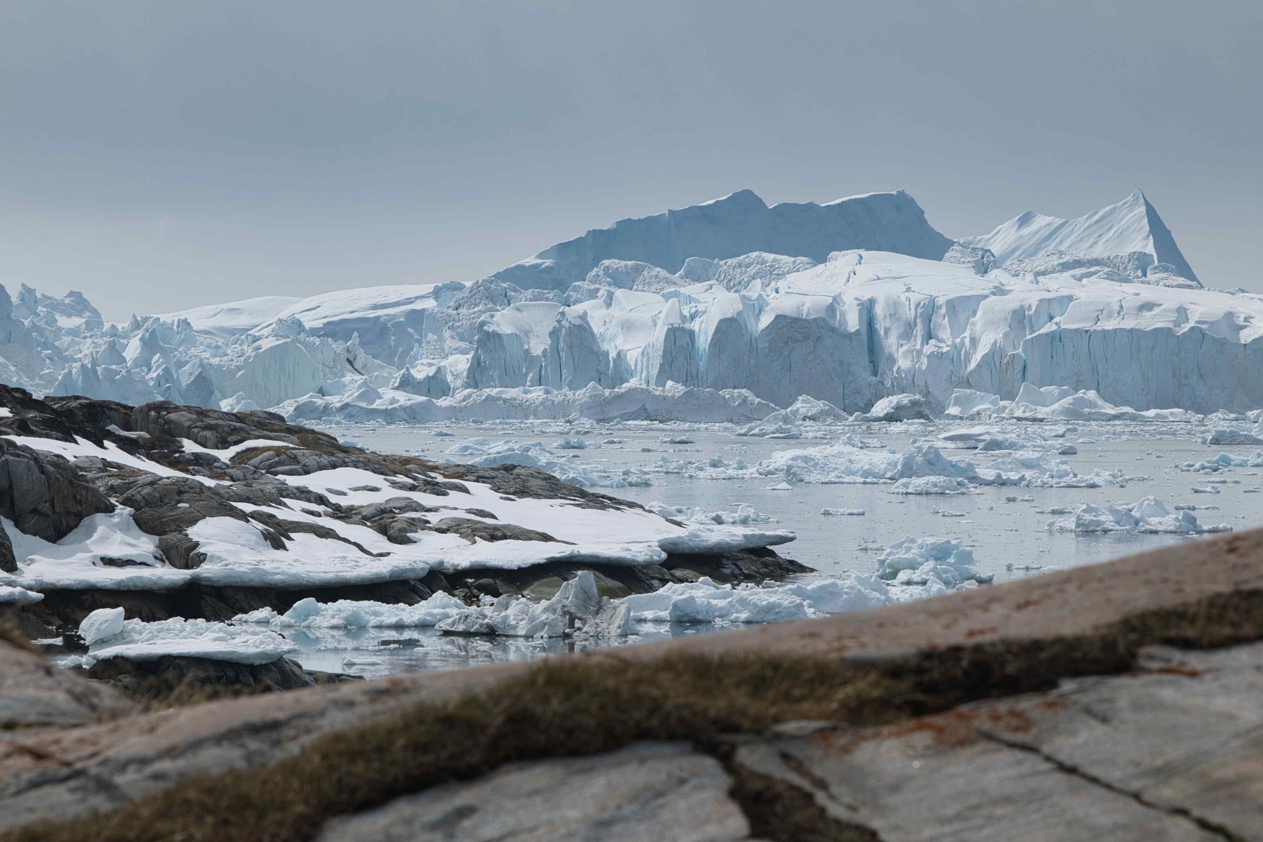
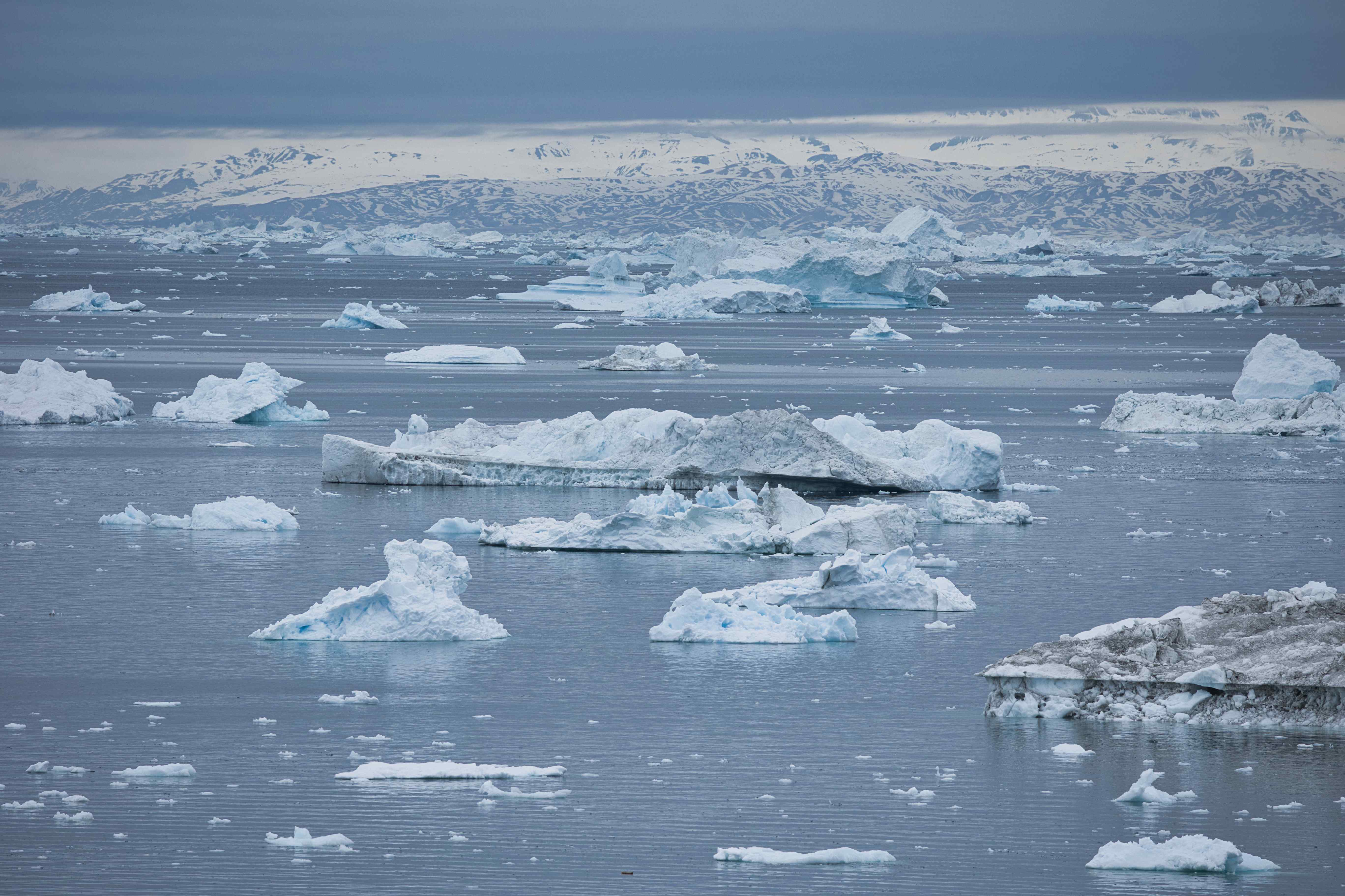
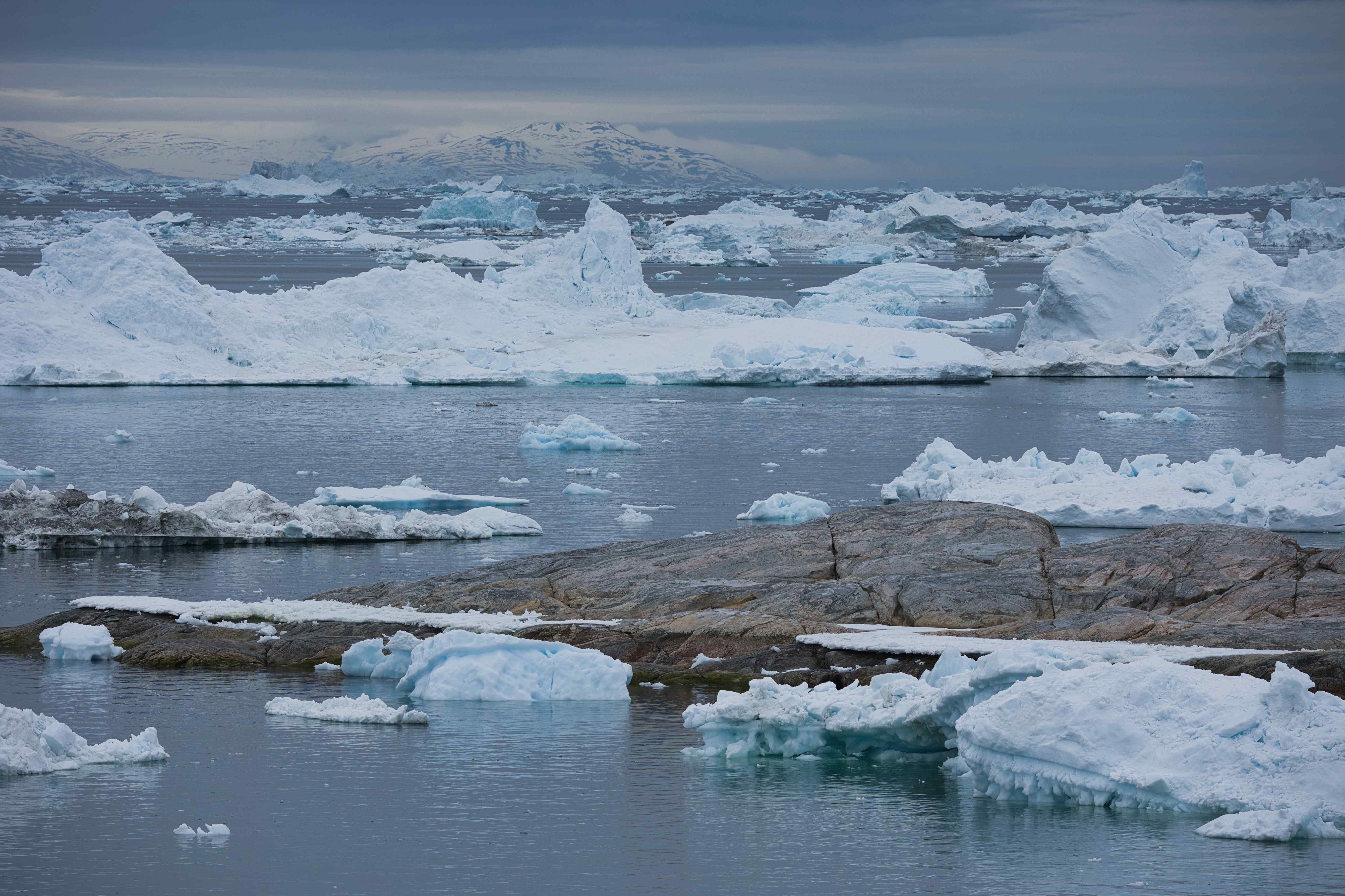
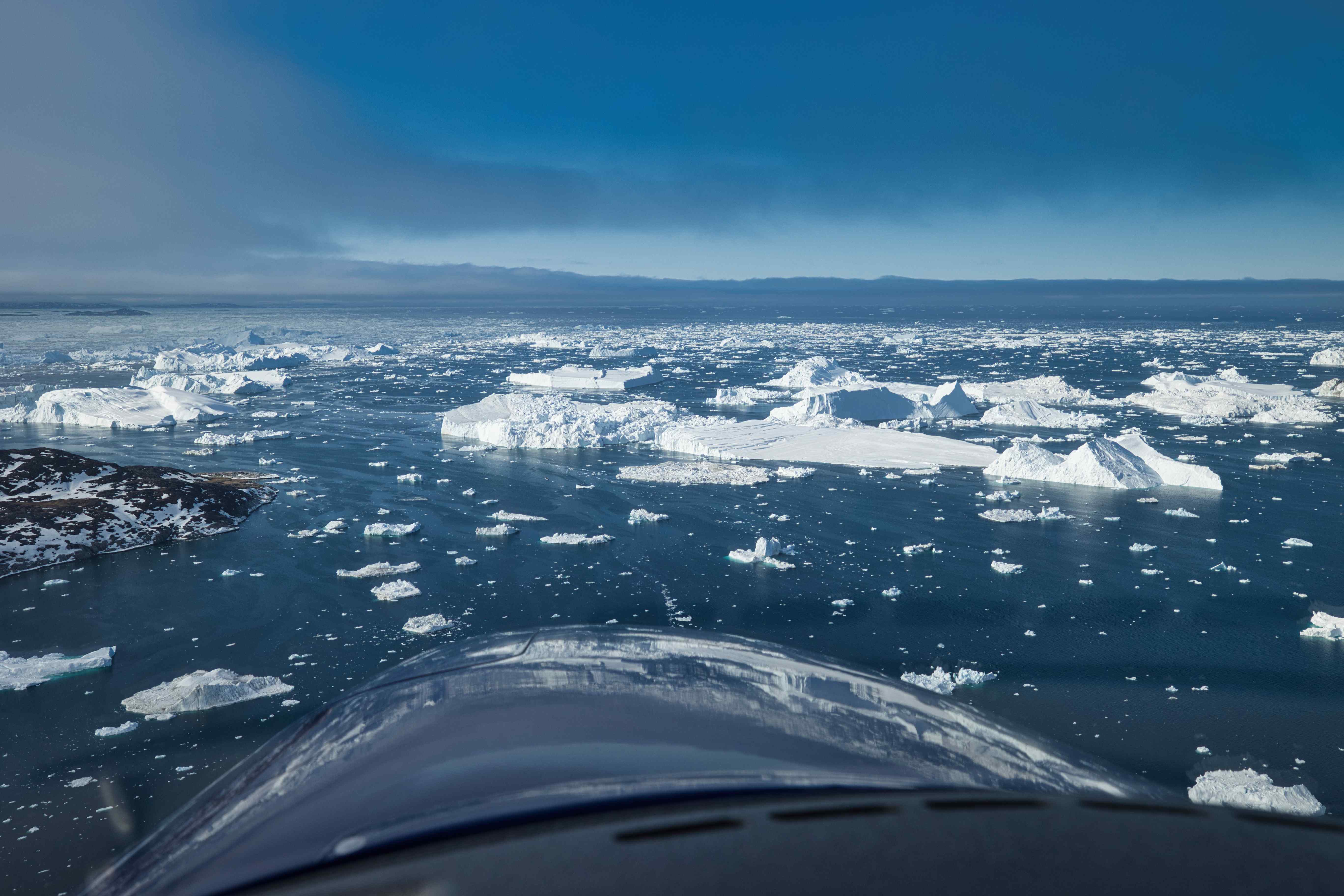
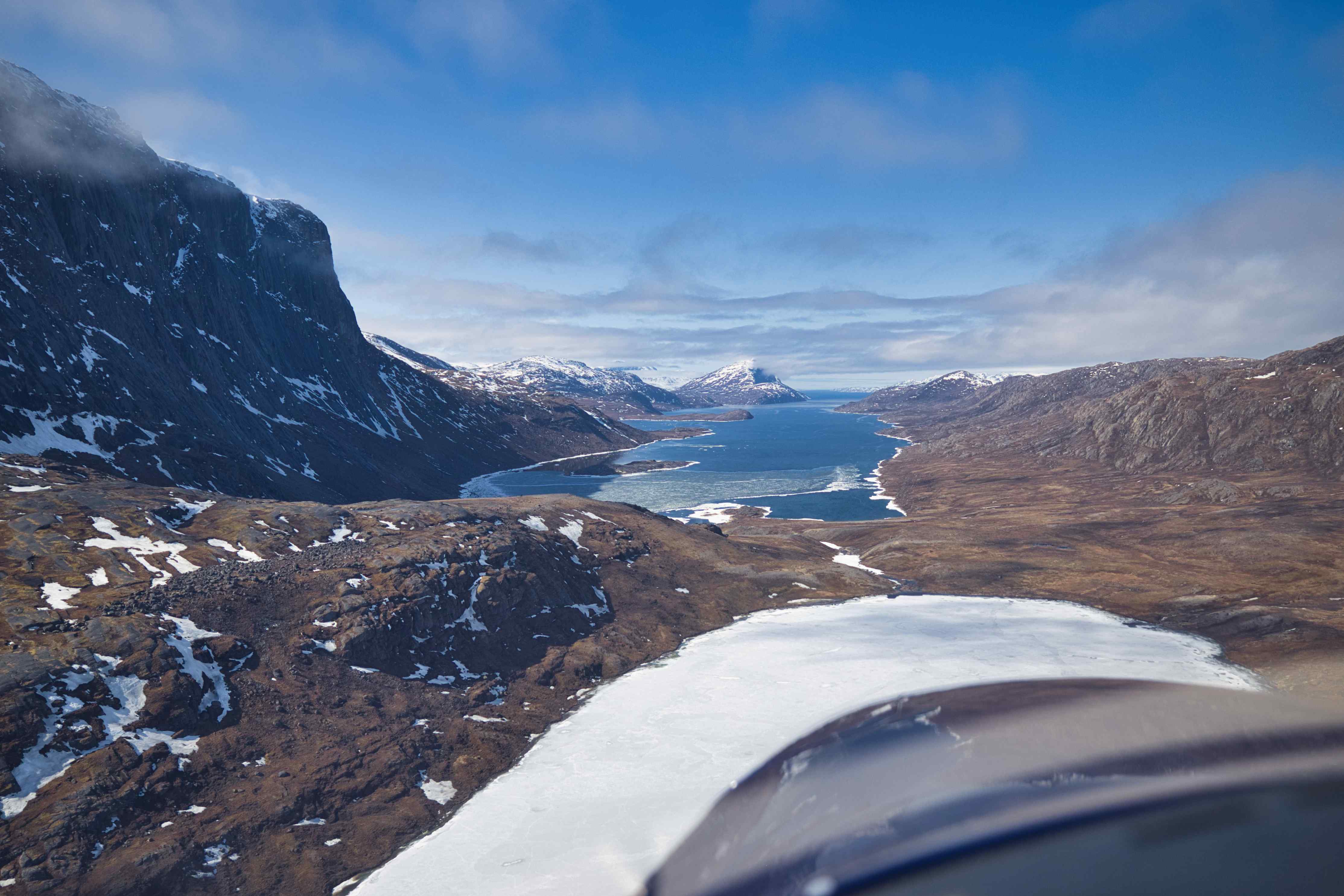
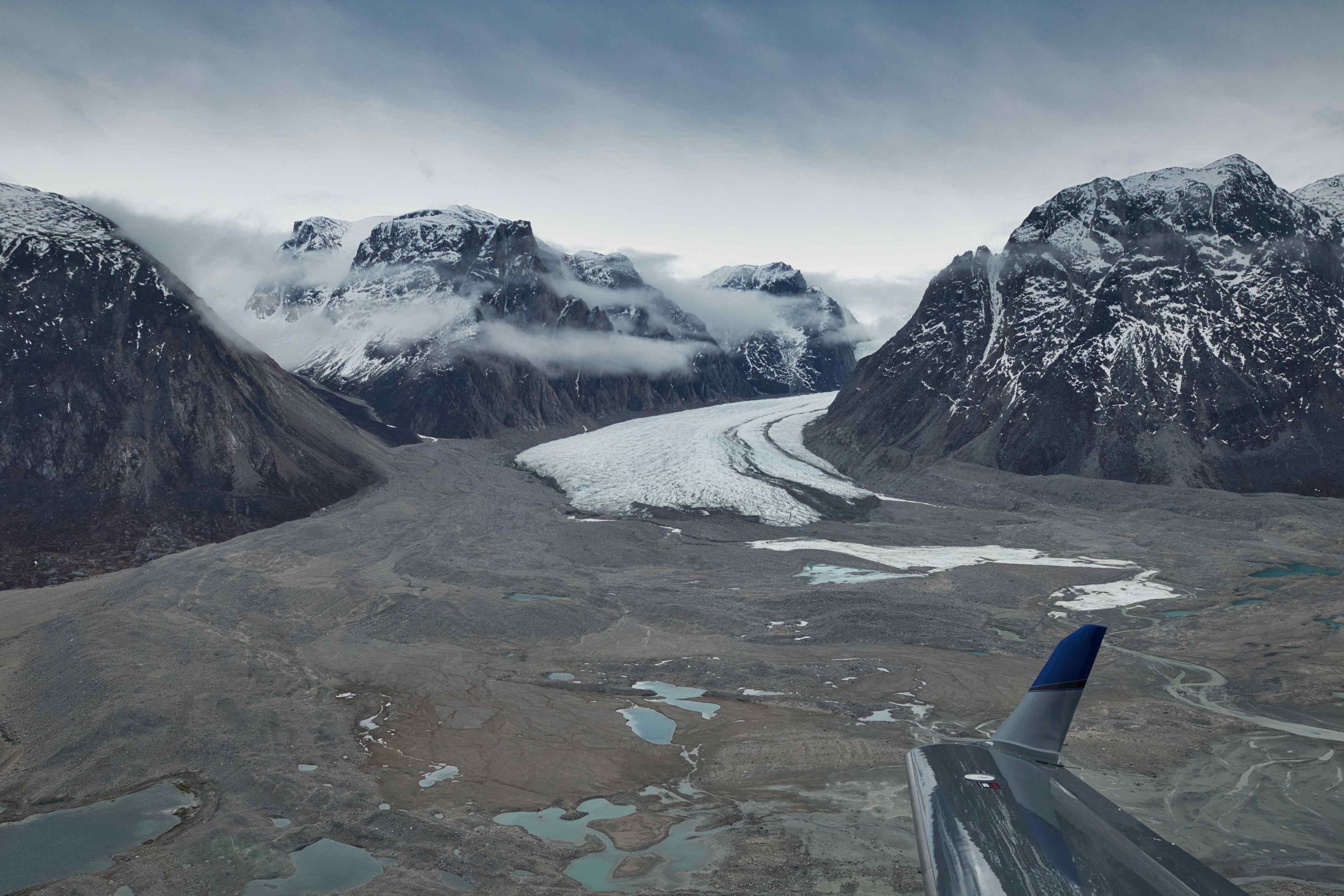
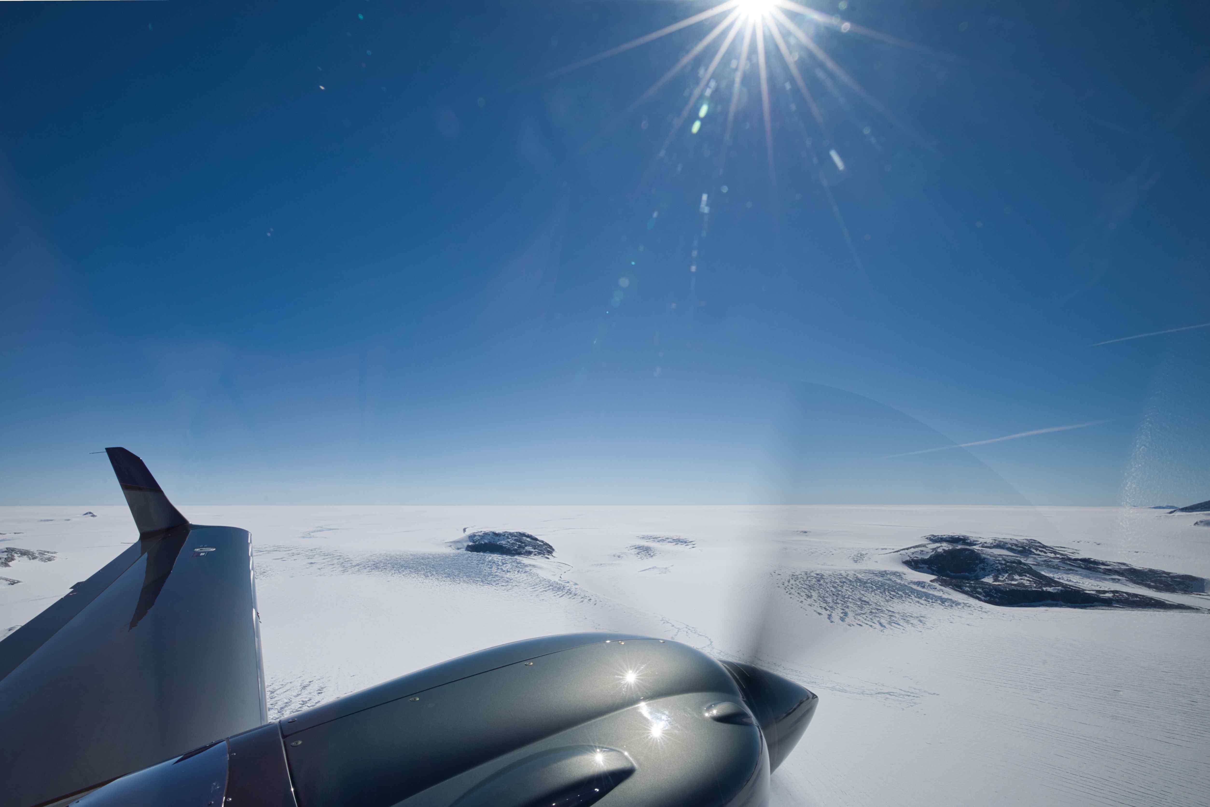
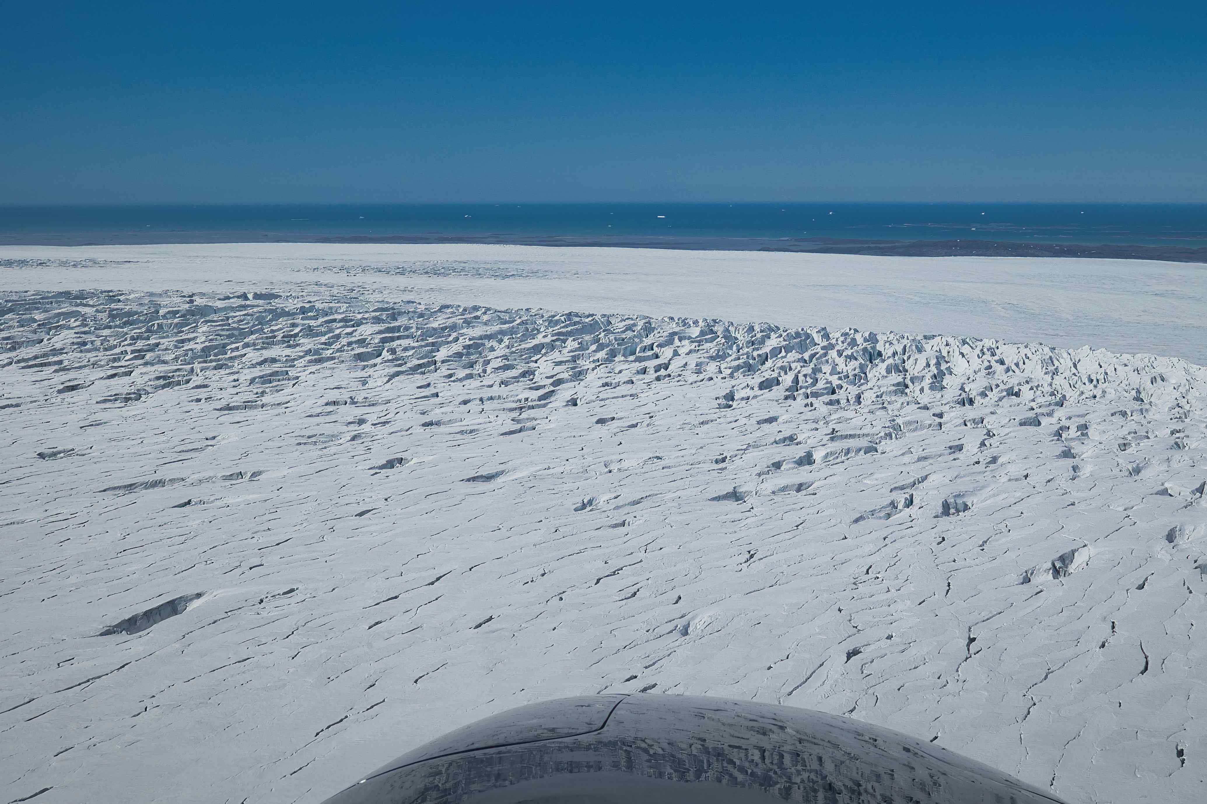
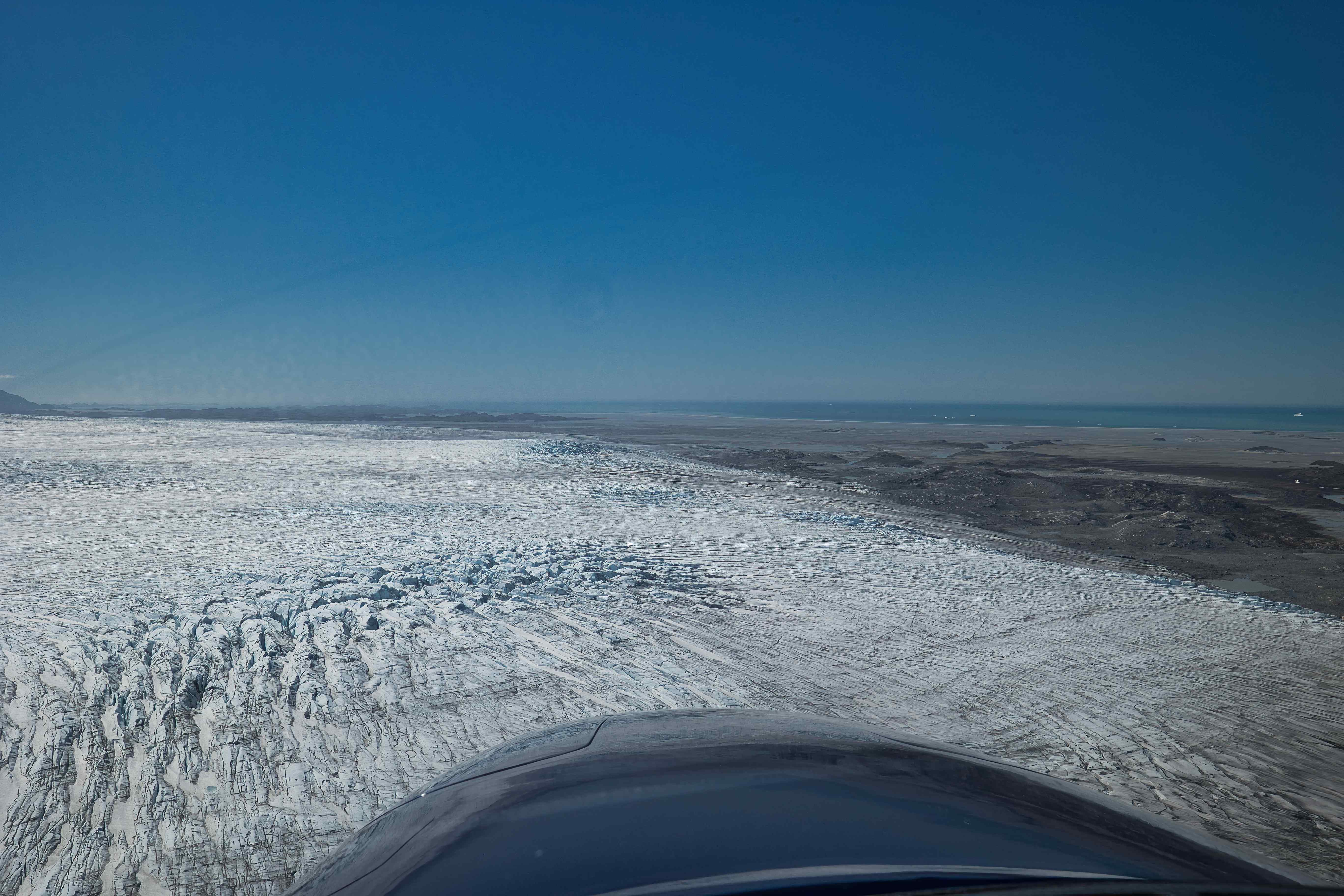
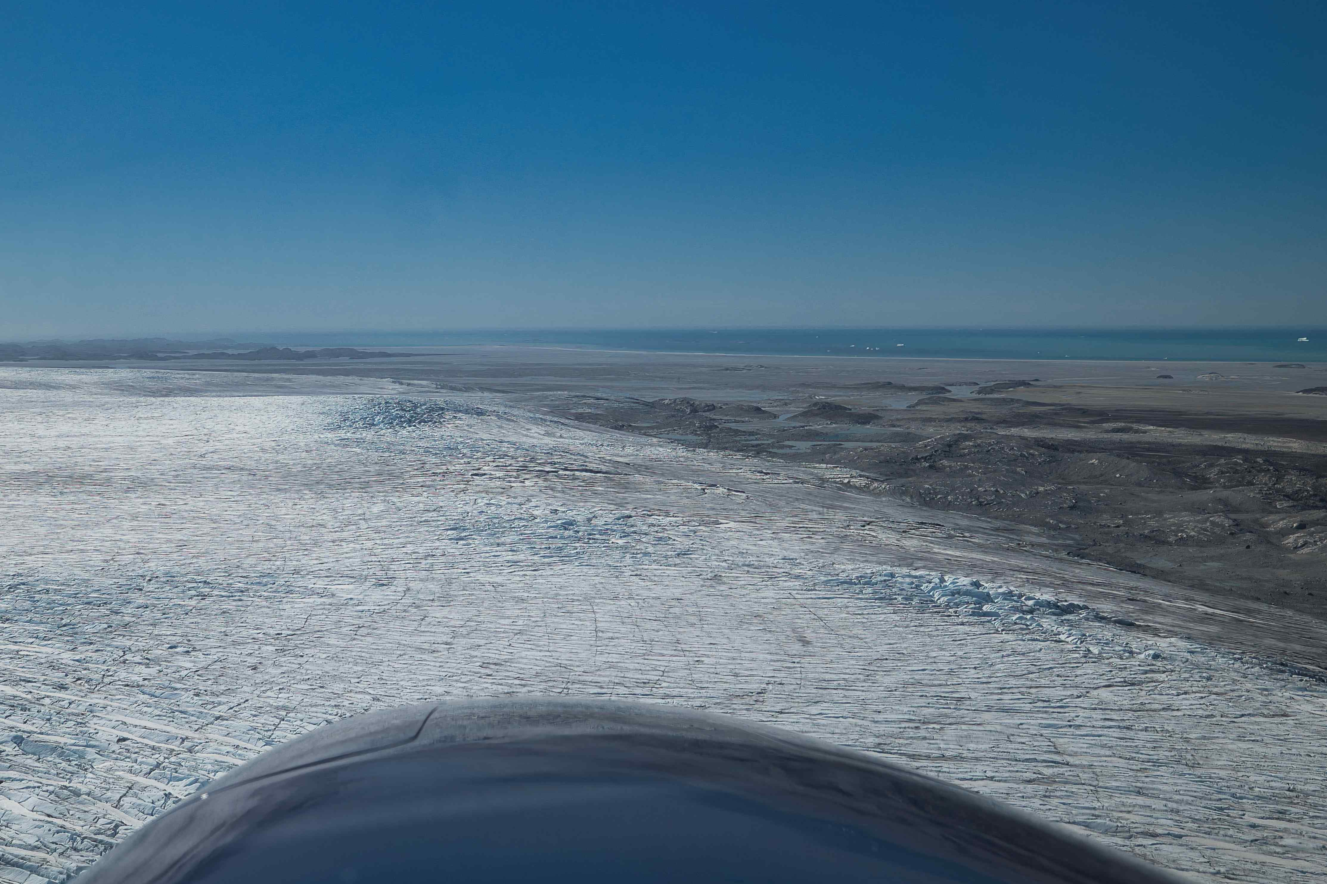
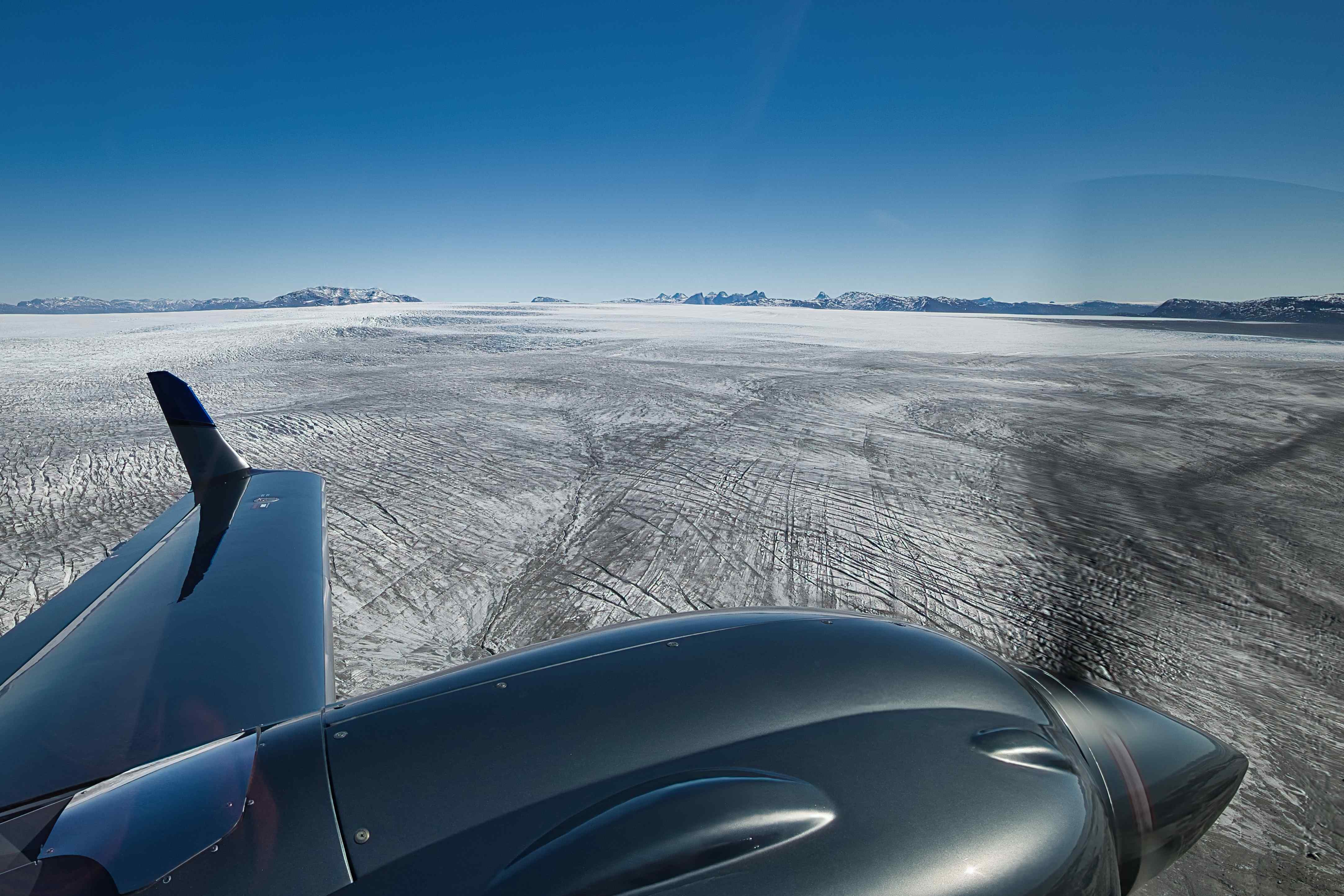
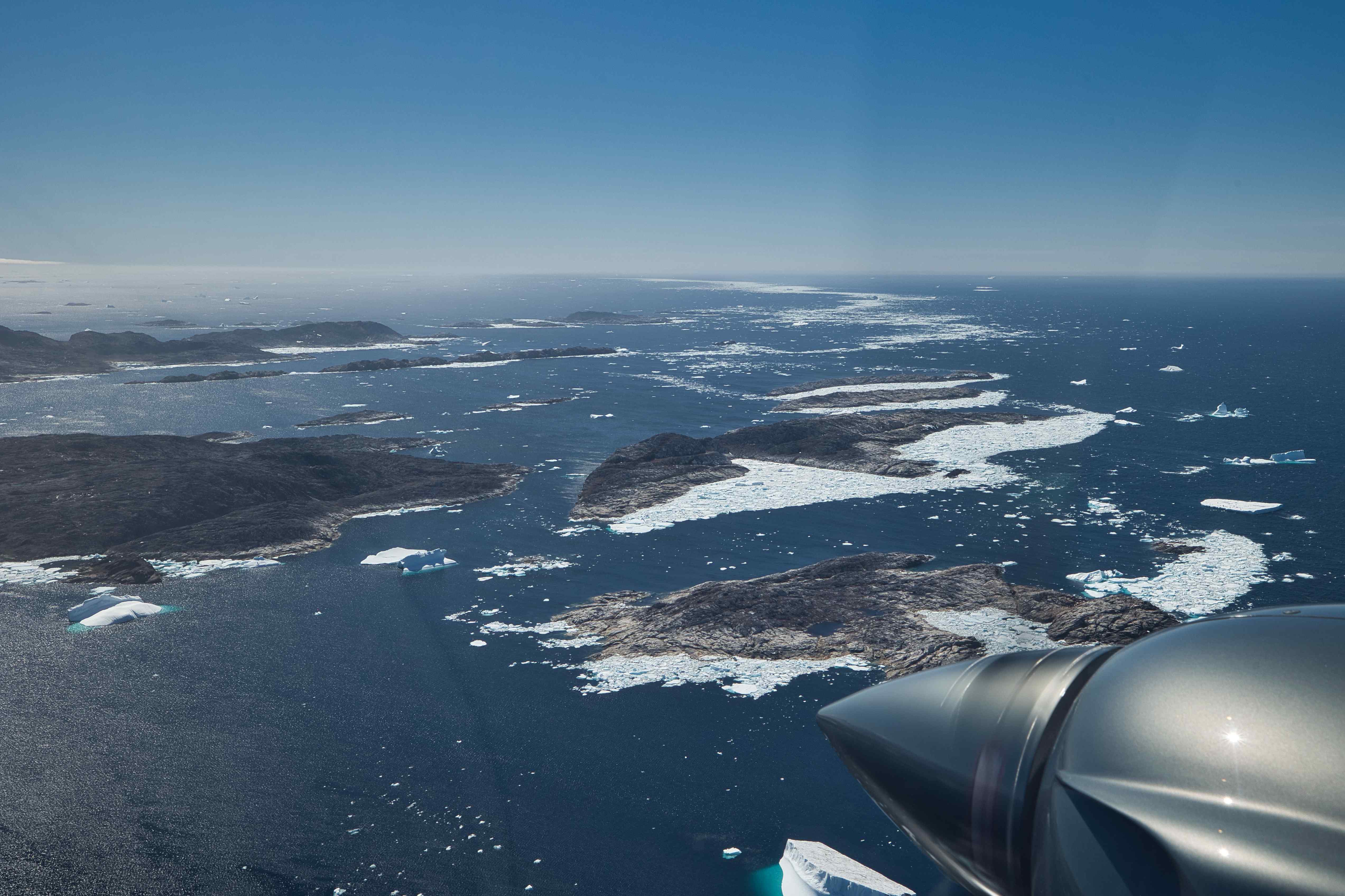
Our original plan was to follow the east cost of Greenland southbound to Narsarsuaq and then the west cost northbound as far as time and weather permitted. But this plan fitted very badly with the weather forecast, to the south, on both sides of Greenland, low clouds was forecast for many days. Instead we decided to fly over the icecap to Ilulisat north around the clouds. We hence filed a VFR flight plan to Ilulisat with no alarming service enroute, only alarming service 4 hours later at Ilulisat. This way we could fly low over the icecap without having to fly high enough to establish radio for position reports. We flew most of the flight over the icecap at 100 to 200 meters above the ice in stunning sunshine. We met the west cost at the bottom of the Disco Fjord where glacier meets sea and fills it with icebergs. What a sight!


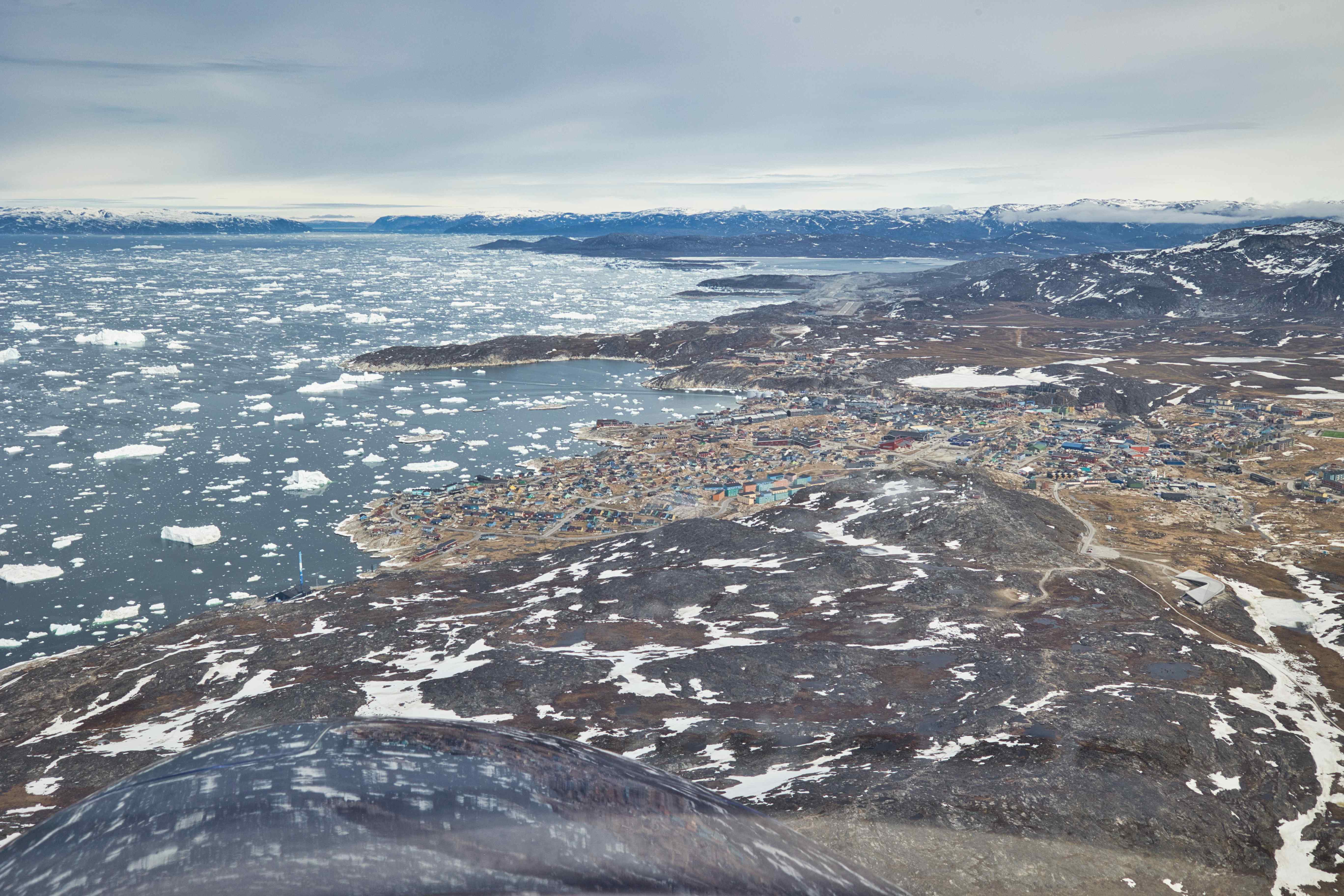
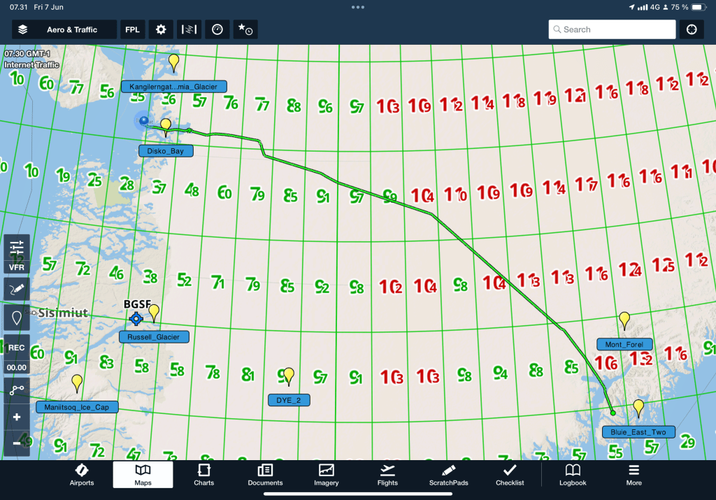
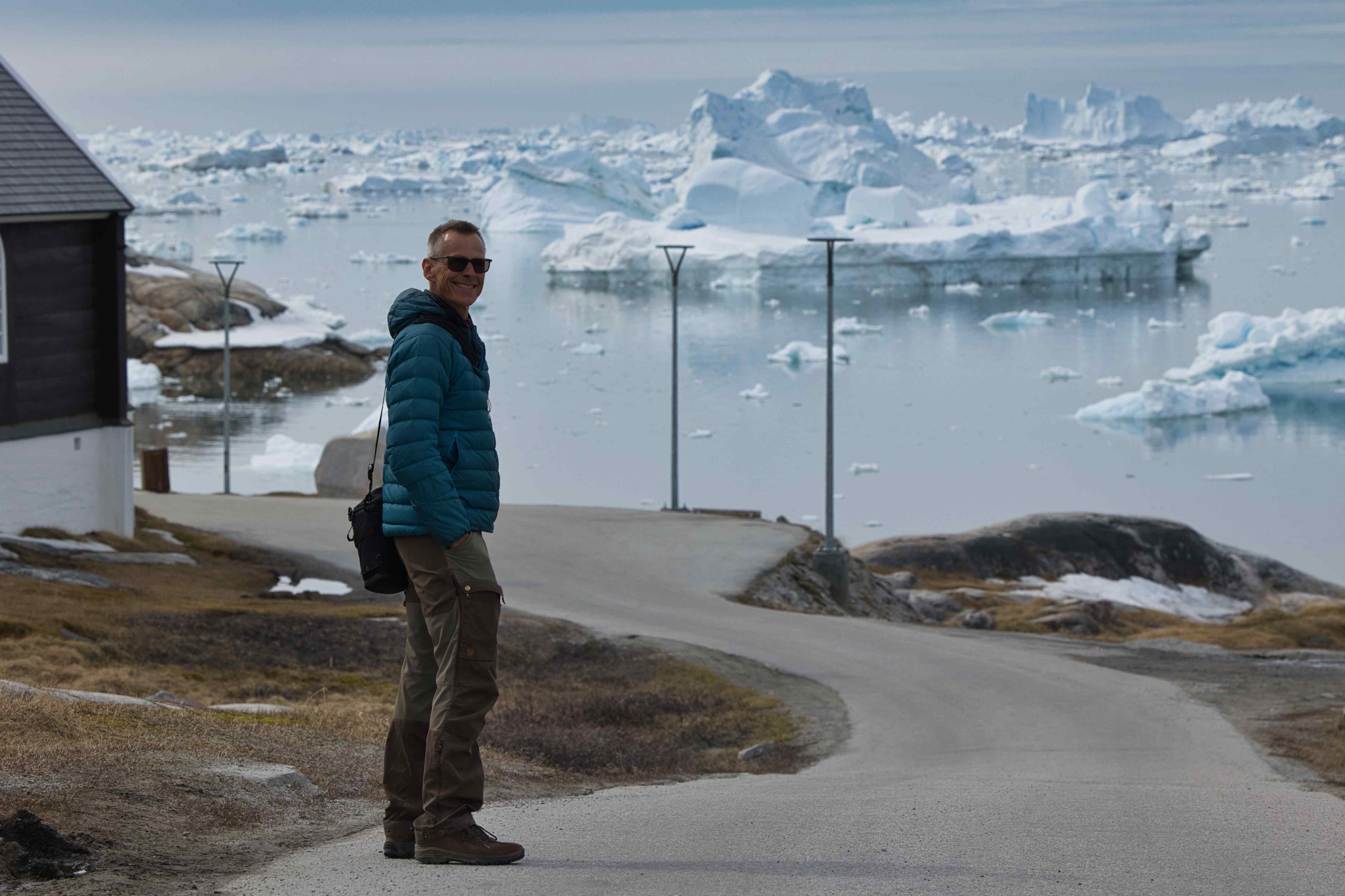
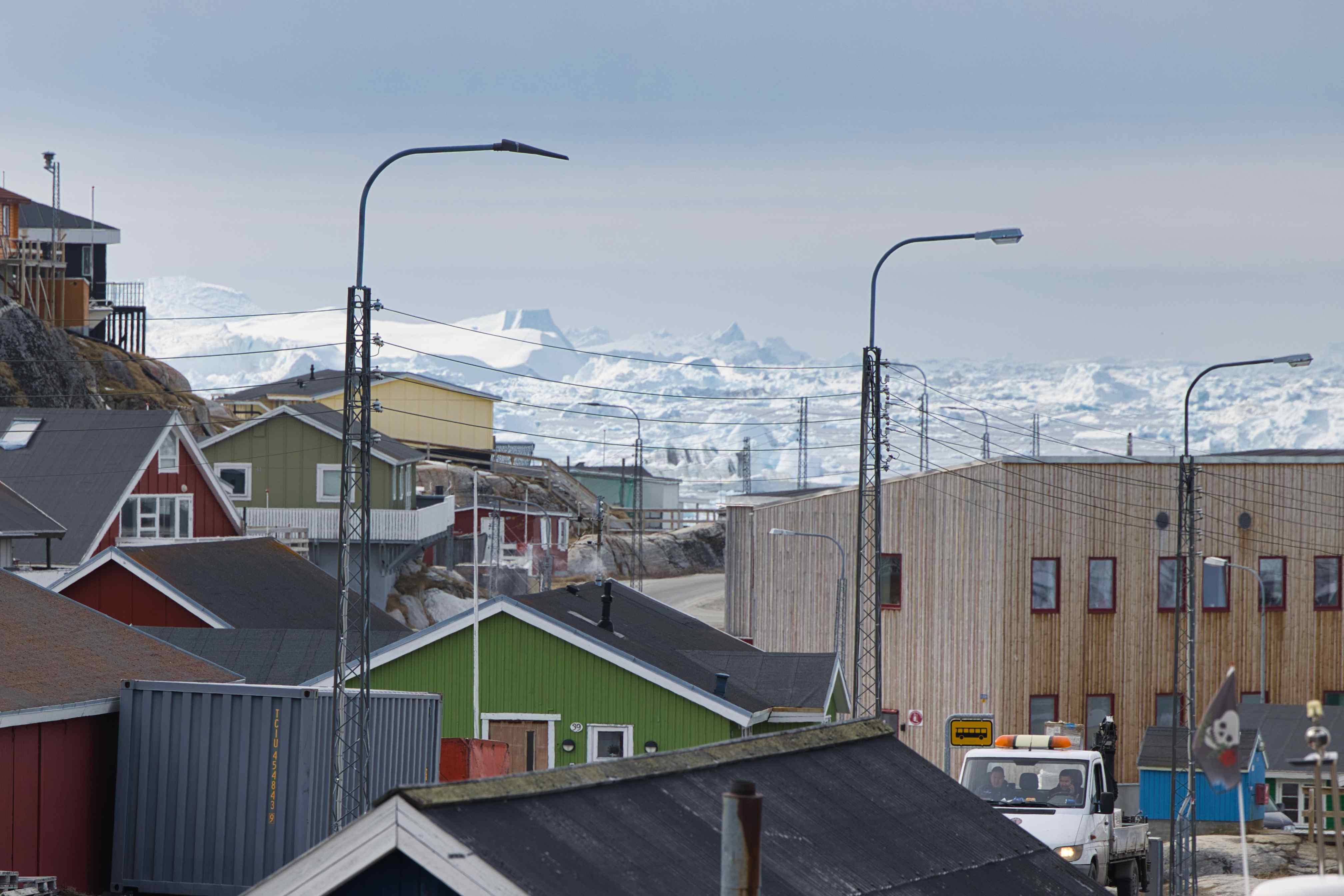
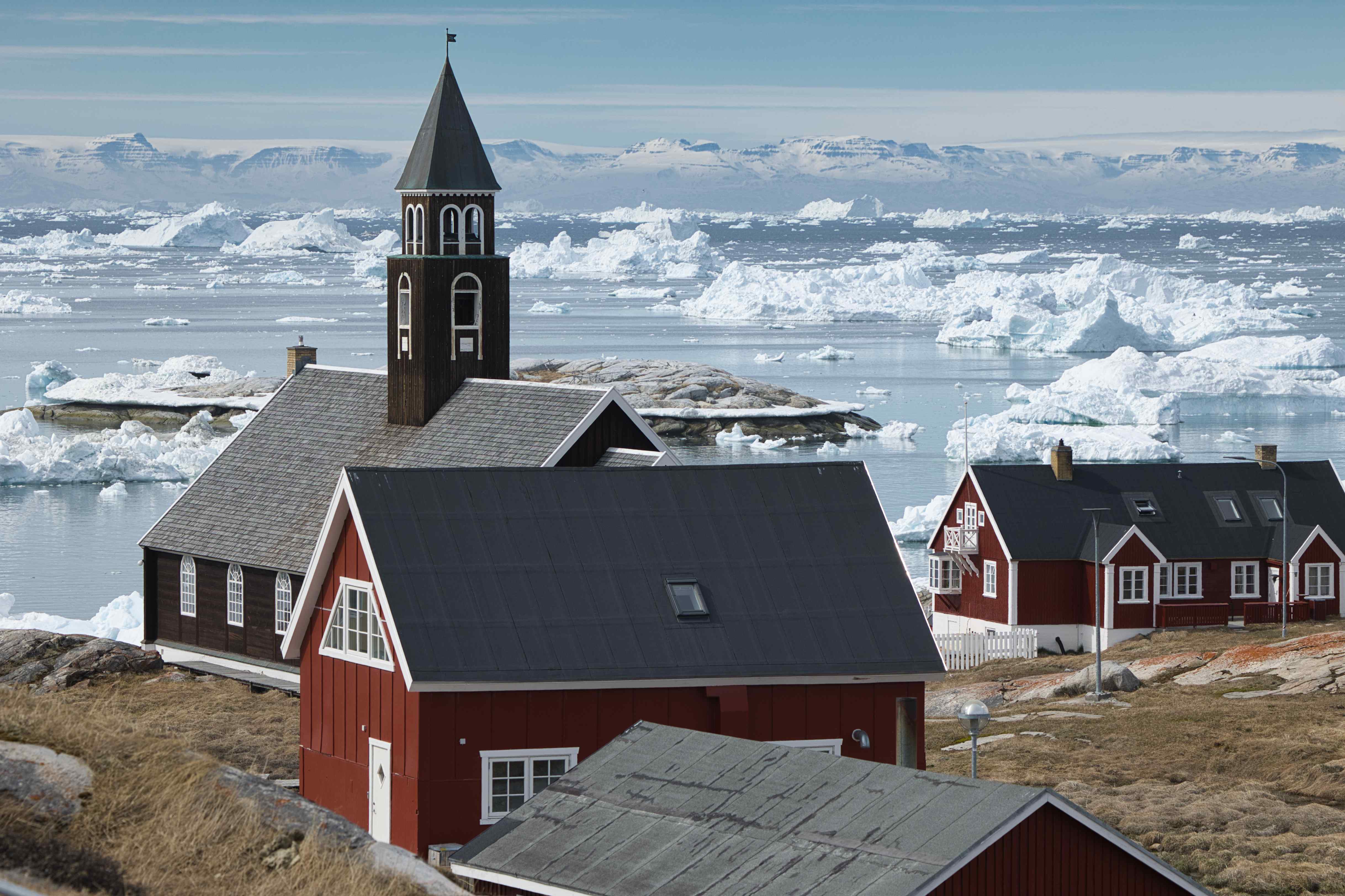
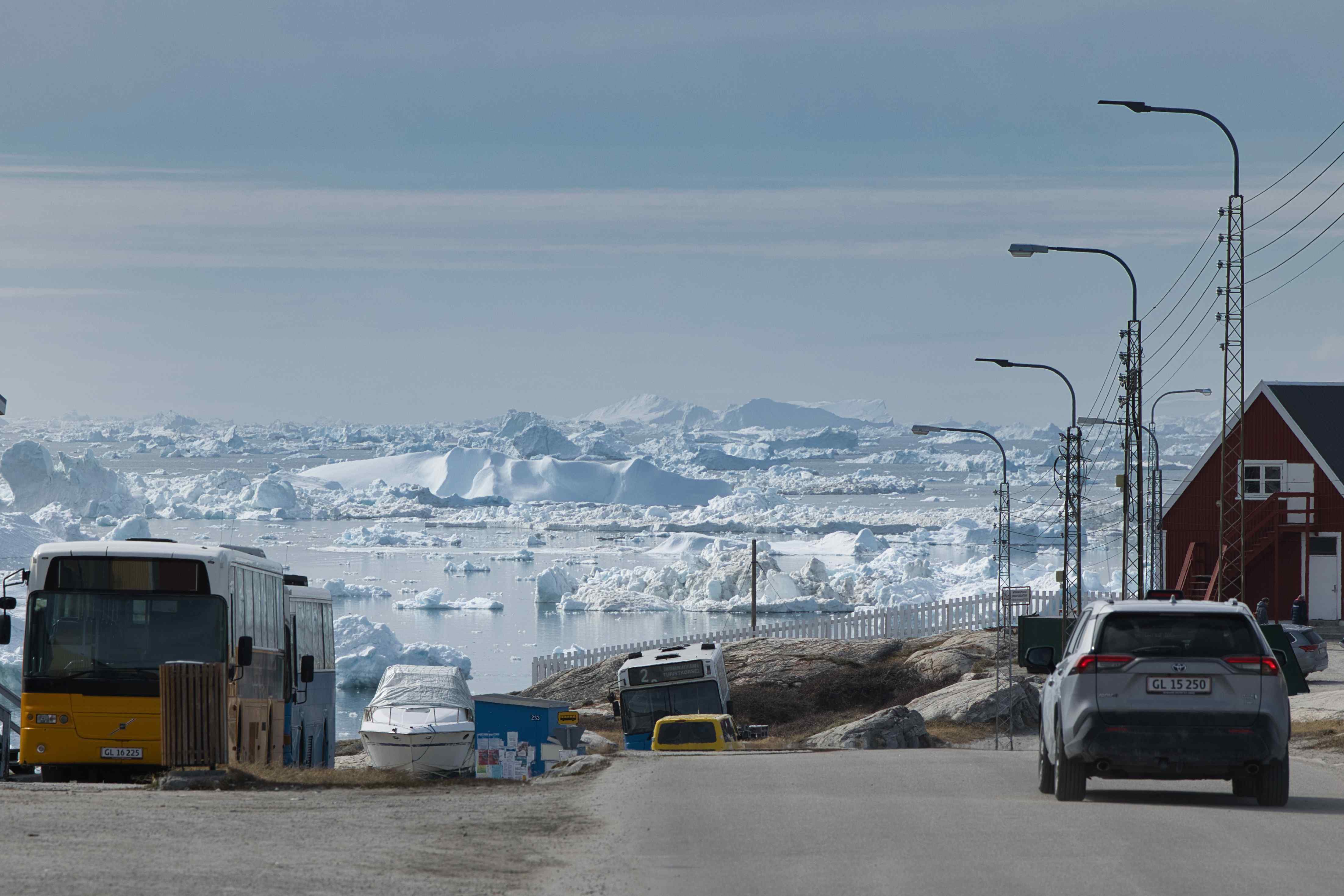
Ilulisat
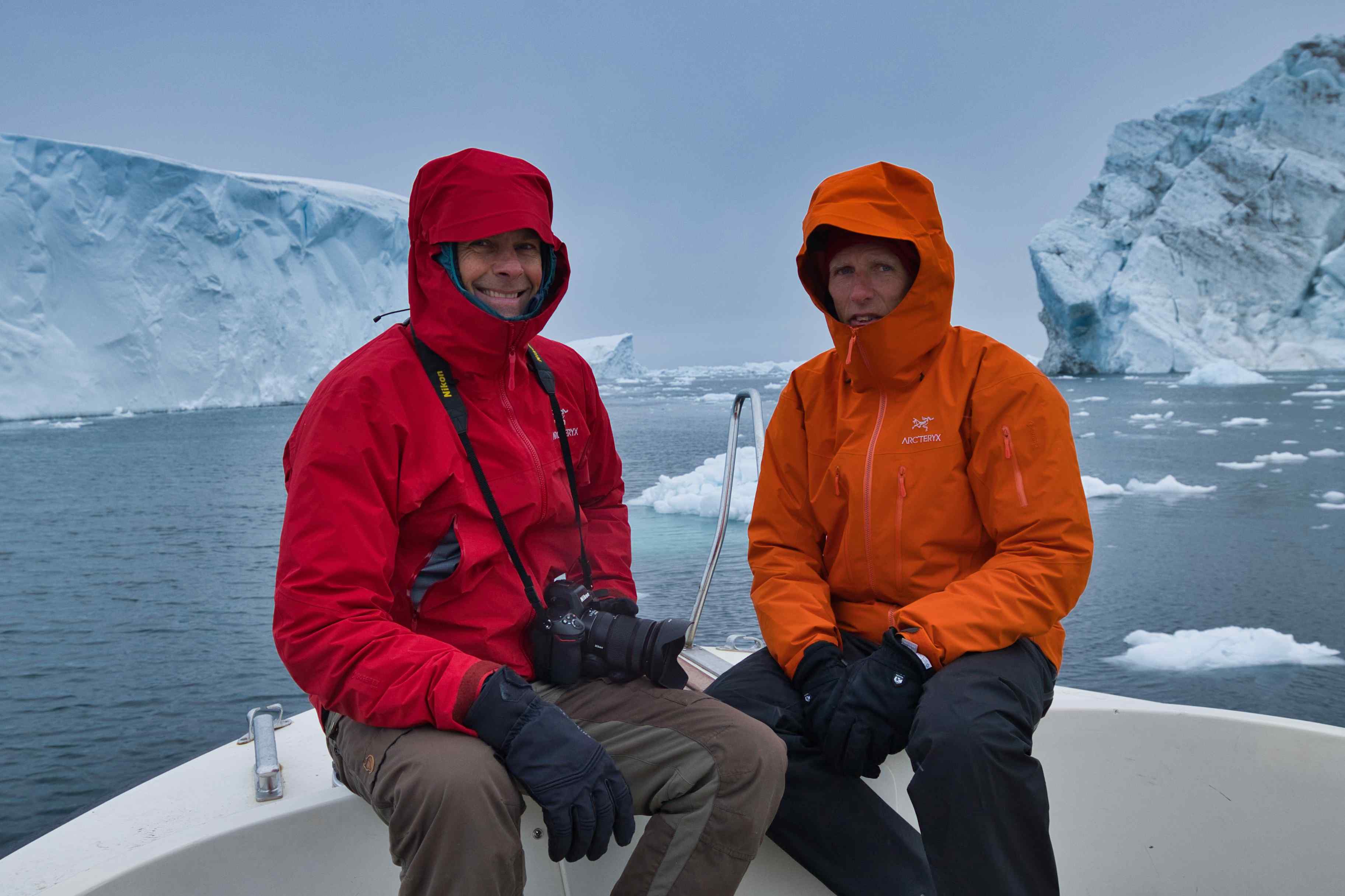
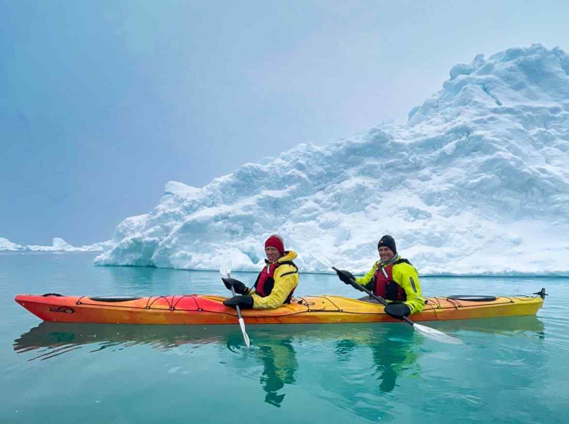
We spent two days in beautiful Ilulisat. We stayed at Hotel Hvide Falk and joined two of their tours, a midnight boat tour among icebergs of all sizes and a kayak tour, also out among the icebergs.


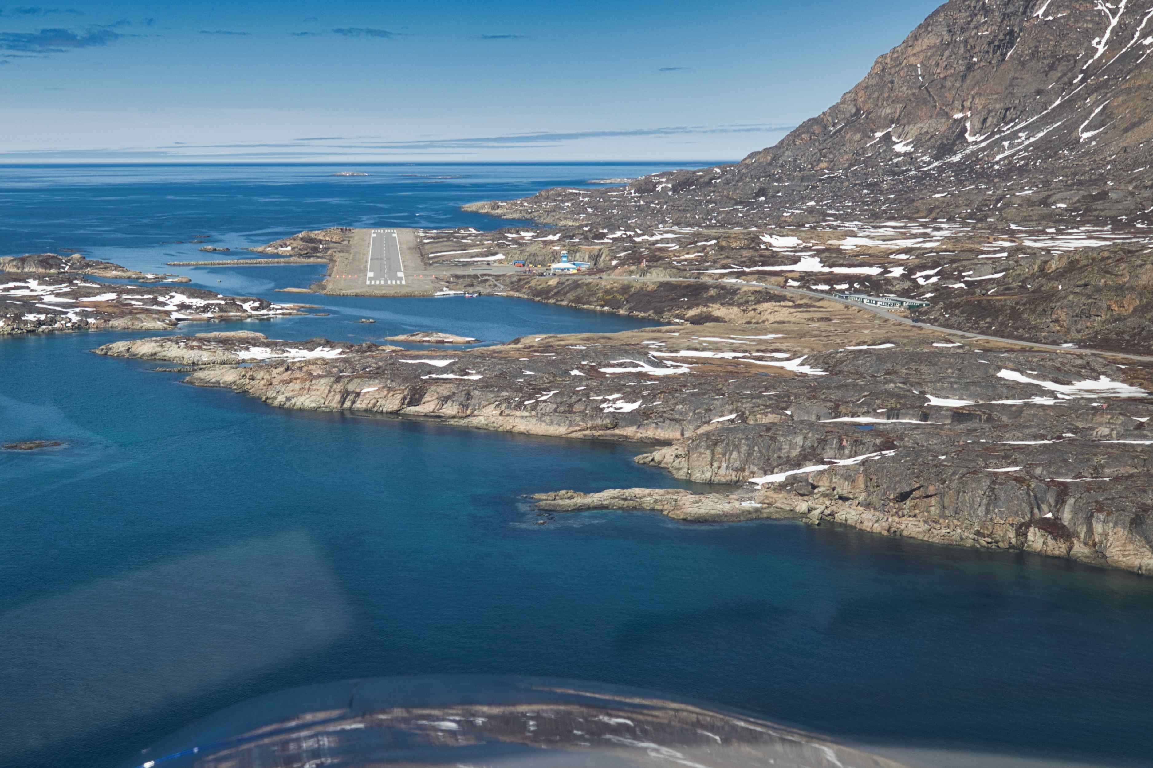
From Ilulisat to Sisimiut
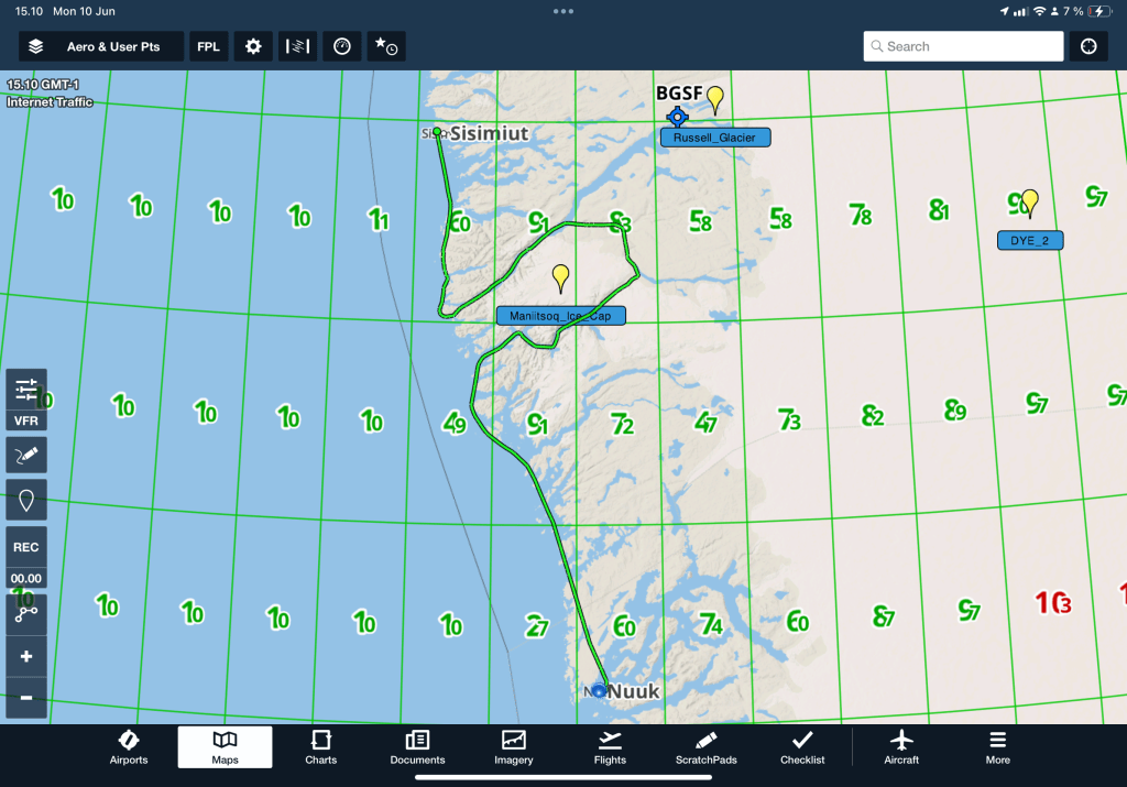
8th flight, BGJN to BGSS, flight time 2 hours and 5 minutes, 151 nautical miles or 280 kilometres
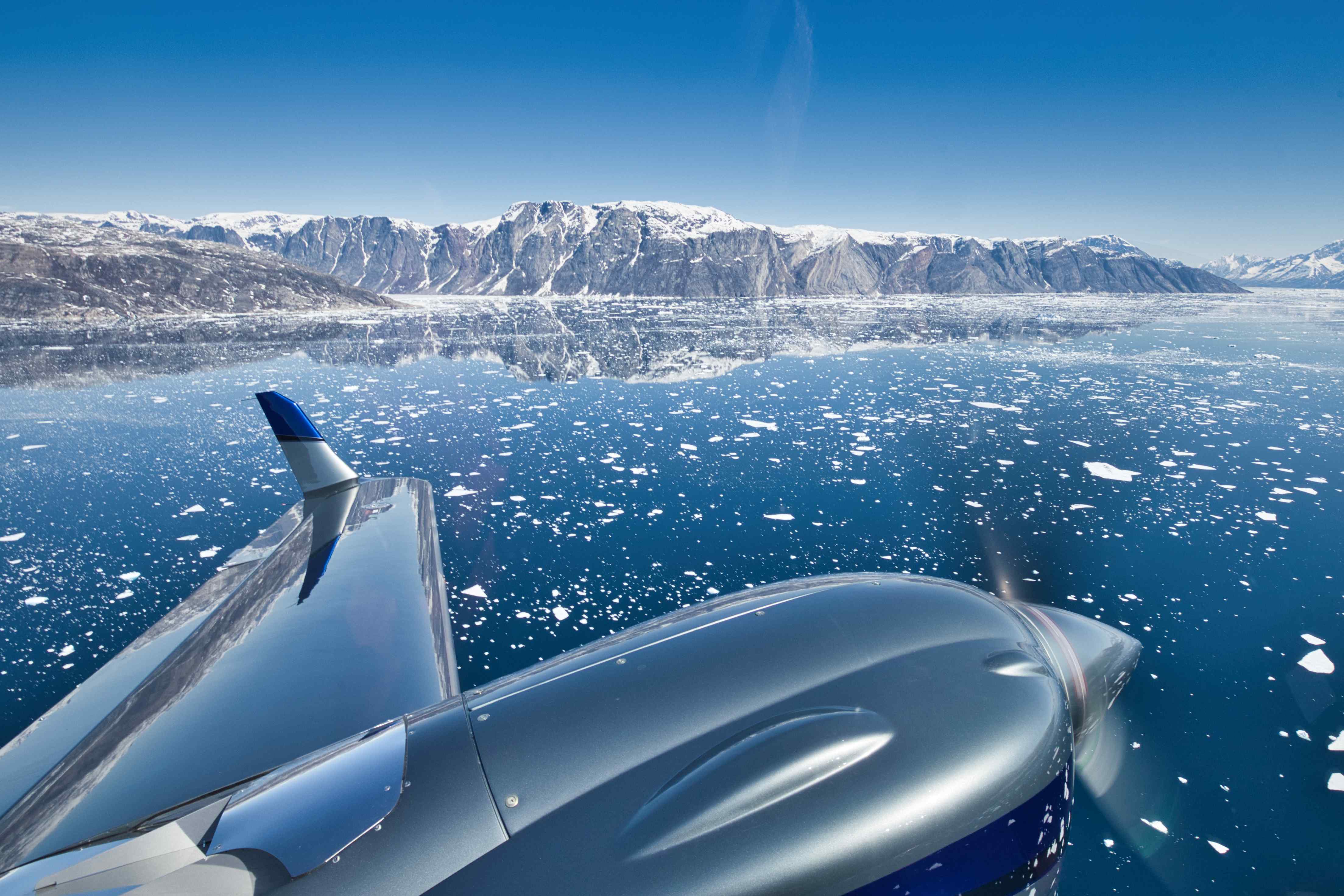
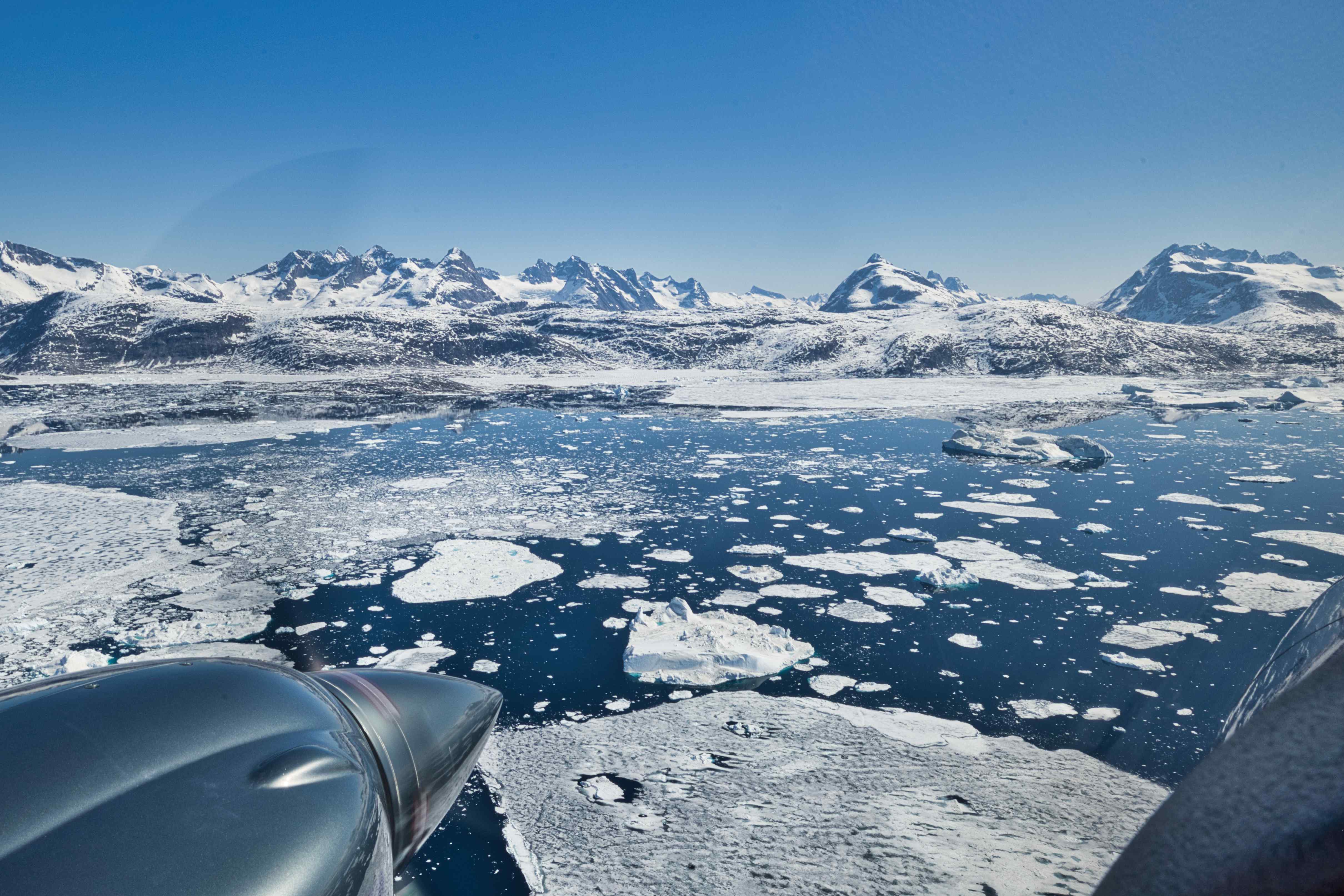
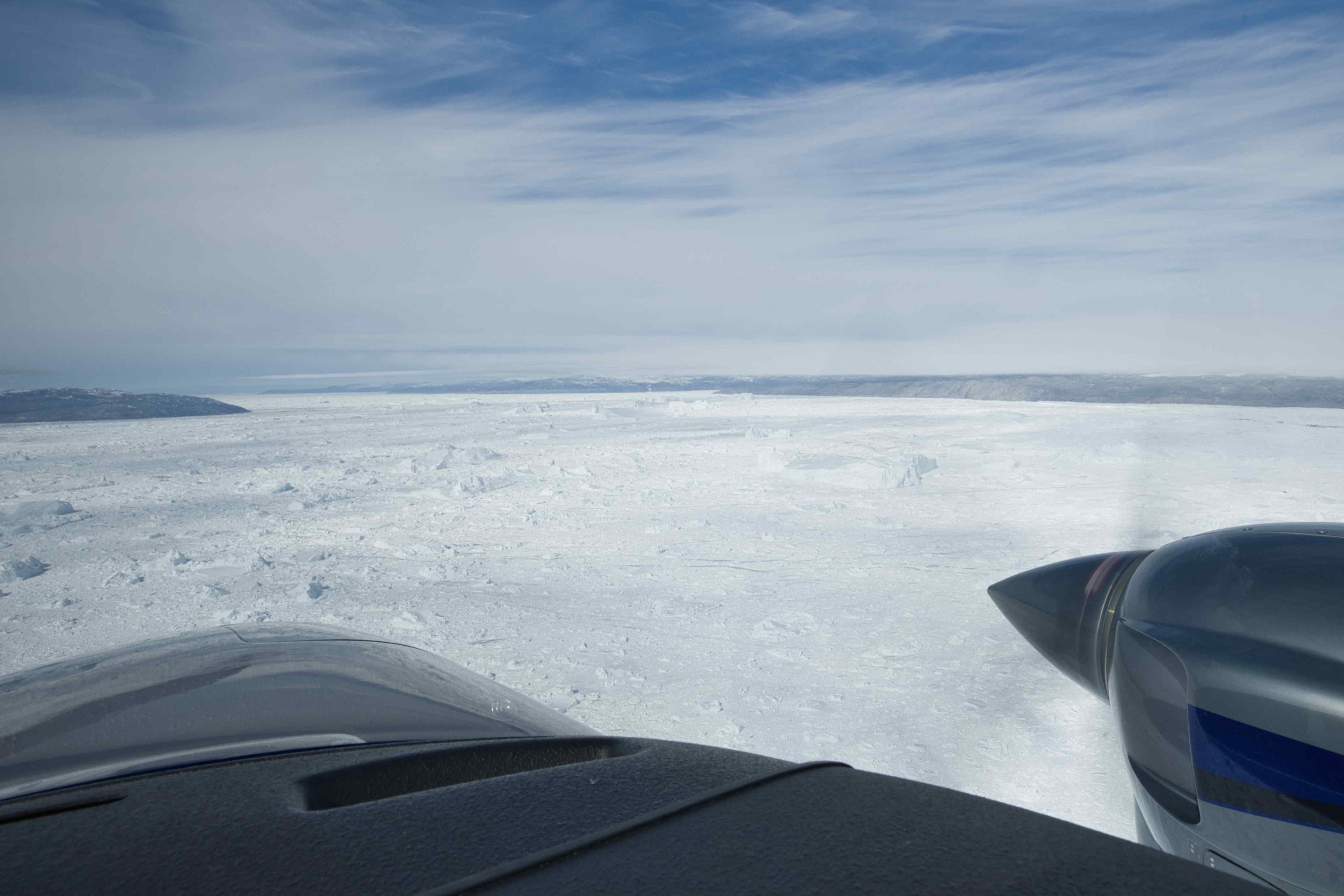
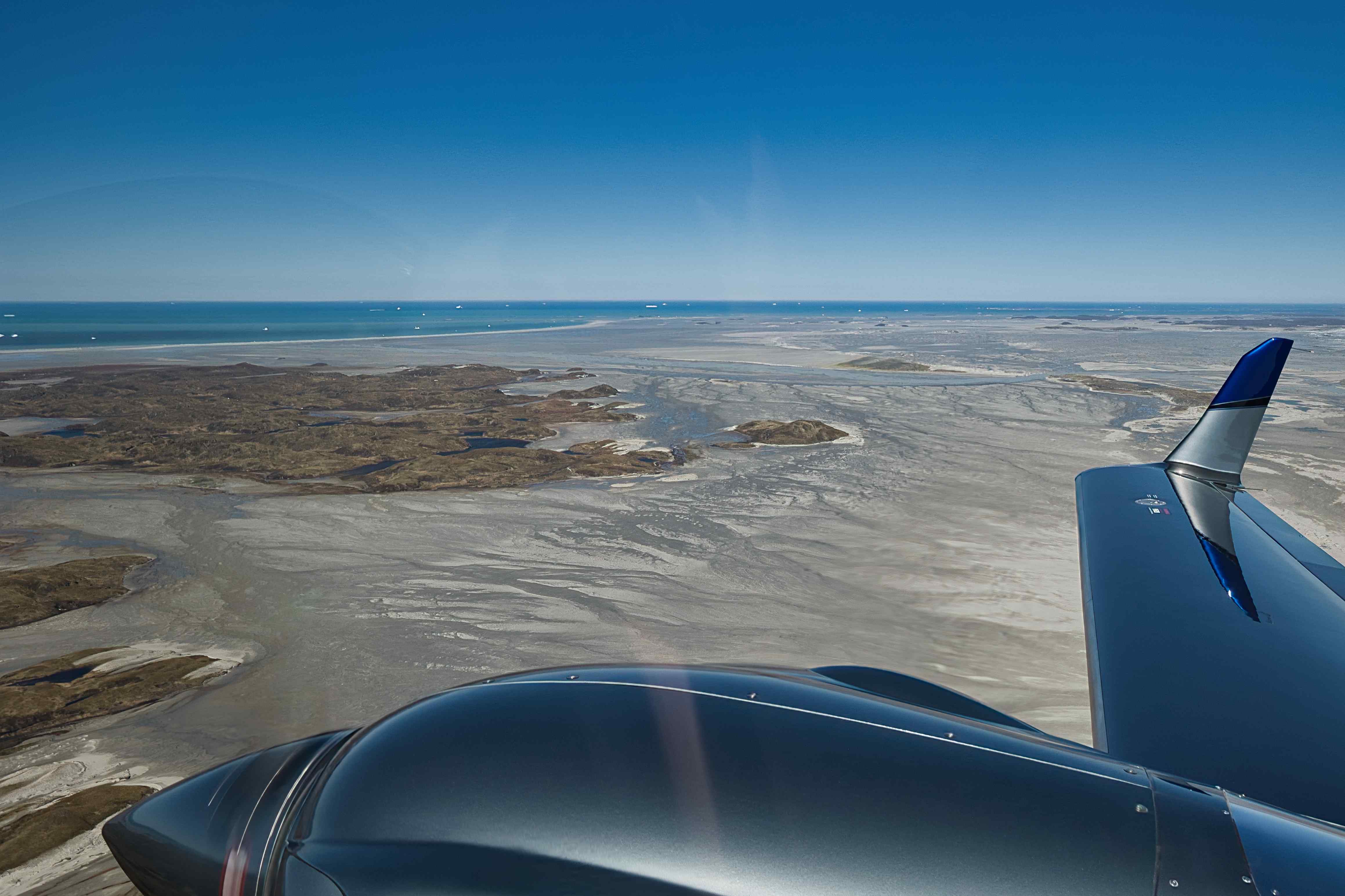
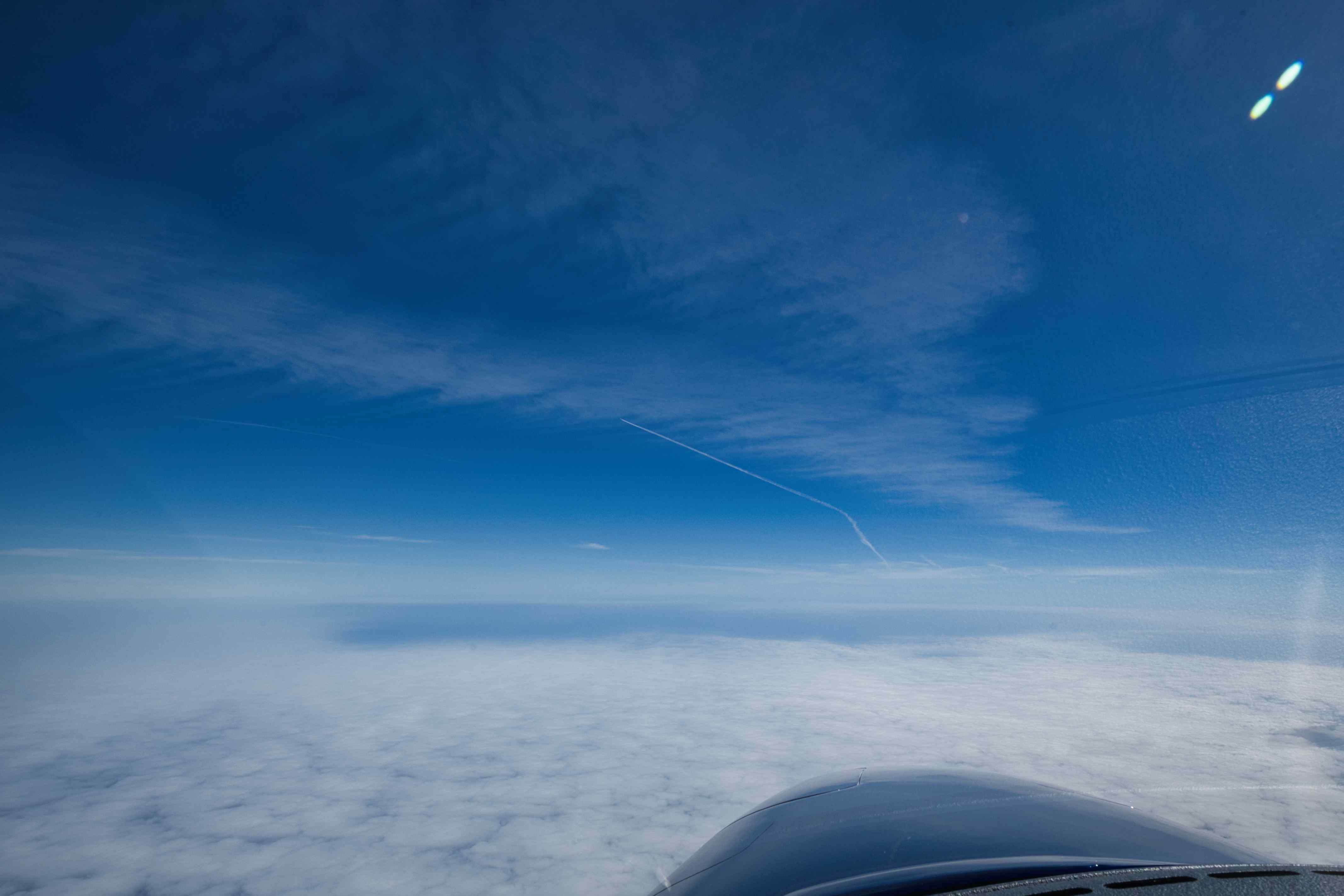
From Ilulisat we flew down to Sisimiut. We started flying north though, a last view into the Disco Fjord – the source of all the icebergs – and up another beautiful iceberg filled fjord. Flying south we had to stick to the fjords as the cloud base was down to 1,000 feet for a good portion of the flight. In Sisimiut we again had severe good weather.
As always, we were greeted by very friendly and helpful people, both on the apron and up in the tower.


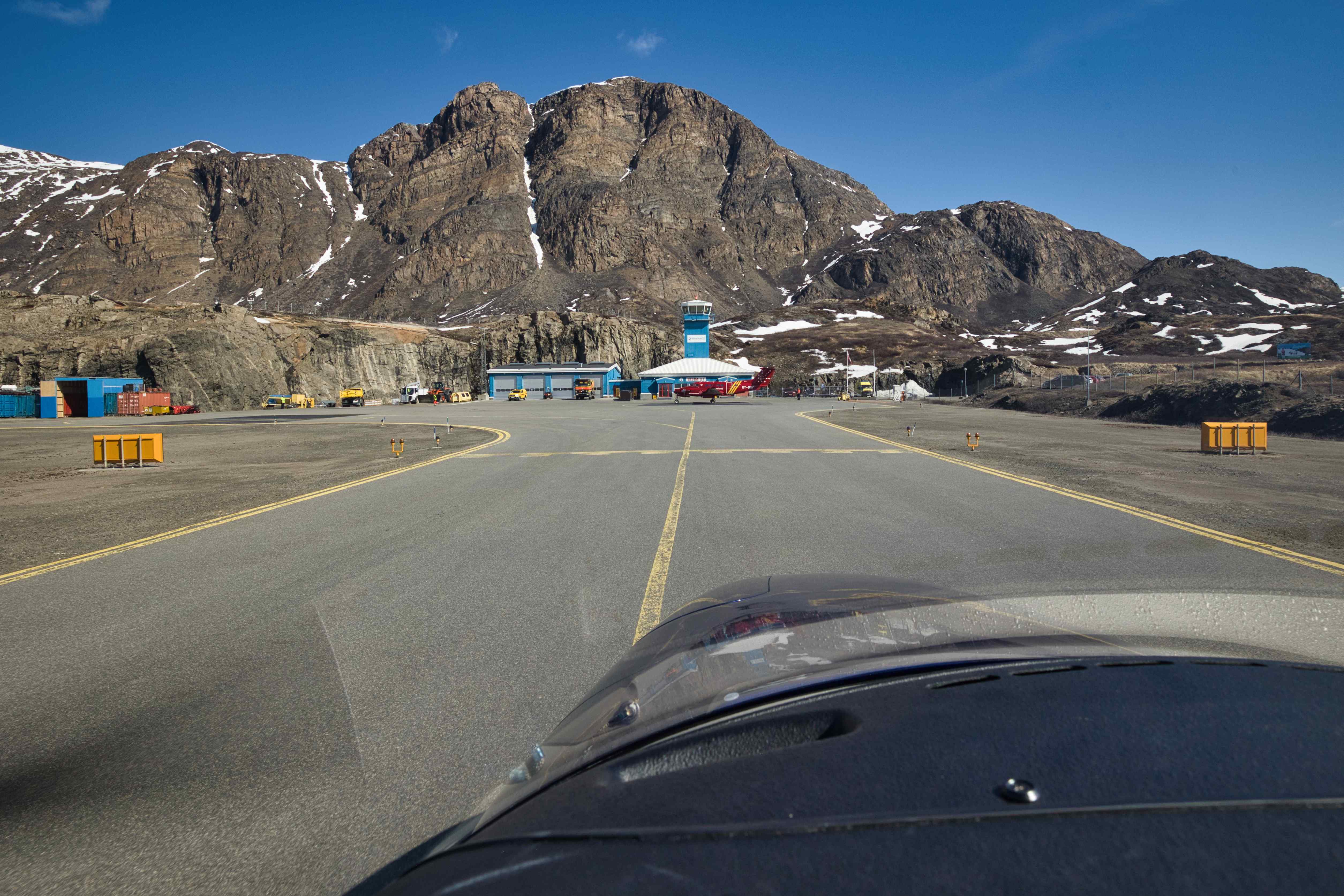
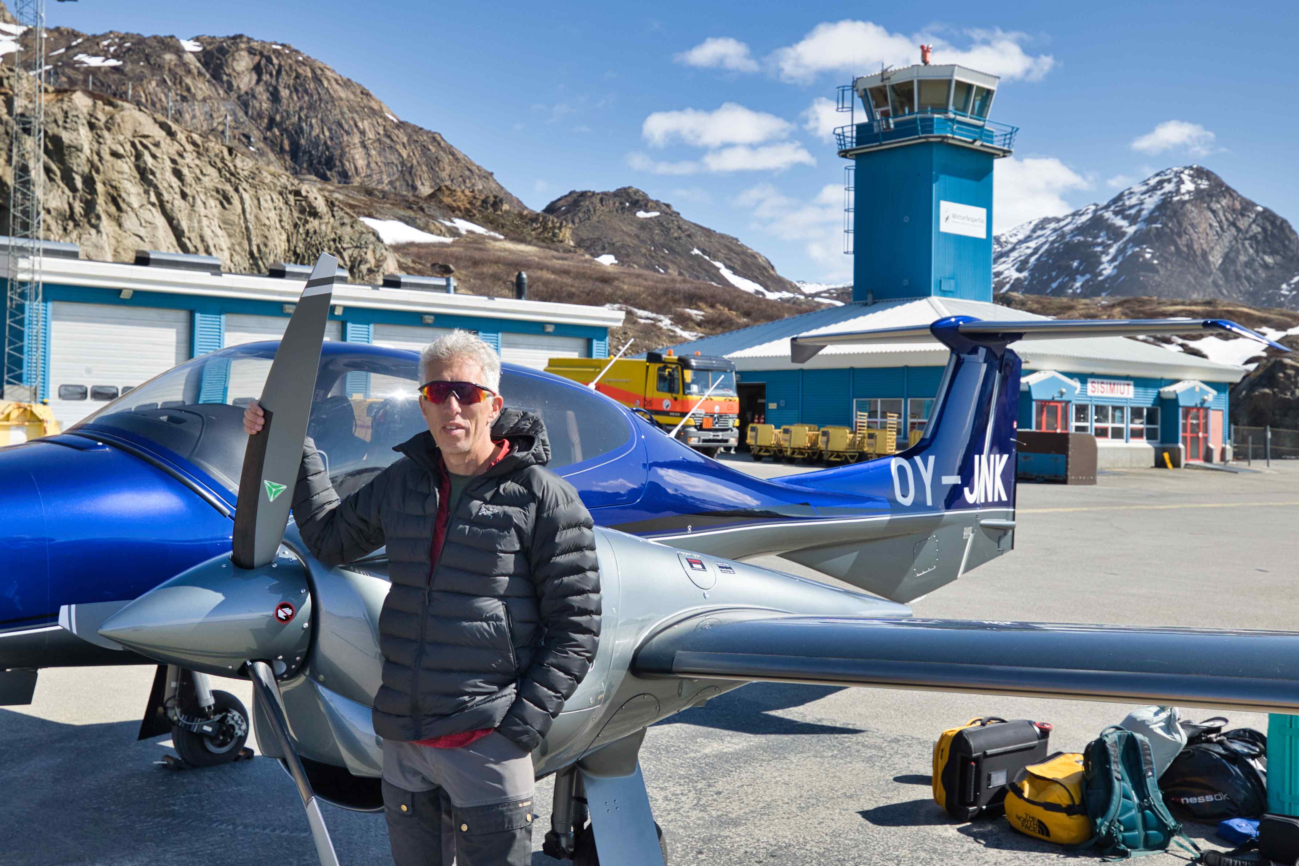
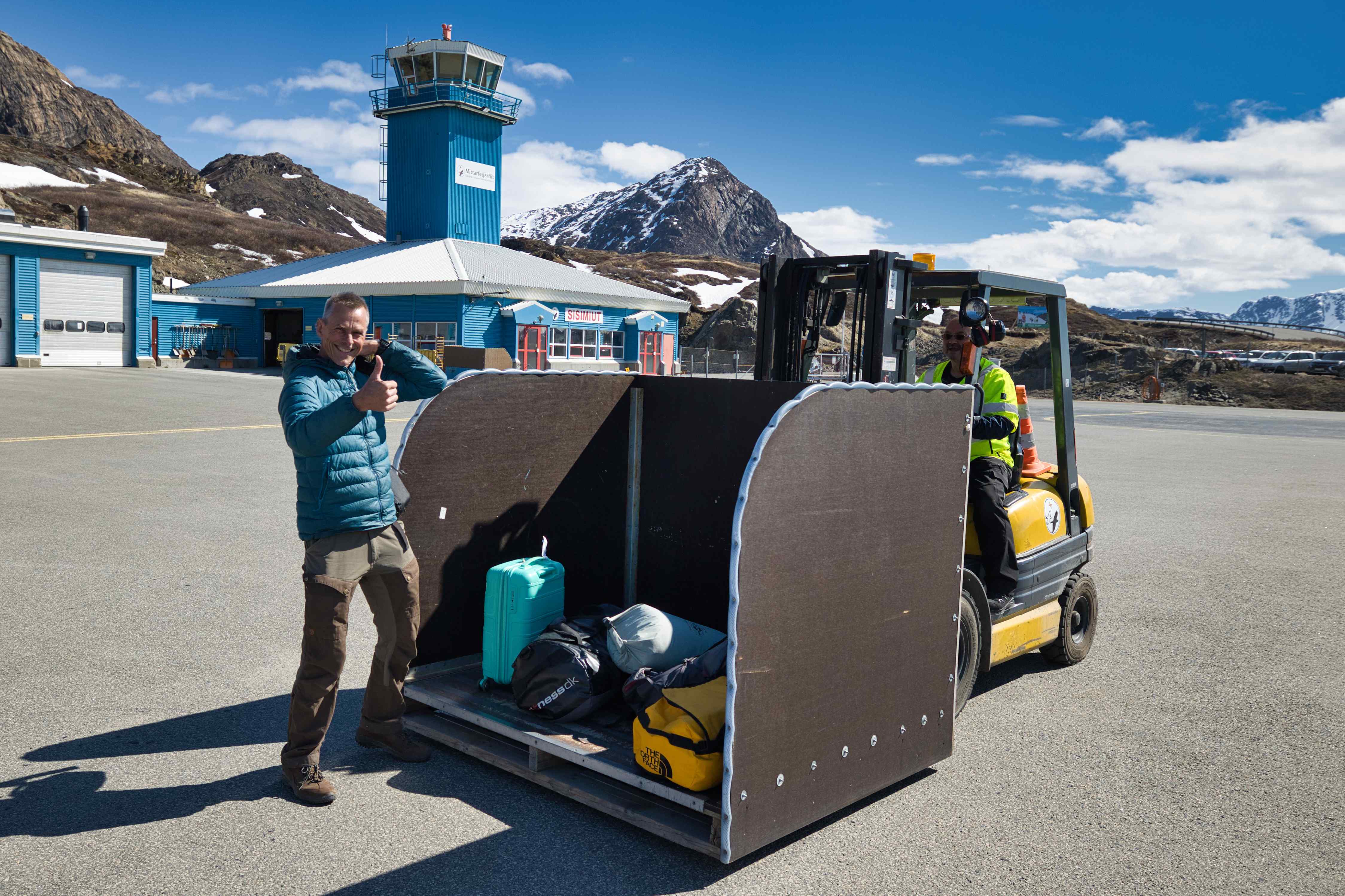
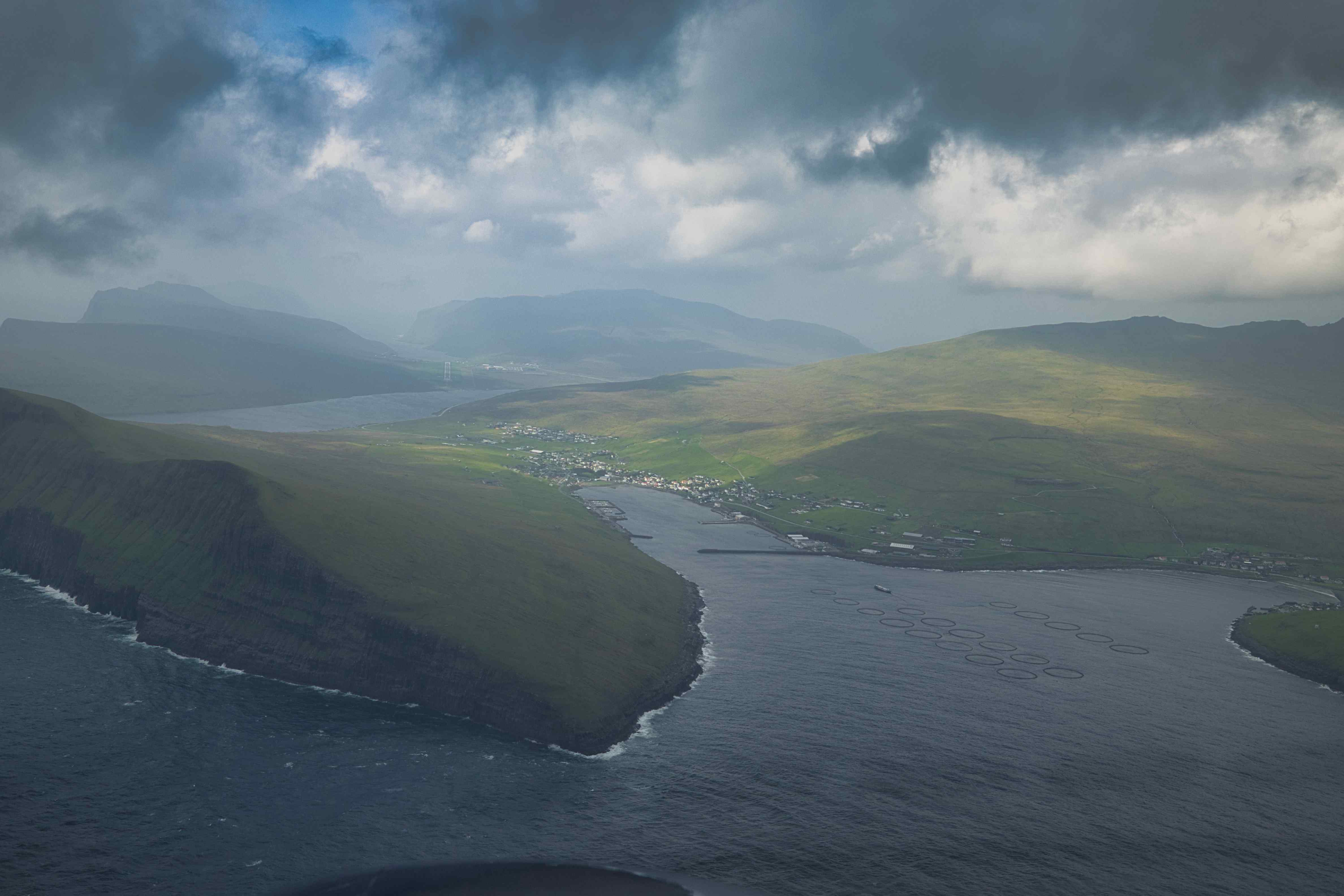
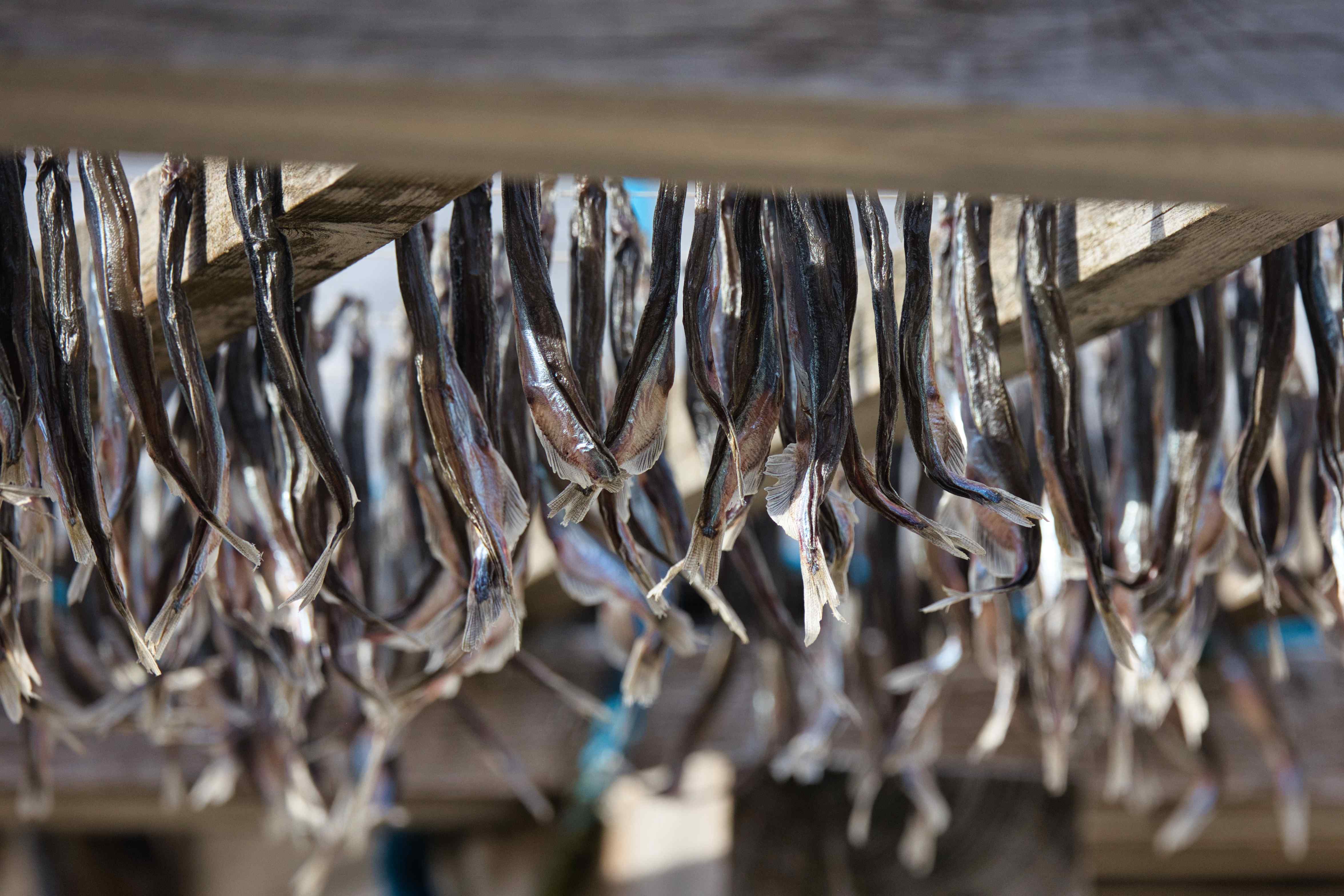
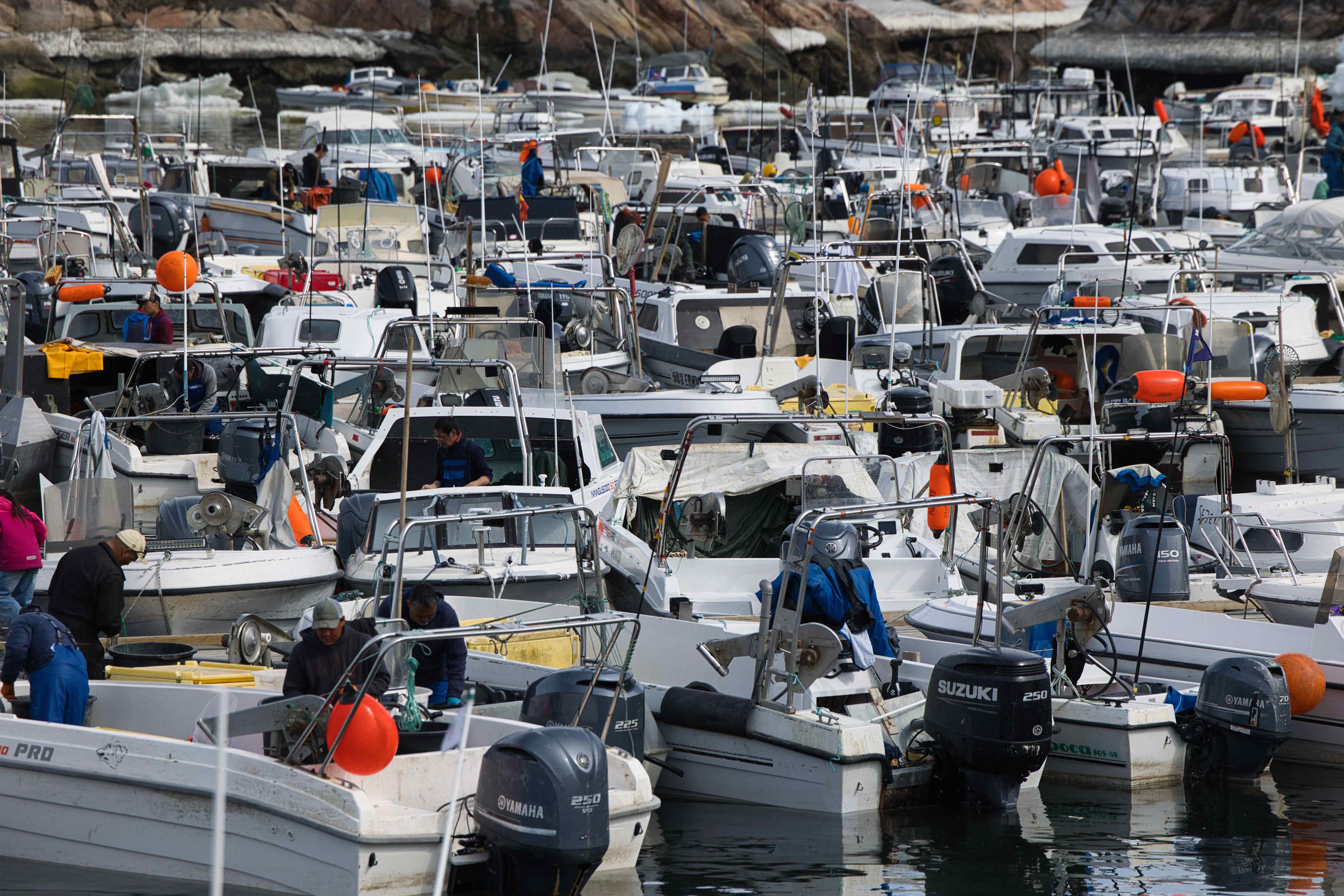
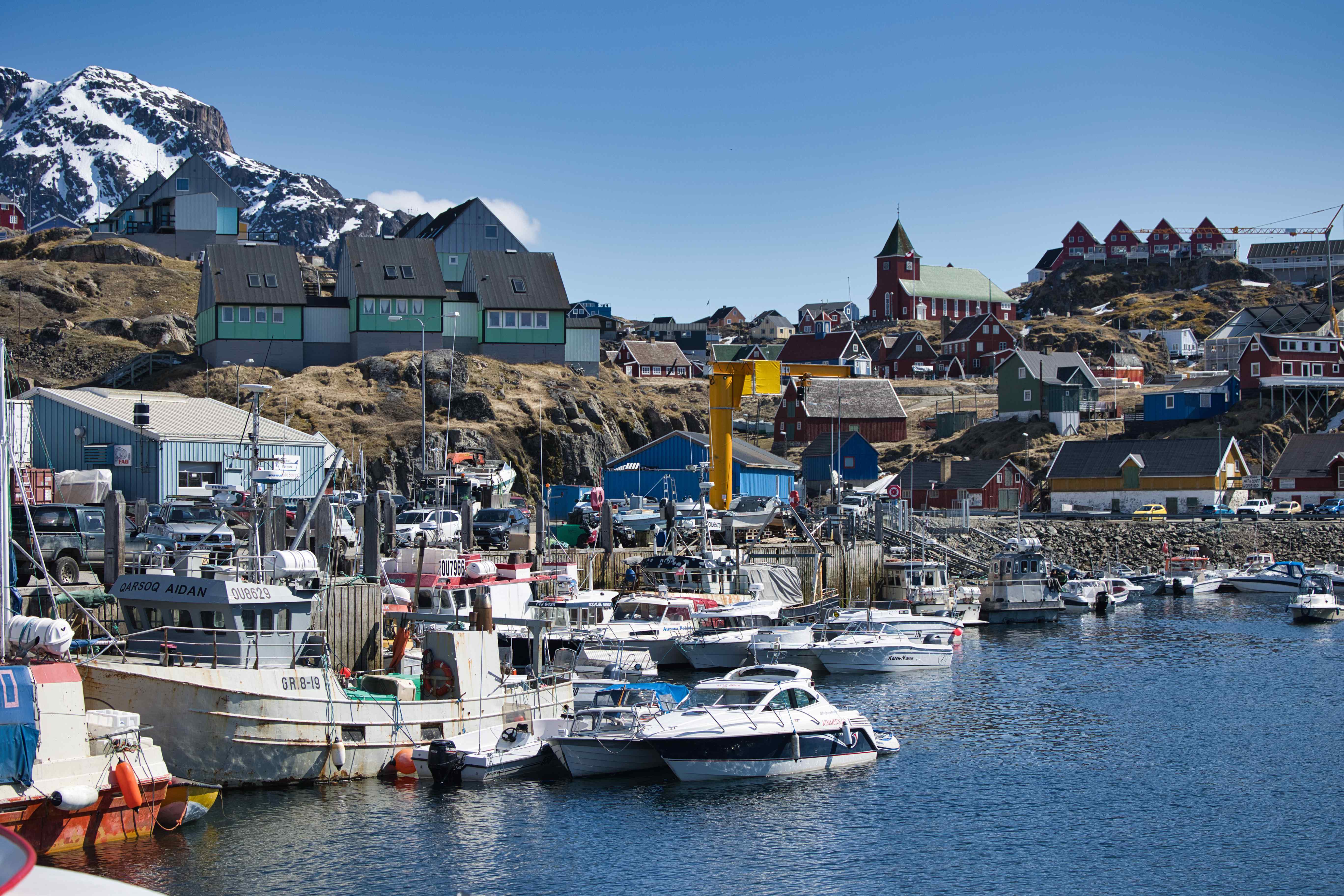
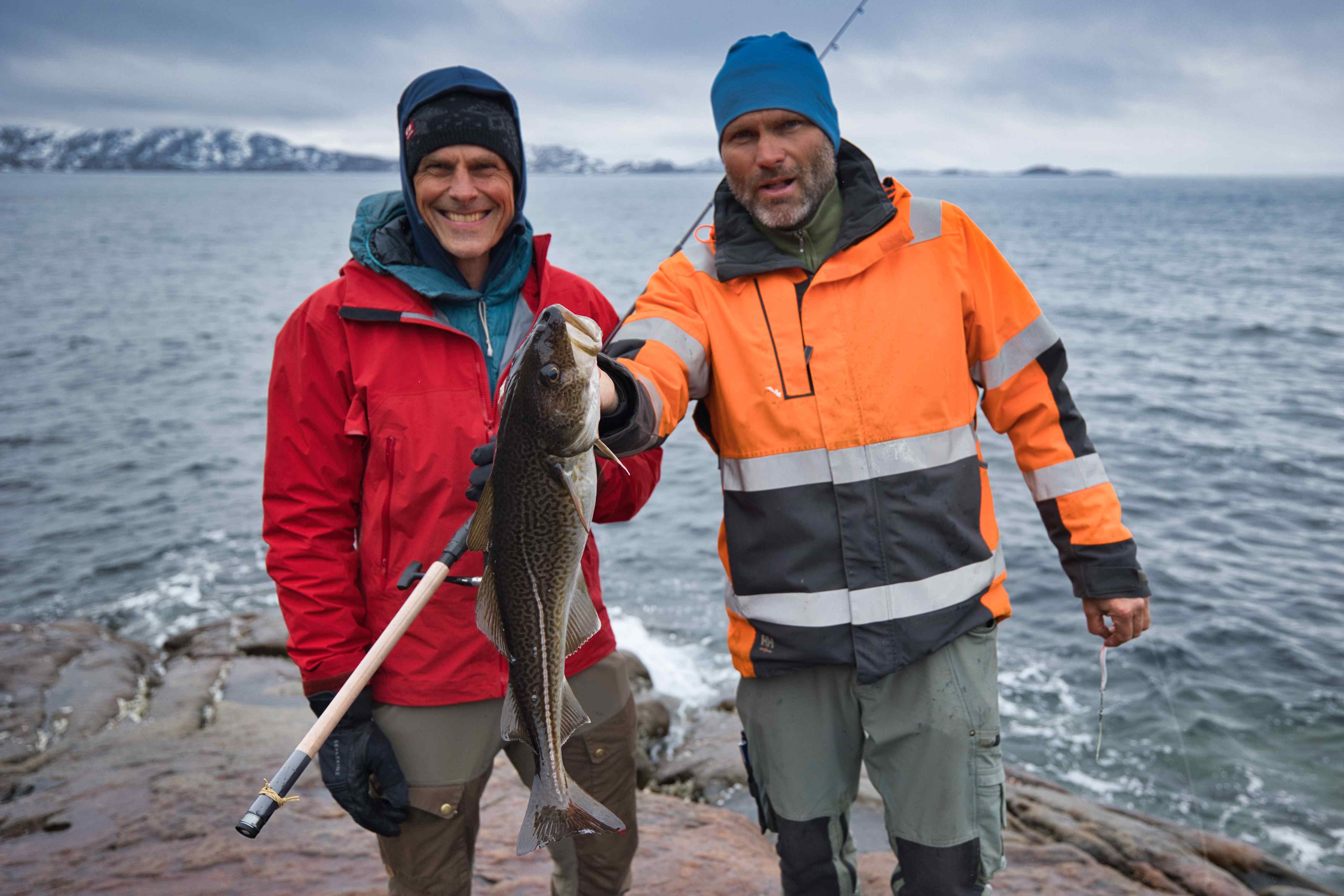
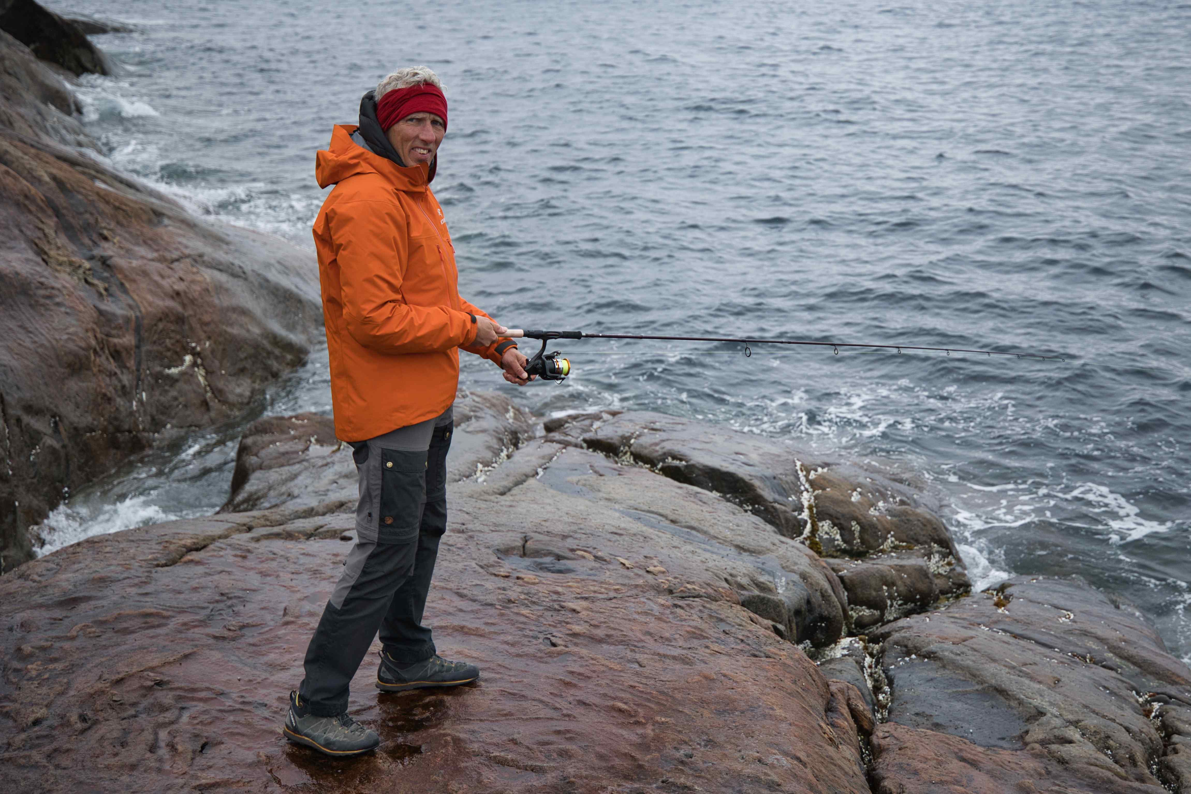
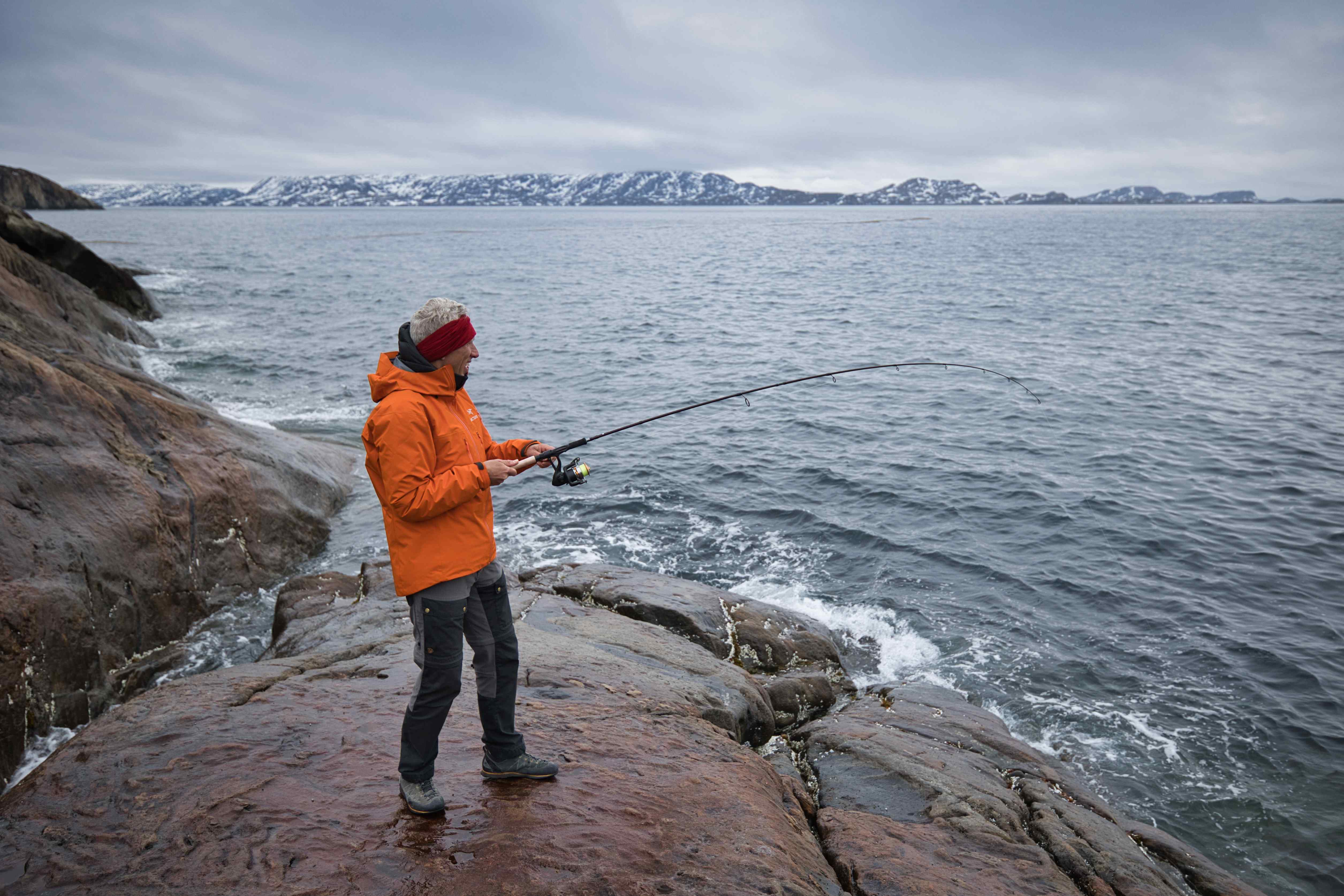
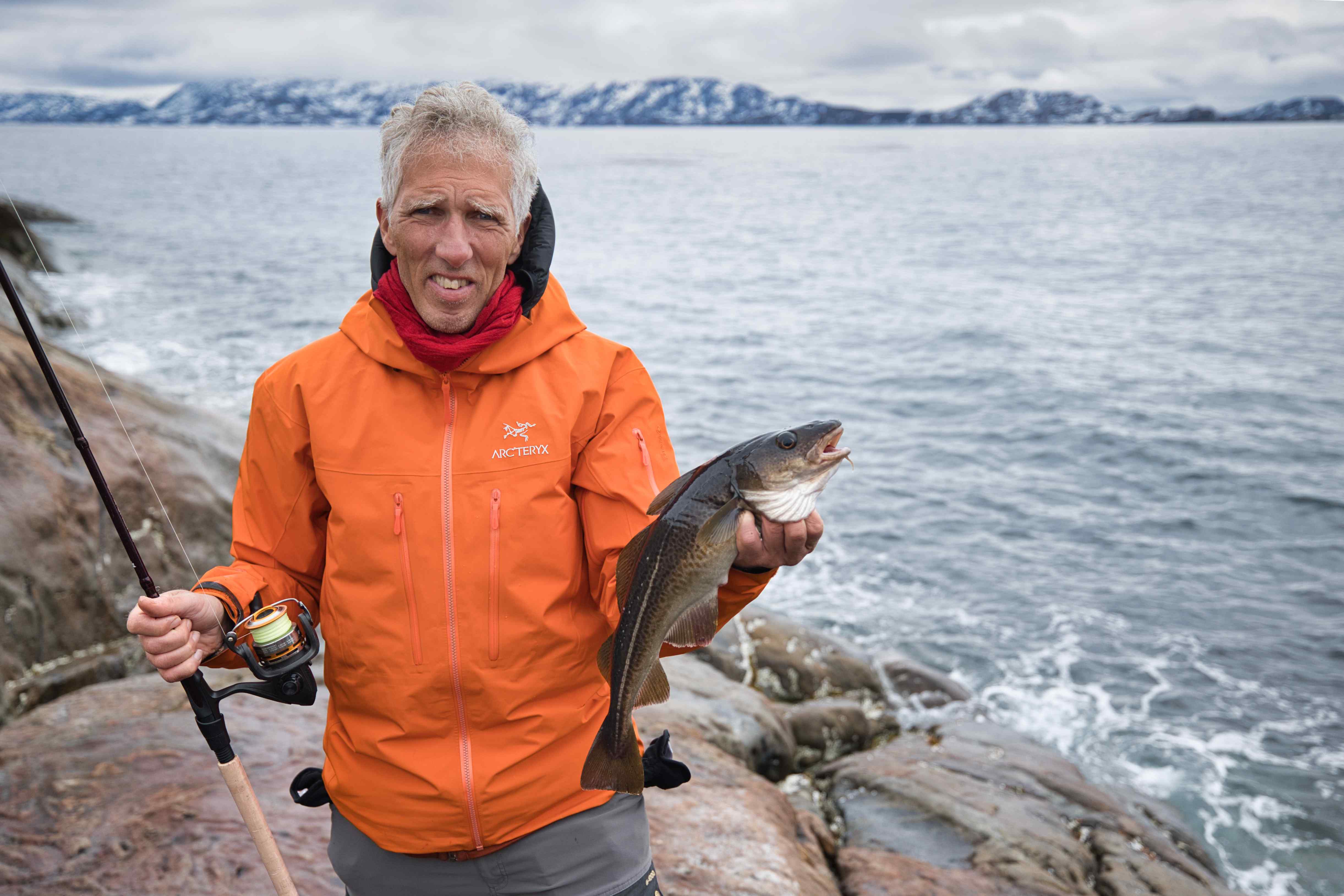
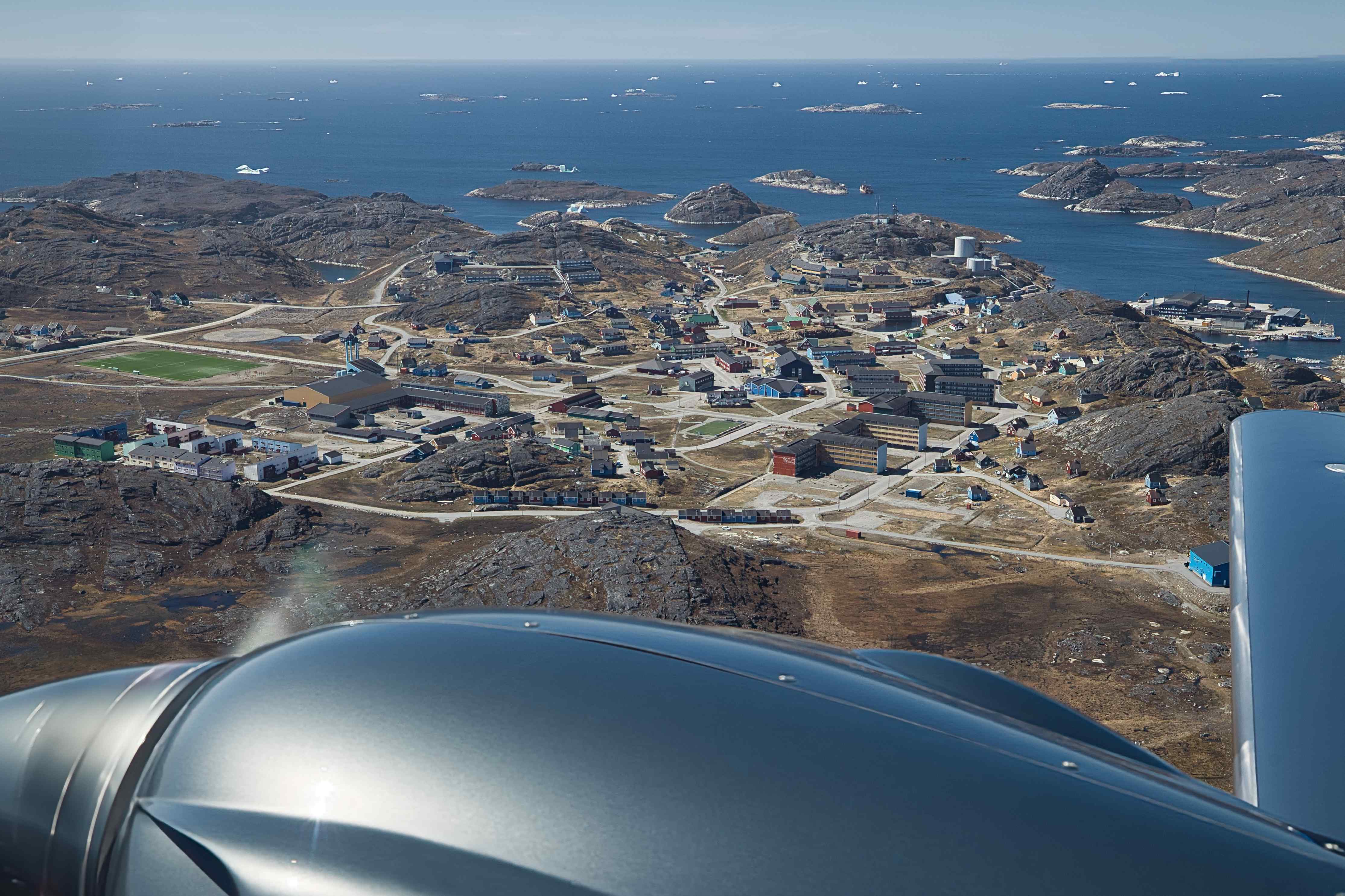
Sisimiut
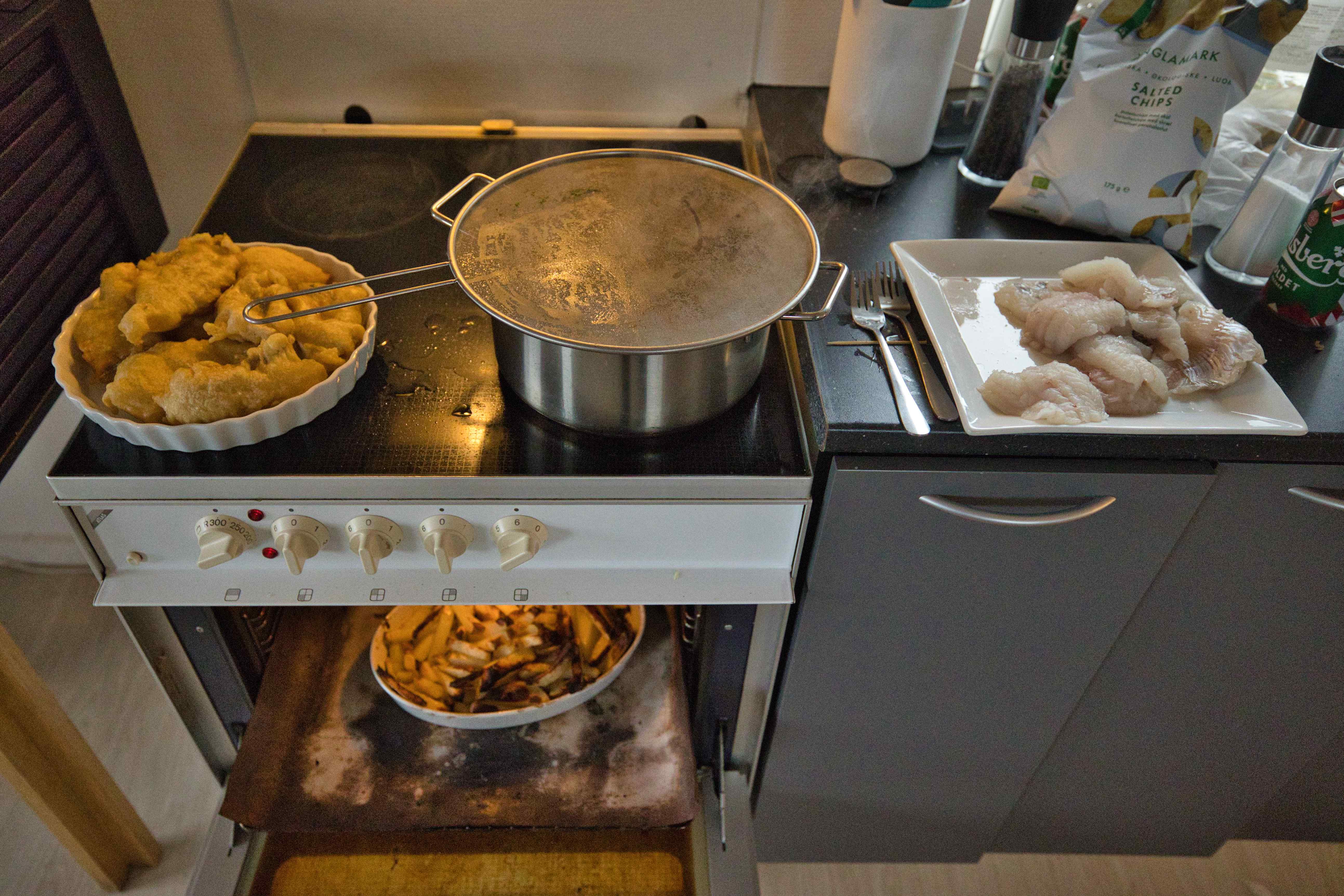
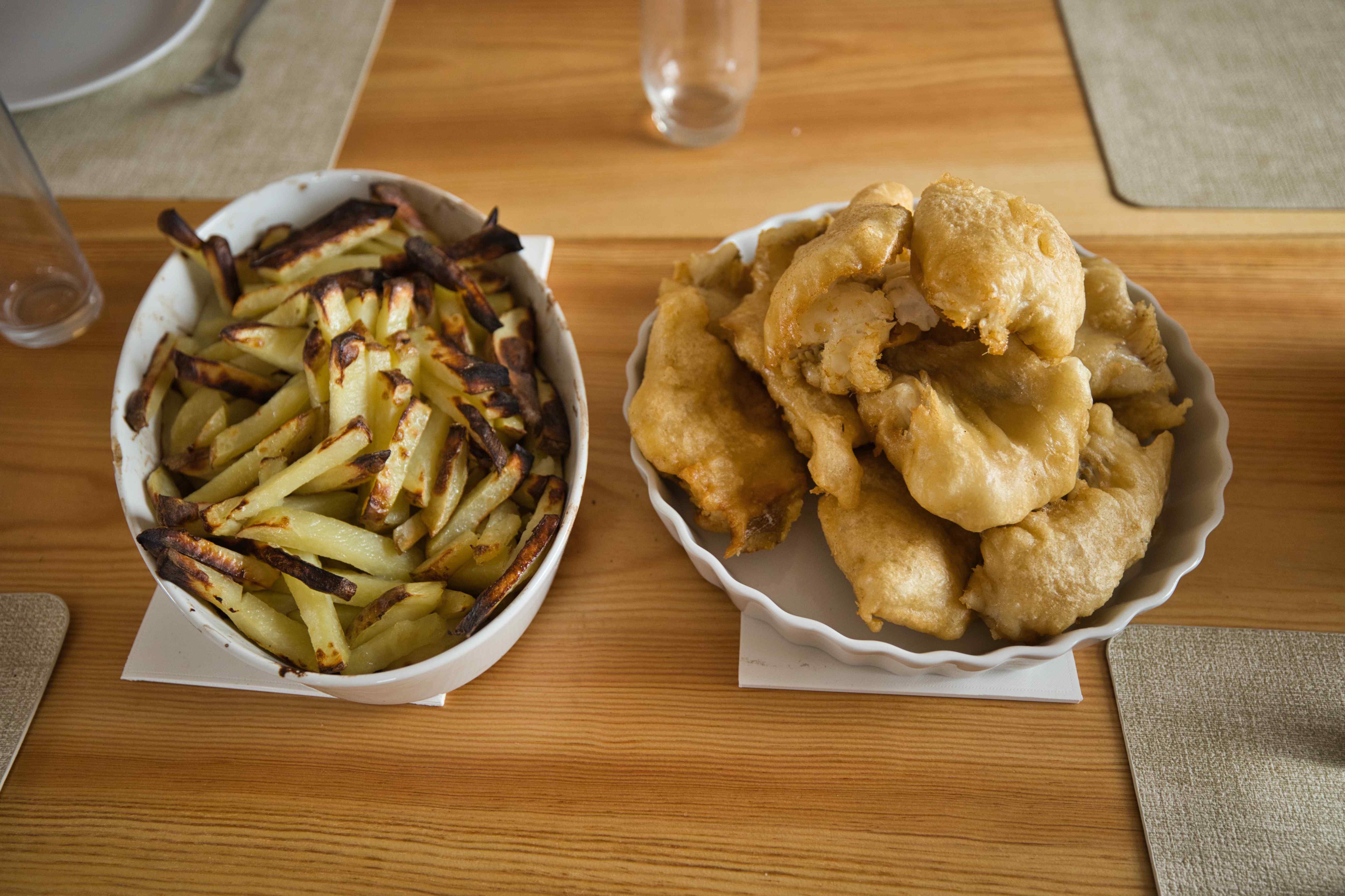
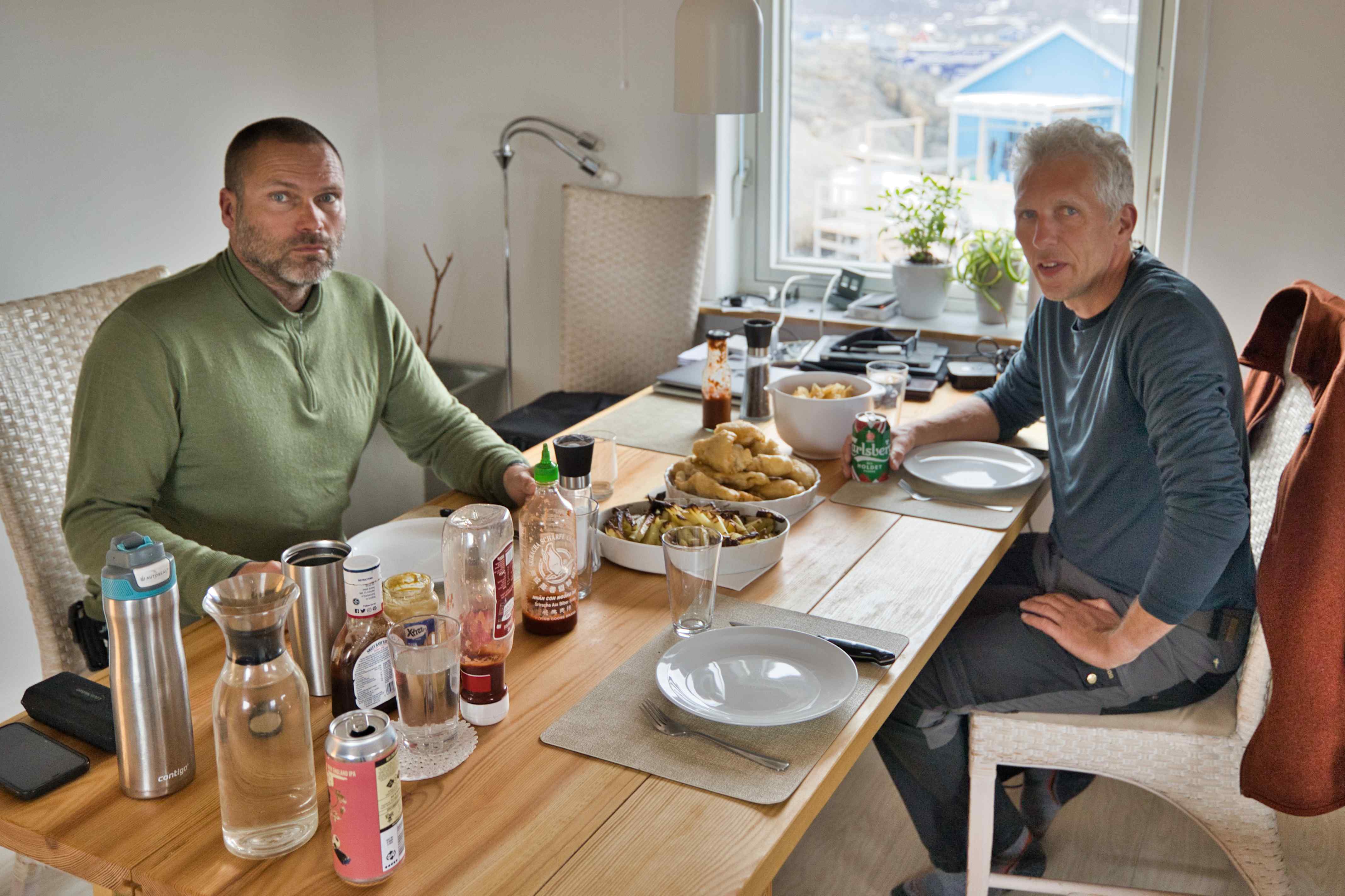
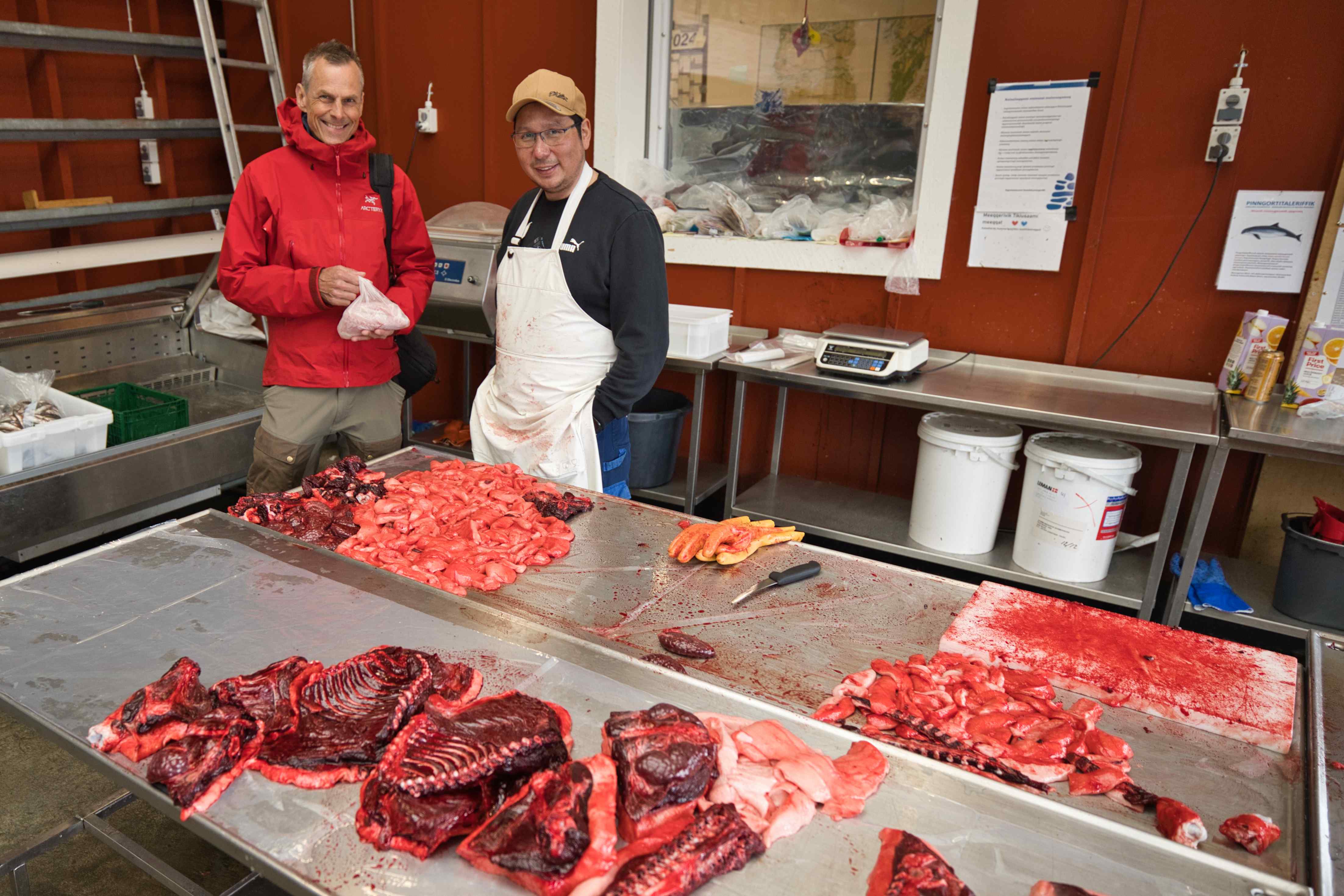
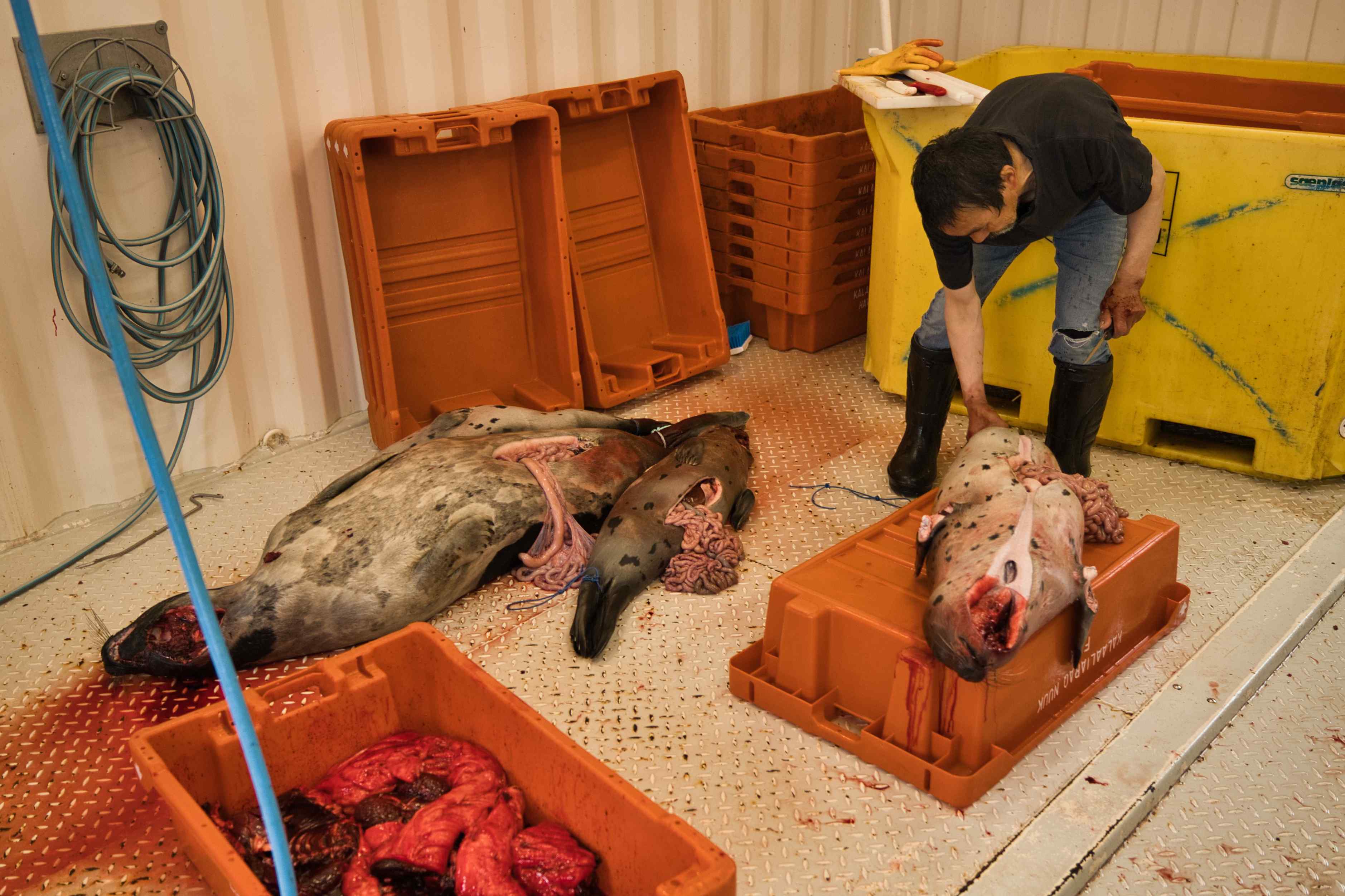
In Sisimiut we stayed with a Andreas, a good friend of Frode. He took us sightseeing and fishing. And I made Fish & Chips from all the cods we caught.


From Sisimiut to Nuuk
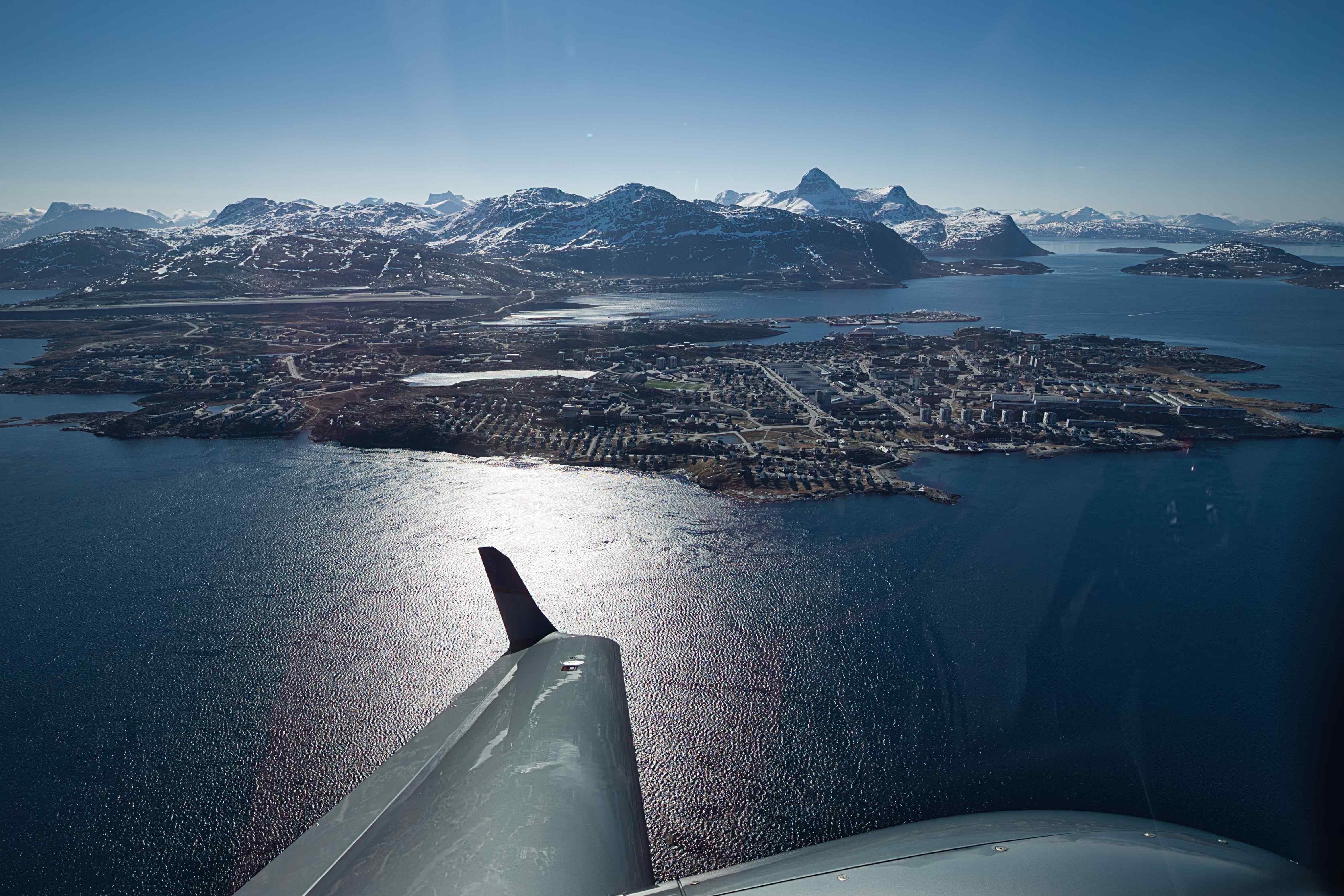
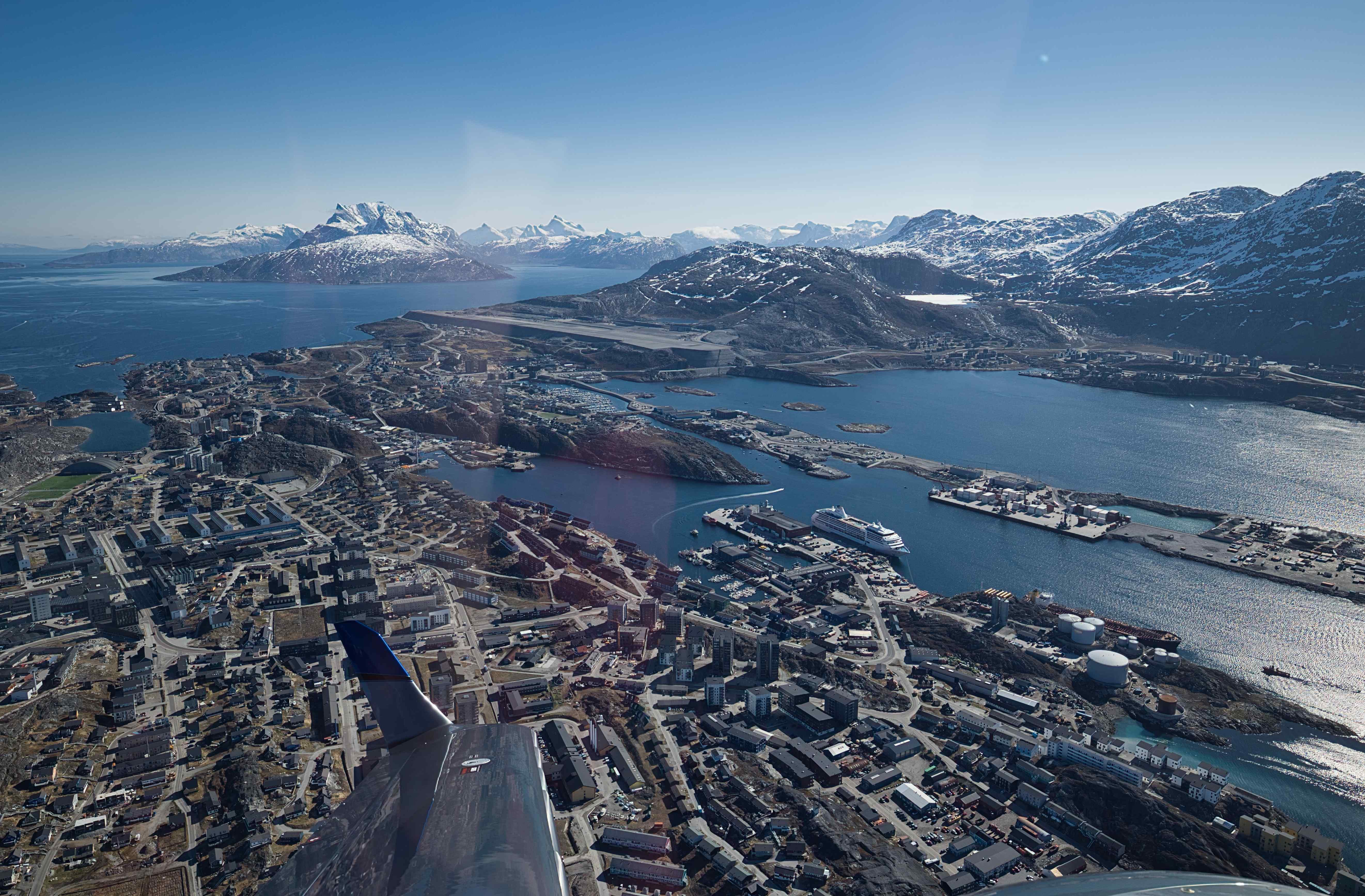
9th flight, BGSS to BGGH, flight time 2 hours and 20 minutes, 174 nautical miles
Low clouds all the way. But nice visibility and ok cloud base until 30 minutes before Nuuk where we had to ask for an IFR pickup. We got an IFR clearance within a minute, climbed up into the clouds and saw nothing before approaching Nuuk airport via an RNAV (GPS) approach. Once in visual contact with the airport we continued on a visual approach and landed in wet and rainy conditions.
The staff on the apron insisted on bringing our luggage to the terminal building where we could pick it up on the baggage carrousel, I have never tried this before as a private pilot.


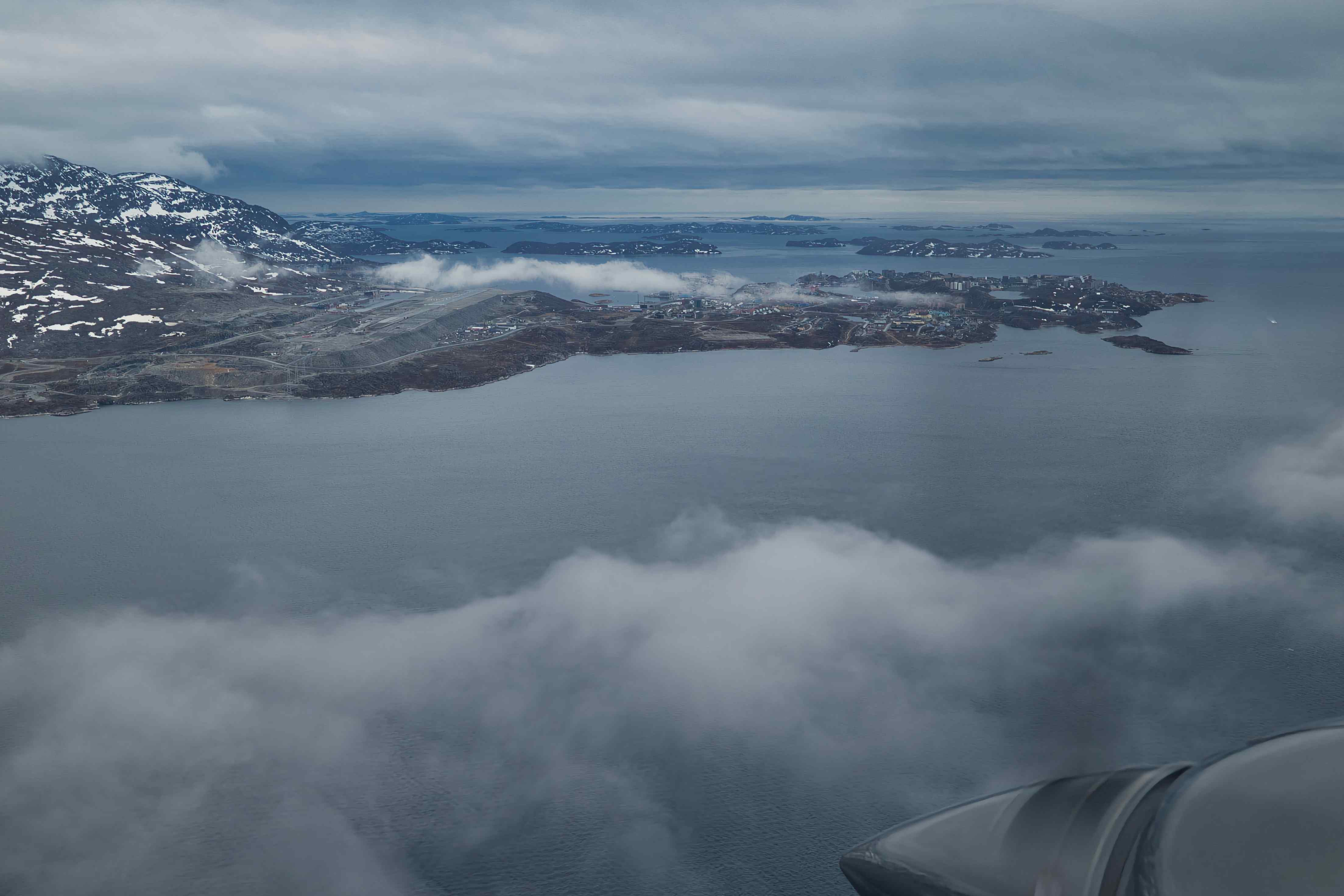
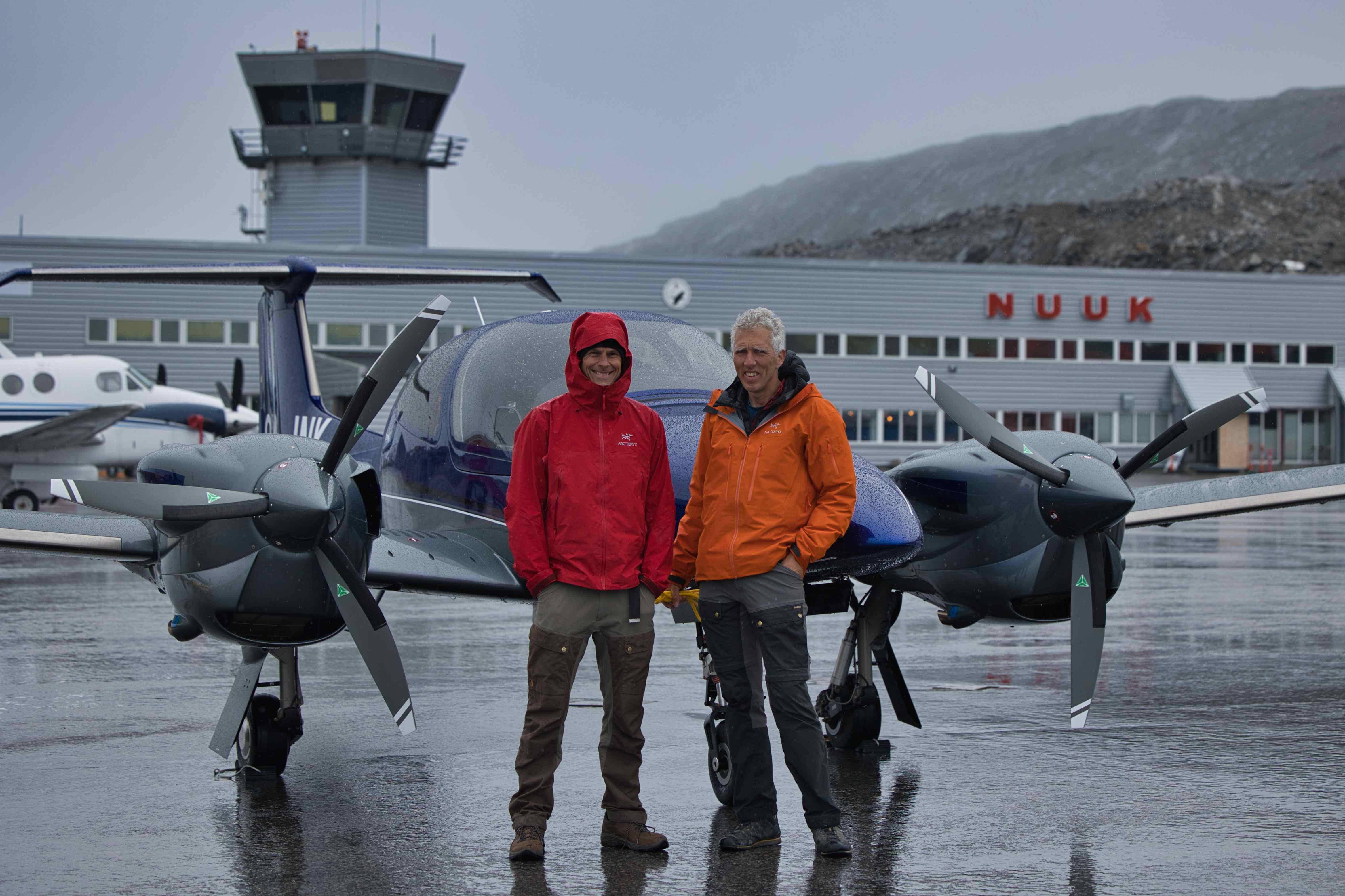


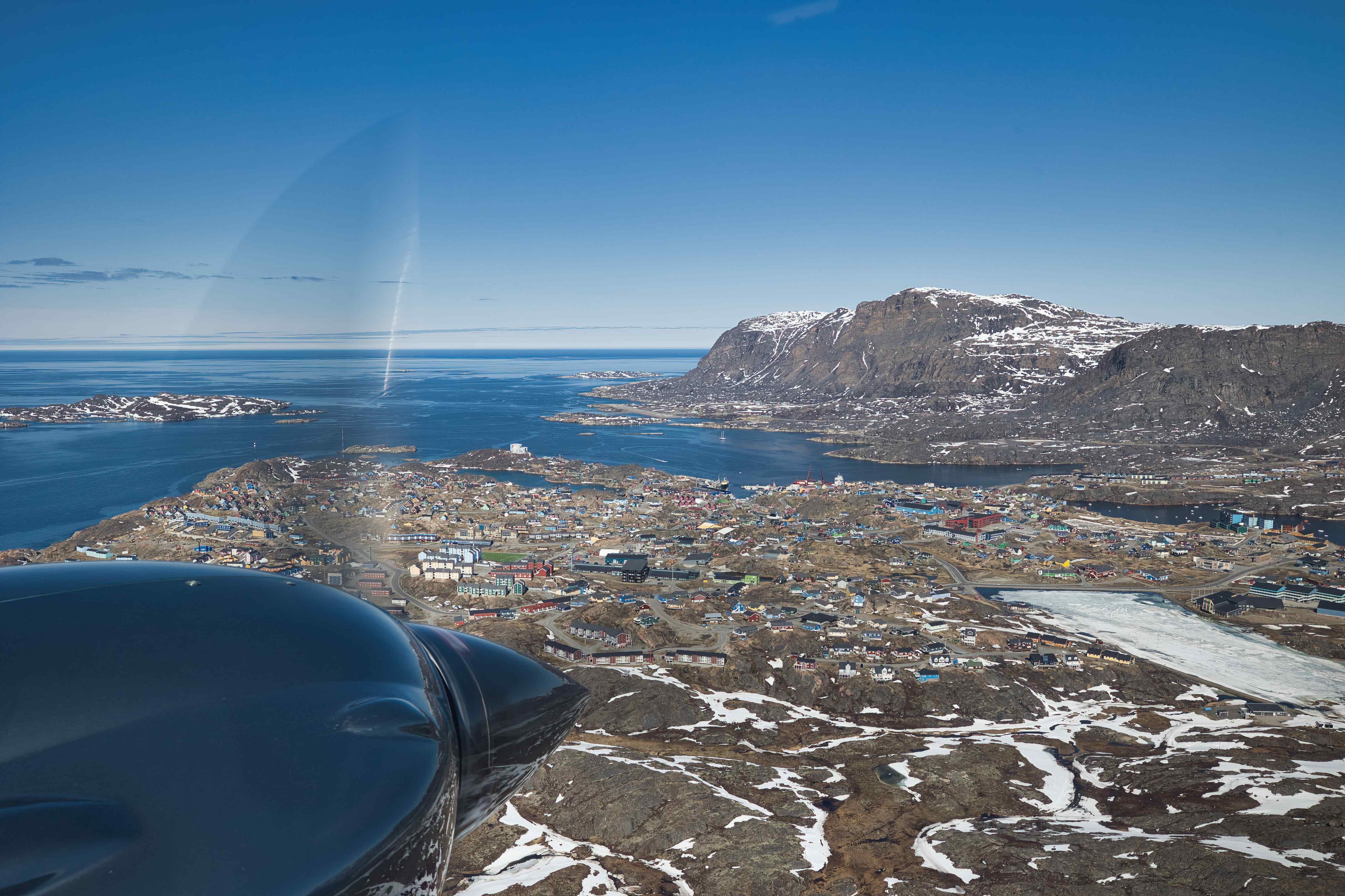
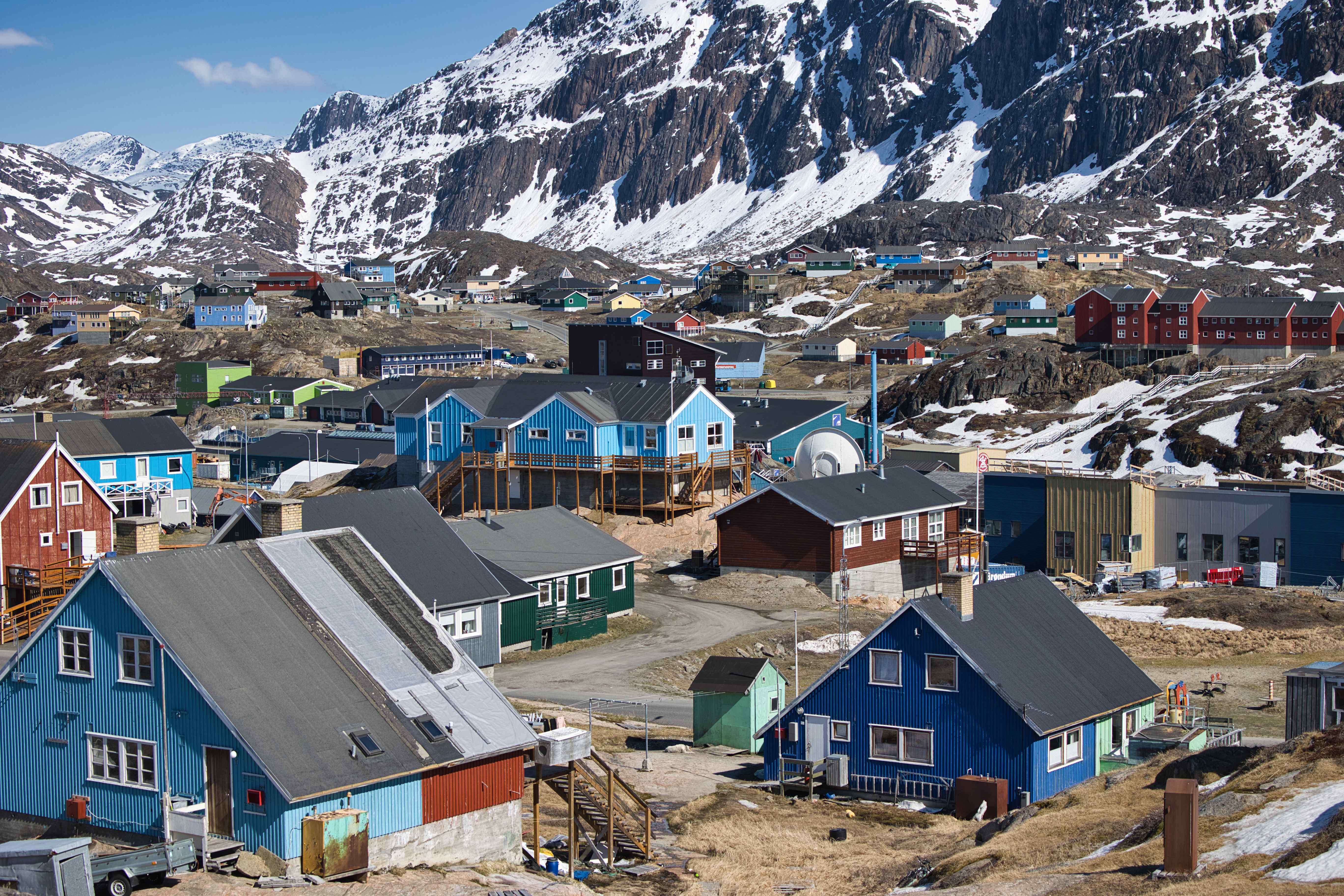
Nuuk
Wa stayed three days in Nuuk waiting for better weather.


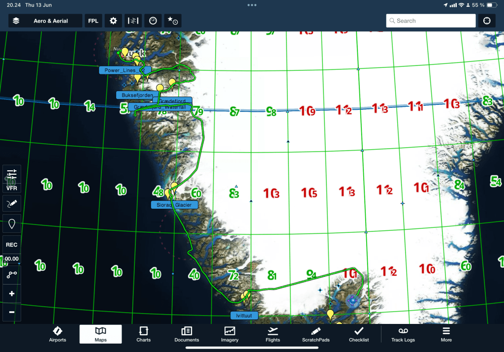
From Nuuk to Narsarsuaq
10th flight, BGGH to BGBW, flight time 3 hours and 45 minutes, 251 nautical miles
After three days of bad weather, the sky was clear. Exactly as forcast three days earlier!
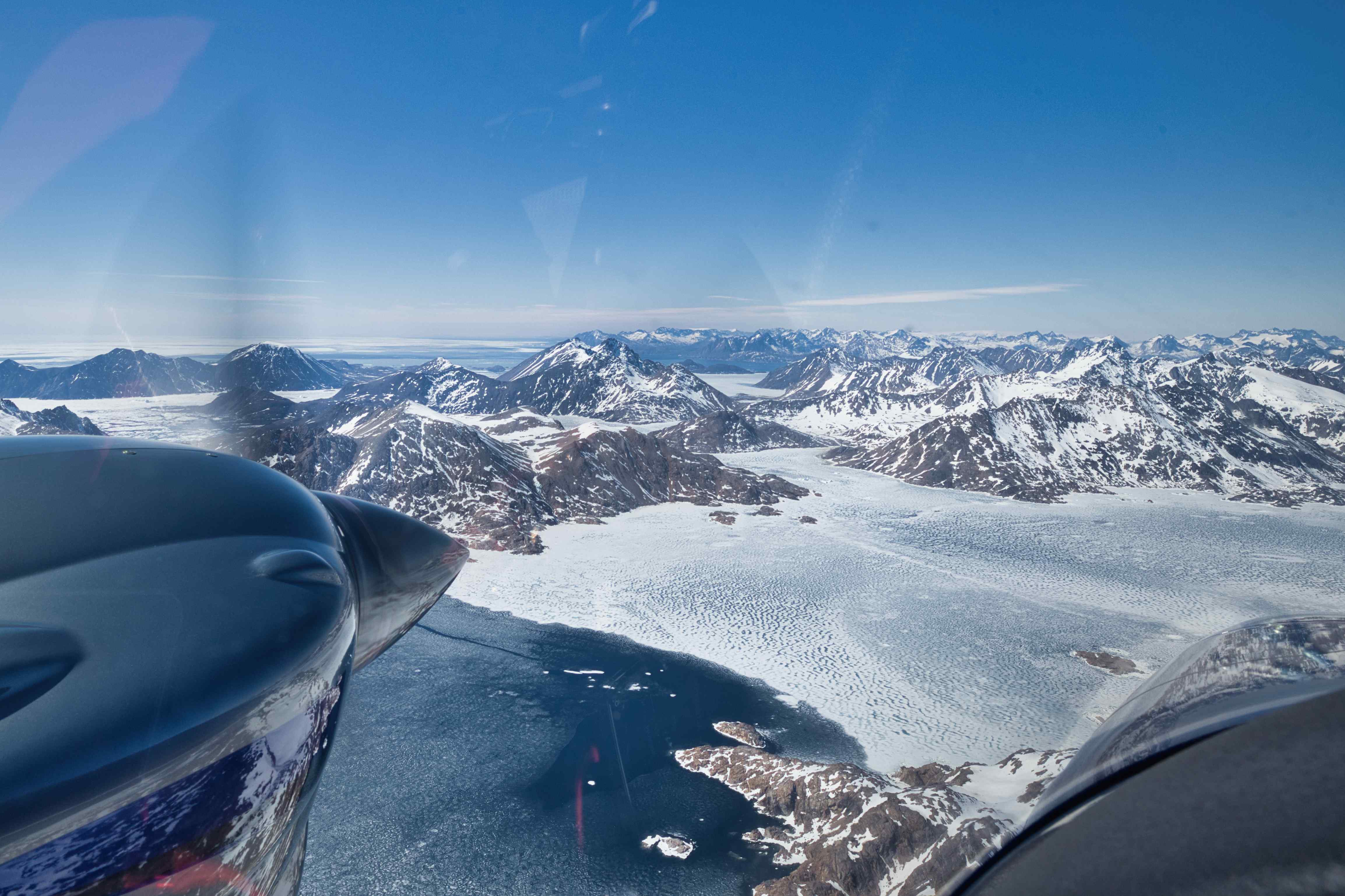
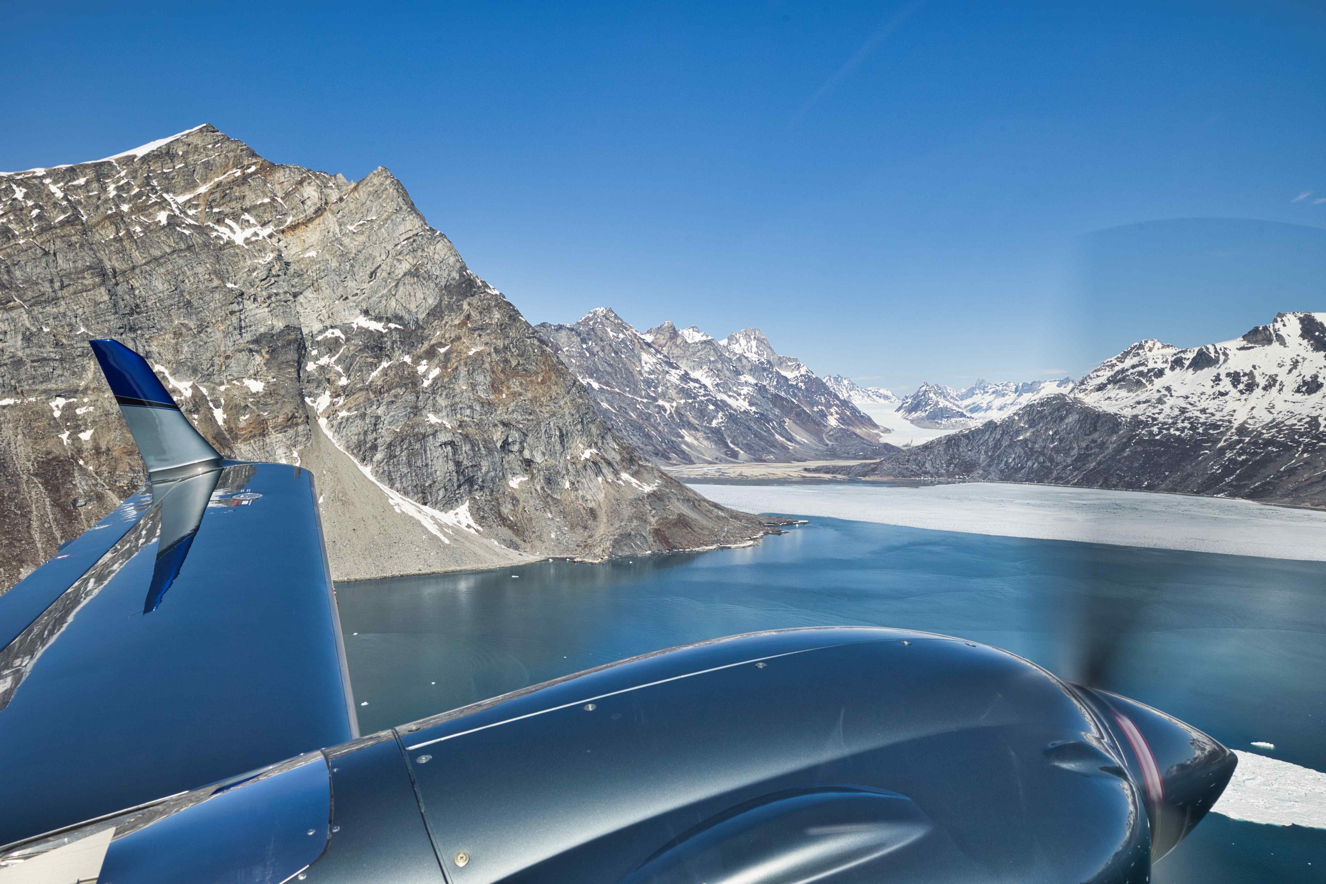
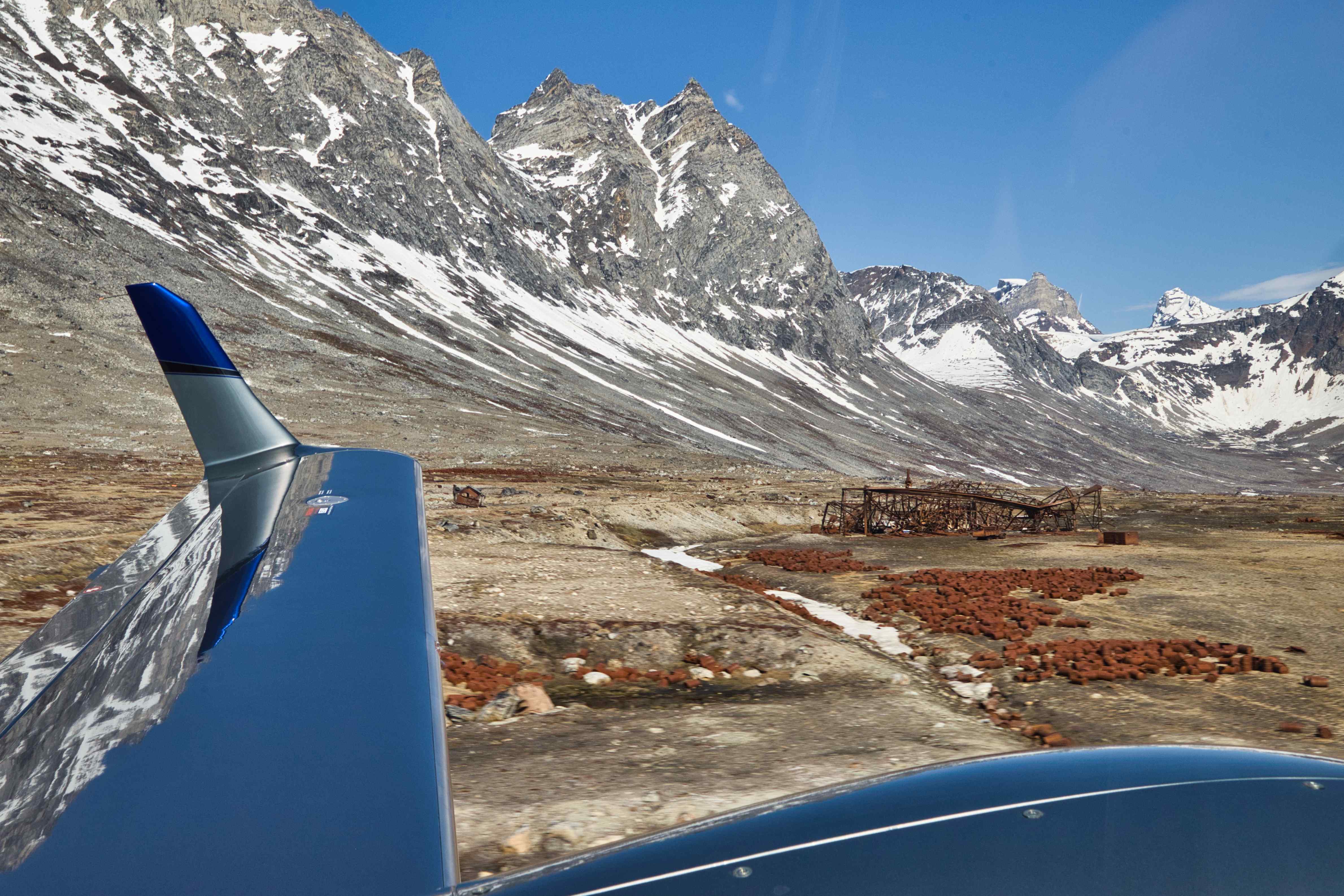
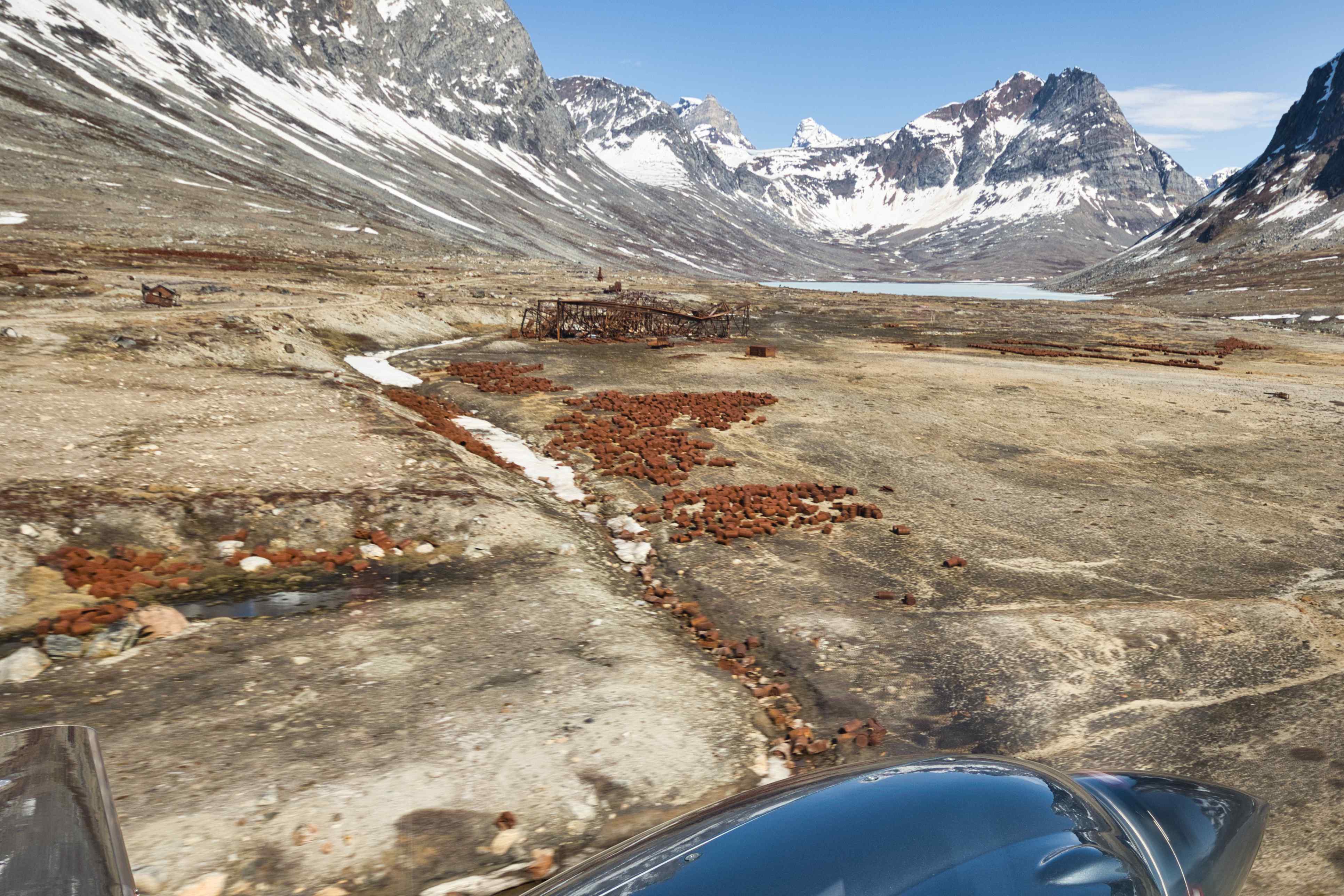
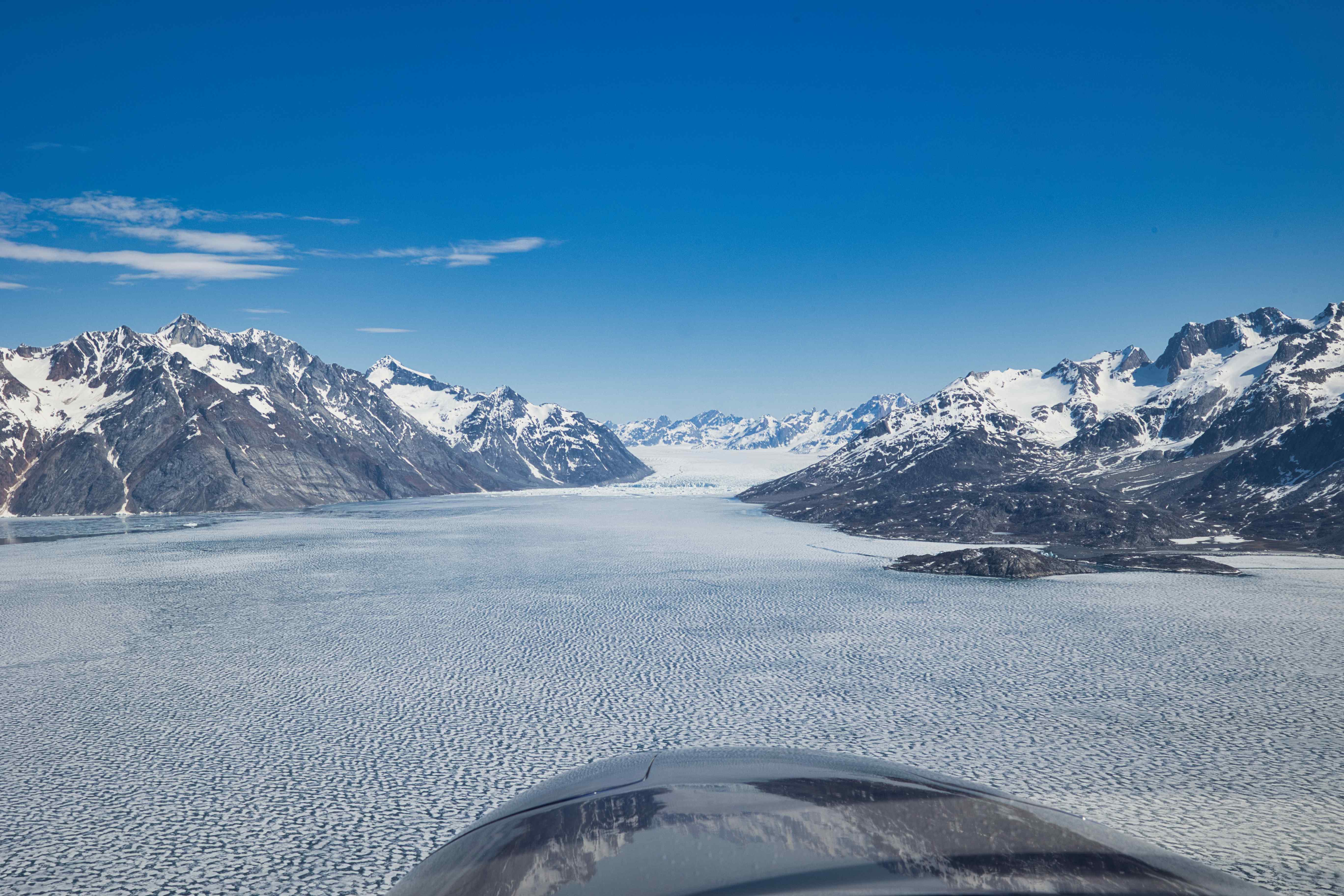
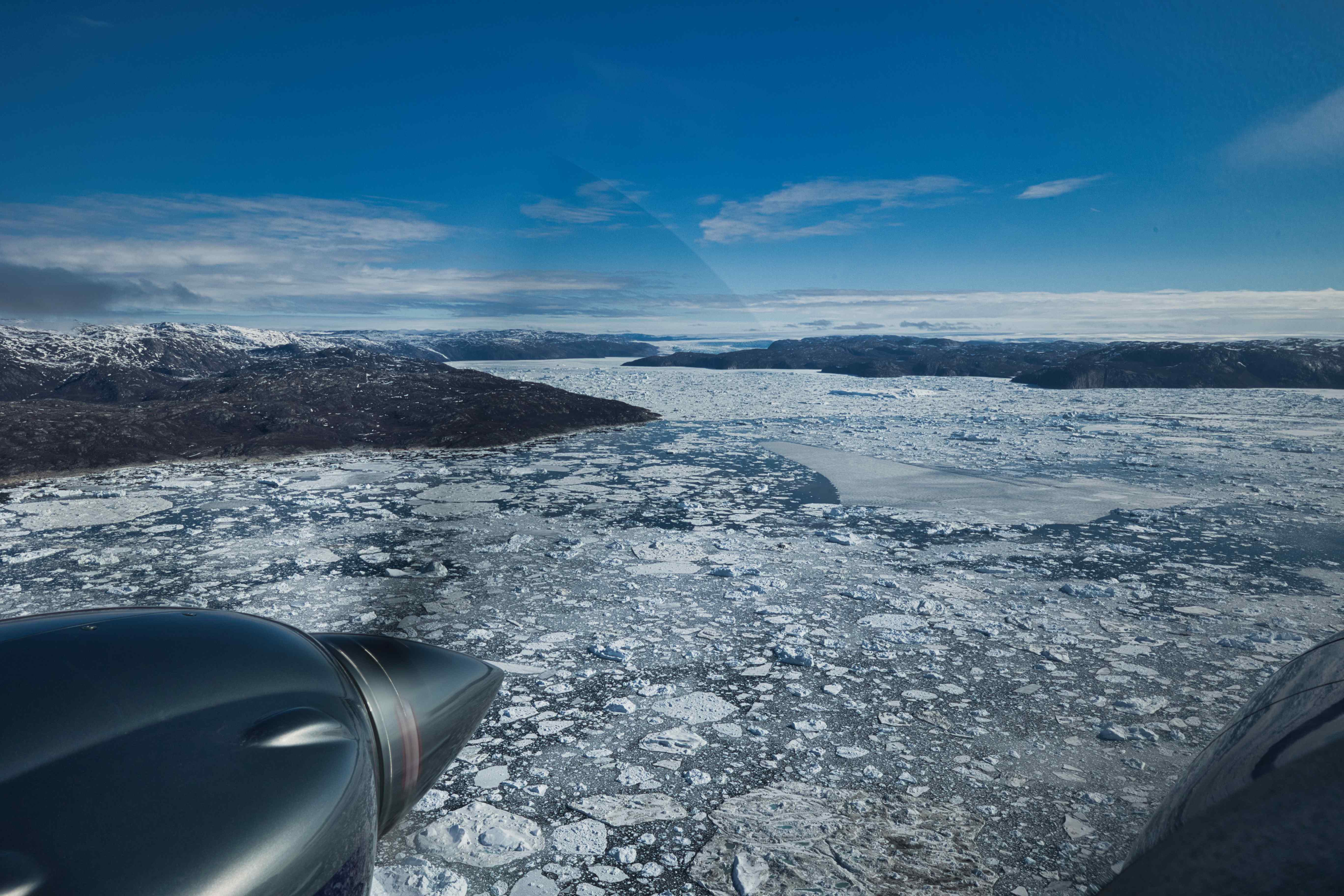
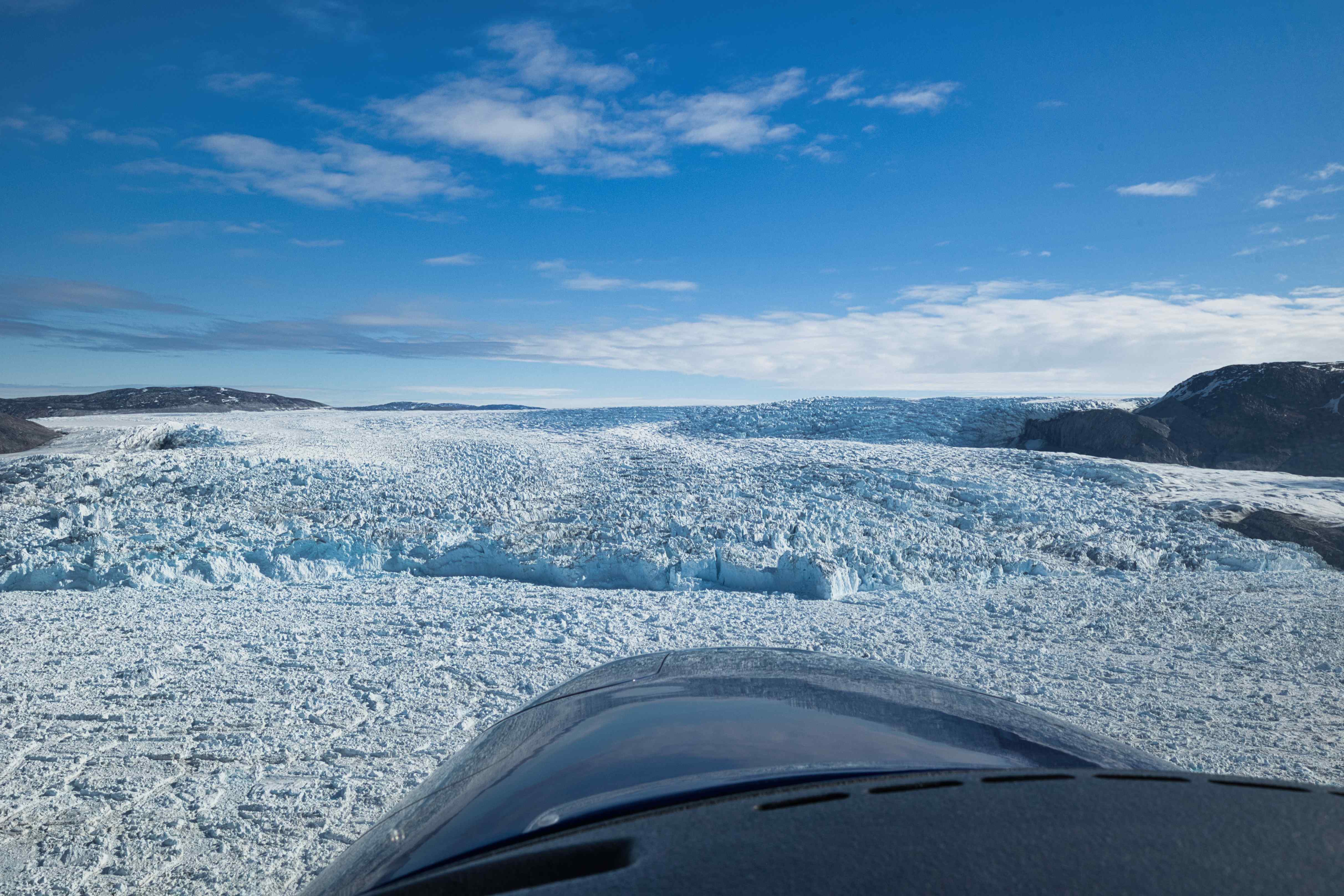
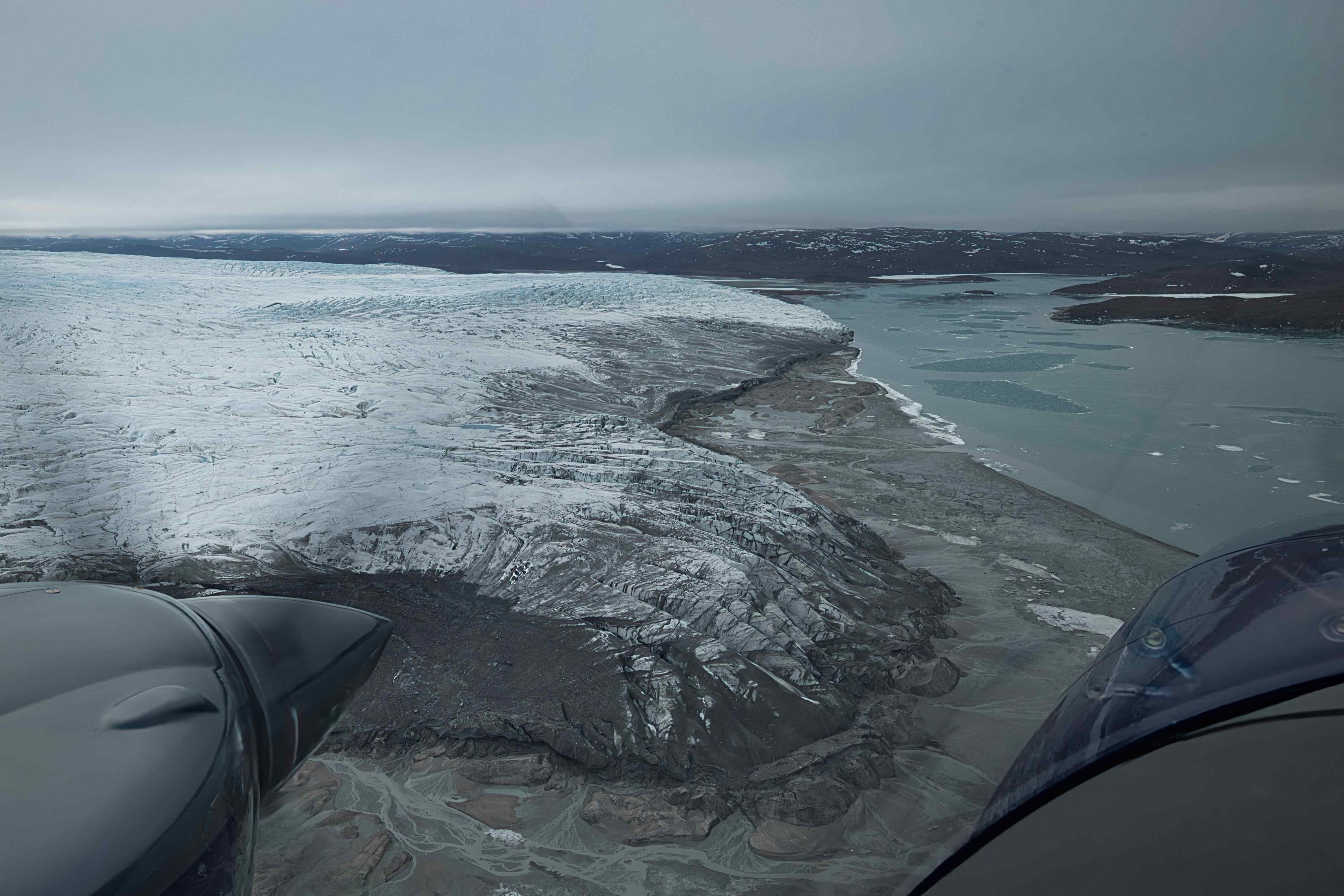
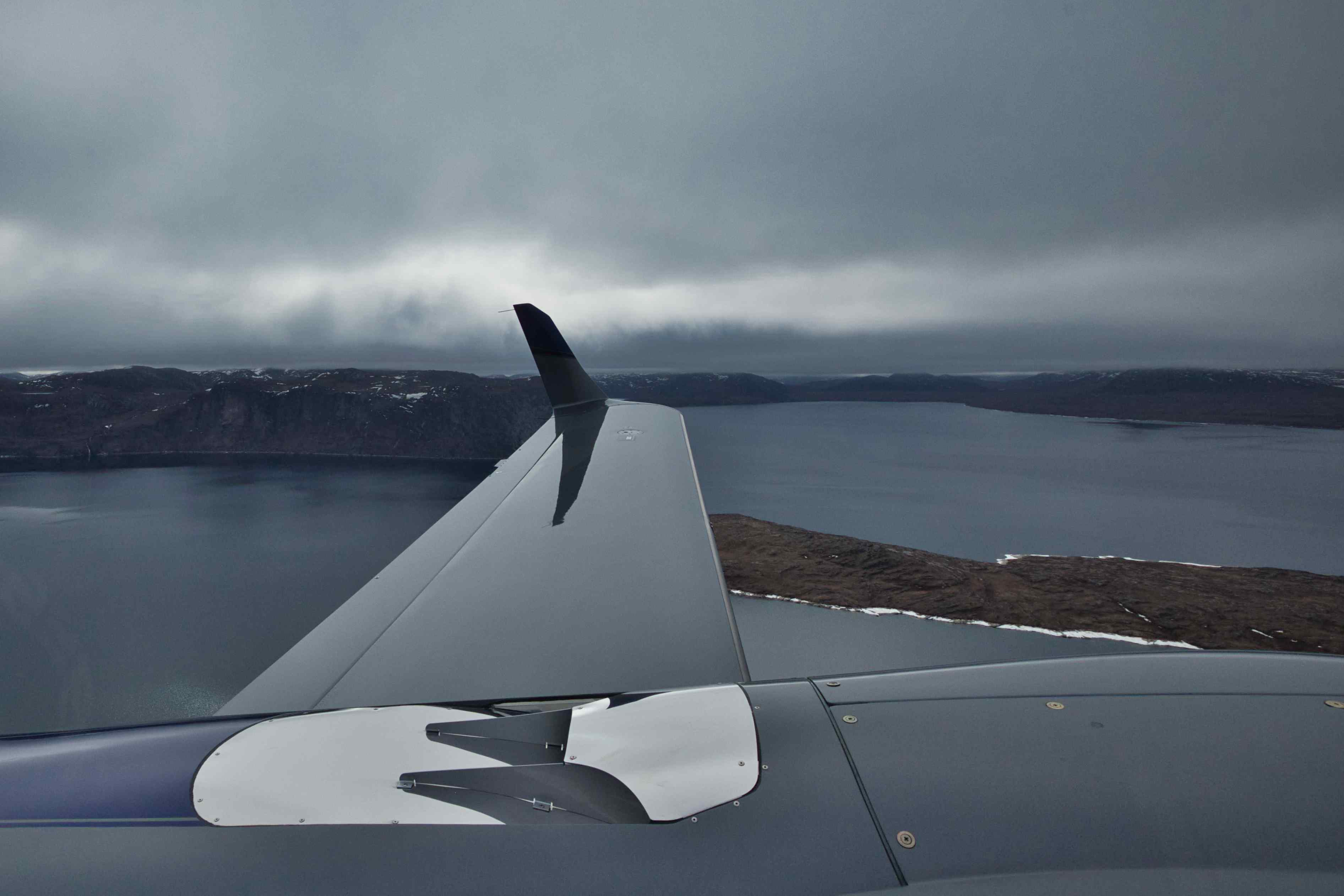
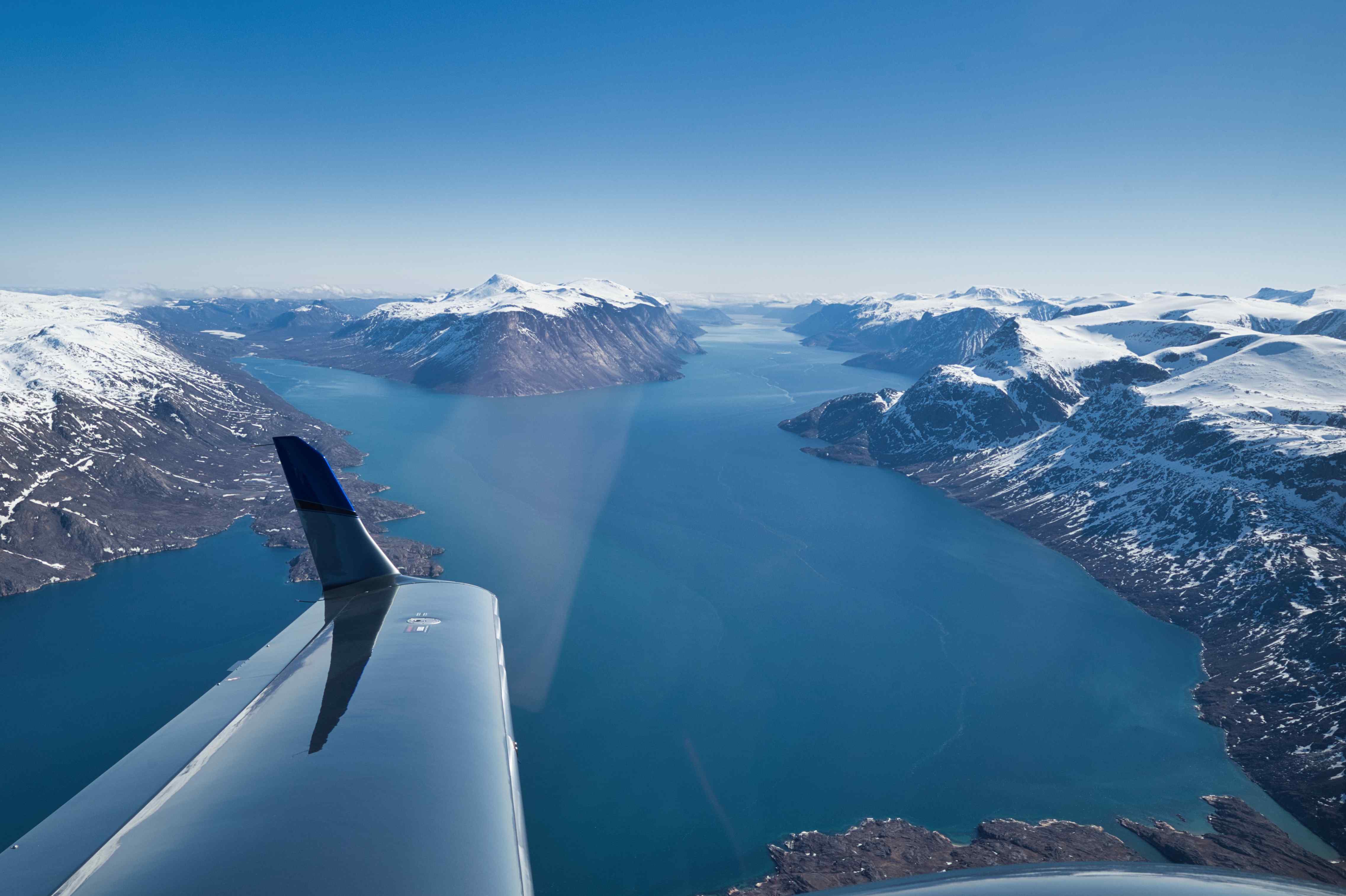
We spent four hours in the air from Nuuk to Narsarsuaq, the direct trip would have taken under two hours. Instead of going direct we flew up the Buksefjord to the ice cap. And down the Grædefjord all the way to the sea. And later in the flight we flew down the Frederikshåb glacier and the large Frederikshåb Isblink of ice that the glacier ends in. Low pass over Paamiut airfield (BGPT). Above the now closed cryulit mine at Ivittuut and around the nearby and now closed military port at Kangilinnguit. And finally over the southern ice sheet and down towards Narsarsuaq runway 24 via the glacier northeast of the airport, what a fantastic approach 🙂


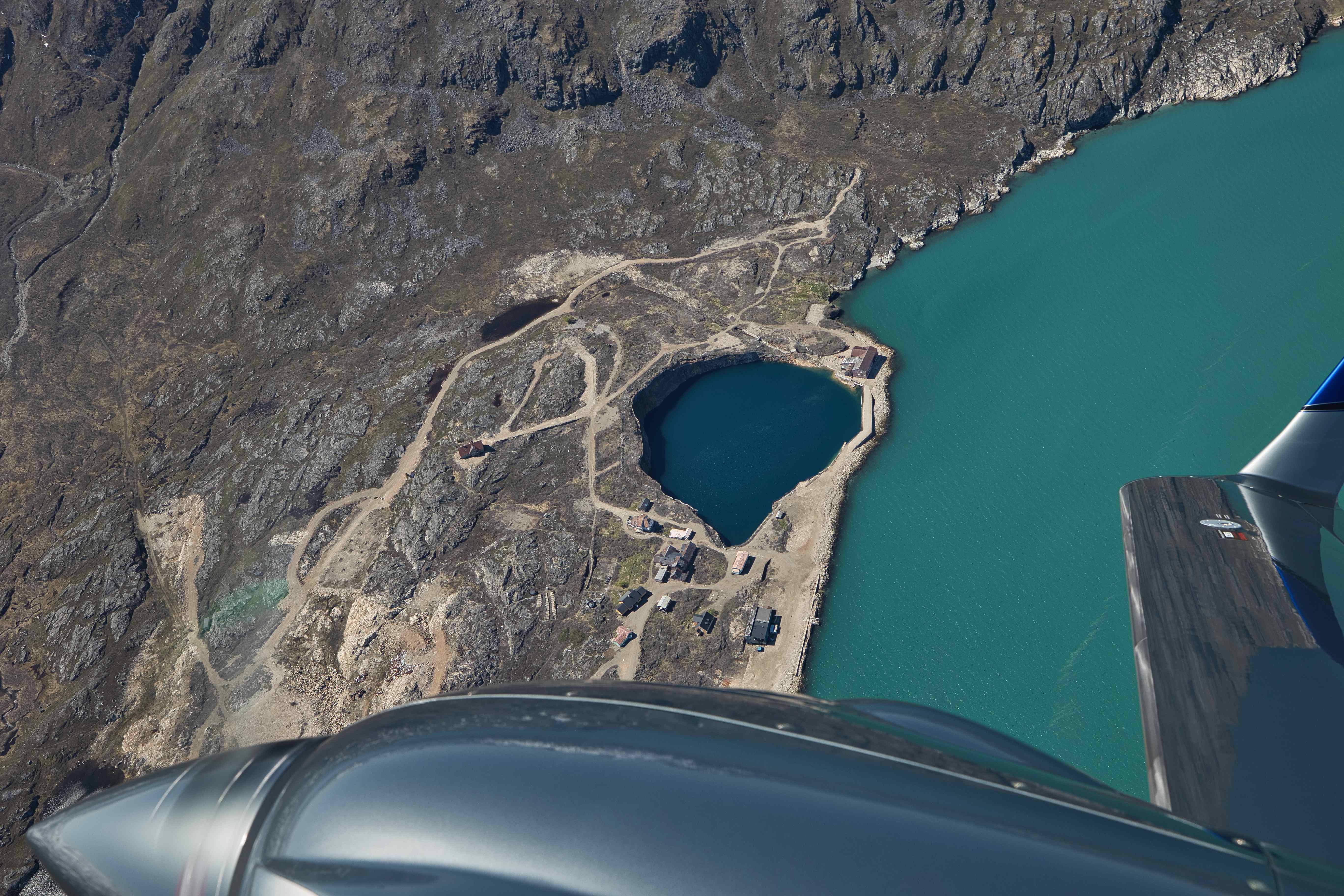


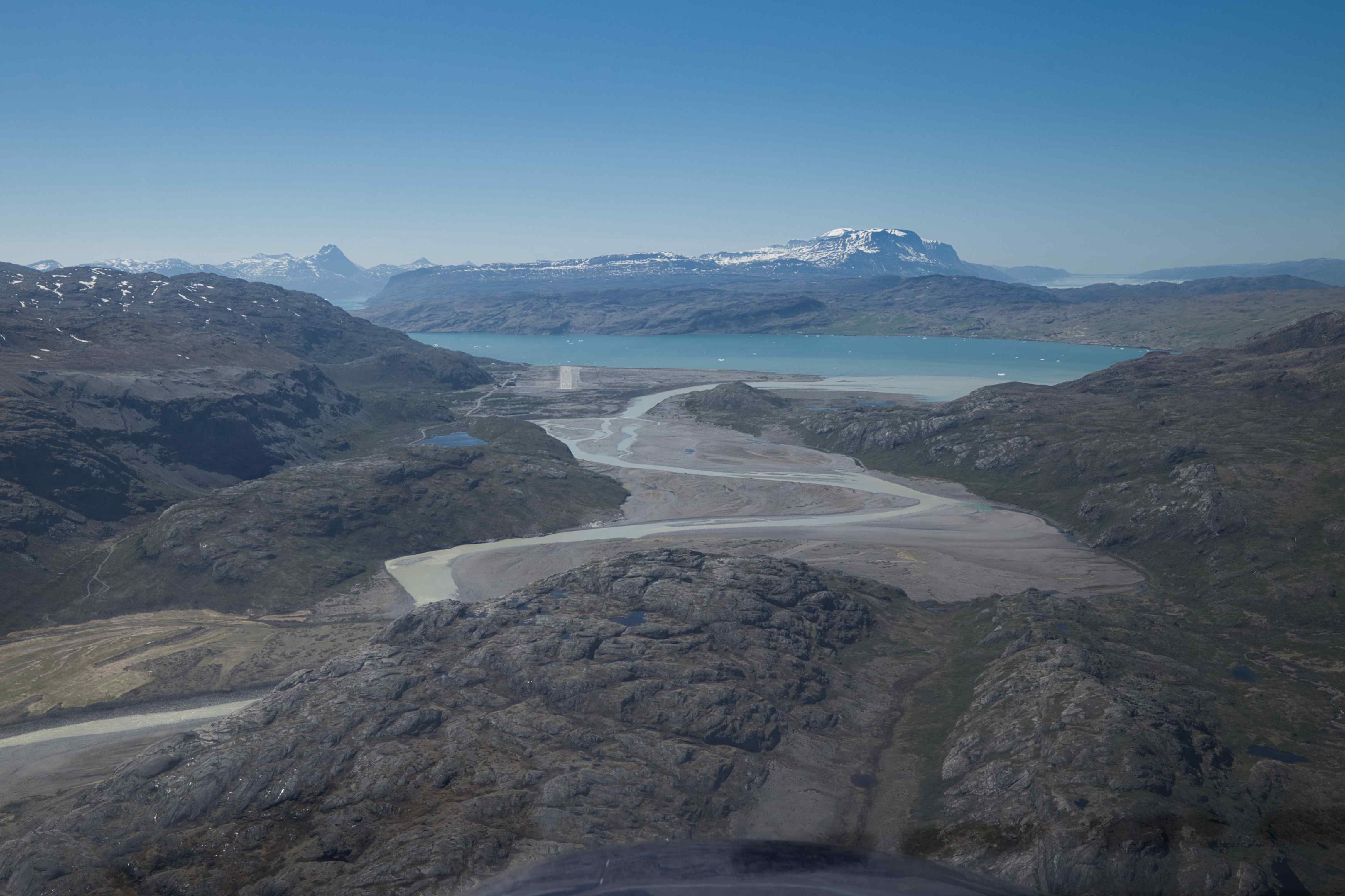

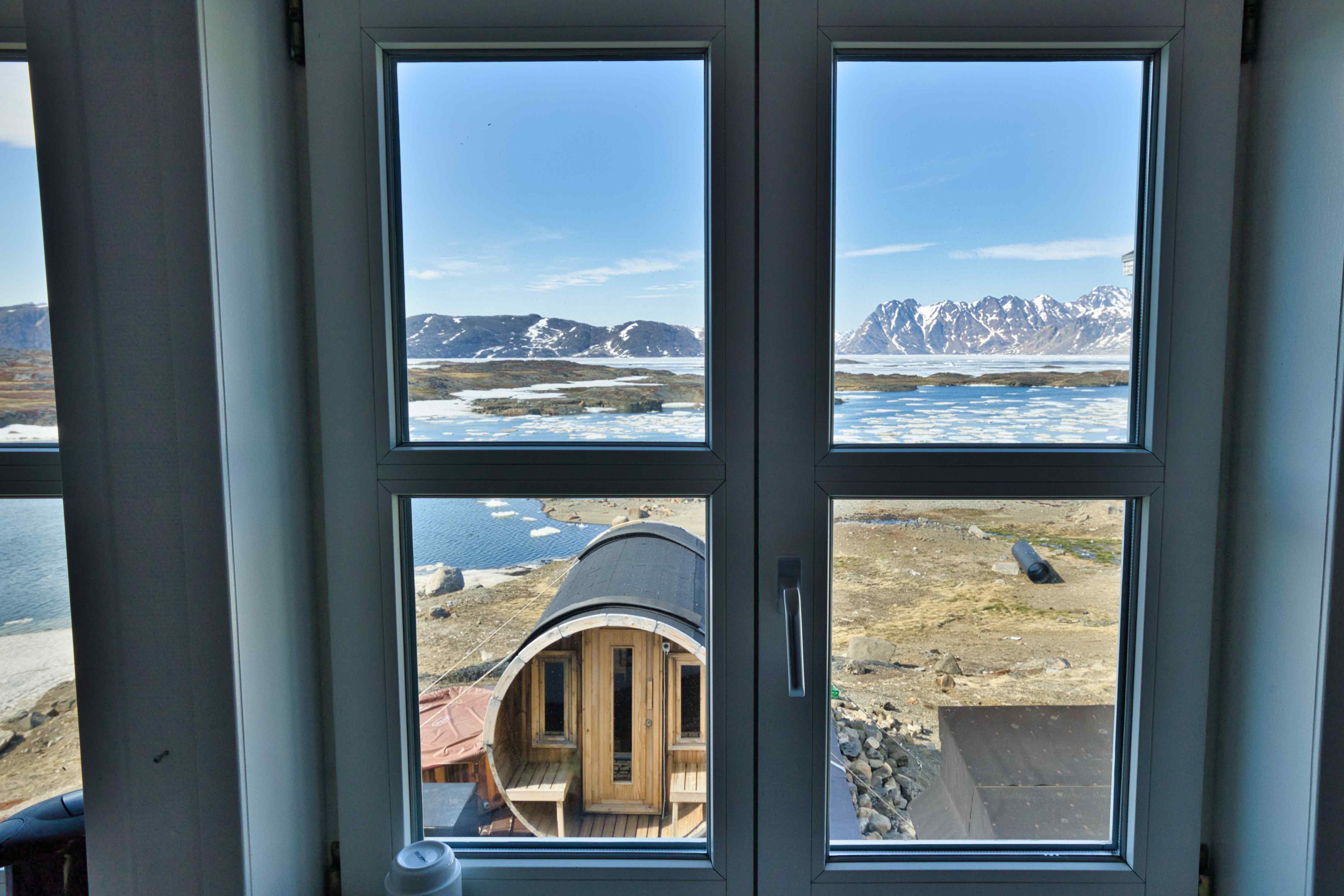
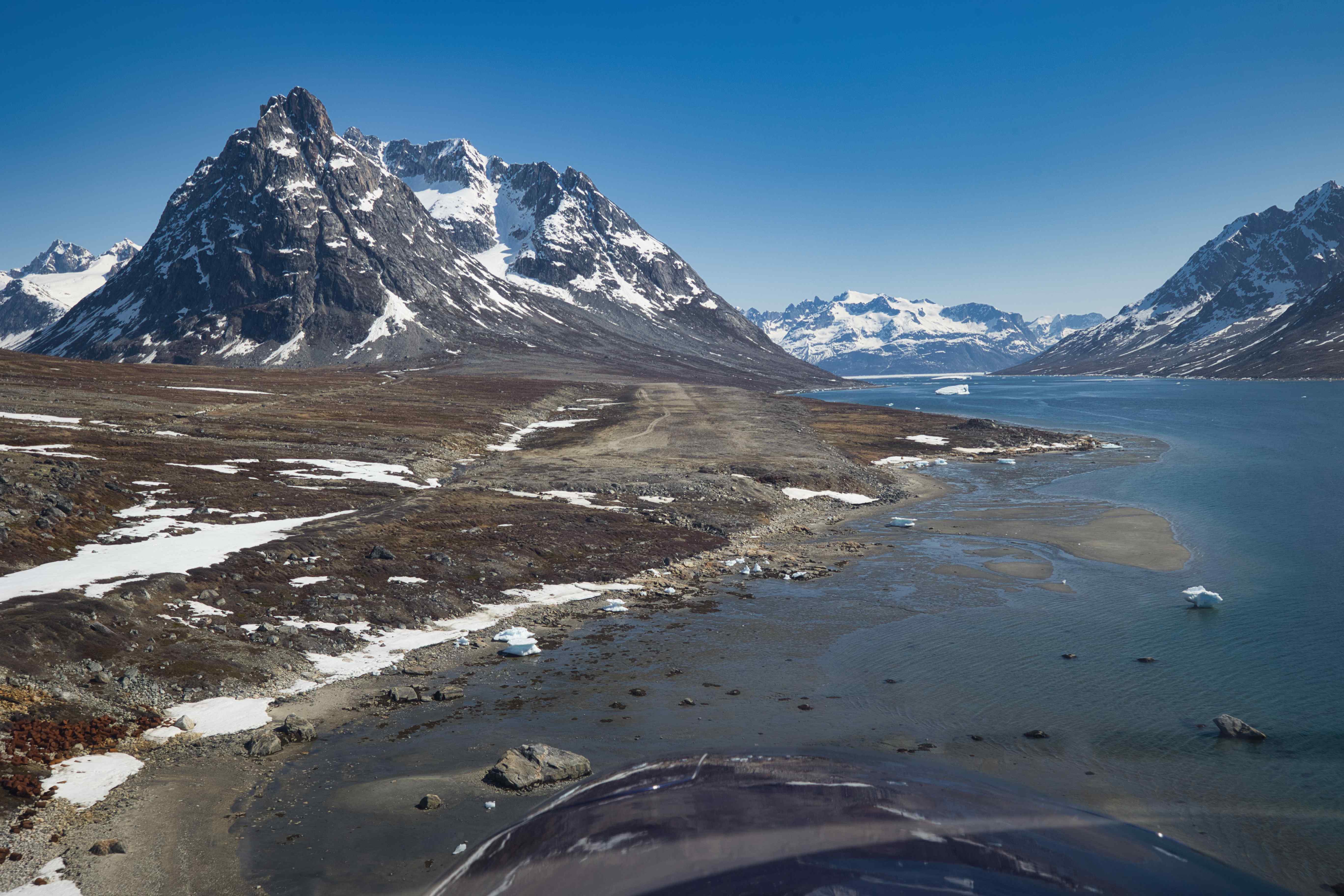
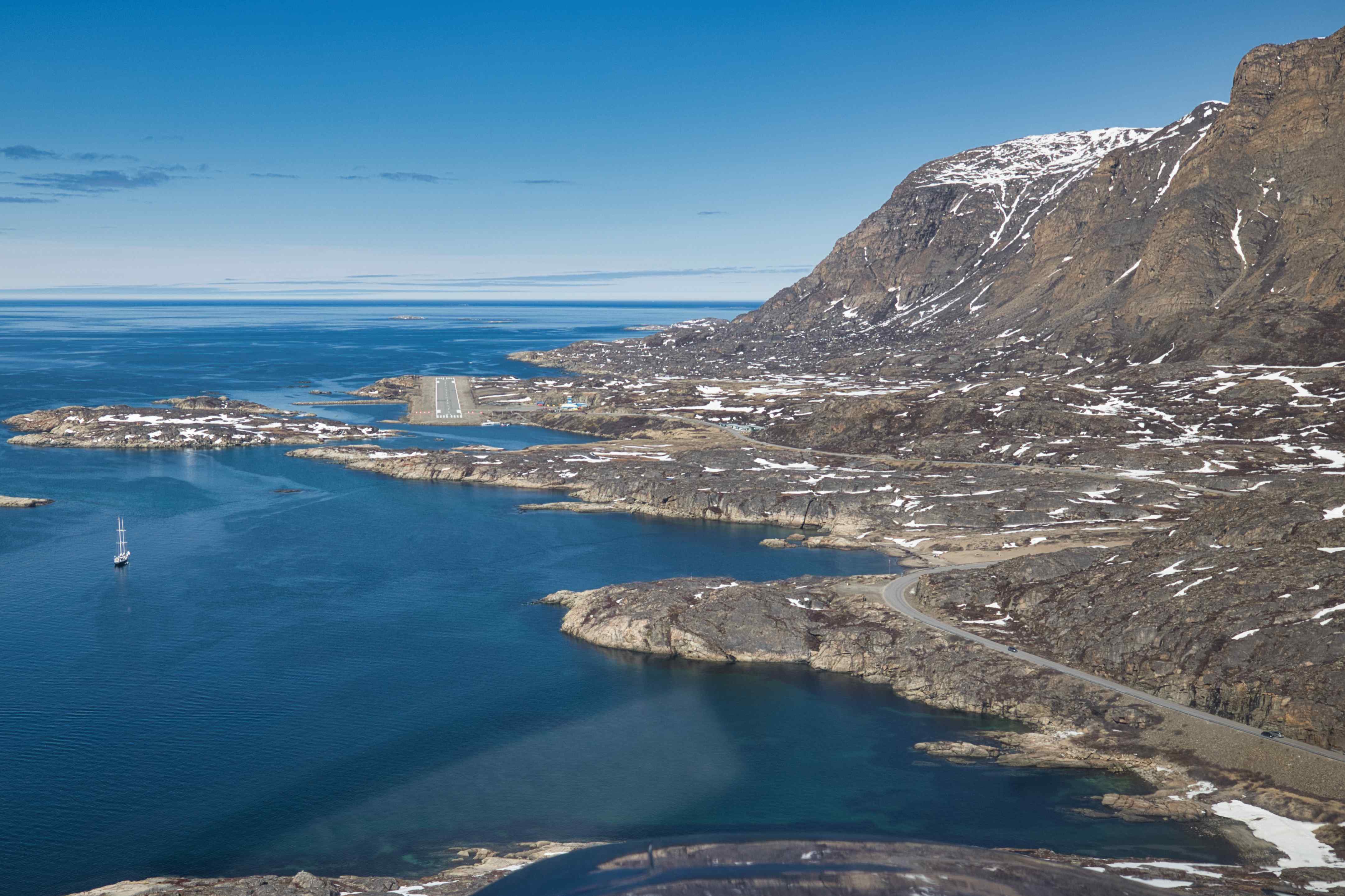
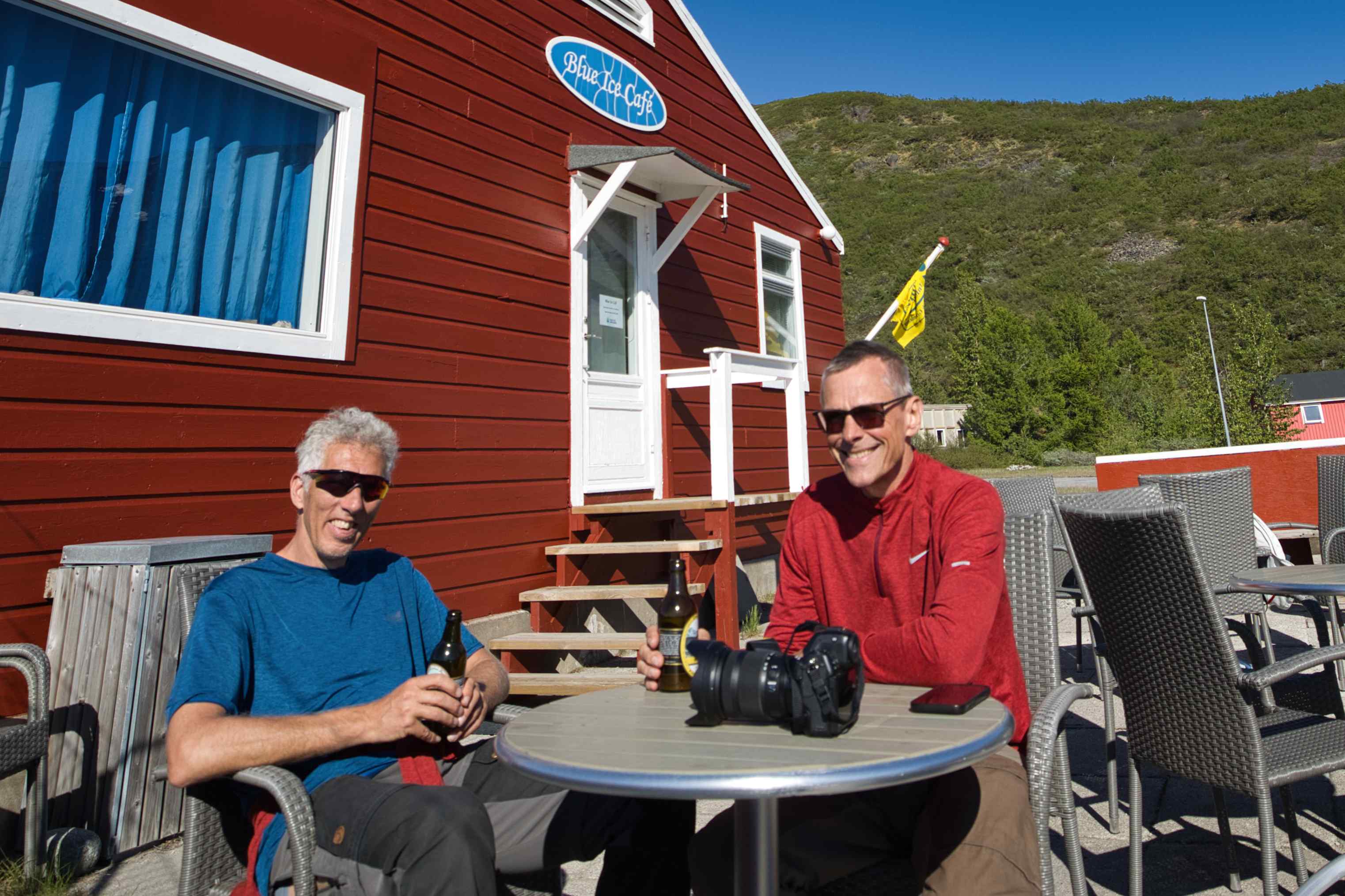
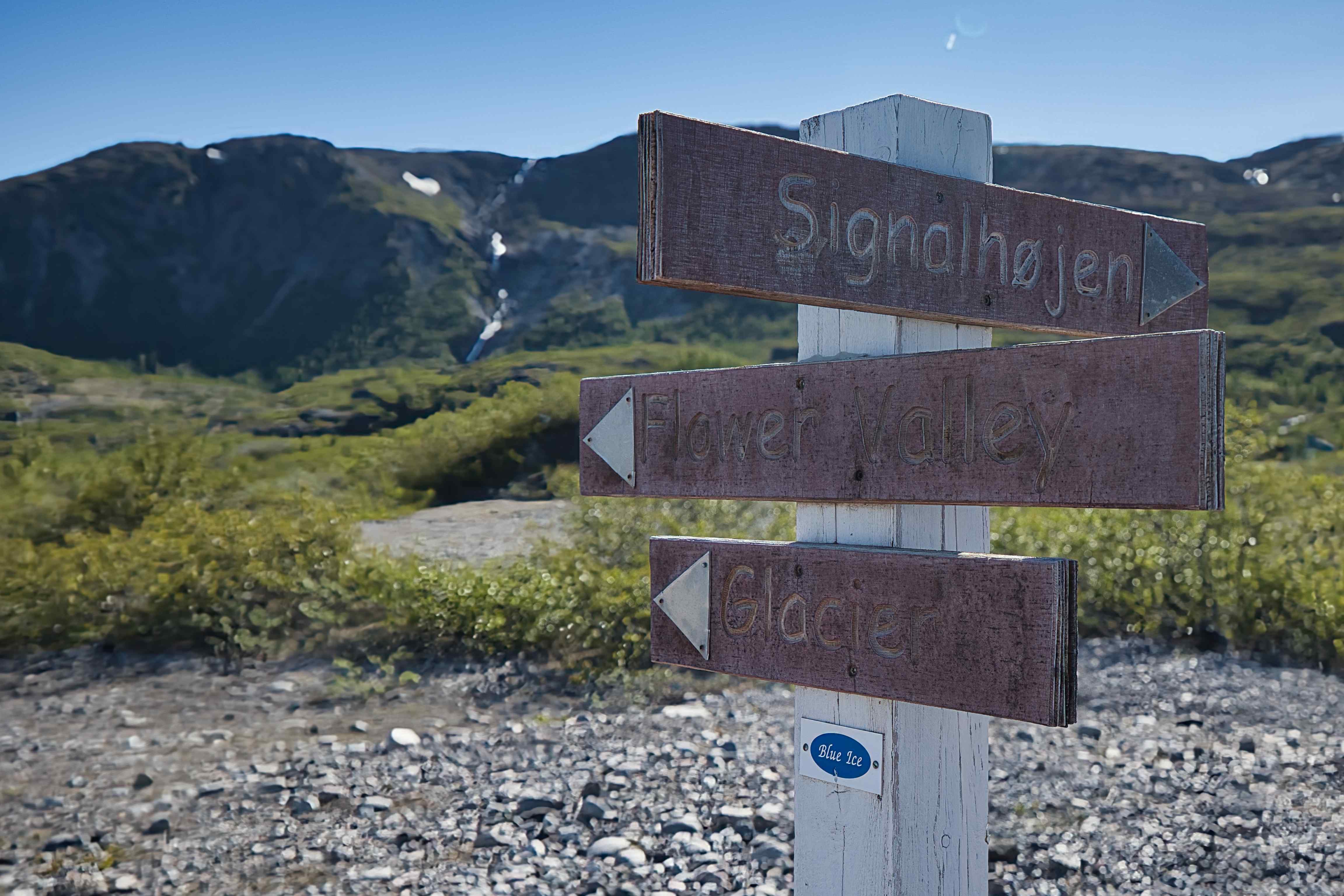
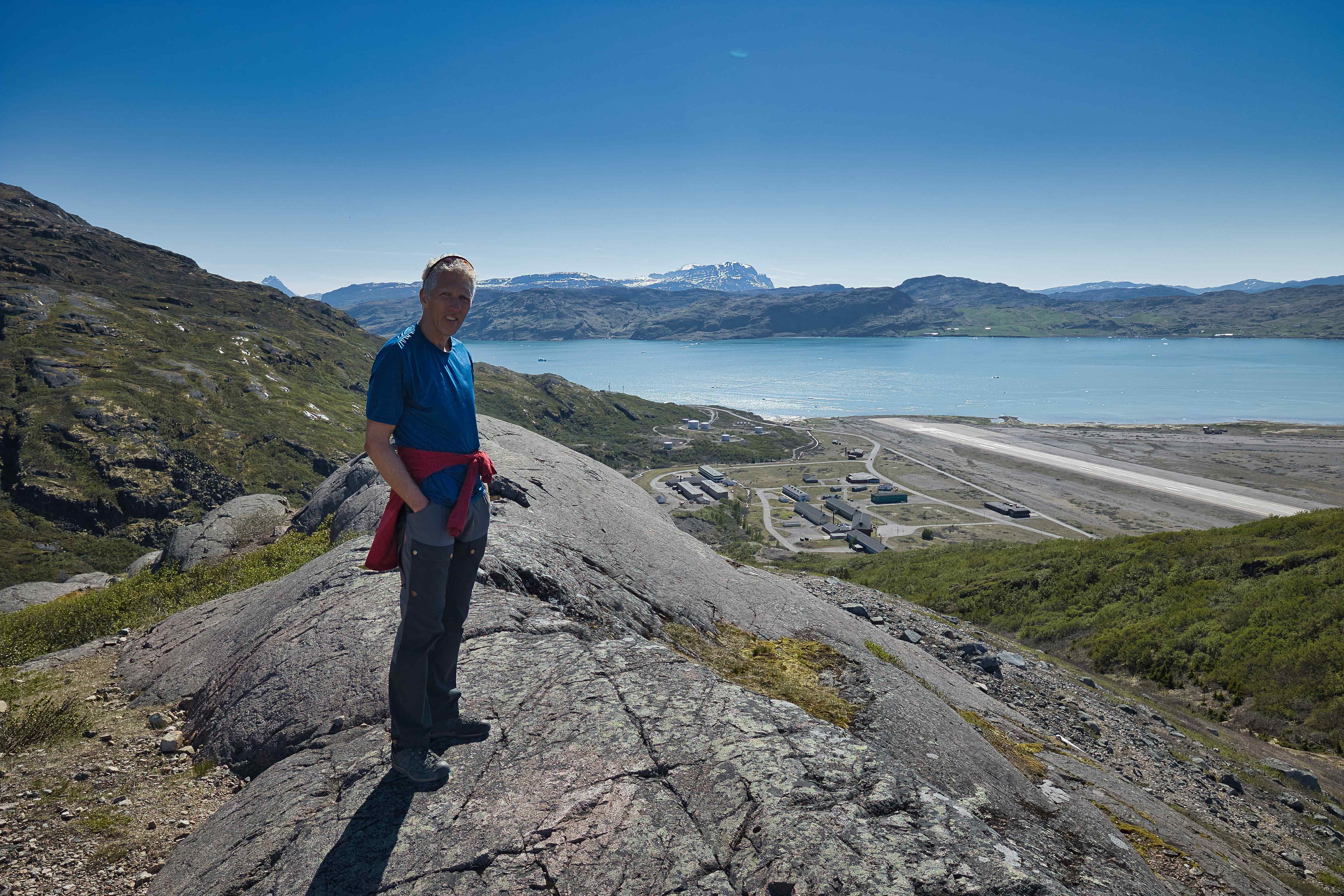
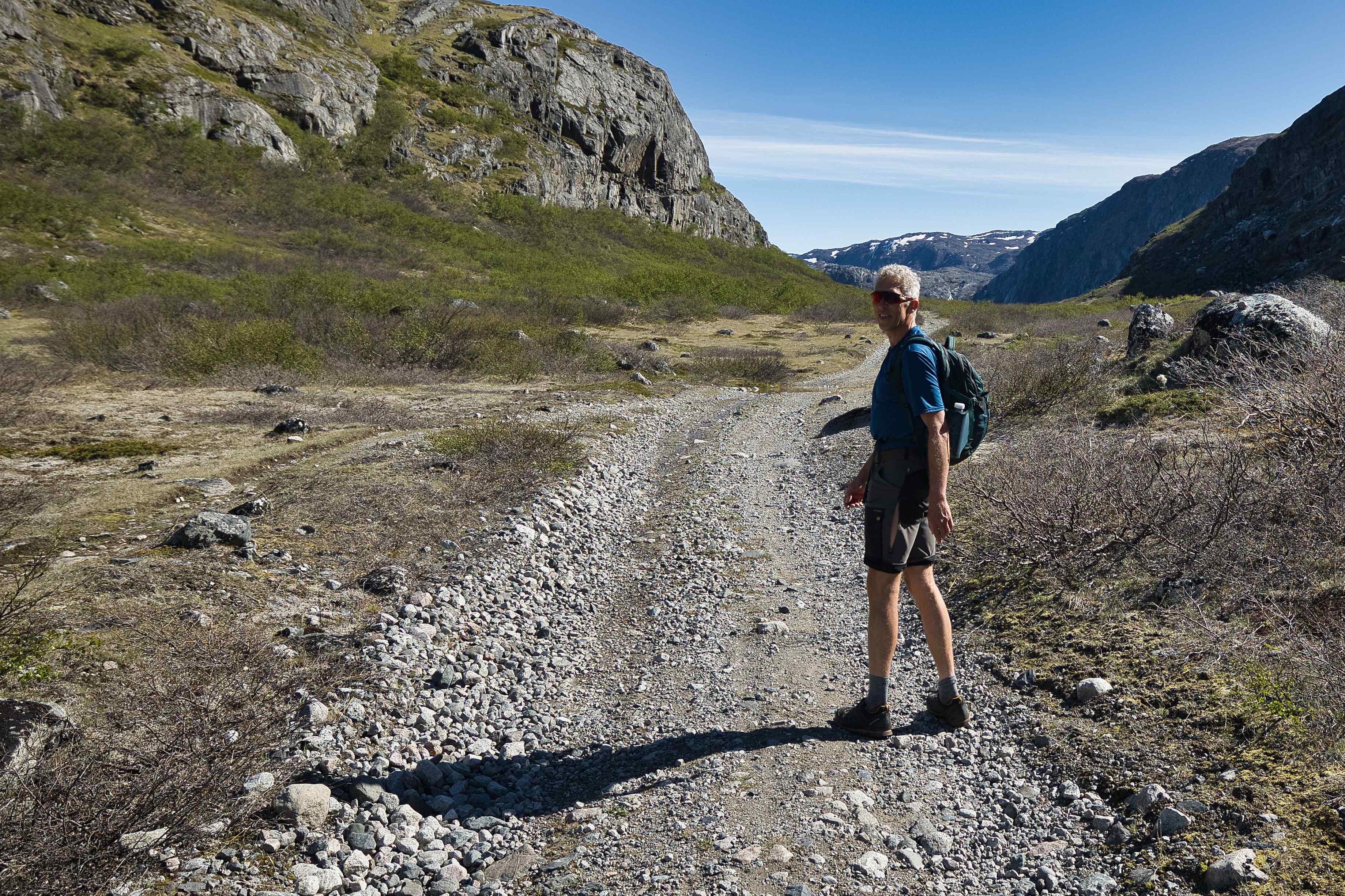
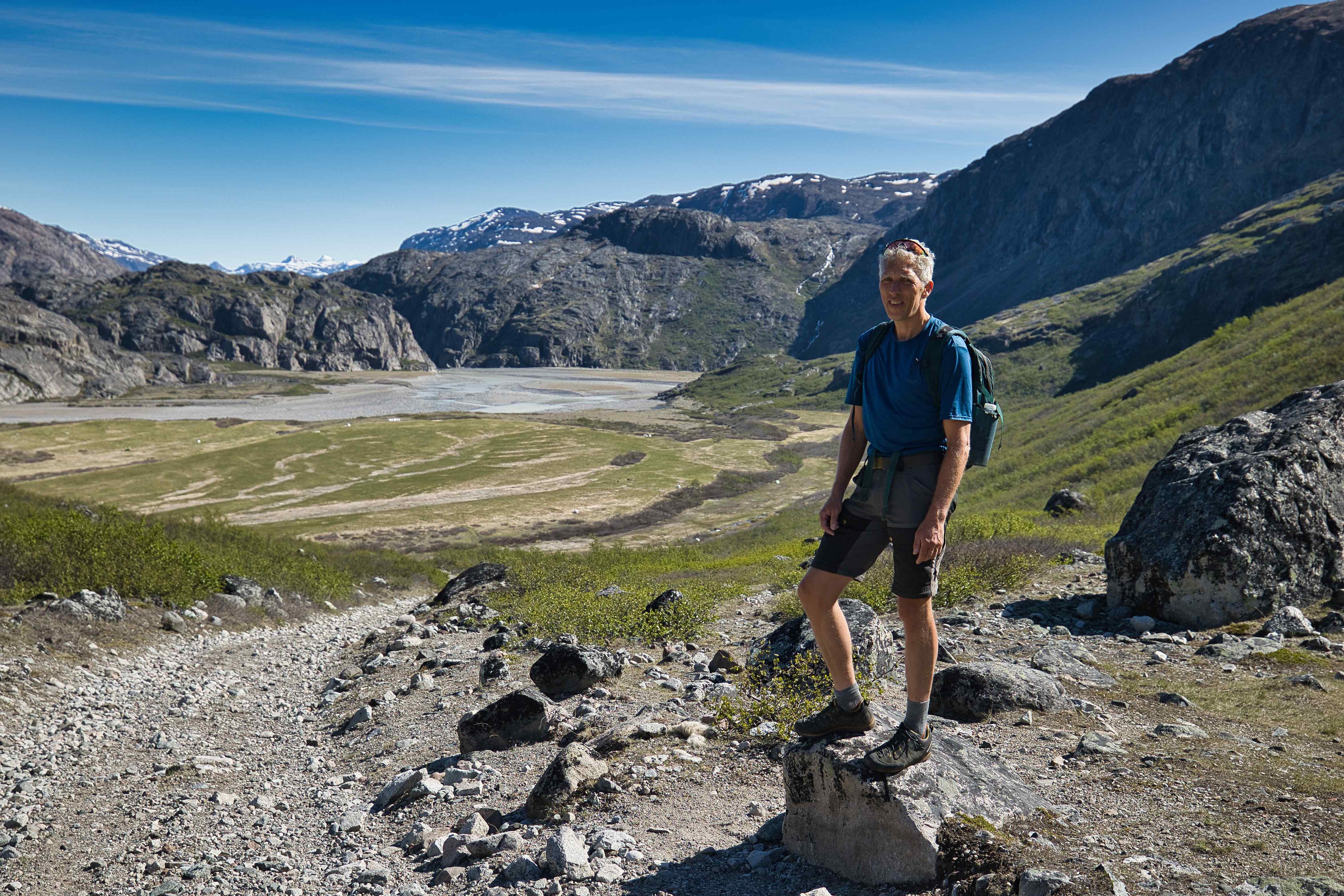
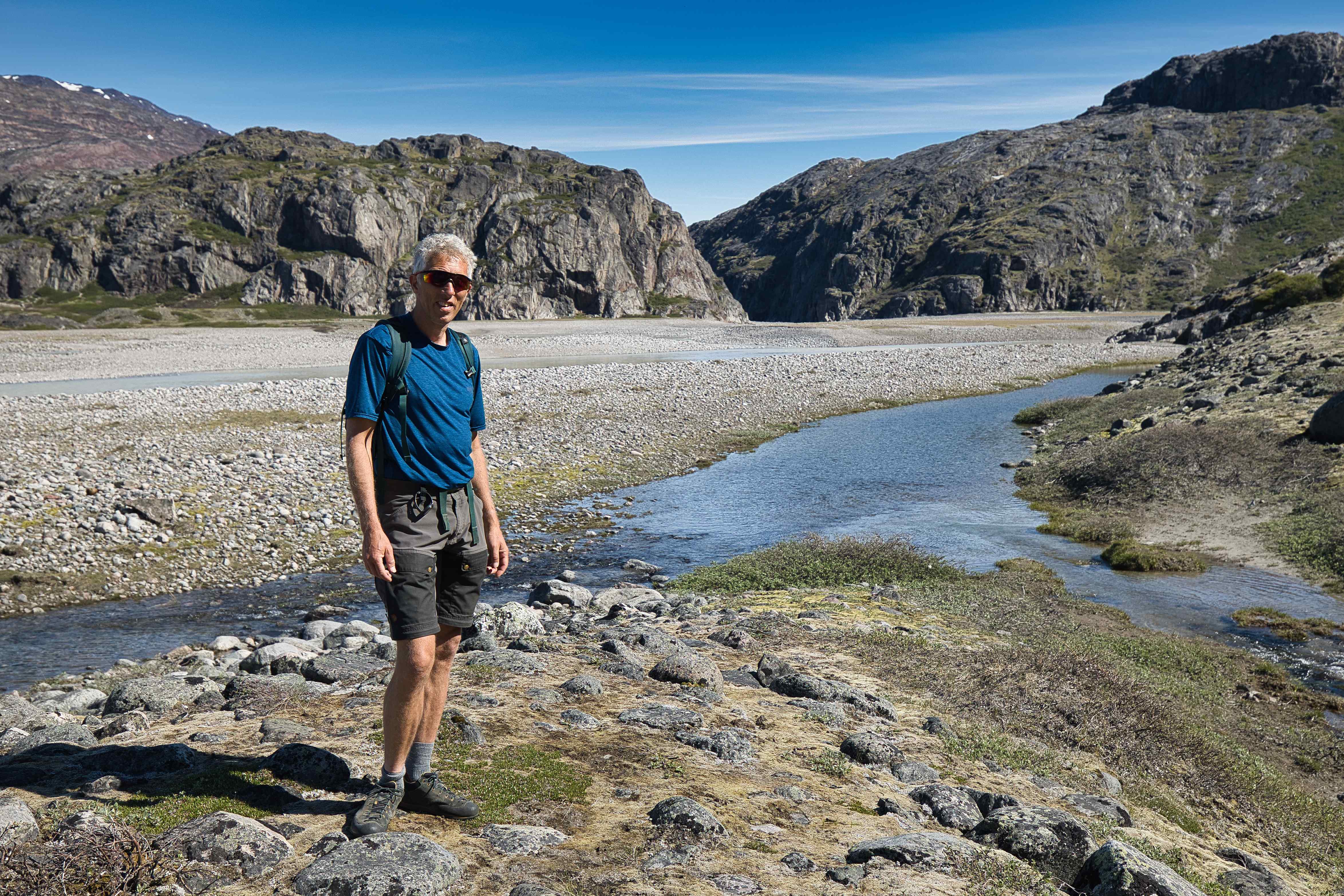
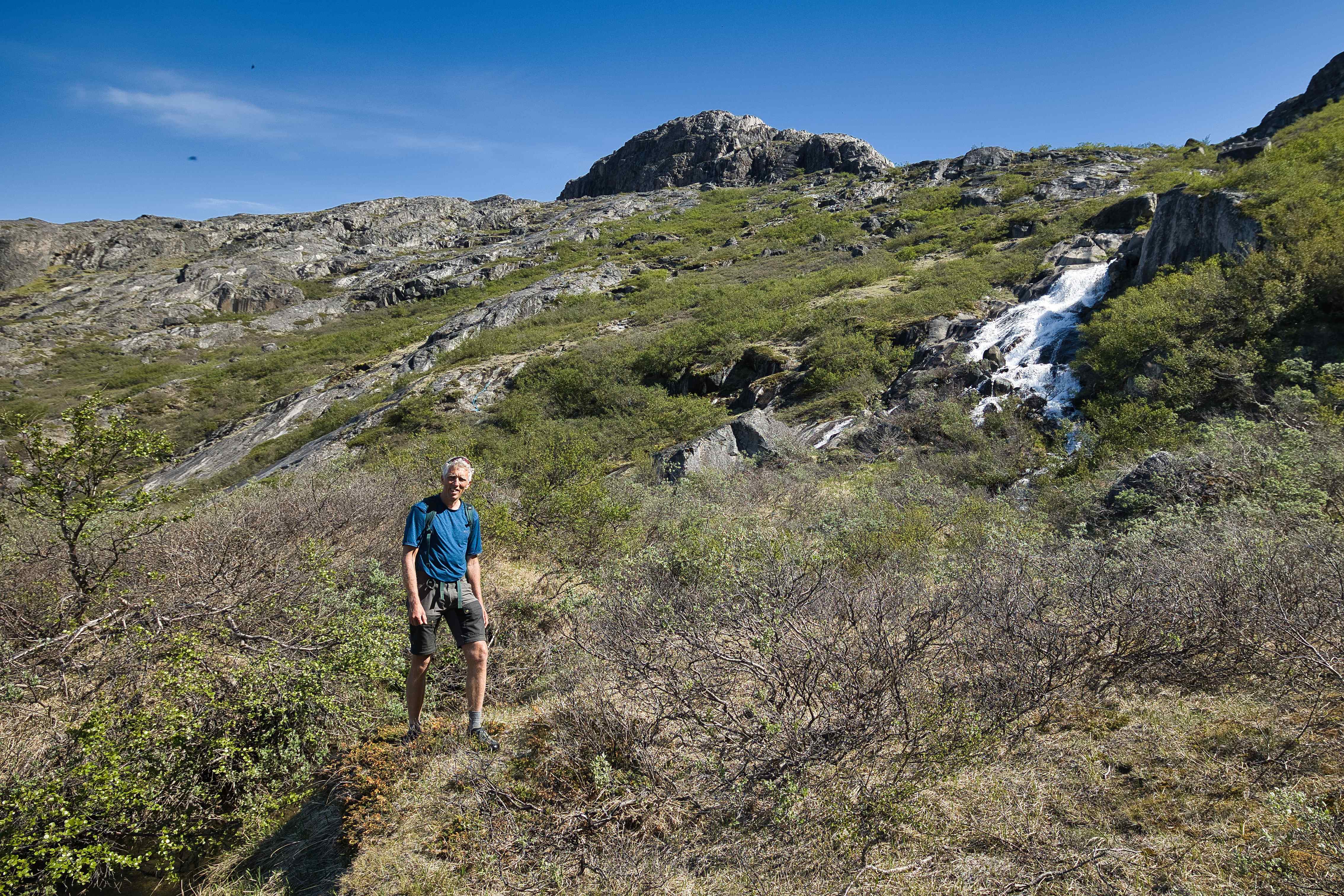
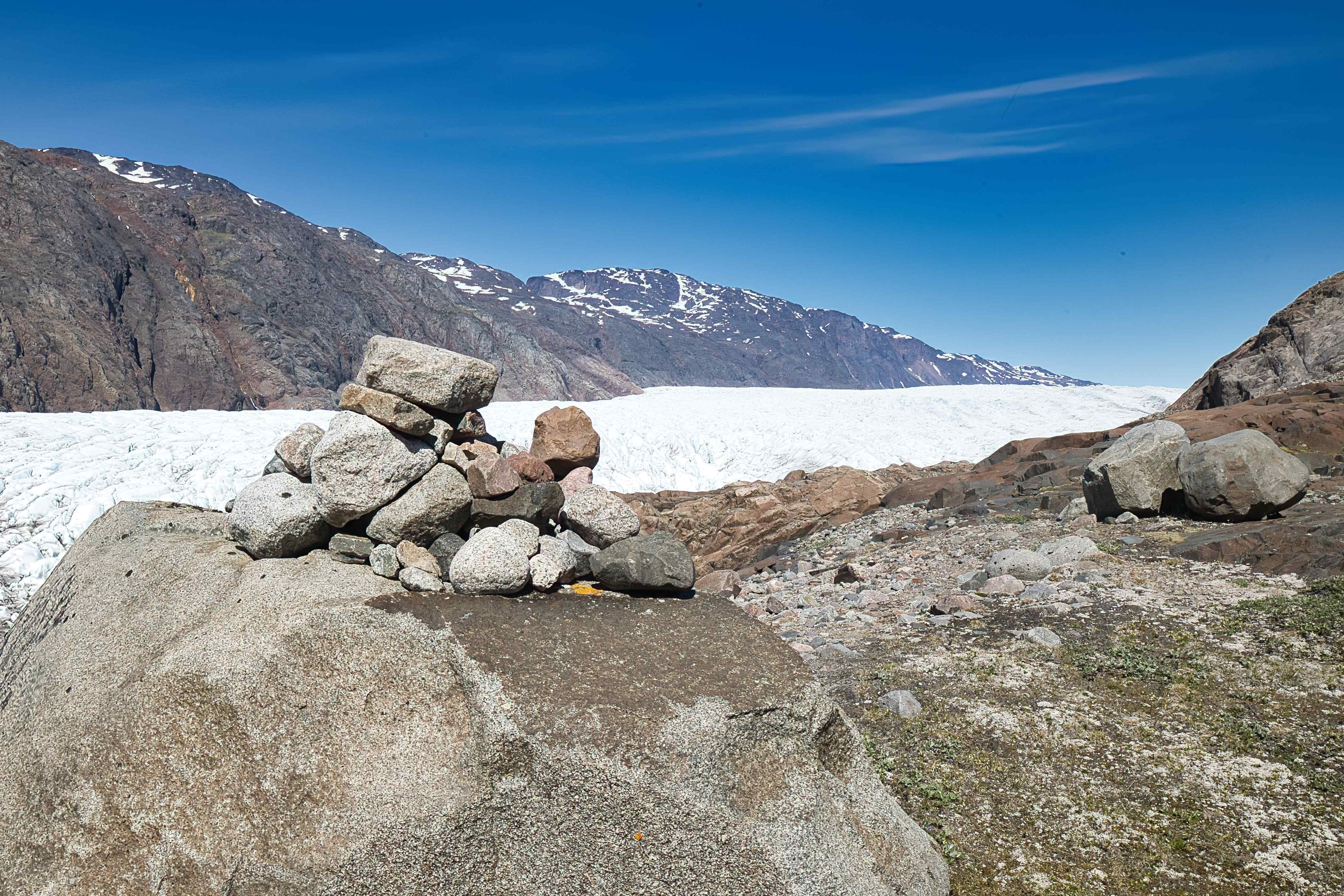
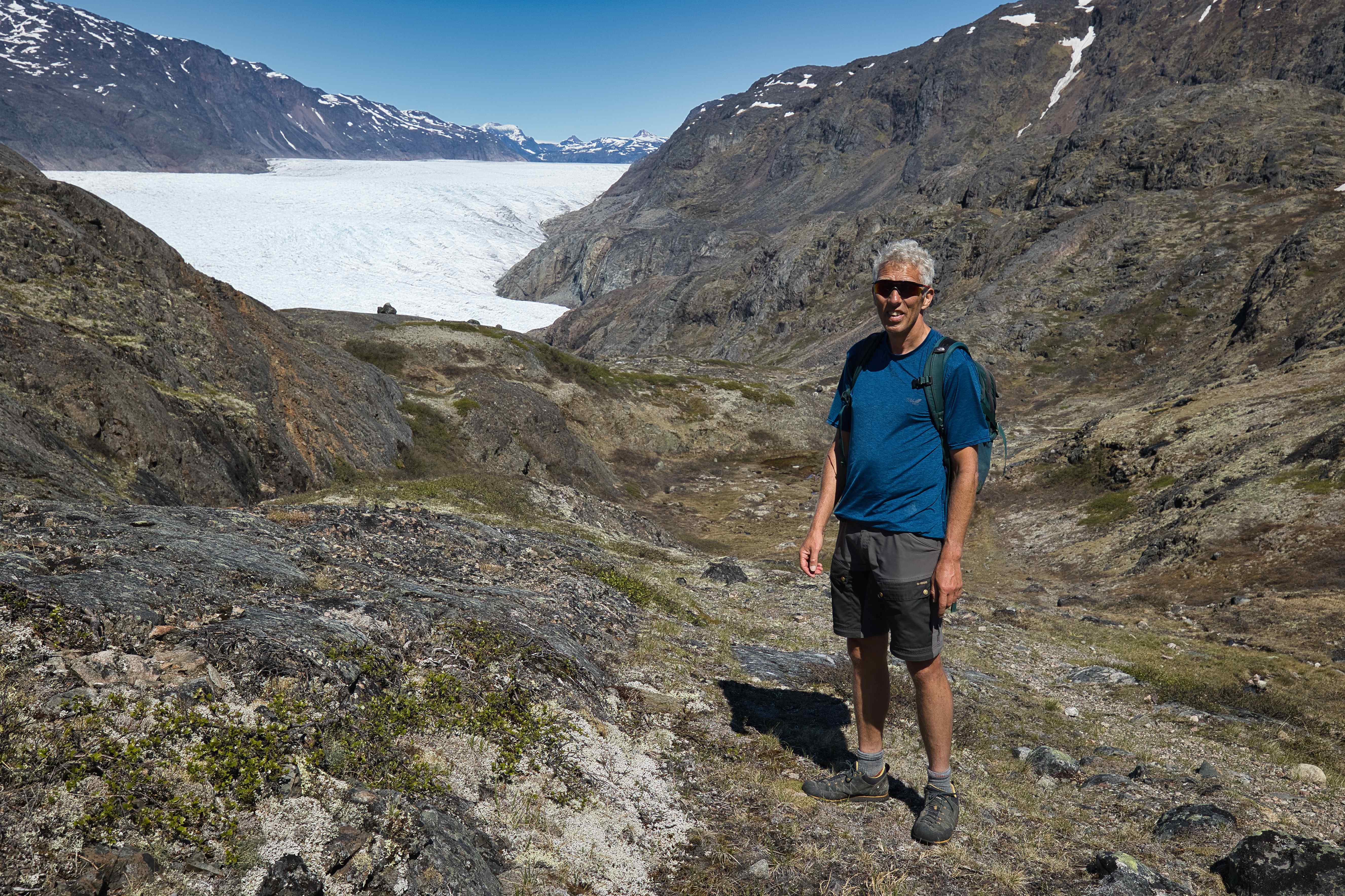
Narsarsuaq
Narsarsuaq is truly a special place. It is (until end of 2025) one of the biggest airports in Greenland, and still the city only has around 10 houses, 100 inhabitants and a hotel.
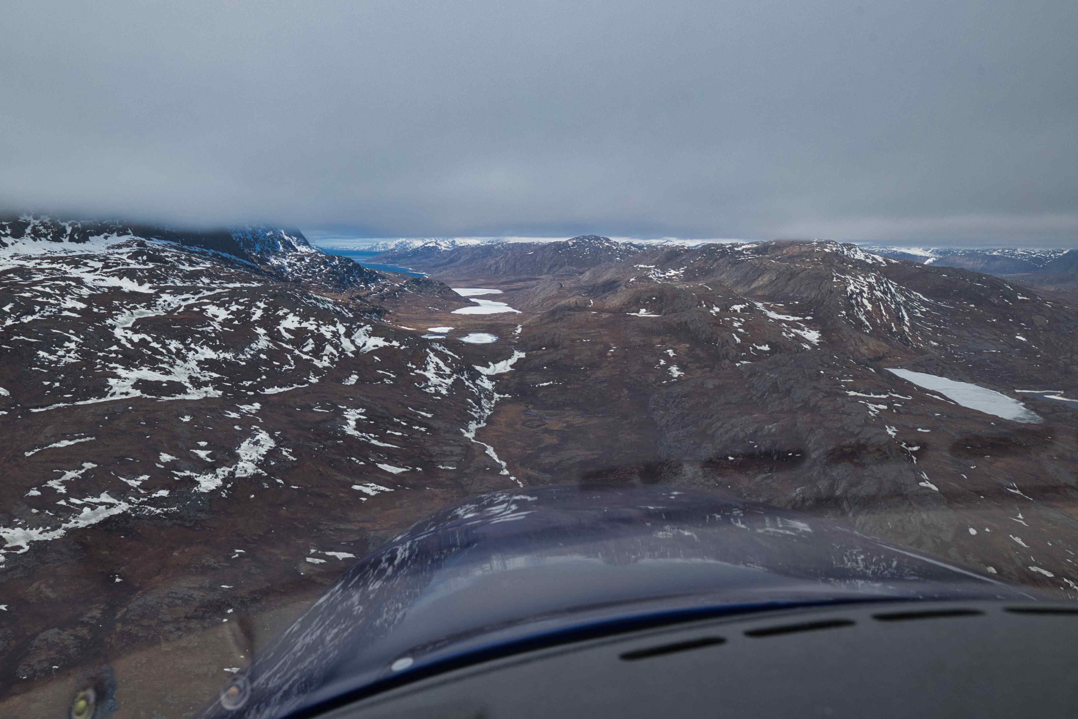
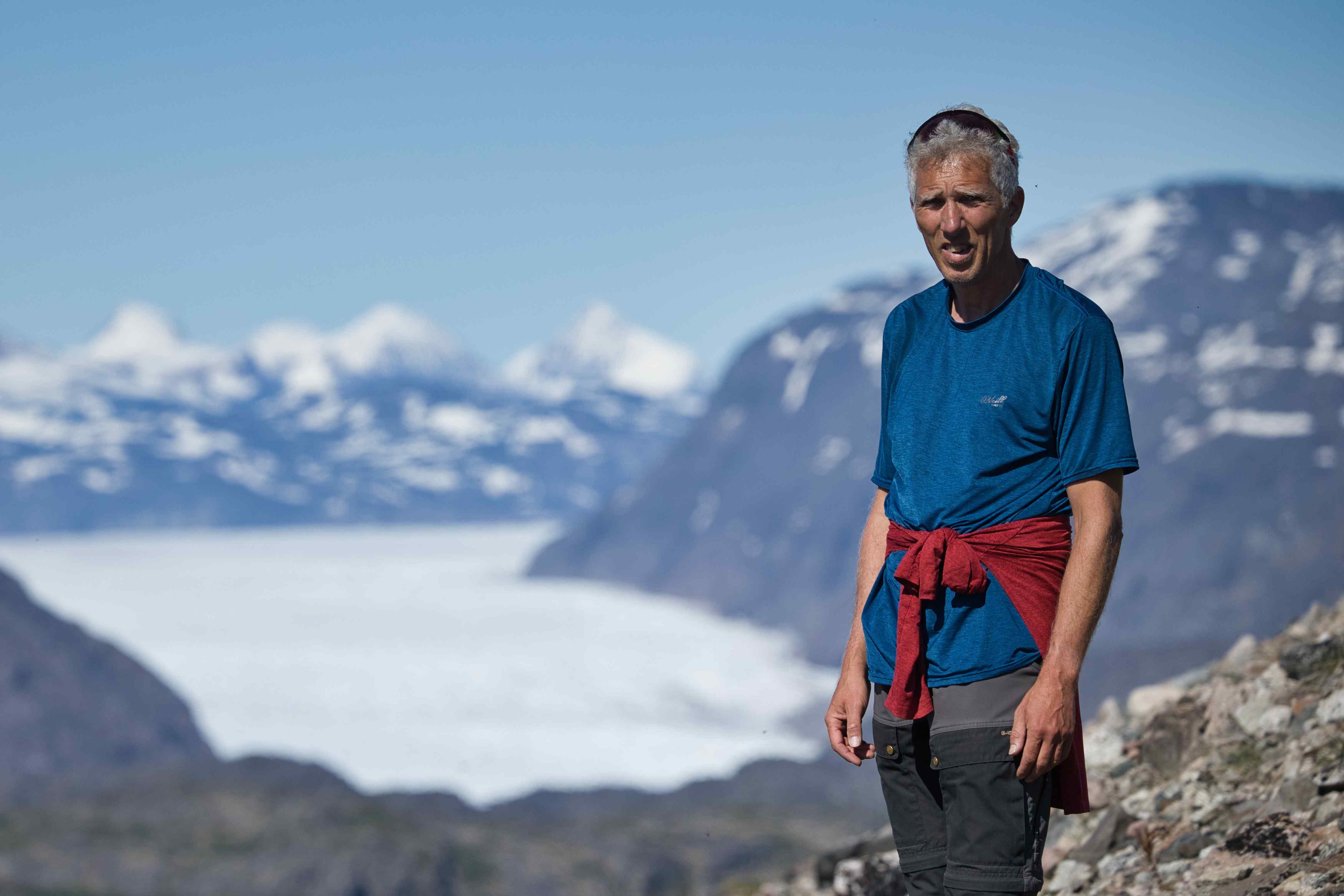
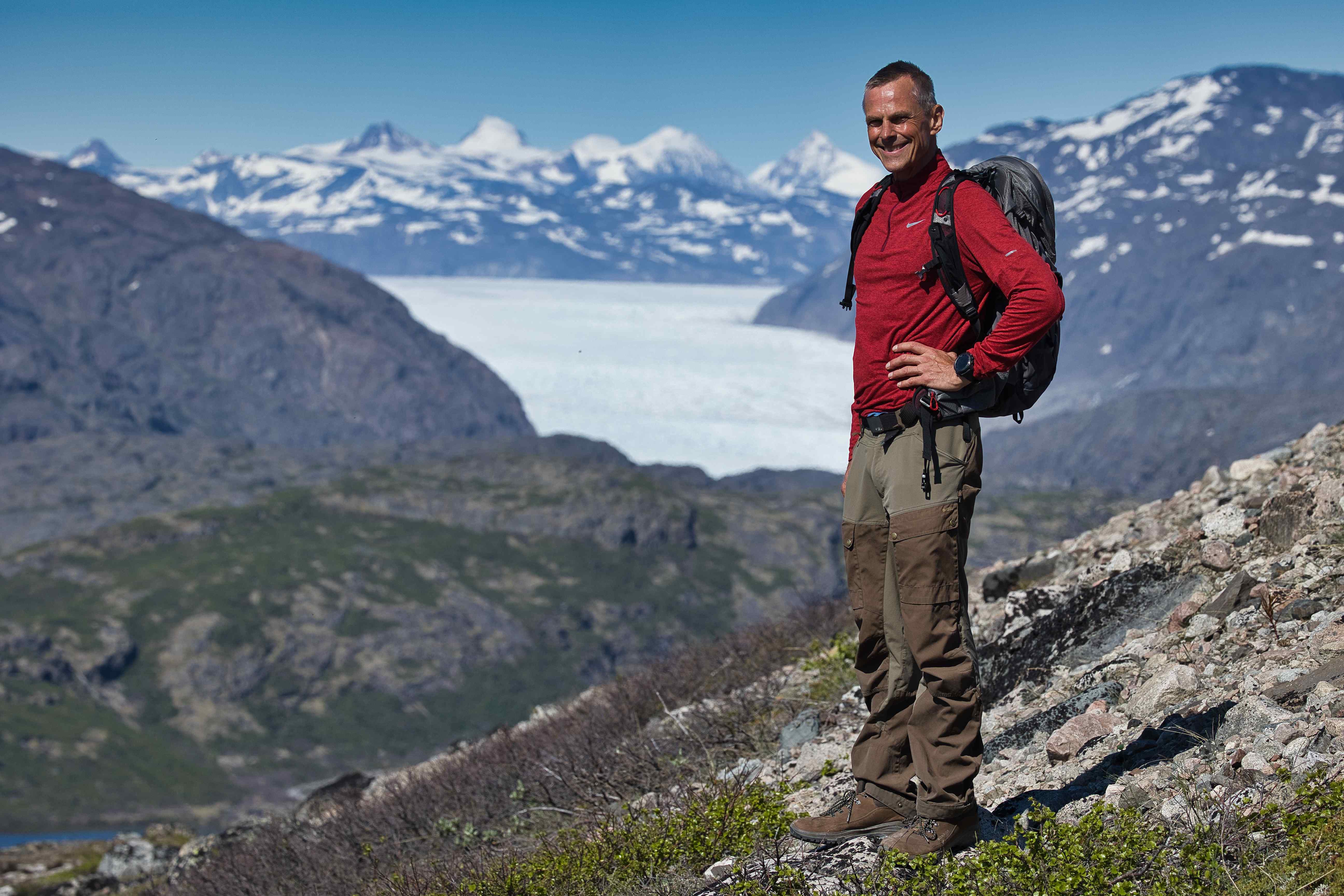
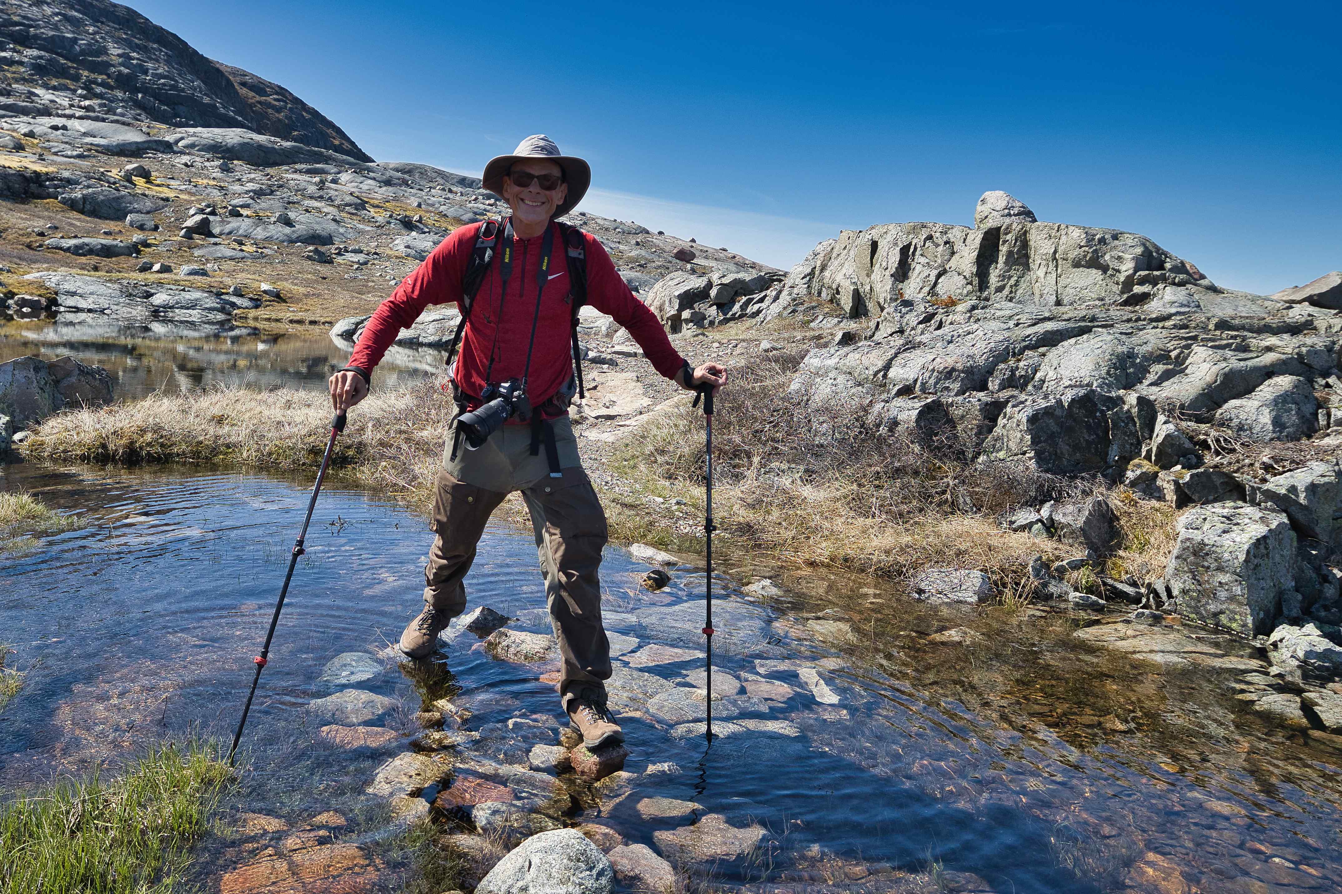
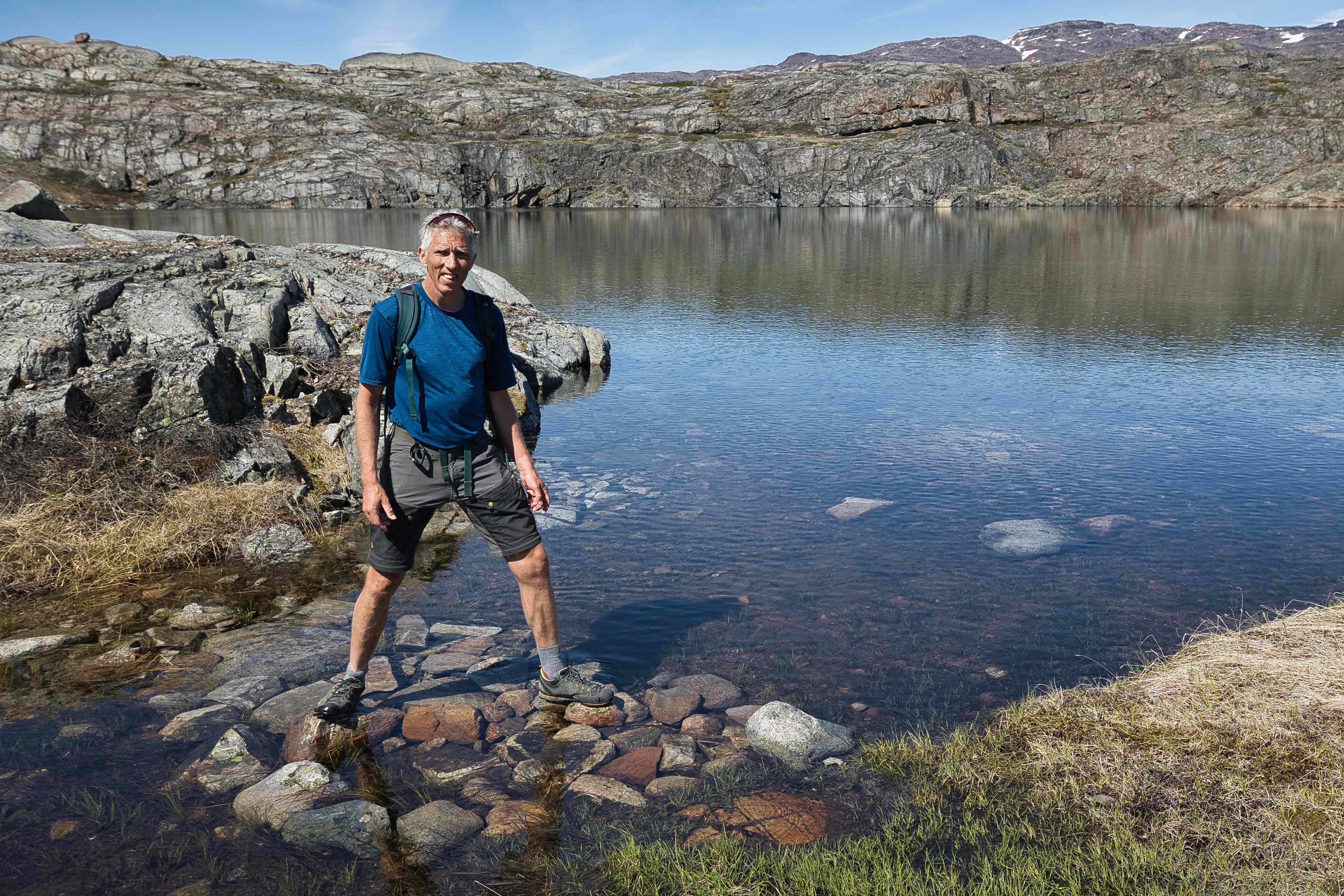
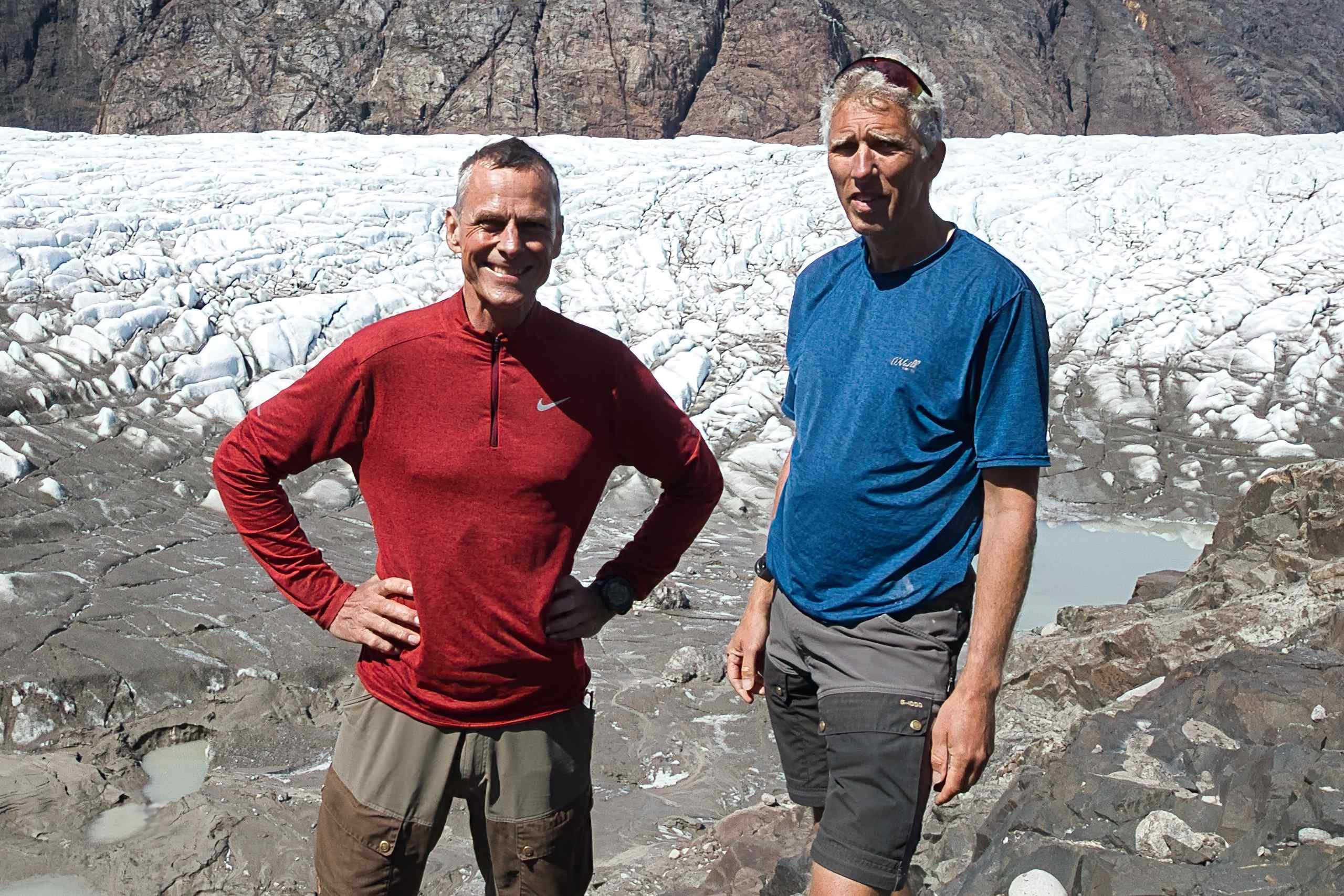
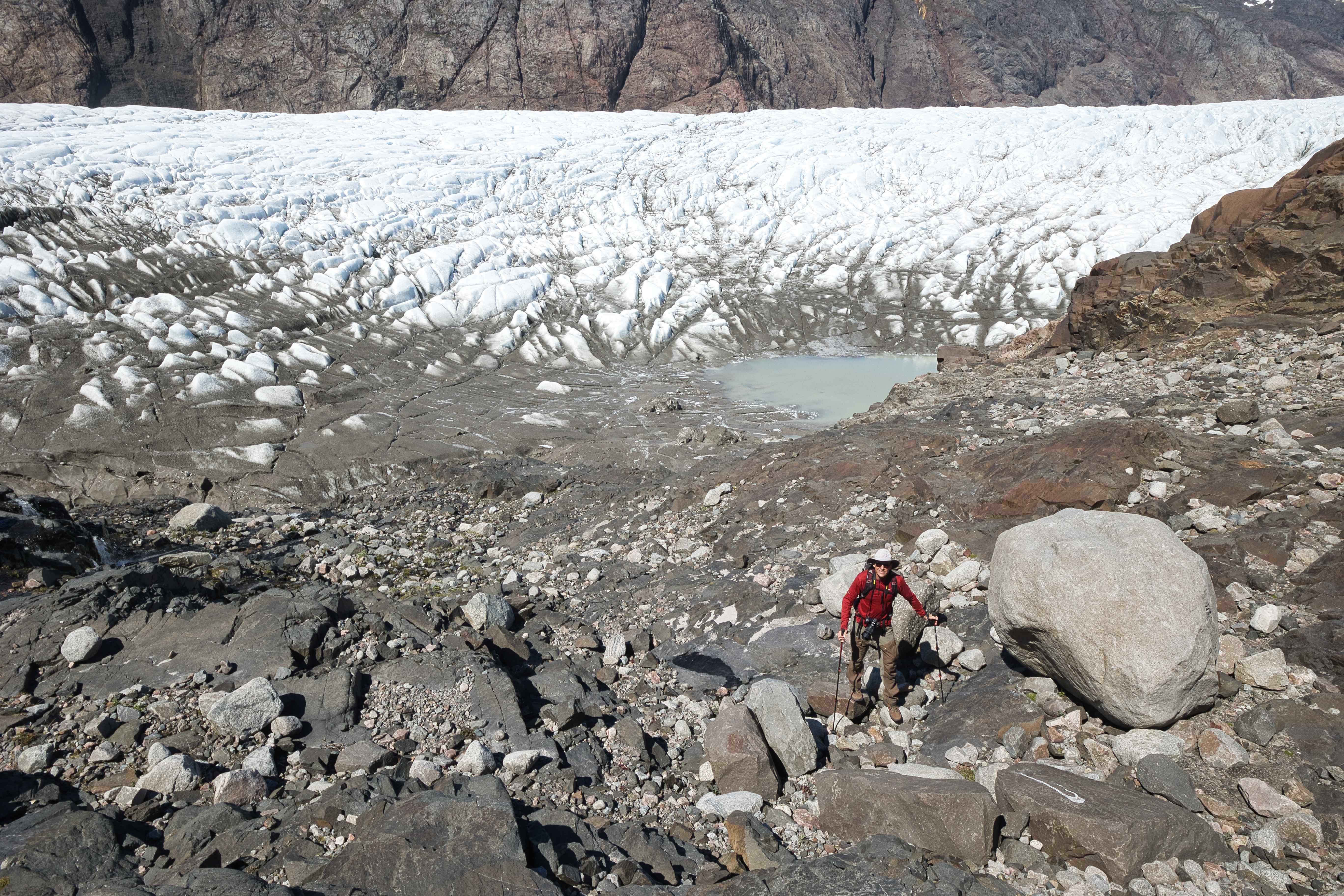
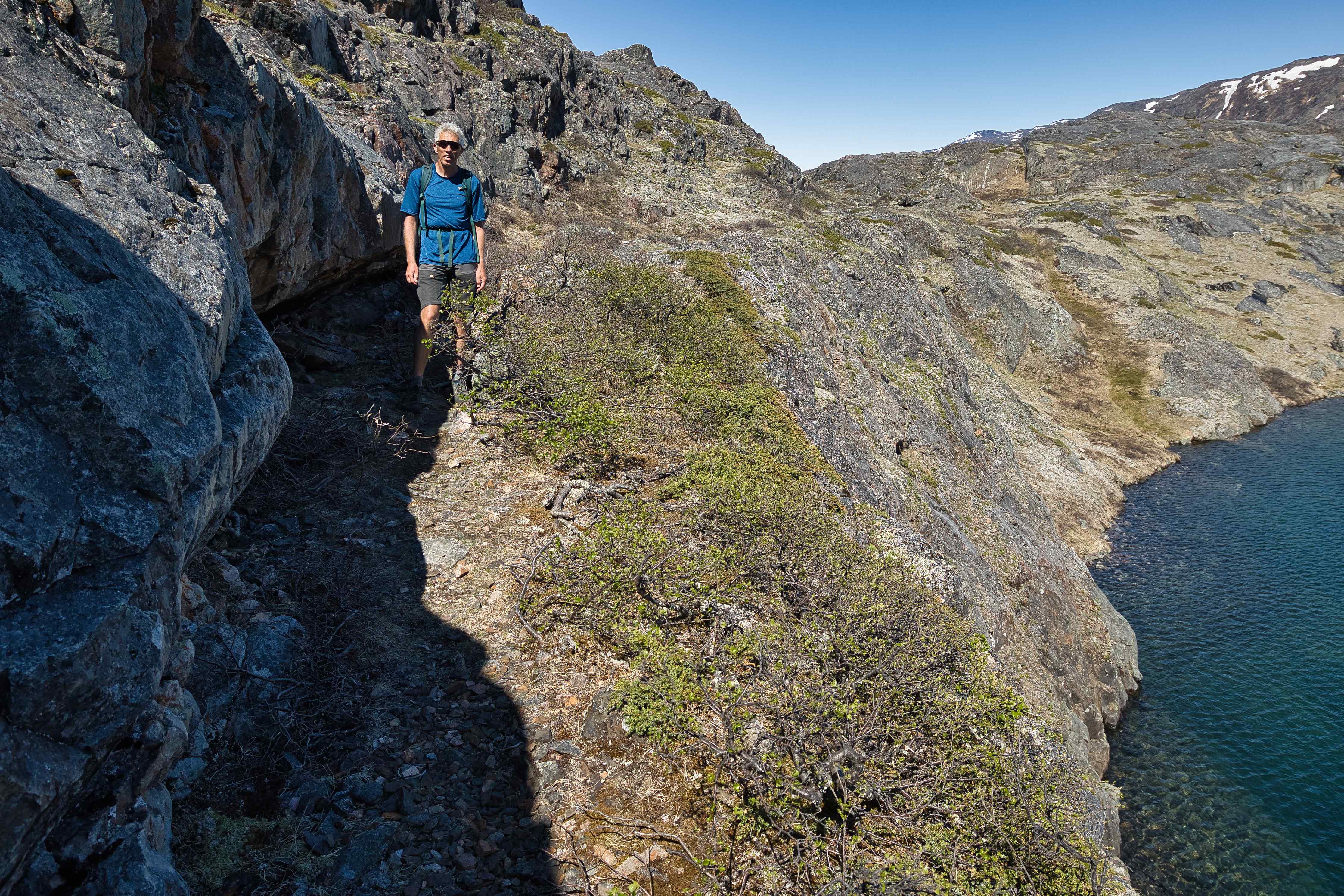
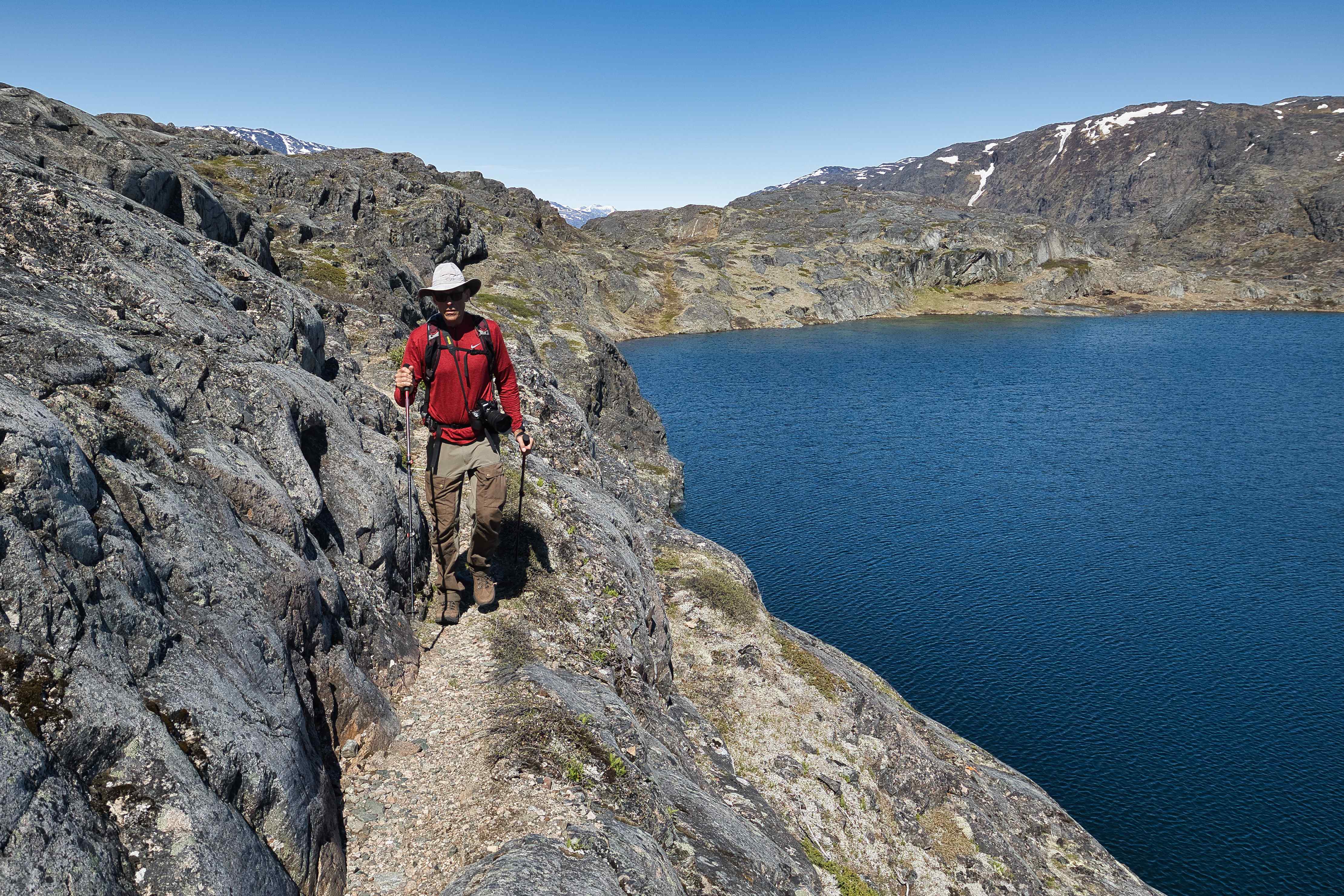
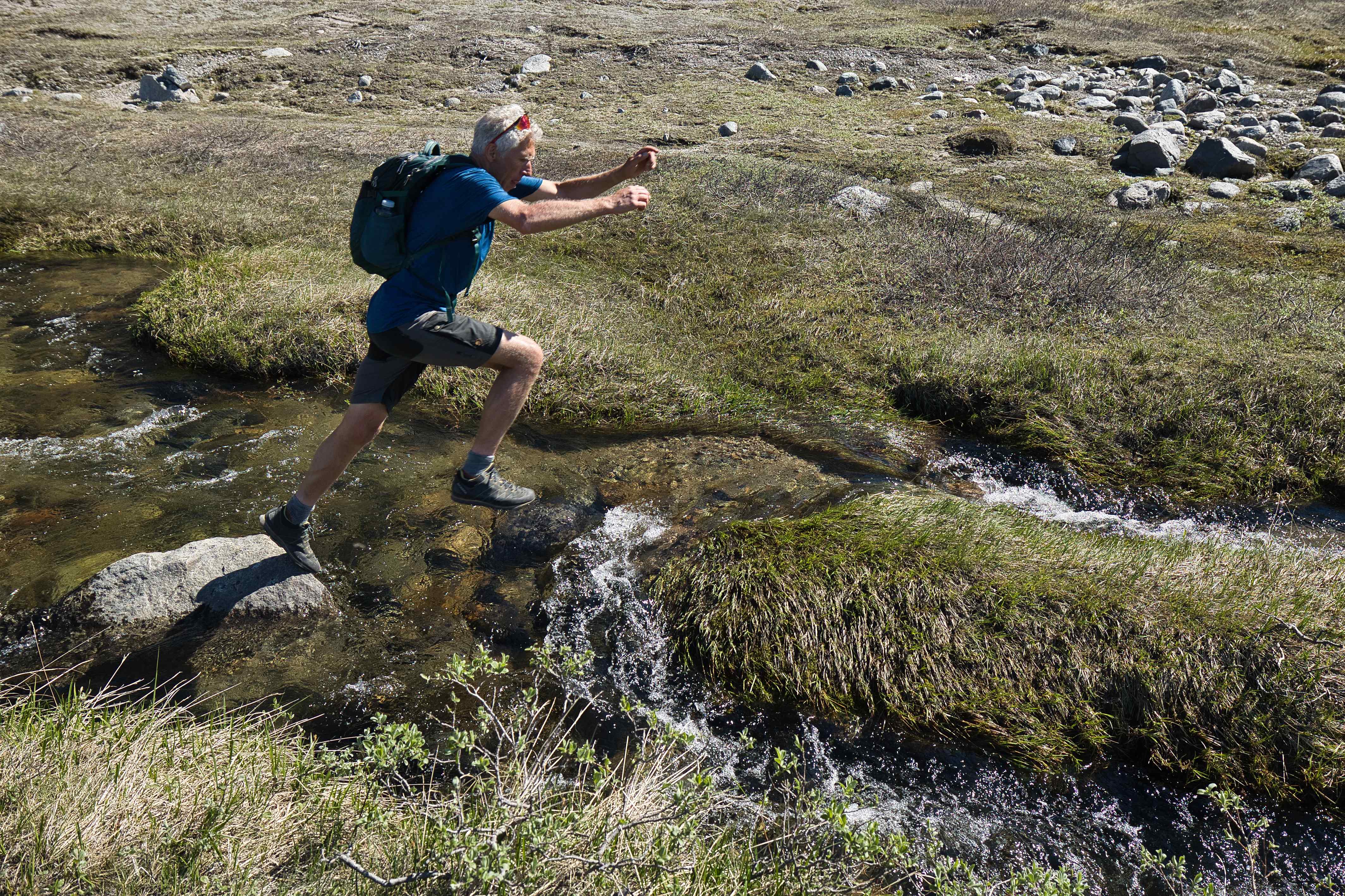
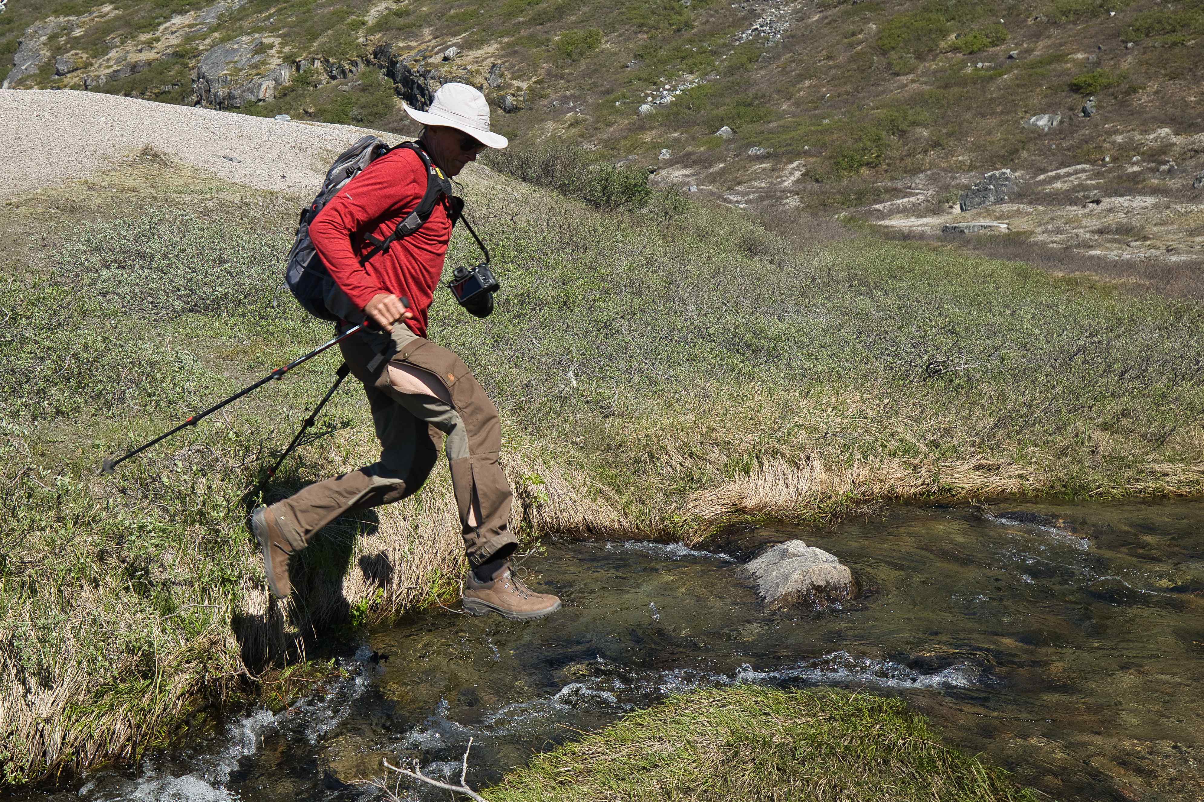
We spent two days hiking around Narsarsuaq. The first day (the day we arrived from Nuuk) we hiked Signalhøjen, a local top just behind the city. The second day we did a full day hike up Hospitalsdalen to the local glacier, a 25 kilometre round trip hike with 800 meters up and down.


From Narsarsuaq to Reykjavik
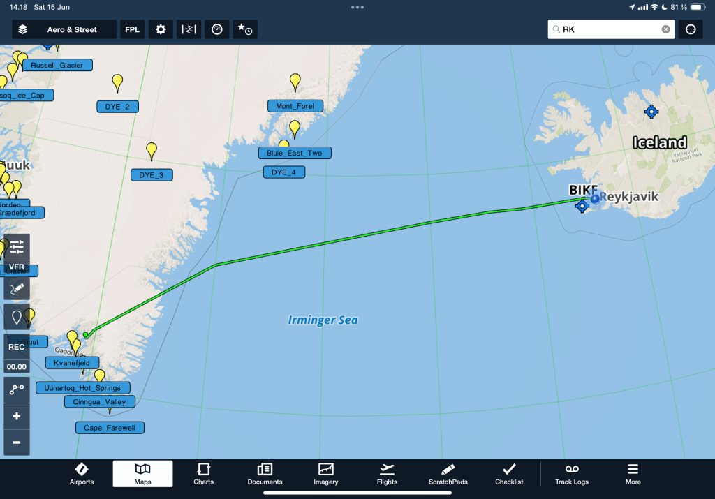
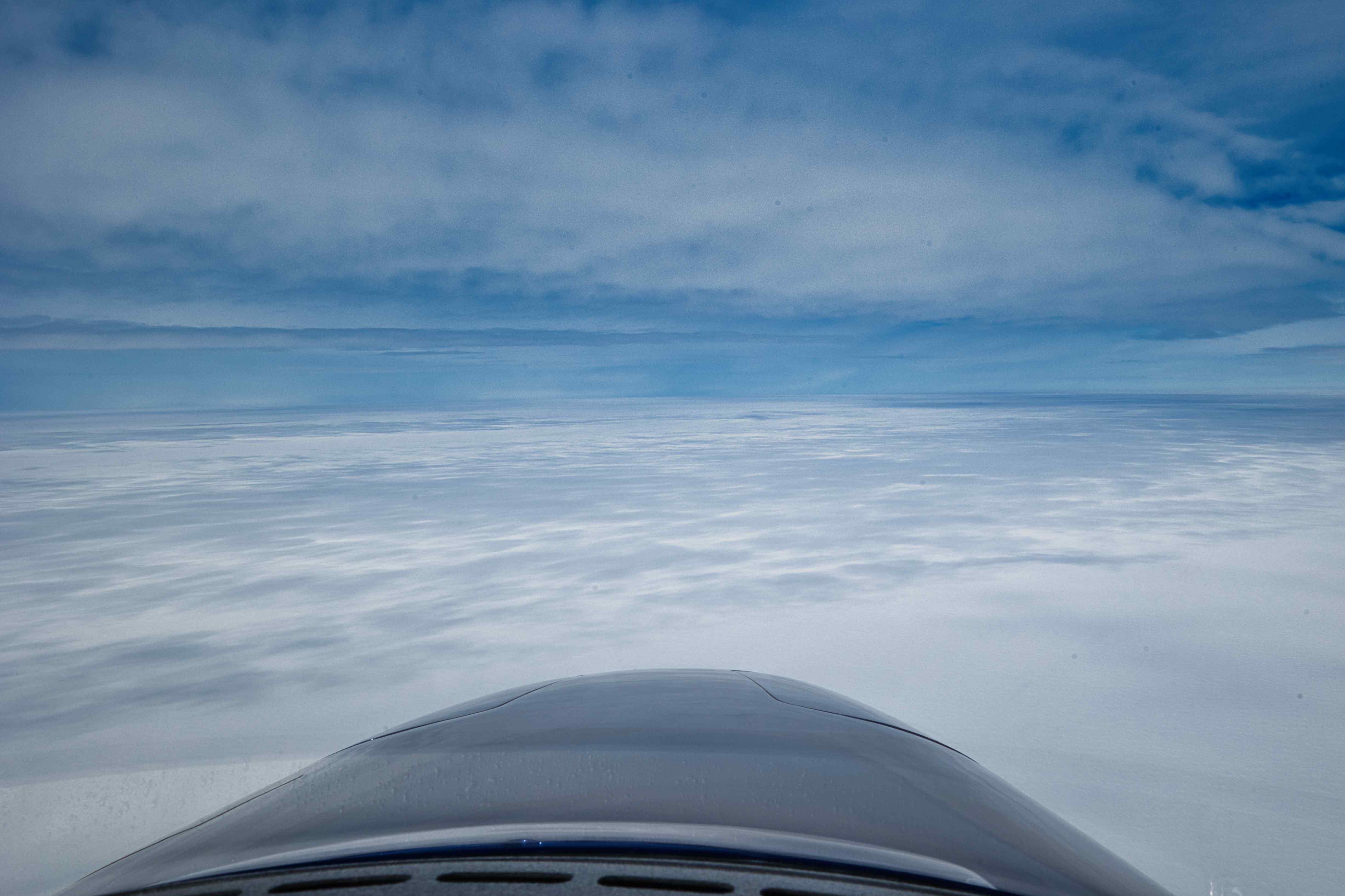
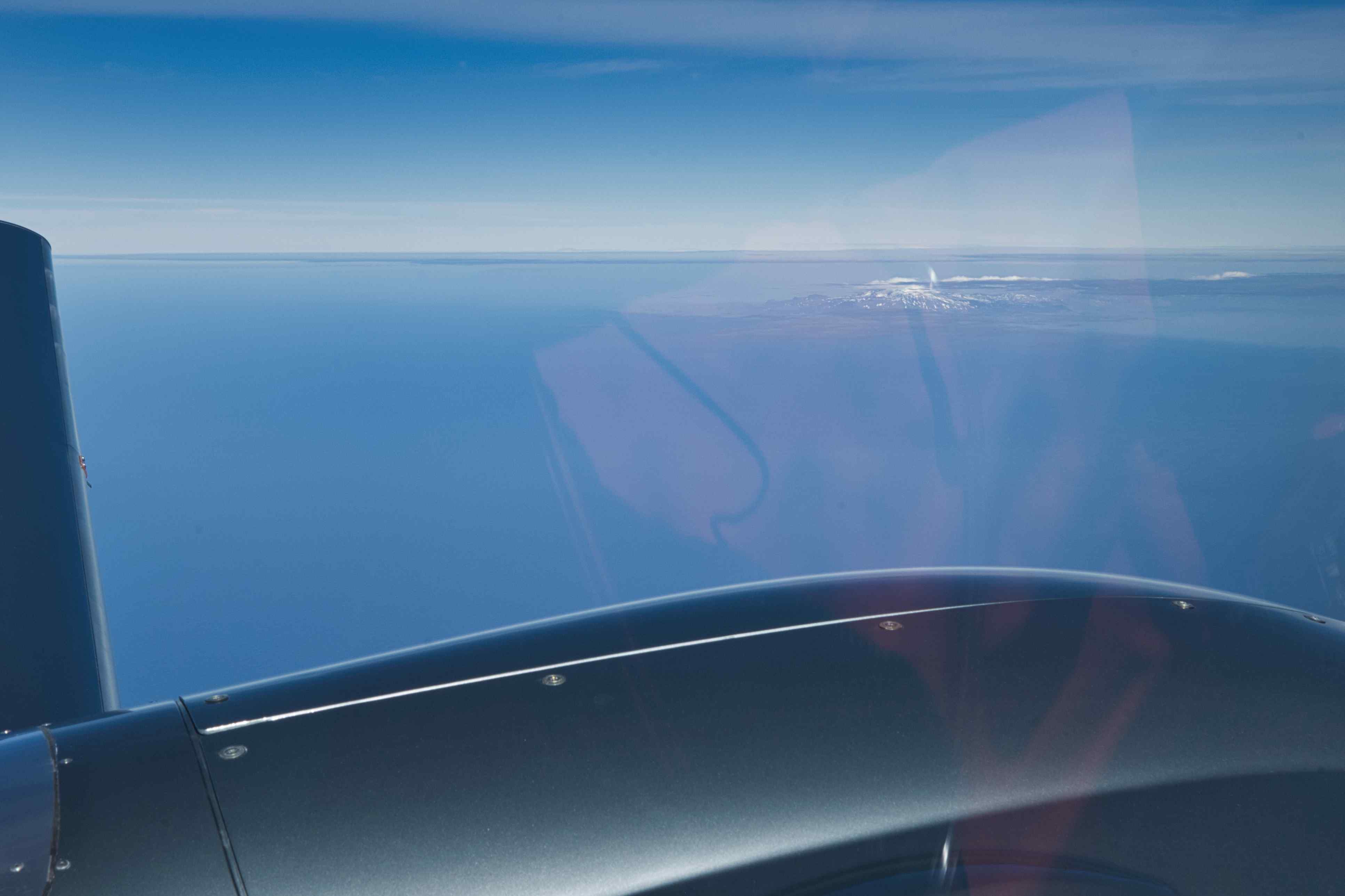
11th flight, BGBW to BIRK, flight time 4 hours and 20 minutes, 670 nautical miles or 1,241 kilometres
First leg on the flight back to Denmark. The flight started with beautiful sunshine and views over the icecap, but soon we were flying on top. We saw some of the beautiful mountains on the east coast of Greenland before starting the long distance over water. Iceland and Reykjavik greeted us with severe CAVOK so the landing was super easy.
This was my longest leg as a pilot so far, 1,241 kilometres from take off to landing.

From Reykjavik to Wick
12th flight, BIRK to EGPC, flight time 3 hours and 40 minutes, 640 nautical miles or 1185 kilometres
From Wick to Roskilde
13th flight, EGPC to EKRK, flight time 3 hours, 527 nautical miles or 976 kilometres
